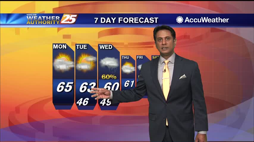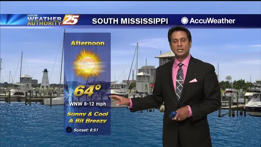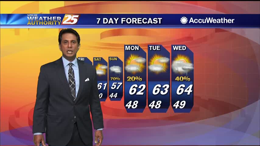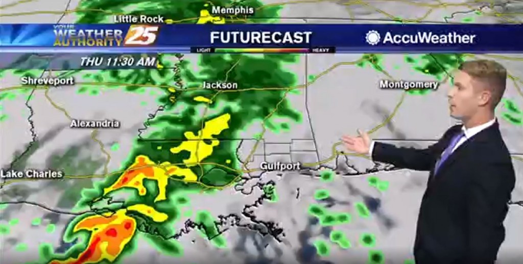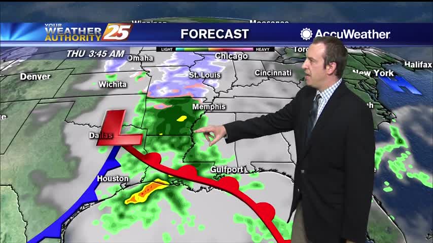
01/27 – Brantly's "Cool and Muggy" Monday Afternoon Forecast
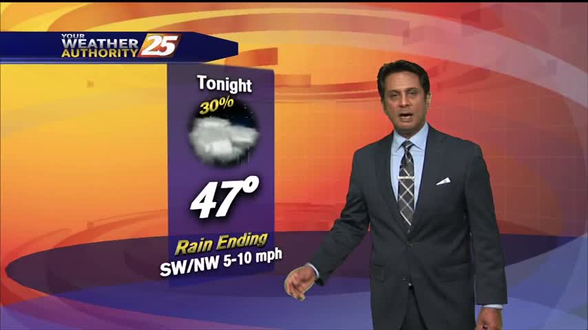
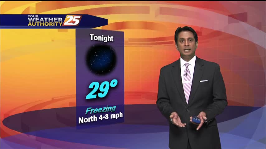
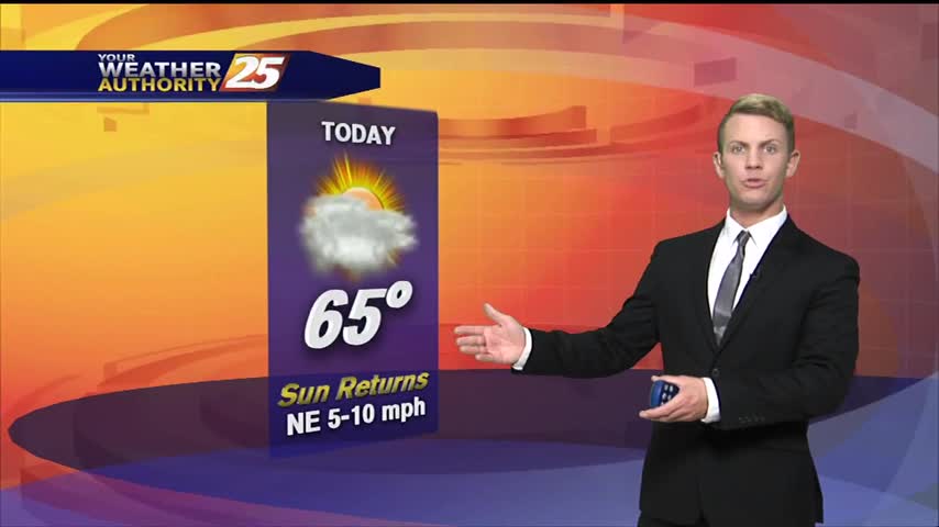
Mostly cloudy skies are in store for most of Monday, but skies will gradually become more clear by the end of the afternoon. Highs will be in the mid 60s. Tonight, mostly clear skies are expected in the upper levels,…