03/10 Ryan's "Barely Changing" Wednesday Night Forecast
Not seeing significant changes right now, but each day will be slightly warmer and more humid than the last until next week....
Not seeing significant changes right now, but each day will be slightly warmer and more humid than the last until next week....
Upper clouds continue to thin and move east as temperatures climb into the mid-70s...
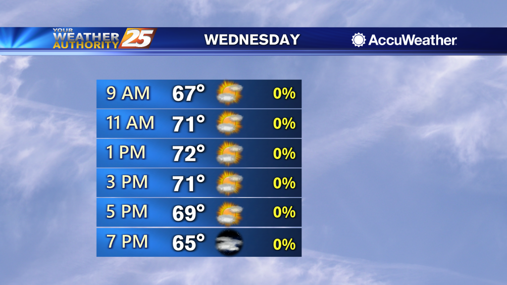
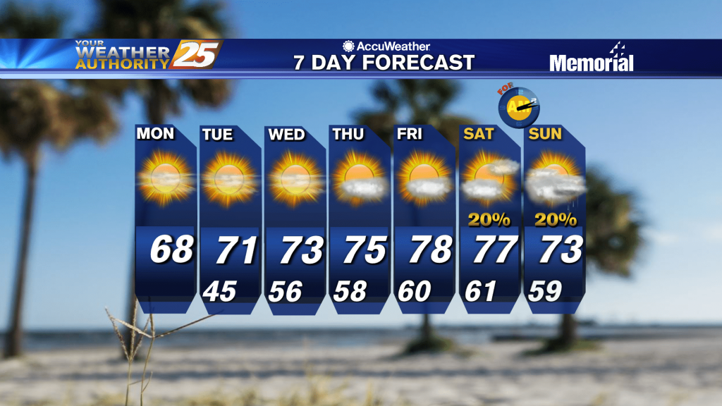
A slightly warmer and drier airmass with lower afternoon humidity looks to remain in place across much of south Mississippi. Expect the warmest temperatures of the week to be on both Wednesday and Thursday. Highs Wednesday generally range in the…
Over 10 degrees warmer tonight than it was last night, and we'll continue to warm in the days ahead.
Temps have climbed into the 70s with a few clouds expected this afternoon...
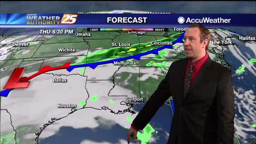
The near term forecast is mainly a temperatures forecast with rain chances near zero. A high pressure system centered over the Carolina/Georgia coast shifts east to over the eastern Atlantic, leaving calm conditions across the region stretching from the East…
Clear skies for now, but clouds will slowly build over the next week before our next round of active weather moves in over the weekend.

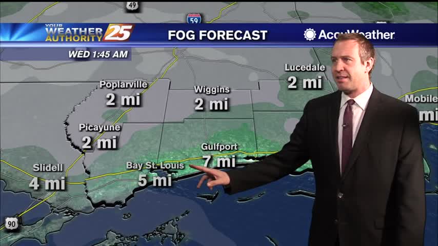
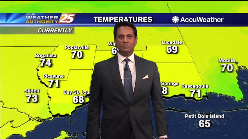
After a CHILLY start to the day , temperatures have warmed nicely into the mid/upper 60s...

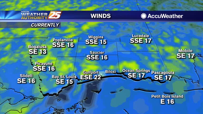
High pressure shifts eastward Monday, with surface winds turning more southeasterly, and resulting in gradual warming and moistening trend through Tuesday. While lows on Tuesday will still be near or slightly below normal, expect afternoon highs to be about 5…
High pressure shifts eastward Monday, with surface winds turning more southeasterly, and resulting in gradual warming and moistening trend through Tuesday. While lows on Tuesday will still be near or slightly below normal, expect afternoon highs to be about 5…
Getting some quick cloud cover and showers out of the way tonight so we can enjoy a beautiful, slightly cooler weekend.
Clouds will continue to increase this afternoon with rainfall overnight...
A chilly start to the day as cloud coverage will begin to increase...
Another chilly one lies ahead, but it will begin quickly warming ahead of our next frontal system....
An absolutely BEAUTIFUL afternoon ahead as high-pressure will begin to depart the area...
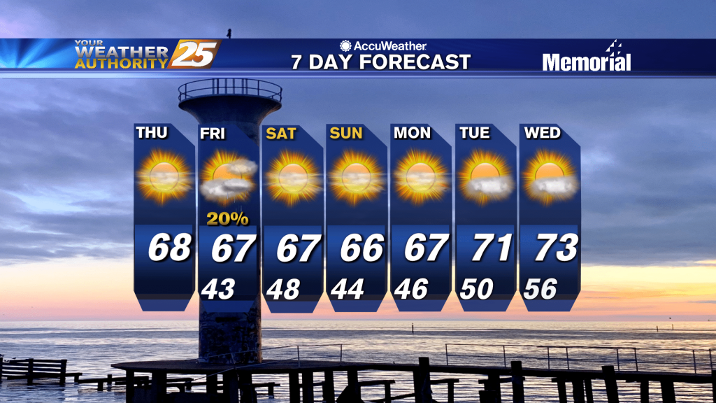
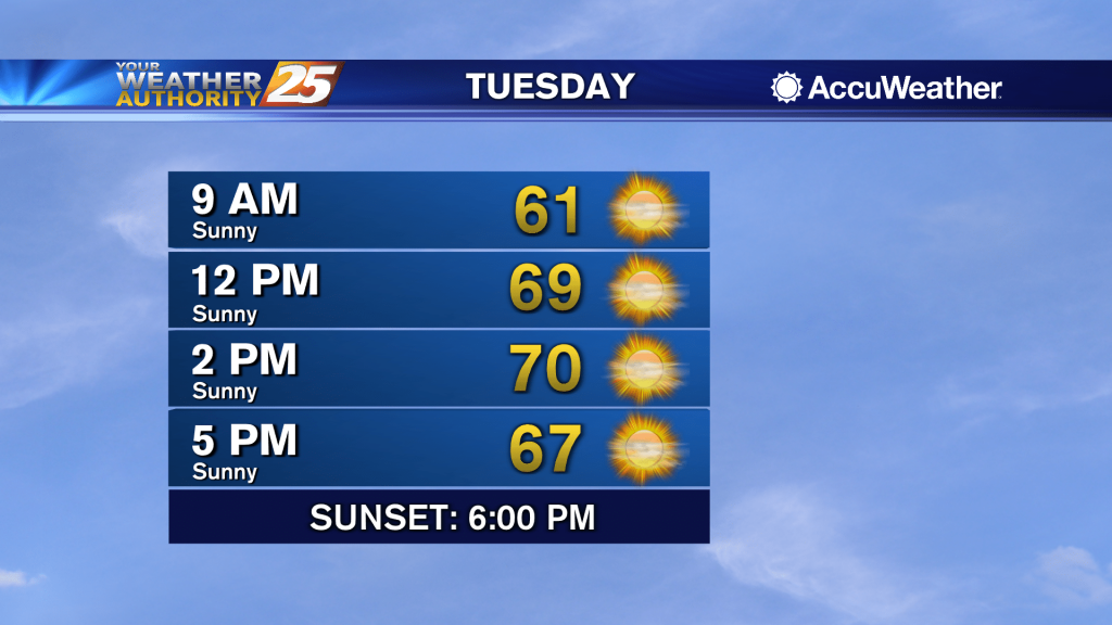
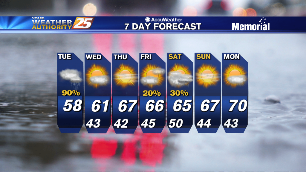
Thursday's highs are expected to be in the upper 60s to mid 70s across the region. It sure is nice to have a nice quiet and simple extended forecast as spring finally arrives after the last two roller coaster weeks.…
Finally dry after a string of fronts paraded through South MS over the past several days, but now we're looking at a sunny rest of the week....

Sunny and cool this afternoon as high-pressure begin to move into the region...
Rain has ended over the local area. Some clouds may still linger in the morning, but clearing is expected from west to east across the region going into the afternoon. High pressure builds in at both the surface and in…
We have one more cloudy night ahead before a long, dry period of sunny, mild weather....
Rain will continue this afternoon with a few embedded t-storms...
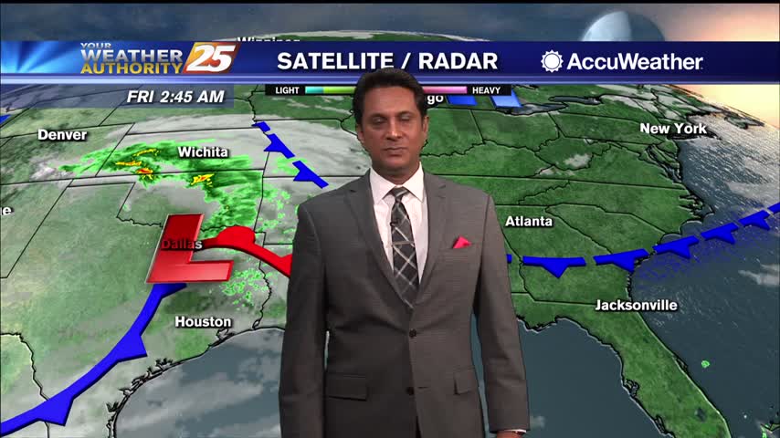
Radar shows next wave of rain spreading in from the west as the next system approaches. We continue to be sandwiched between a strong upper level high pressure to our south and an approaching low pressure system currently centered over…
One last grey, rainy day before the sun returns for an extended period, but it isn't going to cool all that much....
Rainfall will continue to move into the area this afternoon as a cold front moves through...