Weather Headlines

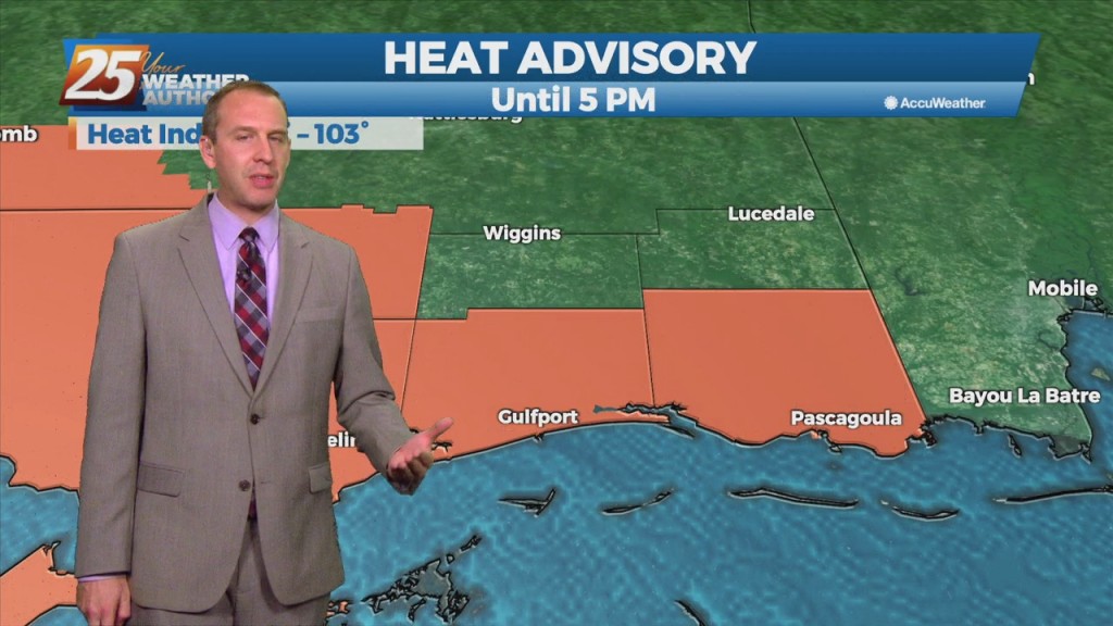
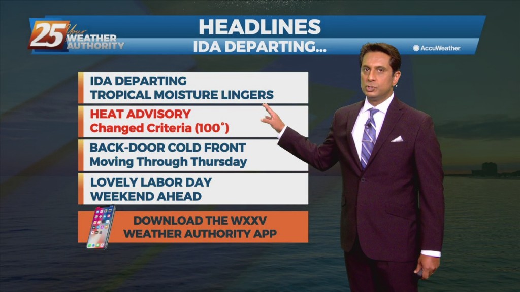
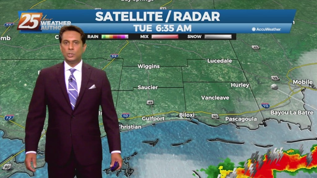
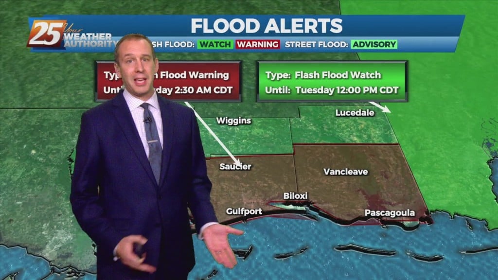
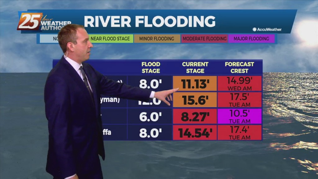
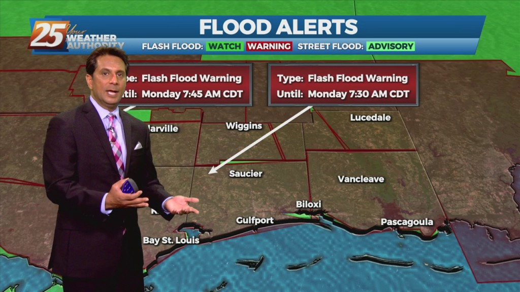
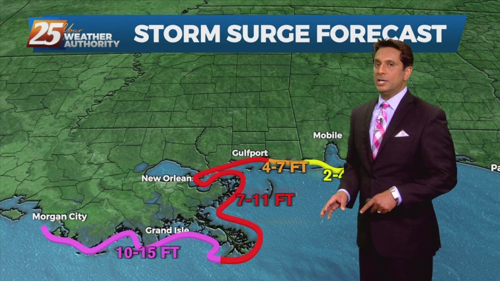
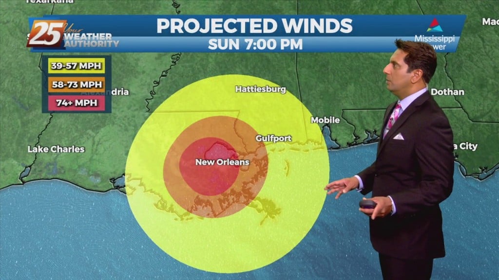
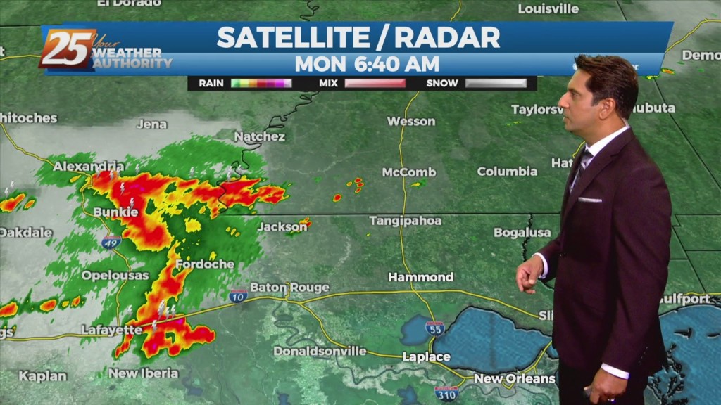
9/6 - Rob Knight's "Labor Day" Morning Forecast

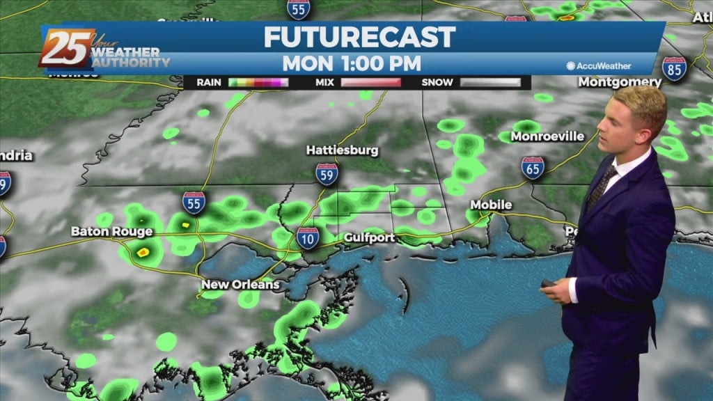
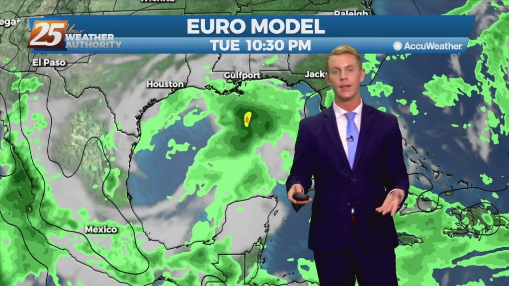
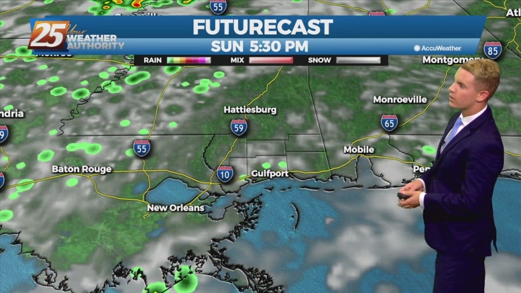
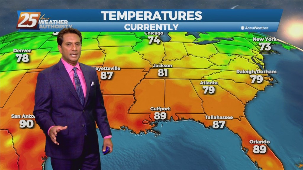
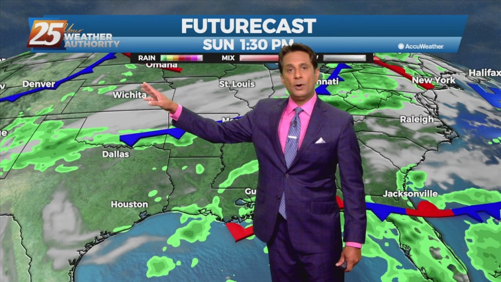
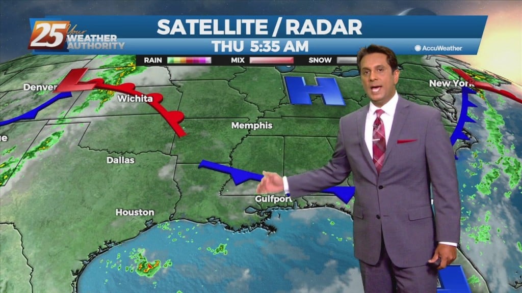
The upper level high-pressure centered along the northern Gulf Coast will continue to move south and weaken. An upper level trough digging across the Mississippi Valley and an associated surface cold front will drop southeast into the forecast area. Showers/T-Storms along…

9/3 - Rob's "Less Humid" Labor Day Weekend Forecast

This afternoon will bring hot temperatures in the wake of yesterday's cold front. Temperatures will climb to around 90 degrees but will be rather tolerable a a less humid flow continues to dominate the region. The aforementioned frontal boundary will…

9/3 - Rob Knight's "Post-Frontal Passage" Friday Morning Forecast

In the wake of yesterday's cold frontal passage, a less humid flow will dominate heading into the weekend. The aforementioned frontal boundary will likely stall near the coast today through Saturday, with any diurnal afternoon convection being immediately along the…

9/2 - Rob's "Cold Frontal Passage" Afternoon Forecast

A cold front will continue to push south through the area providing dry air moving into the area. Despite the passing of the front, there will not be any noticeable cool off with highs staying in the upper 80s to…

9/1 Rob's "1st Day of September" Afternoon Forecast

A surface low associated with Tropical Depression Ida will continue to move NE, dragging a weak cold front into south Mississippi Thursday morning. Northwesterly flow aloft will develop across the area today between the upper level High pressure over Texas…

9/1 - Rob's "September Outlook" Morning Forecast

A surface low associated with Tropical Depression Ida will continue to move NE, dragging a weak cold front into south Mississippi Thursday morning. Northwesterly flow aloft will develop across the area today between the upper level High pressure over Texas…

8/31 - George County Deadly Road Collapse

Late Monday night a portion of Hwy 26 in George county collapsed leaving 2 dead, 10 injured with 3 dealing with life threatening injuries. Authorities are speculating the torrential rainfall from Hurricane Ida was to blame for the erosion that…

8/31 - Rob's "Tropical Moisture" Tuesday Morning Forecast

Trailing feeder bands in the wake of now remnant Ida will continue to drag across the area thorough today. These bands will slowly press southeastward into the Gulf through the morning and late afternoon. Despite southeastward movement of the band,…

8/30 - Rob Knight's "Monday Morning/Ida Update" Forecast

With IDA to the NNW moving towards north central Mississippi, expect gradual improvement through today. Widespread rain across the area will continue and gradually decrease to scattered showers later today as Ida tracks slowly to the north. After the center…