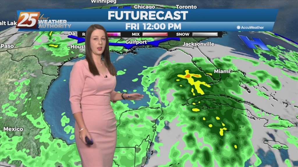
6/2 - Rob Martin's "Storm Chances For Friday" Thursday Night Forecast
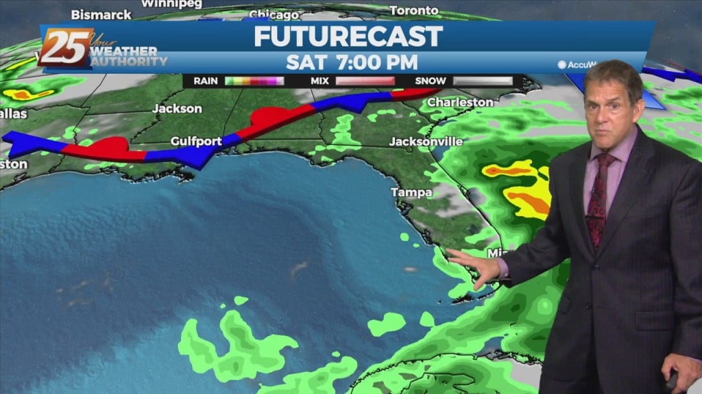
Earlier storms are again fizzling out after sunset this Thursday night. A weak cold front will crawl into the area and stall through Saturday. The…
Earlier storms are again fizzling out after sunset this Thursday night. A weak cold front will crawl into the area and stall through Saturday. The…
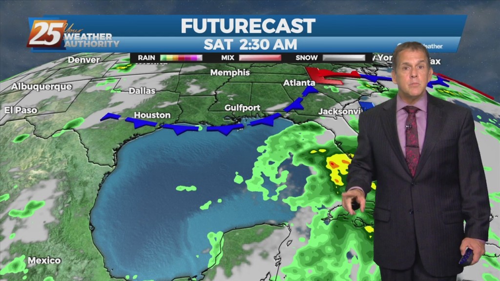
Persistence is the call with the forecast through Thursday night with some pop-up storms again. A weak cold front will crawl into the area and…

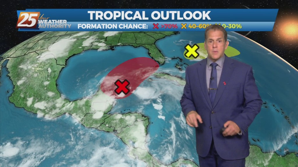
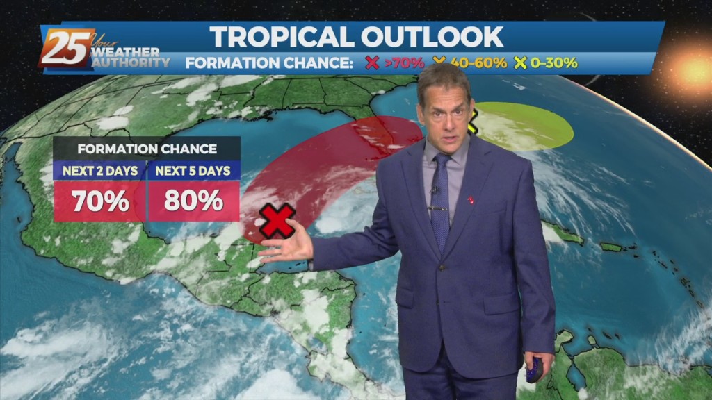
Not a lot of change as all indications for a frontal boundary to sag into the area and stall through Saturday. The interaction between the Caribbean…
The downpours from earlier today have dissipated and we’re not expecting anything more through this Wednesday night. June has arrived and the weather is right…
June has arrived and the weather is right on cue today with the spotty downpours, which is quite normal for this time of year…hot, muggy…
Fairly quite conditions ahead which is normal for this time of year...Hot muggy with a few showers/t-storms around. This focus of moisture moving back to…
The short term weather will be quite normal for this time of year...Hot muggy with a few showers/t-storms around. The moisture is being brought…
Our typical summer downpours are fizzling out with loss of daytime heating this Tuesday night. For the first day of June, the southeast flow will…
A typical summer pattern of afternoon/evening slow-moving storms is on display this final day in May. The southeast flow will continue this scenario through mid-week. These types…
Current upper level analysis shows a ridge centered near the Appalachian Mountains and a trough encompassing nearly half of the western US. A slither of that…
Current upper level analysis shows a ridge centered near the Appalachian Mountains and a trough encompassing nearly half of the western US. A slither of that ridge…
Heavier showers that went through Harrison County this afternoon have dissipated, but more could come in off the gulf by early Tuesday morning. With a sustained…
Some spotty, heavier showers will approach the coast this Memorial Day afternoon and evening, but widespread activity is not expected. With a sustained southeast flow off…
Much, but not all, of the short term forecast period will be dry, with a good bit of sunshine. A weak disturbance currently across the area will…
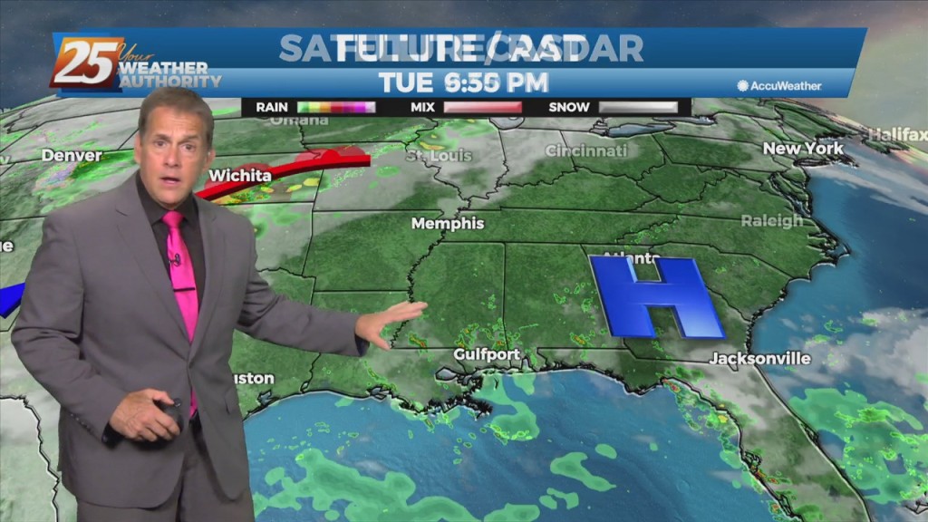
Impulses associated with the weak upper low over the northeast Gulf will work their way westward over the next 48 hours. One will approach the Mississippi coast overnight tonight,…
Expect clear skies and very pleasant weather Friday night, with lows down into the 60s. High pressure continues its dominance over the weekend with plenty…
The big H (high pressure) will continue to dominate the weather pattern over the weekend. A weak upper low-pressure system could form in the eastern Gulf…
High-pressure will be the main factor shaping the weekend forecast. A weak upper low-pressure system could form in the eastern Gulf of Mexico over…
An upper-level low pressure over southern Illinois this morning will slowly drift off the eastern seaboard tonight into the weekend. High-pressure will be the main factor shaping…
Stepping outside today was quite refreshing compared to the recent high-humidity affair earlier in the week. High pressure will shape the forecast through the area Friday…
This morning’s cold front is long gone, and in its wake is a pleasant drop in humidity. High pressure will shape the forecast through the area…
The cold front is now eat of the area with a few linger showers (even an Isolated t-storm) expected early this afternoon. Skies will begin to slowly…
An upper low-pressure system this morning is moving into Missouri, with the associated cold front appears to extend from Jackson to Lafayette, probably just moving into the Baton…
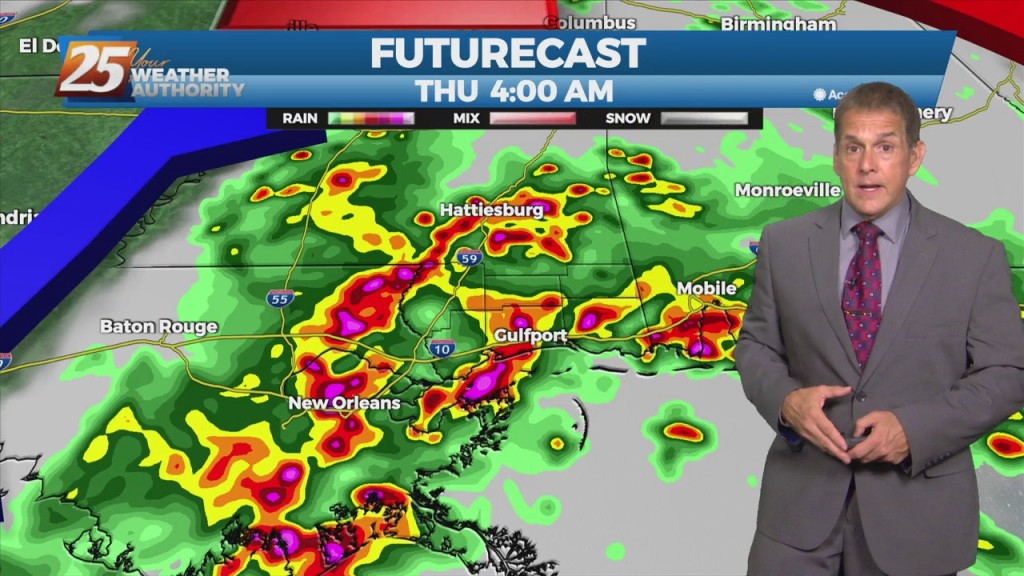
One more round of heavy rain with potential severity arriving Thursday morning. Both heavy rain and thunderstorms are on the way as a cold front arrives…