5/29 - Britt's "Clear" Sunday Evening Forecast
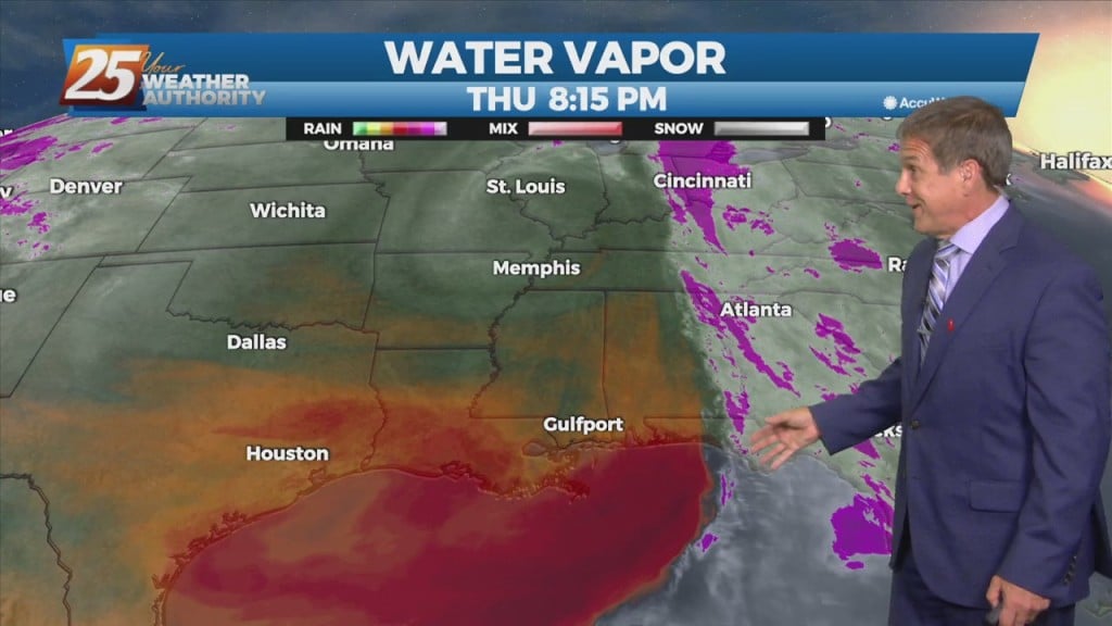
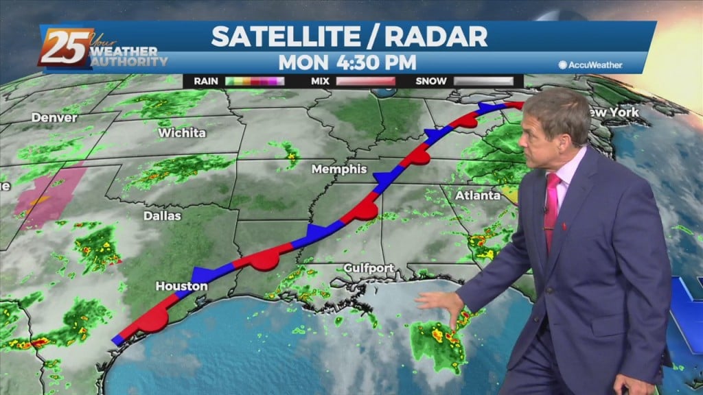
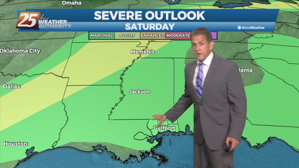
Impulses associated with the weak upper low over the northeast Gulf will work their way westward over the next 48 hours. One will approach the Mississippi coast overnight tonight,…
Impulses associated with the weak upper low over the northeast Gulf will work their way westward over the next 48 hours. One will approach the Mississippi coast overnight tonight,…
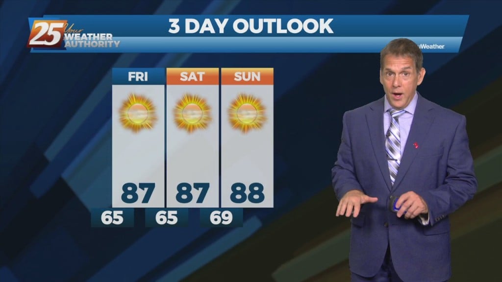
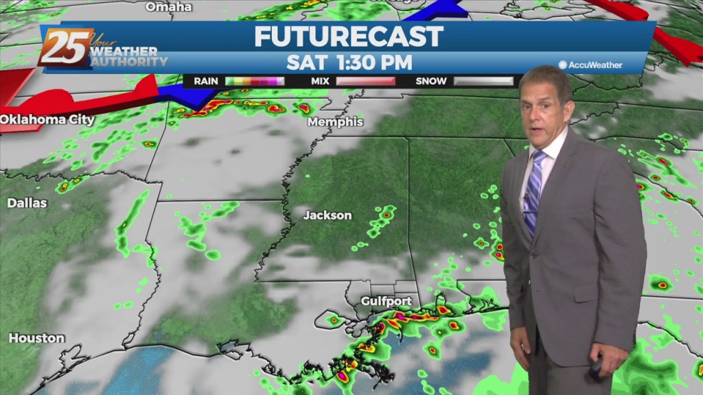
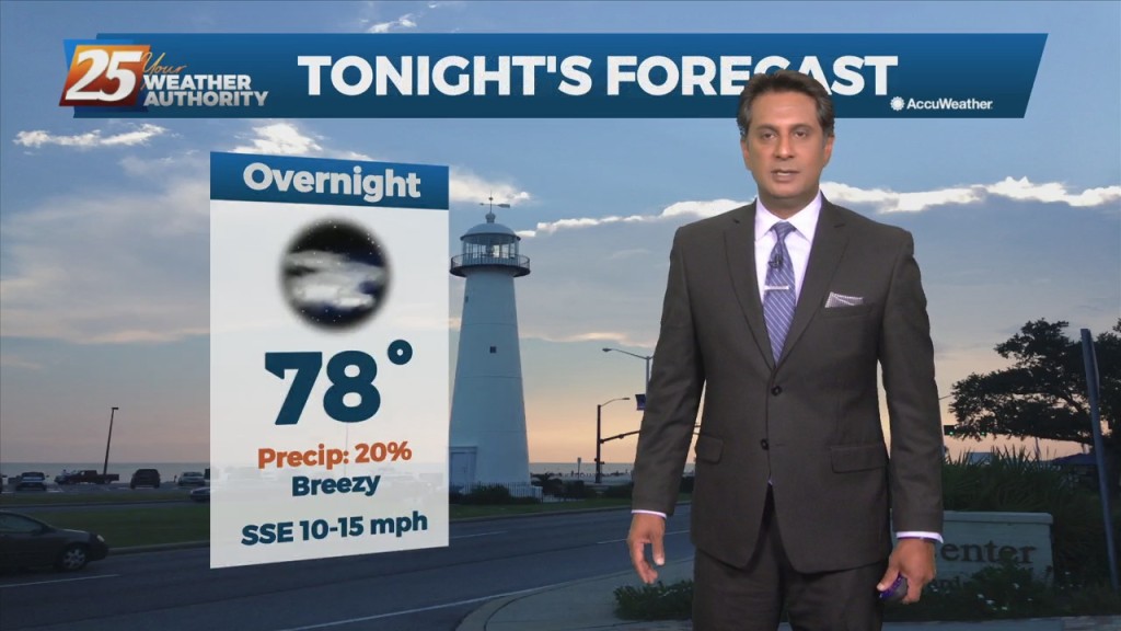
Expect clear skies and very pleasant weather Friday night, with lows down into the 60s. High pressure continues its dominance over the weekend with plenty…
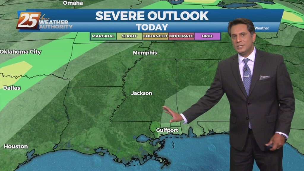
The big H (high pressure) will continue to dominate the weather pattern over the weekend. A weak upper low-pressure system could form in the eastern Gulf…
High-pressure will be the main factor shaping the weekend forecast. A weak upper low-pressure system could form in the eastern Gulf of Mexico over…
An upper-level low pressure over southern Illinois this morning will slowly drift off the eastern seaboard tonight into the weekend. High-pressure will be the main factor shaping…
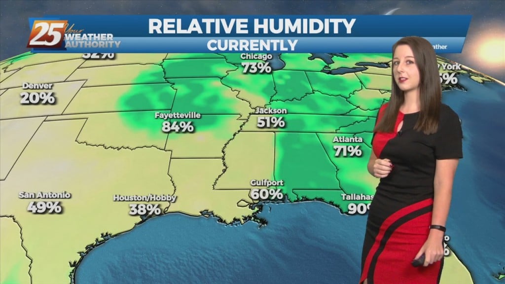
Stepping outside today was quite refreshing compared to the recent high-humidity affair earlier in the week. High pressure will shape the forecast through the area Friday…
This morning’s cold front is long gone, and in its wake is a pleasant drop in humidity. High pressure will shape the forecast through the area…
The cold front is now eat of the area with a few linger showers (even an Isolated t-storm) expected early this afternoon. Skies will begin to slowly…
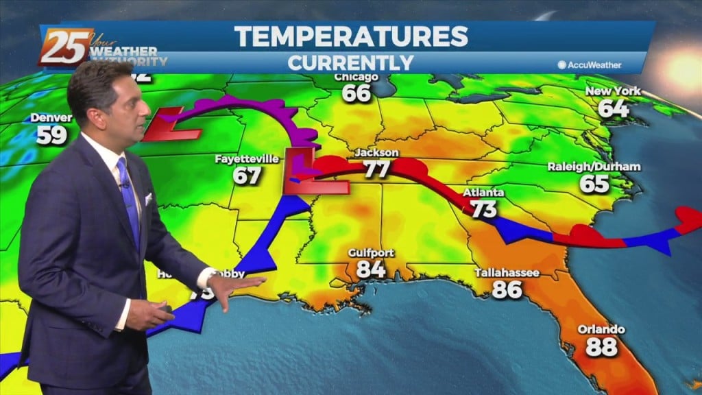
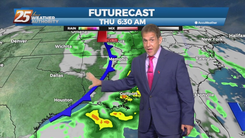
An upper low-pressure system this morning is moving into Missouri, with the associated cold front appears to extend from Jackson to Lafayette, probably just moving into the Baton…
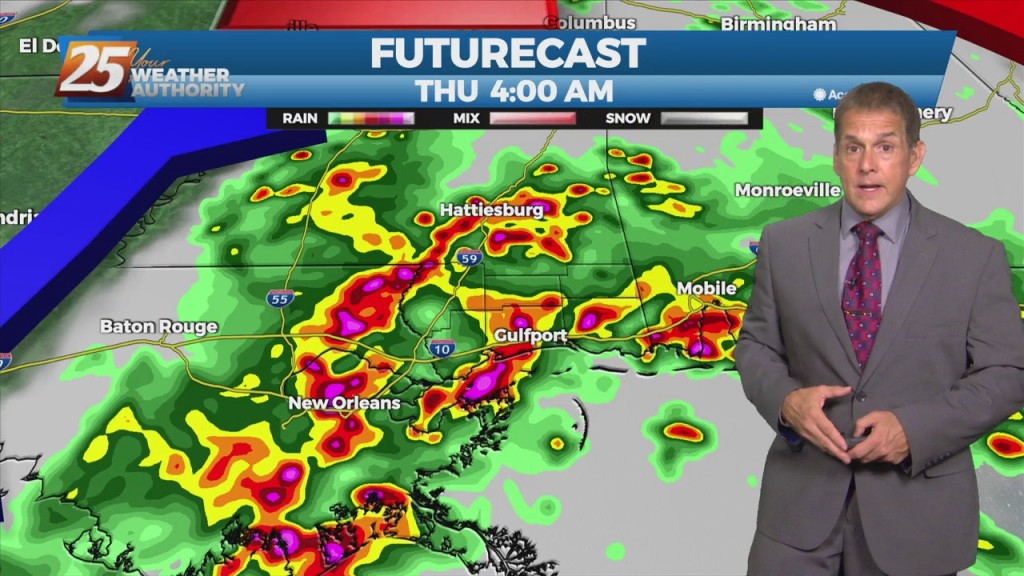
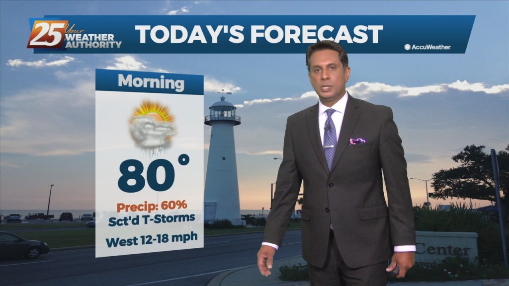
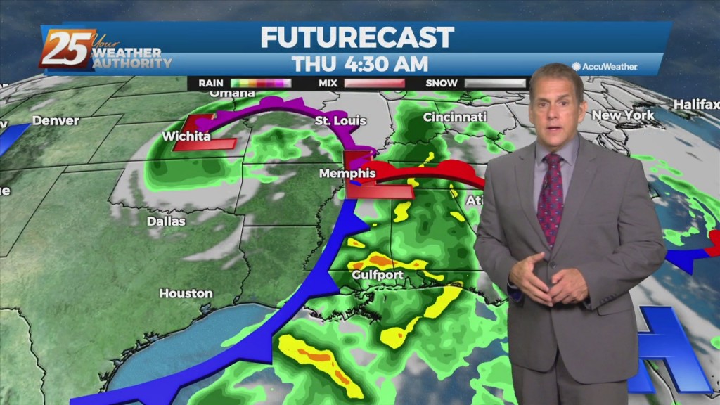
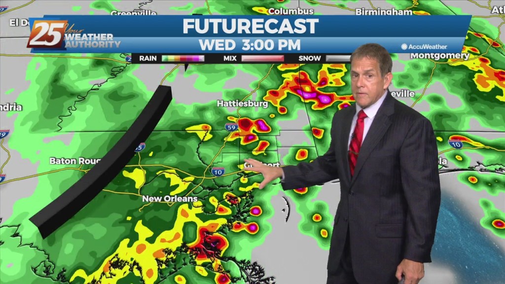
One more round of heavy rain with potential severity arriving Thursday morning. Both heavy rain and thunderstorms are on the way as a cold front arrives…
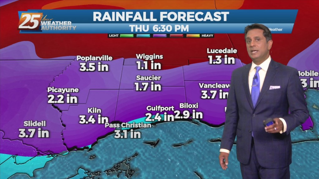
The main concerns are for heavy rain in the first 12-18 hours of the forecast…round one came through this afternoon, with round two overnight into Thursday…
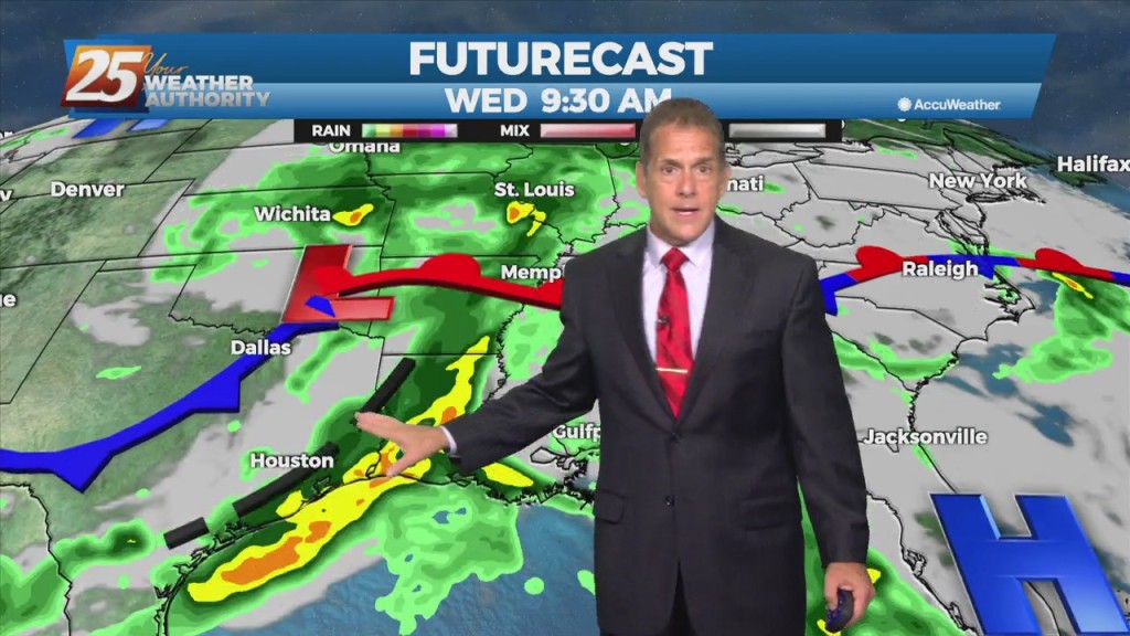
The main concerns are for heavy rain in the first 36 hours of the forecast...or in other words, today and Thursday. as showers…
The main concerns are for heavy rain in the first 36 hours of the forecast...or in other words, today and Thursday. The disturbance swinging through the…
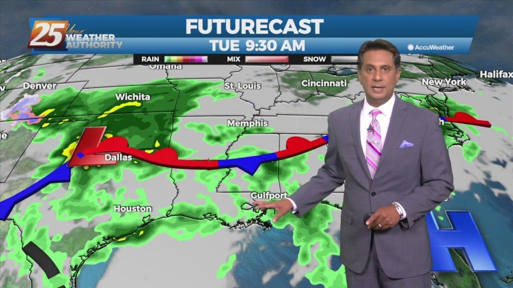
Expect only scattered showers and t-storms into Wednesday morning, although humidity will remain quite high. Wednesday and Thursday, however, return to a heavier-hitting pattern. Moisture flow…
After last night’s heavy rainfall, scattered showers and t-storms is the name of the game through Tuesday night, although humidity will remain quite high. Wednesday and…
An upper level High-pressure remains off the Atlantic Coast with southwesterly upper flow across much of the southeast. Scattered showers and t-storms will taper off this…
Finally, some decent rainfall graced a swath of the forecast area Monday night. The heavier rainfall stayed away for the most part over the…
We avoided the heaviest rainfall in the region over the weekend, as an area of low pressure in the eastern gulf pulled…
An area of low pressure located of across Central Alabama is producing showers and thunderstorms that are expected to move to the north and east. This low…
An area of low pressure located of across the Northern Gulf of Mexico is producing showers and thunderstorms that are expected to move to the north and…
As high pressure continues to move east and lose its grip, some showers popped up to our east Friday. With the humidity and southerly flow,…
With a bump in humidity, real-feel temps crept up a bit today (mid-upper 90s), but the hottest weather this week is still behind us. As…
The hot and dry pattern will come to and end this weekend... The upper pattern will start the transition into a wetter one late in the…
The upper pattern will start the transition into a wetter one late in the day with a weak disturbance sliding across the region. It’s not until Saturday…