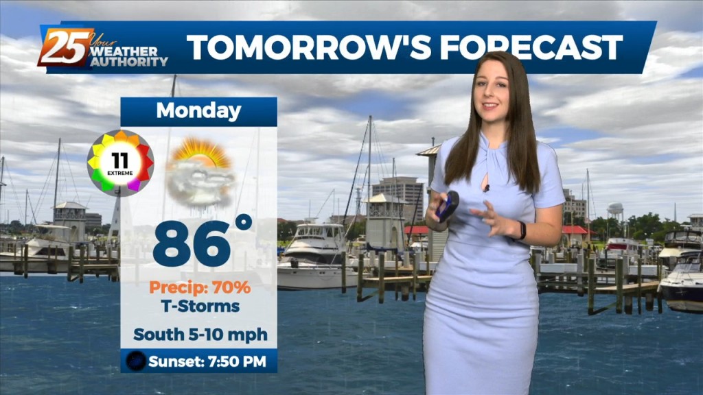
8/5 - Brittany's "Pleasant" Friday Afternoon Forecast
The area is currently still between high pressure to our west and and the Bermuda high pressure to our east and a weak mid level inverted trough over the…
The area is currently still between high pressure to our west and and the Bermuda high pressure to our east and a weak mid level inverted trough over the…
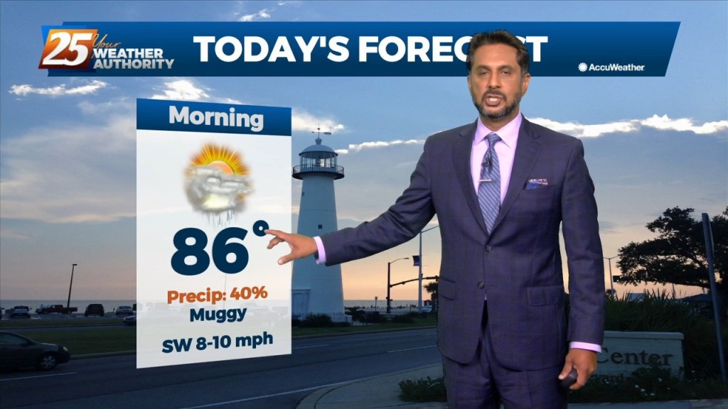
This afternoon will bring hot temperatures and a few showers/t-storms induced by the sea-breeze. Activity will fizzle out just before sunset. With an uptick in mid-level drier…

Today will bring hot and humid conditions with t-storm coverage slightly more reduced for generally areas along/near of I-55 and east to the MS coast given…
Upper ridging to the west and east with troughing across the local area. This pattern has been rather stubborn to remain over the area for much of…
A weakness/subtle mid-level inverted trough over the northern Gulf continues a slow retrograding motion towards the WSW along the outer periphery of a mid-level high pressure…
A weakness/subtle mid-level inverted trough over the northern Gulf continues a slow retrograding motion towards the WSW along the outer periphery of a mid-level high pressure…
Looks like one more day of anomalously high moisture levels before some drying occurs. Now...that doesn`t mean we`re going to have totally dry and sunny days, but…
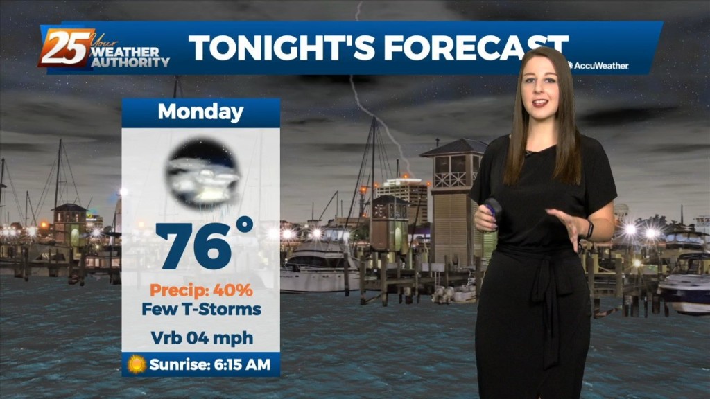
The convection will decay in the late evening as the sun goes down and it will give way to warm and muggy overnight conditions. More of the…
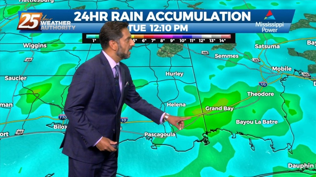
Many parts of the area have seen considerable rainfall over the past several days with a few locations having had measurable rainfall for quite an extended period. While…
The main concern will quickly shift to the possibility of heavy rainfall once again today. Many parts of the area have seen considerable rainfall over the…
Not much in the way of change is expected tomorrow or Thursday. As mentioned yesterday, the continued rainfall across the area will accumulate as the week continues…
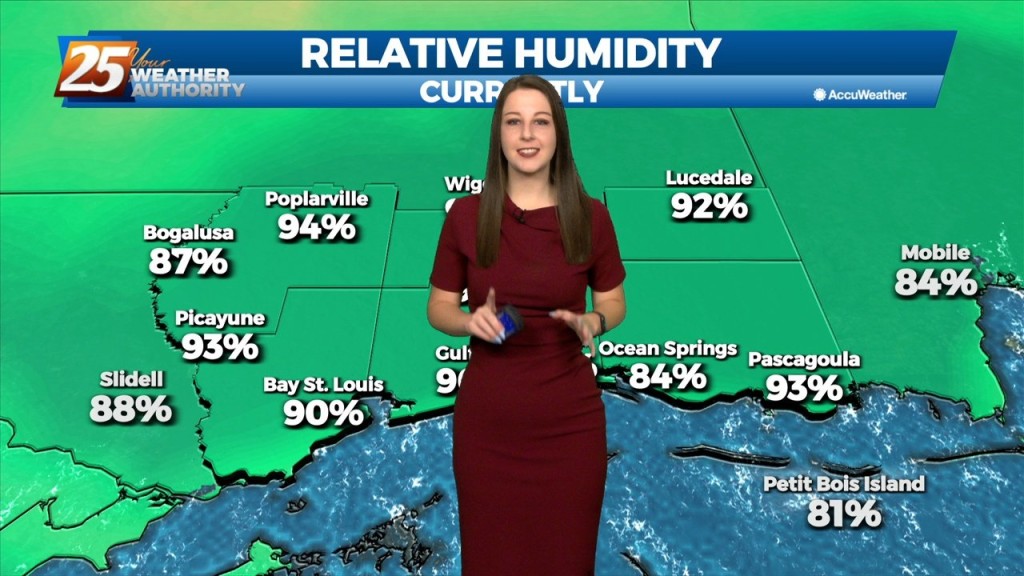
Deep moisture from the Gulf of Mexico continues to stream into the area with model soundings showing precipitable water values well above 2 inches, and as high as…
Deep moisture from the Gulf of Mexico will continue to stream into the area with model indicating well above seasonal normal. This will allow for another…
Today will bring more of the same as yesterday as numerous showers and thunderstorms are expected to develop. Deep moisture from the Gulf of…
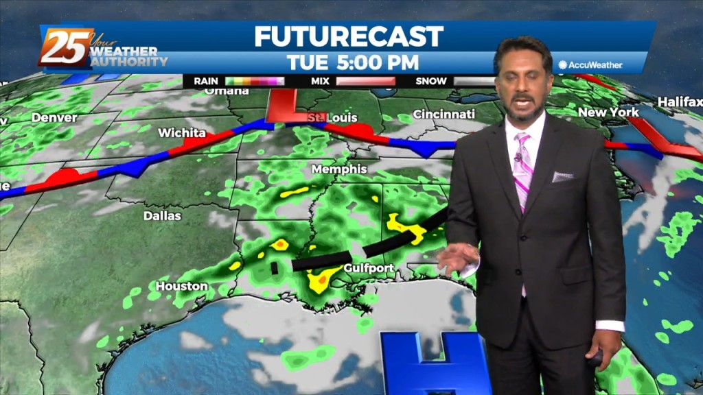
Winds will be variable in and around storms, then light southerly winds will prevail overnight. Another round of afternoon and evening thunderstorms is expected on Tuesday. Over…
Thunderstorm activity will taper off after sunset, then lingering debris clouds and VFR conditions expected overnight. Winds will be variable in and around storms, then light southerly winds will…
Daytime heating will continue to flare up afternoon showers and t-storms which could produce pockets of HEAVY RAINFALL... Over the short term period a wetter period will…

Over the short term period a wetter period will begin today as general weakness in the overall patter to the north of Hattiesburg slowly moves into…
Tonight through Wednesday Night, on the synoptic level, an elongated ridge axis extending from Texas eastward across the Gulf South and then across Florida will weaken…
We should see a gradual transition of dry air replace deep moist air late Saturday into Sunday. Then another transition of this dry air to the deep moist air…
Today won`t be very different from the last several but there are some minor changes on the way. We should see a gradual transition of dry air replace deep…
Upper level ridging remains in control of the southeastern part of the US with weak easterly flow. In addition, ample moisture continues to funnel through the area from the…
Upper level ridging remains in control of the southeastern part of the US with weak easterly flow. In addition, ample moisture continues to funnel through the area from the…
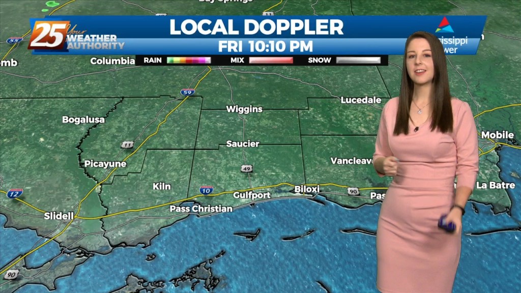
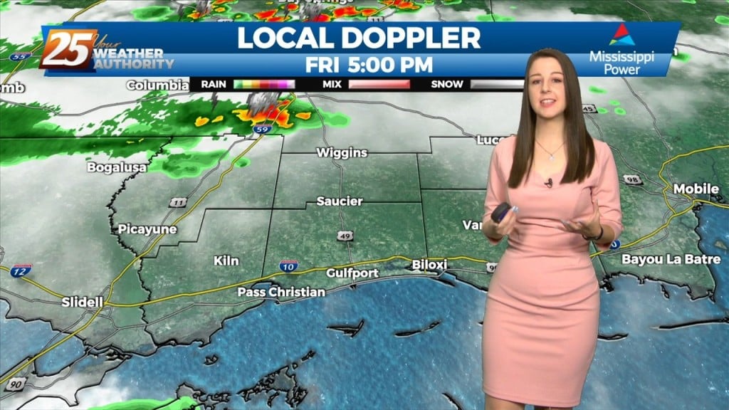
Areal coverage of storms was pretty sparse today, but it’s likely to ramp up Thursday and Friday. A stagnant summer pattern has set up this week, with rain chances dependent upon an oscillating high pressure area and variations in the…