7/28 – Brittany’s “Humid” Thursday Evening Forecast
Upper level ridging remains in control of the southeastern part of the US with weak easterly flow. In addition, ample moisture continues to funnel through the area from the Gulf of Mexico. PW values remain around 2 to 2.2 inches for the next few days.
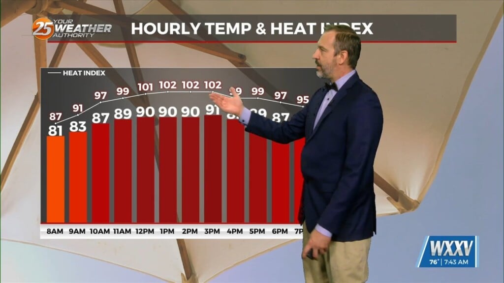
Temperatures will be generally in the low 90s and dew points in the 70s which is typical for this time of year. With the relatively widespread convection and cloud cover expected, not anticipating any heat advisory again today, although it`ll have to continue to be monitored especially later this weekend.
Not much really changes in the long term. Although the ridge weakens some more, we will eventually have high pressure that is centered over the Great Plains build in from the west towards Louisiana. The high temperatures will have a gradual climb up into the mid 90s and still similar dew points in the 70s, which depending on the coverage of showers and storms on any given day, heat advisories may be needed early next week. Diurnally driven convection is expected each day but PoPs are currently looking in the 30% range due to increased subsidence from the high pressure from the Plains.