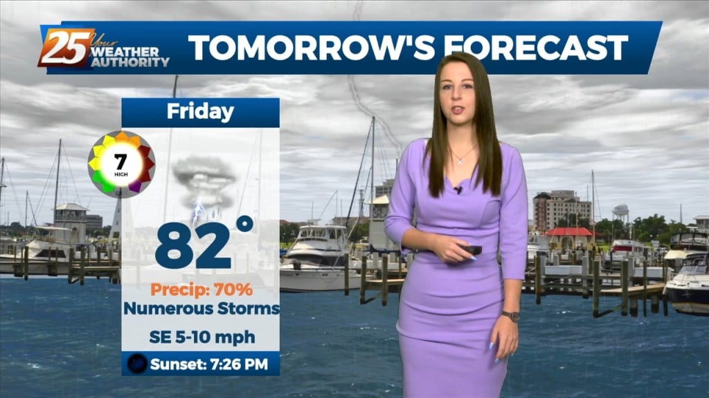
8/28 - Brittany's "Pleasant" Sunday Evening Forecast
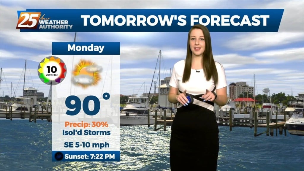
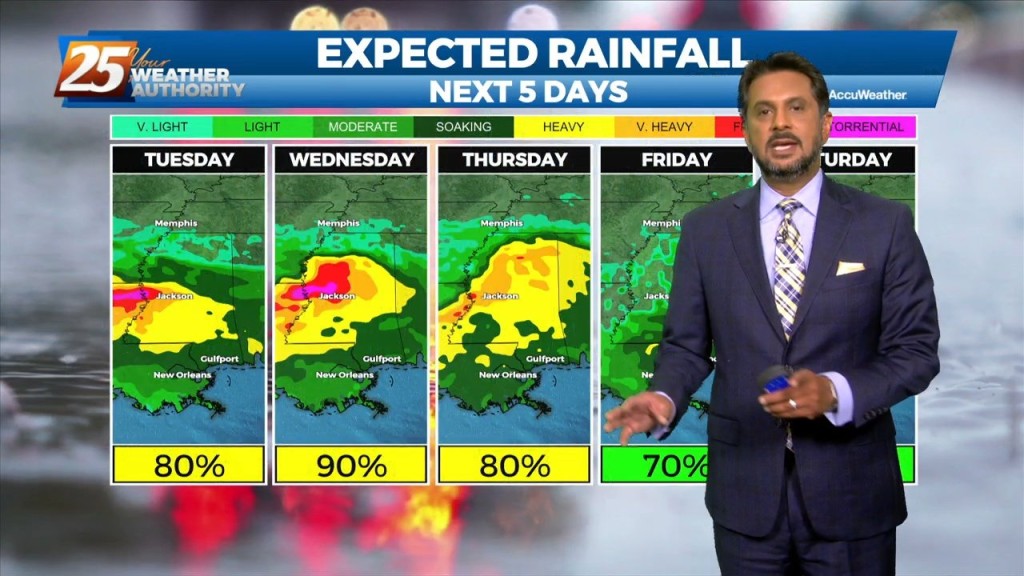
A broad ridge of high pressure will remain over the northern gulf through the week promoting onshore flow with showers and thunderstorms expected each day. Starting out the new…
A broad ridge of high pressure will remain over the northern gulf through the week promoting onshore flow with showers and thunderstorms expected each day. Starting out the new…
The boundary will lift tonight, and there will not be as much of a focus for rainfall that develops. Southerly surface winds will help to enhance warm air and…
The boundary will lift tonight, and there will not be as much of a focus for rainfall that develops. Southerly surface winds will help to enhance…
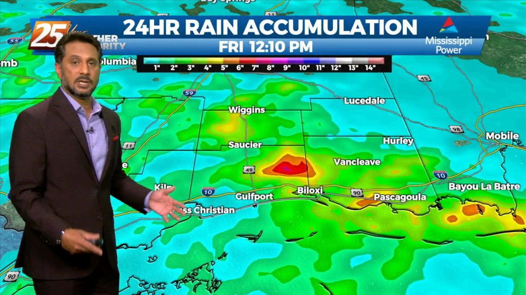
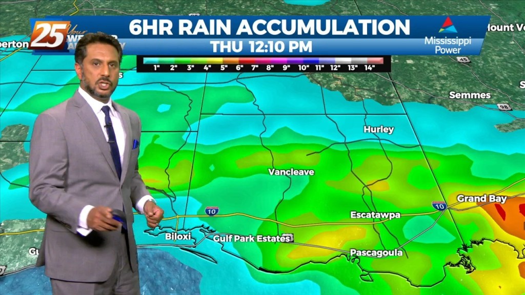
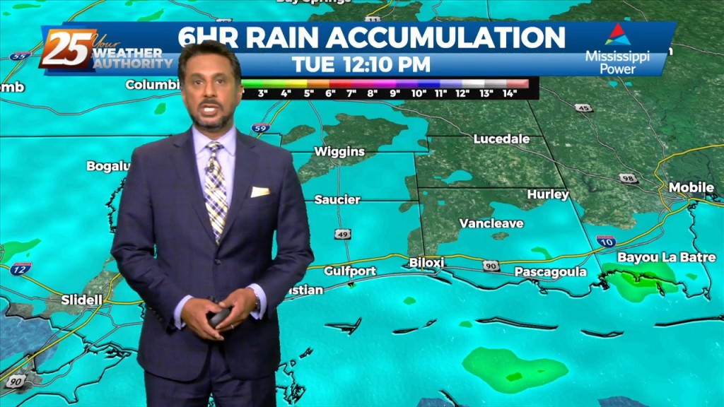
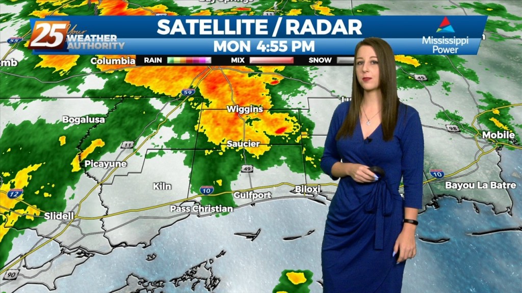
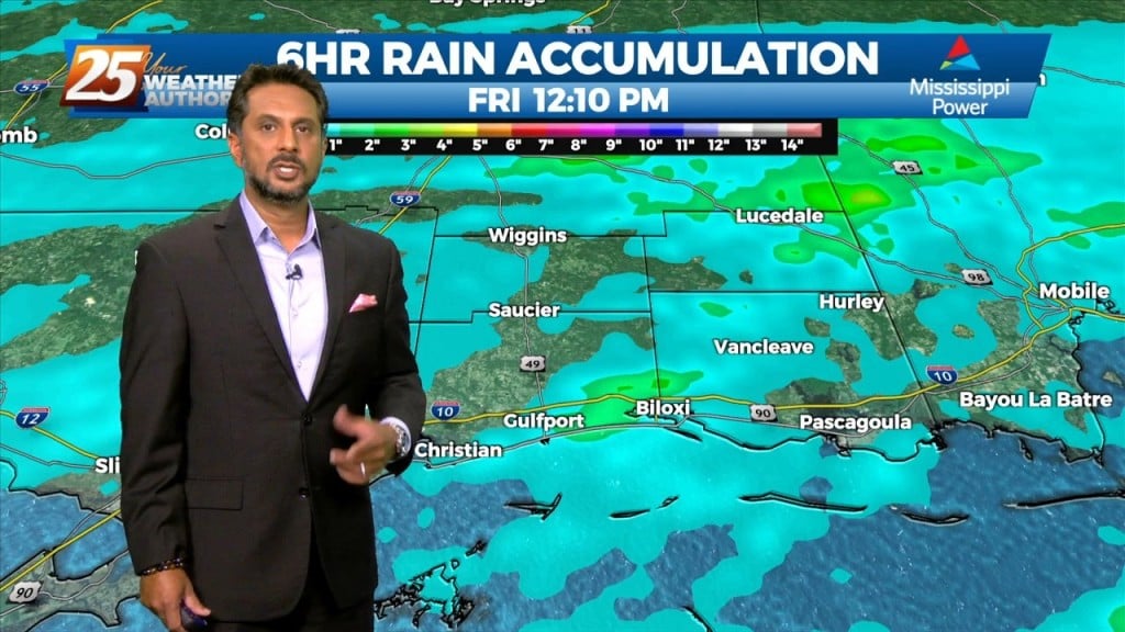
FLOODING ALONG RIVERS; WOLF, BILOXI AND TCHOUTACABOUFFA... A weaker surface low pressure and attendant boundary near or just offshore this afternoon will be the focus for…
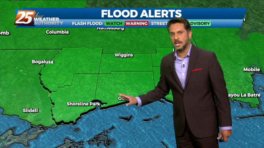
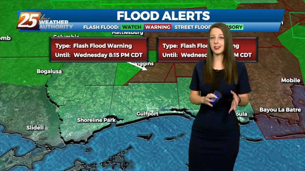
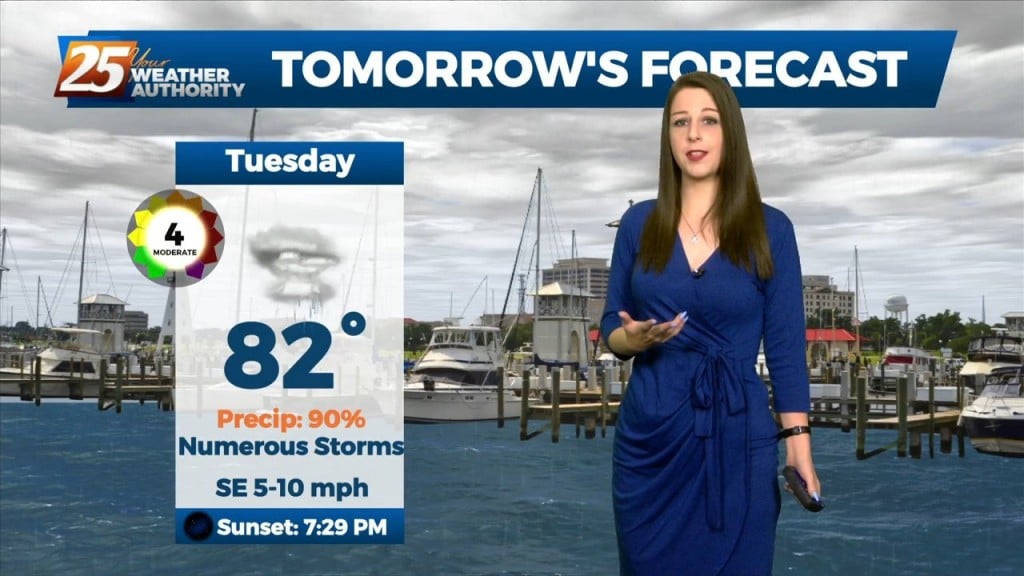
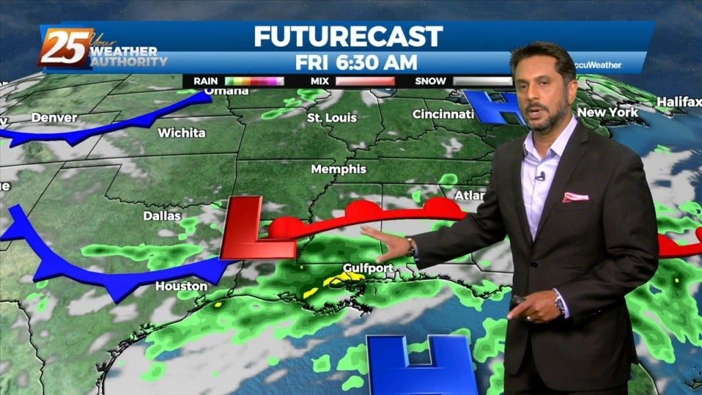
FLASH FLOOD WATCH IN EFFECT - 7 PM... A stalled stationary front overhead will continue to bring the abundant moisture flow to the area. But with…
Will be going up with a flash flood watch for today. This will not be as much of an areawide distribution but moreso a rate driven event. Some…
FLASH FLOOD WATCH IN EFFECT - 7 PM... The threat for pockets of HEAVY RAIN will continue this afternoon. This will not be…
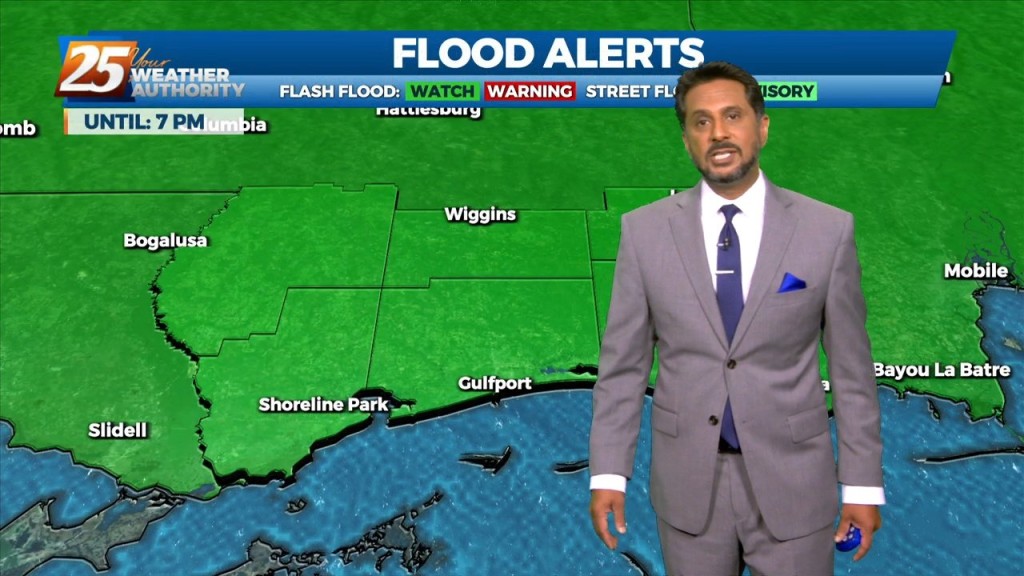
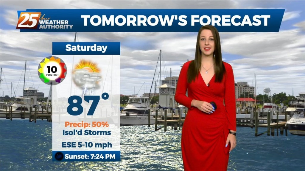
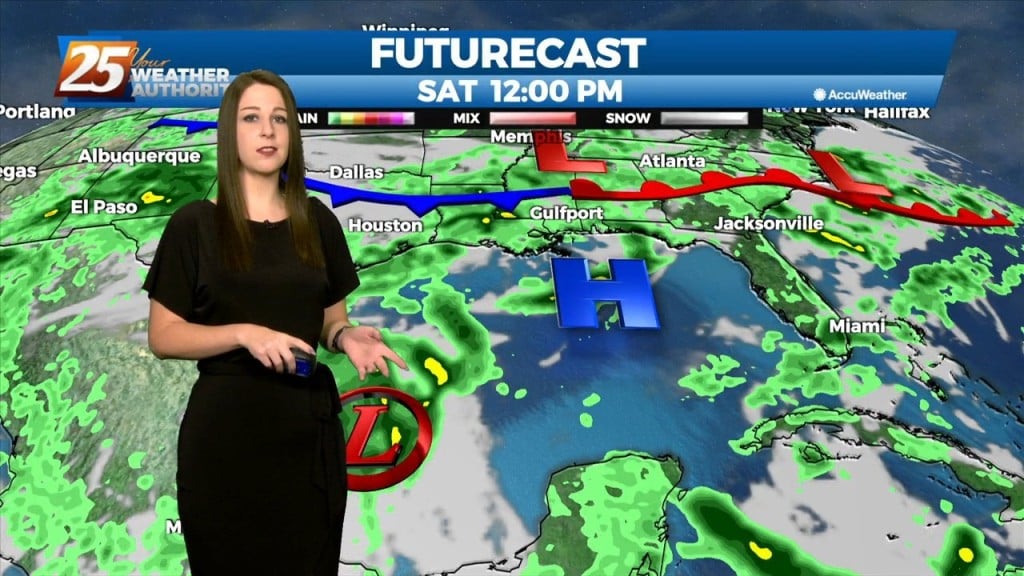
FLASH FLOOD WATCH IN EFFECT - 7 PM... Today through Saturday will continue with the wet pattern. A flash flood watch has…

A stalled surface low and trough north of the coast will keep a higher risk of showers and thunderstorms in place through Friday. The low should slowly…
A stalled surface low and trough north of the coast will keep a higher risk of showers and thunderstorms in place through Friday. The low should slowly dissipate…
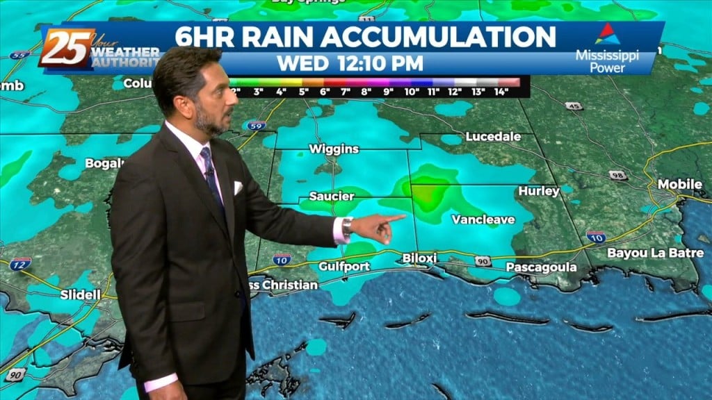
Today through Friday, high precip chances along with high rainfall rates will remain the topic along with an environment conducive for waterspouts. The surface…
A strong and persistent meso-low currently over the Arklatex region and broader and weaker shortwave trough in the upper levels will continue to work in conjunction to produce…
A strong and persistent meso-low currently over the Arklatex region and broader and weaker shortwave trough in the upper levels will continue to work in conjunction to produce…
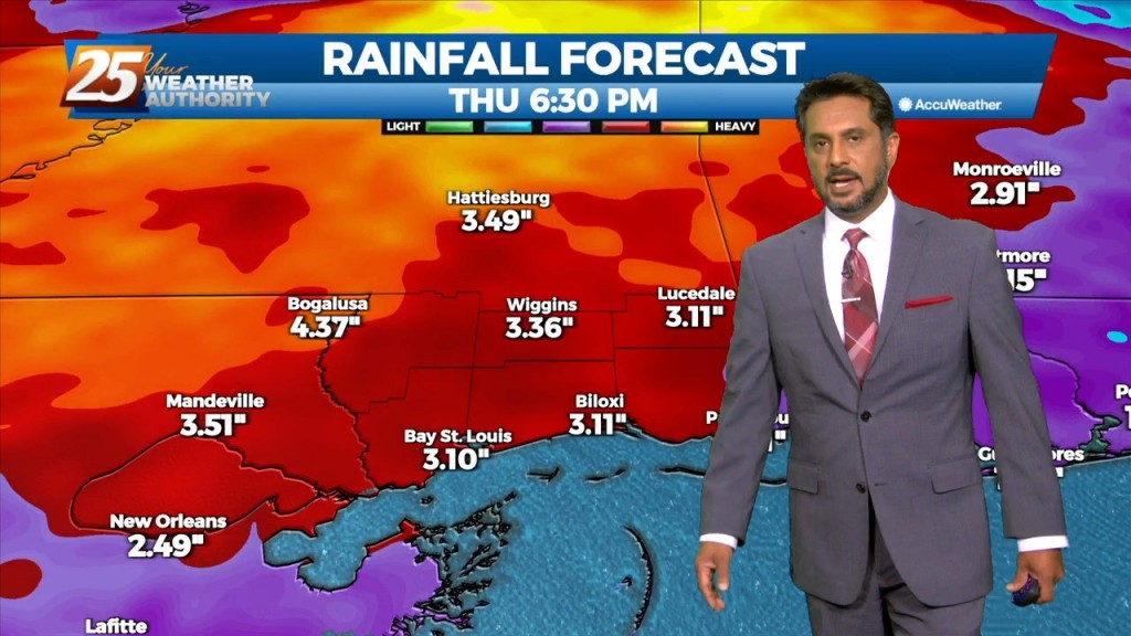
Rainfall tallies could be robust the farther north one moves though. This will be due to a surface low over east Texas and trough extending…
High precip chances will remain the topic along with an environment conducive for waterspouts. Rainfall tallies could be robust the farther north one moves though. This…
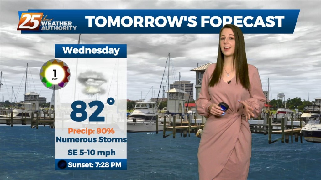
Tonight through Wednesday Night, little change in the ongoing pattern is expected through Wednesday night as a broadly diffluent westerly upper level pattern, a weak shortwave trough,…
Tonight through Wednesday Night, little change in the ongoing pattern is expected through Wednesday night as a broadly diffluent westerly upper level pattern, a weak shortwave trough, and favorable…
As minor disturbances move through multiple frontal systems through the Gulf South, they will trigger rounds of showers and thunderstorms each day. Moisture flow values remain…
A broad upper disturbance across the eastern half of the country doesn’t really go anywhere over the next several days. As minor disturbances move through the…
A shortwave trough will move through the area over the next few days. Southerly surface winds will continue to enhance warm air and moisture advection, which will…
A weak front along the coast will dissipate by tomorrow. A more typical August pattern of high pressure extending westward across the eastern Gulf and…
A weak front along the coast will dissipate by tomorrow. A more typical August pattern of high pressure extending westward across the eastern Gulf and into the…
Water vapor imagery continues to show a plume of moisture extending from south Texas to the Carolinas, covering much of our area. The current disturbance that is…
Multiple disturbances expected to move through the eastern US today. One is moving through Arkansas and east Texas into Louisiana, while a stronger one is dropping…