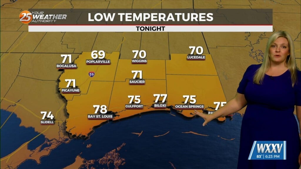
5/31 – The Chief’s “Final Day Of May” Afternoon Forecast
Heading in to this afternoon expect hot conditions under partly cloudy skies. All eyes continue to track an upper level disturbance in the Gulf near our outer coastal waters, with a lot of dry air being brought southward on the west side of the disturbance. This feature will stick around the central, eastern and northern gulf over the next few days. The low pressure system will begin to move closer increasing our rain chances towards sunrise Thursday.
The Hurricane Center has lowered the chances of development to 10%-20% over the next 24 hours. The low pressure will exit our area by Friday, with the driest conditions expected. Saturday, moisture will return to our area bringing a chance of rain mainly for the afternoon hours due to daytime heating. This pattern looks to continue through next week with daily rain chance during the afternoon with temperatures in the mid to upper 80s.