6/13 - Sam Parker's "Rain Free" Thursday Midday Forecast
Today will bring increasing subsidence through the area as high pressure begins to expand eastward from the southern Plains. Cumulus cloud development can be expected this afternoon…
Today will bring increasing subsidence through the area as high pressure begins to expand eastward from the southern Plains. Cumulus cloud development can be expected this afternoon…
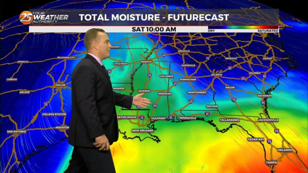
The very weak front has finally settled and now stalled in the outer-coastal waters. The drying throughout the column has been achieved bringing rain chances close to…
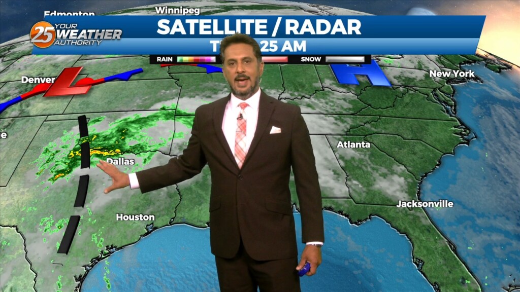
A complex of t-storms well to the NW will continue SE and dissipate late this evening. The activity will move in to the region and traverse…
The fight between a series of fast moving disturbances sliding along the I-20 and further north and high pressure to the E/SE will be the main forecast…
High pressure through the region will continue to provide subsidence and warming through the period. This will result in a dry forecast through the…
A somewhat weak high pressure across the Bay of Campeche and southern Gulf will help warm most of our region well into the 80s again…
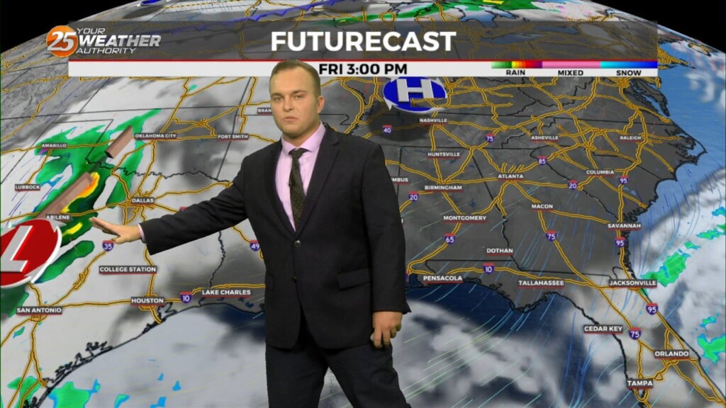
A disturbance along the NE’tern portion of Texas will continue to eject to the NE moving across the extreme NW portion on Mississippi later this afternoon. Friday…
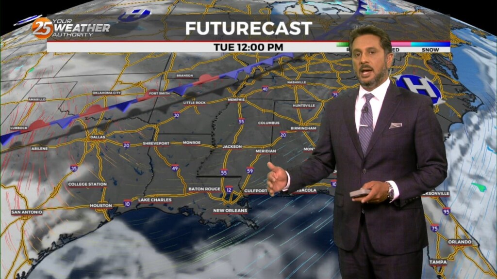
An are of upper-level low pressure will continue to move northeast over the next 36 hours as it gradually gets absorbed by a stronger system over…
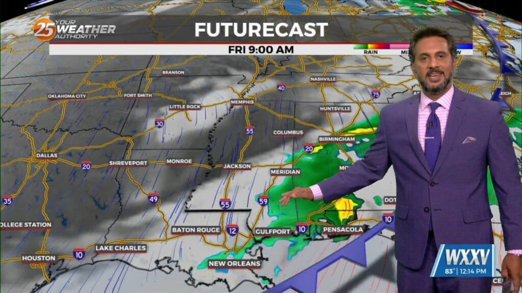
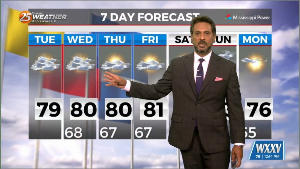
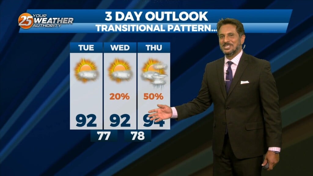
The forecast through the remainder of the workweek is pleasant with no major impacts. Rain should at least hold off till late Friday if not…
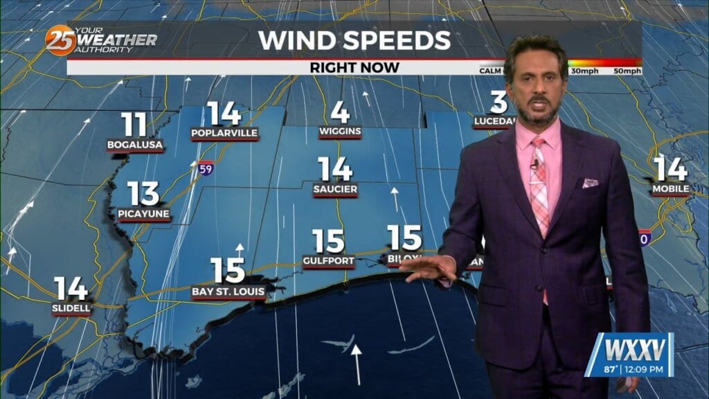
Winds will start to come around to southerly today for most of the area. This will help transport some moisture to the area but not enough for…
The general upper high pressure over the lower and middle Mississippi River Valley extends off the eastern seaboard. At the surface, high pressure was centered…
It will be cold again overnight but frost concerns should be very isolated. Your Wednesday will feature upper-level clouds streaming in leading to a few clouds…
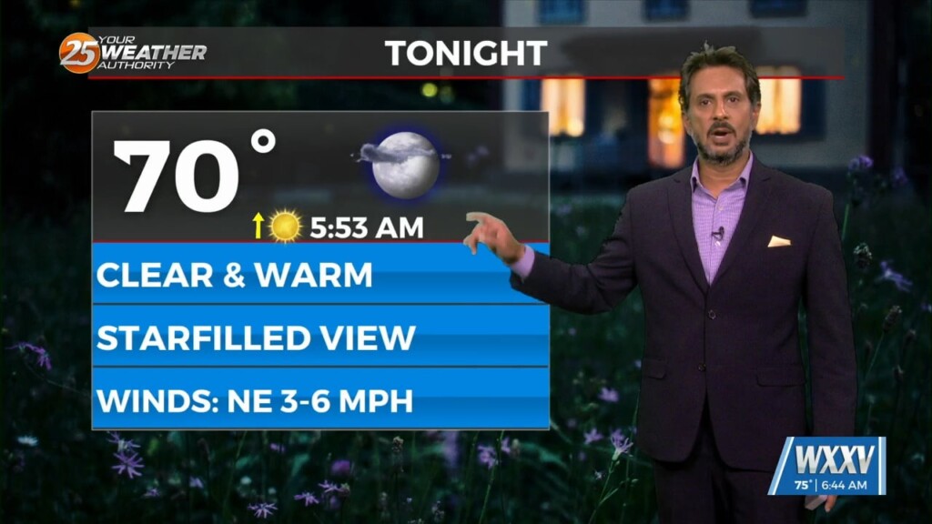
Temperatures will be cool this evening but winds will back off gradually. Skies will be mostly clear which will help it turn cold in a hurry…
A departing surface high pressure will continue to induce light north to northeast flow, low Dew-points, and clear skies through this morning. Upper-level clouds will continue to…
Some clouds move for this afternoon but the biggest change will be the wind direction. Gradually, our area will experience a moderating pattern with temperatures not as…
Skies will clear out somewhat this evening into the overnight hours. A weak dry cold front will make its way through the area overnight. Winds will pick…
This afternoon will be a repeat of yesterday with slightly cooler temperatures and a bit less wind. Cool conditions linger into this evening and clouds will clear out…
Any rain this afternoon will be light in nature with drizzle and intermittent bouts of showers fading by the evening. Winds remain elevated as an area of…
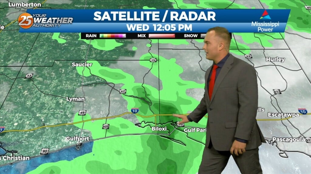
Mostly light showers have been intermittent across the region this morning as rain continues to move in from the south. An area of…
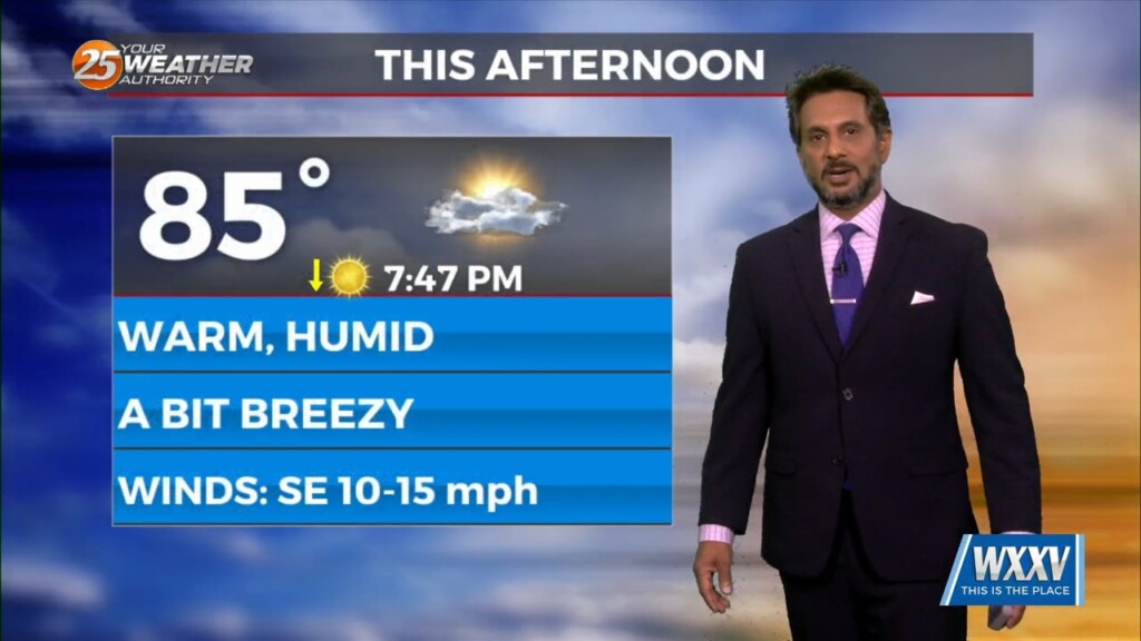
A few clouds to partly cloudy skies can be expected this afternoon with warm temperatures yet again. Winds remain out of the south which will keep humidity around.…
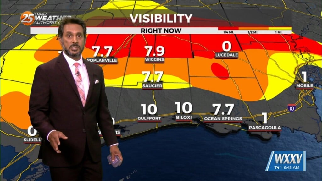
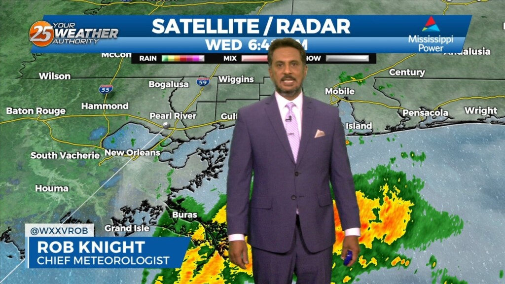
The biggest impact of the short-term is the fog potential this morning. With the east-southeasterly surface winds promoting low-level moisture, the areas where the winds have…
High pressure yesterday just west of Shreveport/Bossier City La has shifted to our NE. This will innate the return flow from the Gulf of Mexico. Warmer…
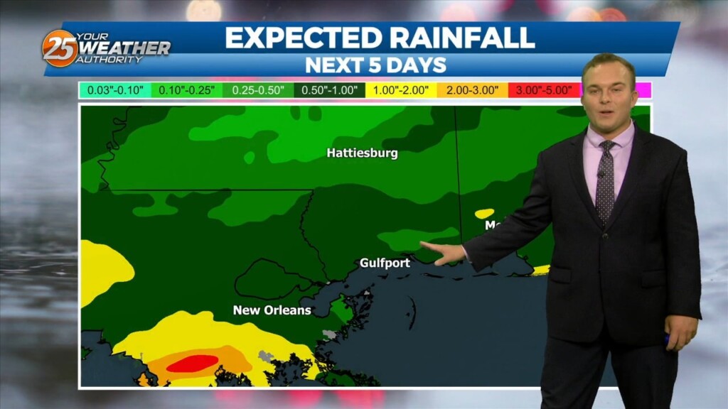
The month of September will bring a changing pattern where dominant high-pressure in the SE begins to break down allowing cold fronts to move through the…
Upper level high pressure continues to spread eastward through the central MS River Valley and into the southern Appalachians. Basically, in a nutshell, same old same old…