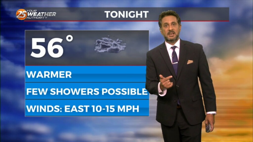
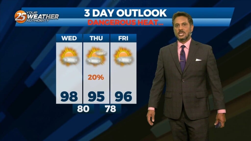
6/18 - The Chief's "Tropical Moisture Slowly Departing" Tuesday Afternoon Forecast
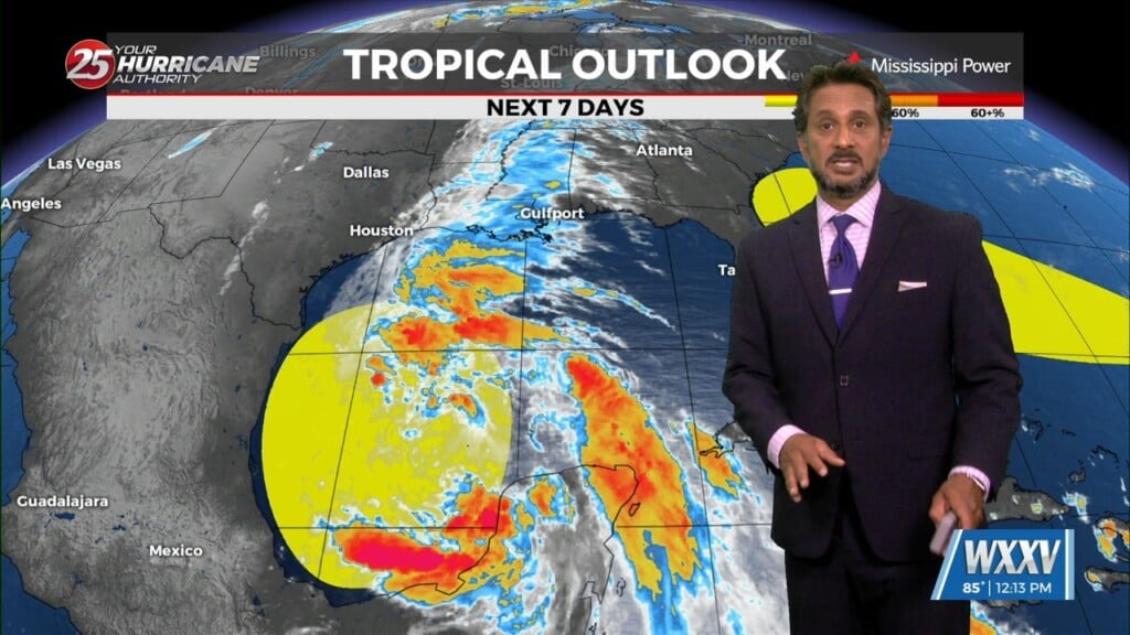
The area of low-pressure over the Bay of Campeche has been designated Potential Tropical Cyclone 1. Still have a fairly significant surface flow between the…
The area of low-pressure over the Bay of Campeche has been designated Potential Tropical Cyclone 1. Still have a fairly significant surface flow between the…

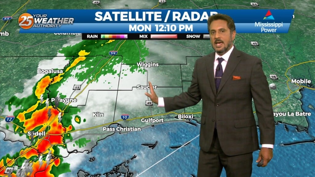
SEVERE THREAT this afternoon/tonight, with multiple potential hazards in the first 24 hours of the forecast before the weather quiets down for a while. A…
High pressure to our east today will help low level dew points to begin to climb and a slight warming trend (overnight) is anticipated to…
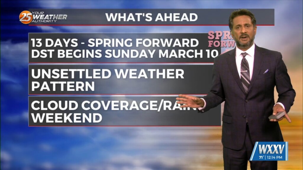
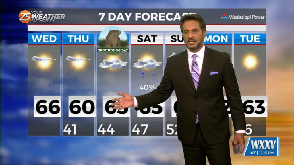
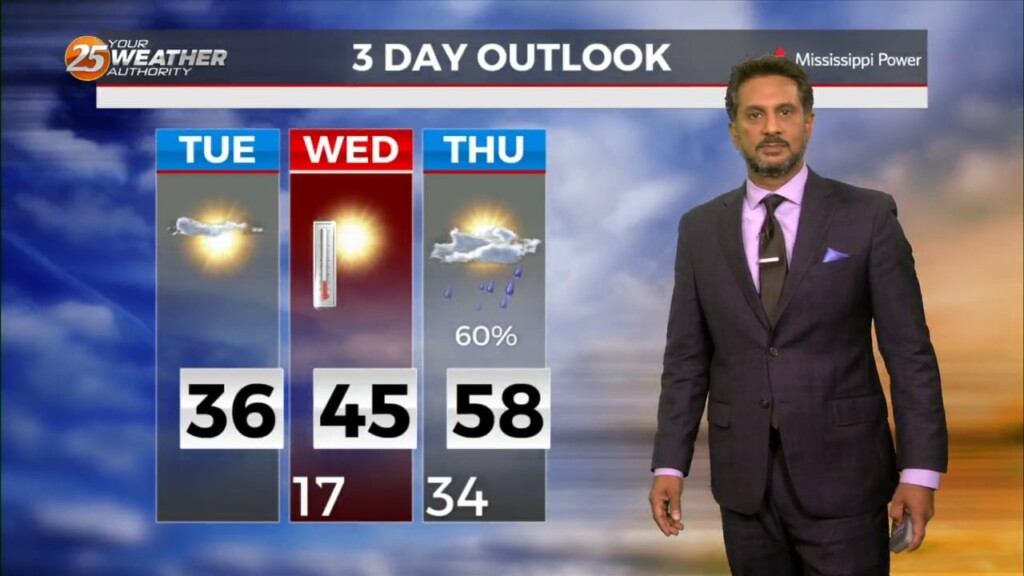
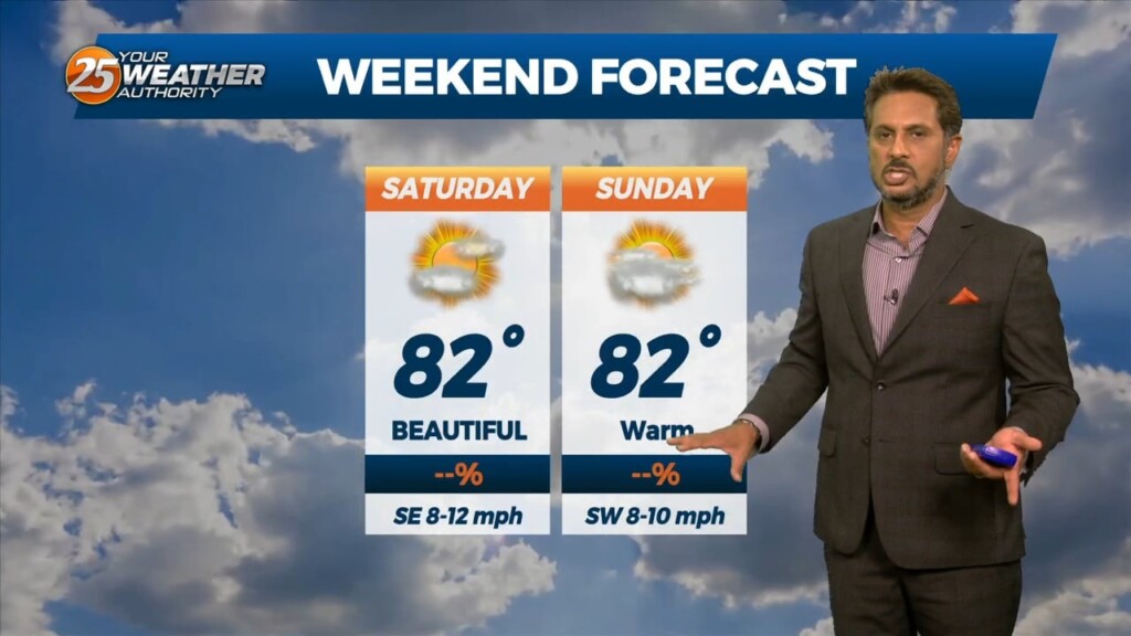
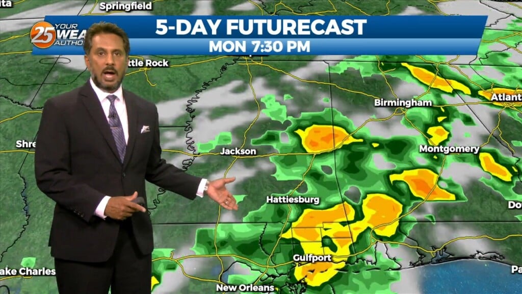
The forecast through the remainder of the workweek is pleasant with no major impacts. Rain should at least hold off till late Friday if not…
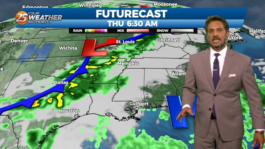
A reinforcing shot of dry air has started moving into the area. A back door cold front has moved into the N’tern GOM and…
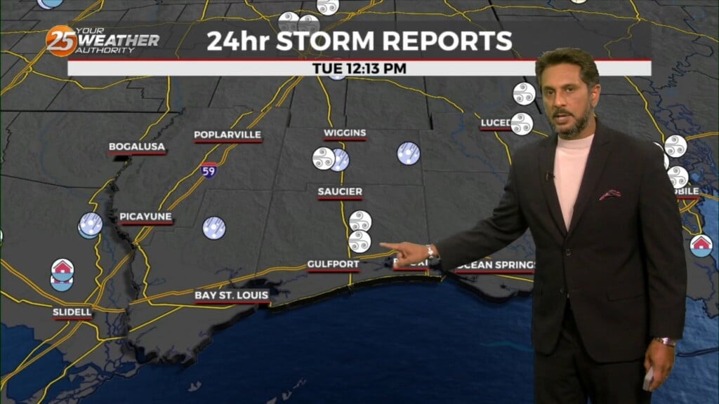
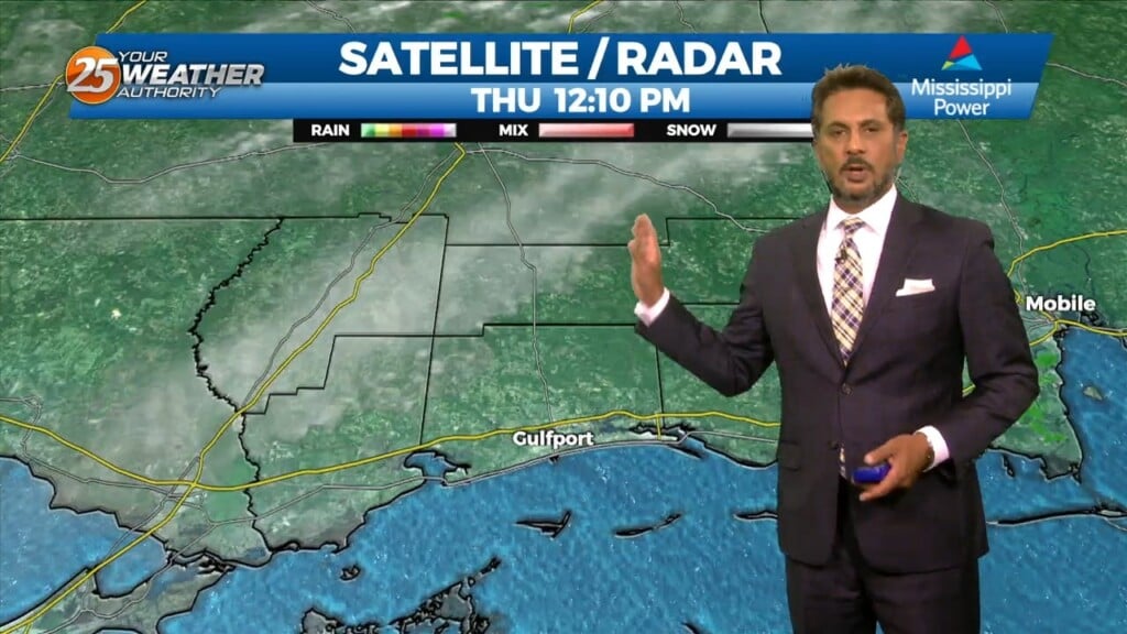
This afternoon will bring an abundant of cloud cover, and at least light precipitation. However, current indications are that rain amounts through Tuesday afternoon…
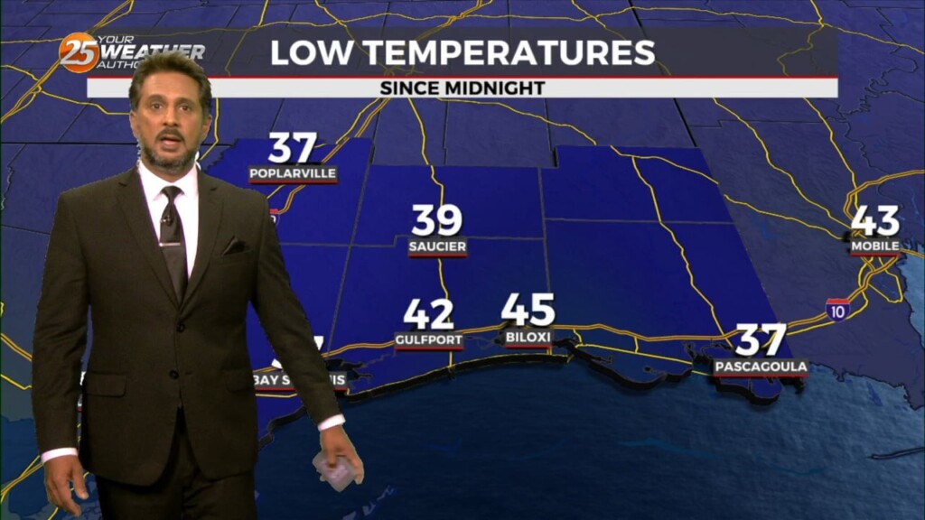
WIND CHILL & HARD FREEZE WARNINGS in effect tonight... Temperatures will struggle to warm into the 40s this afternoon especially with a strong north wind…
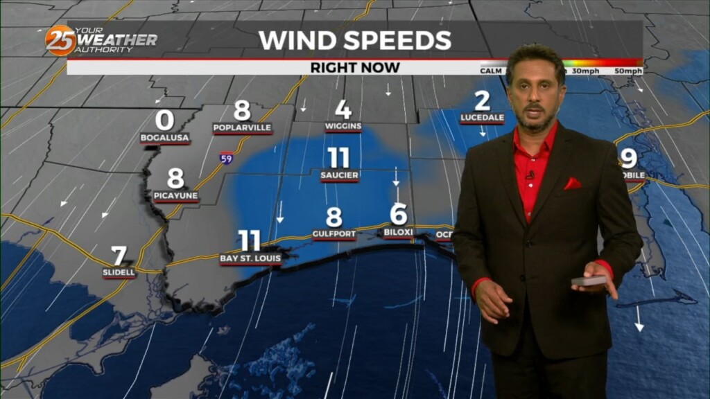
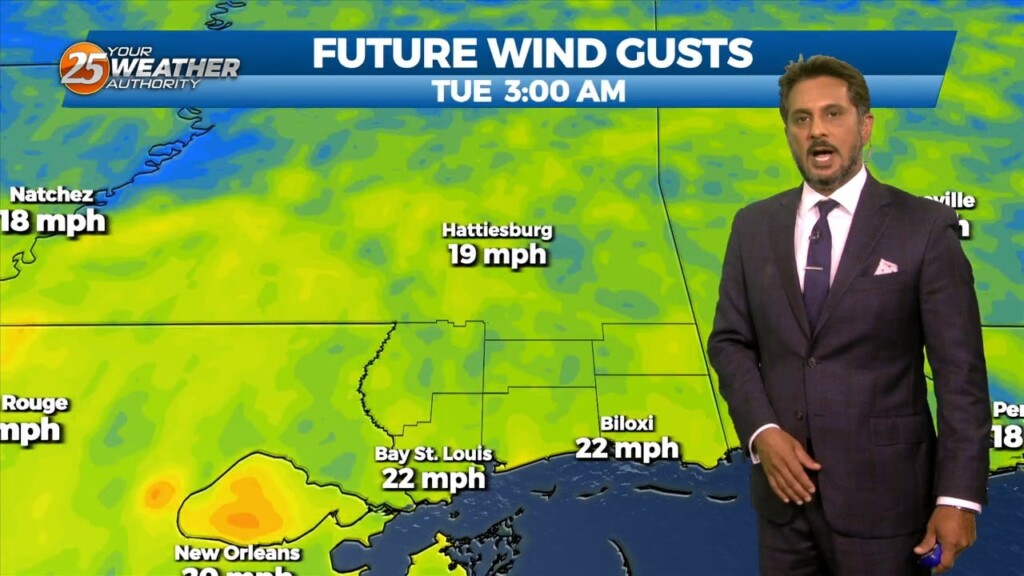
The WIND ADVISORY will continue through this evening before the flow begins to weaken. Breezy conditions will continue overnight with winds around 15 mph…which means the…
In the wake of an upper feature which moved through earlier this afternoon, clouds will rapidly clear this evening/tonight. A fairly potent upper level high…
A rather cool day is in store, however, with high pressure building in over the lower MS River Valley, expect plenty of sunshine today, so overall…
Some clouds move for this afternoon but the biggest change will be the wind direction. Gradually, our area will experience a moderating pattern with temperatures not as…
Expect a mix of clouds and sunshine this afternoon with warm temperatures continuing in the area. Winds will remain breezy especially along and south of…
A n approaching surface front should clear the land by the afternoon as winds shift out of the north. The upper front will lag behind the…
A disturbance over northern Mexico is promoting its development as it ejects over the southern plains. High pressure over the GOM will keep the disturbance too…
A very weak front just north of the area will continue to move toward the Atlantic Coast today and Saturday with upper high pressure beginning…
At the surface, high pressure currently extends along the Atlantic Coast into the northeast Gulf of Mexico. Low pressure over Wisconsin had a cold front…
High pressure to the NE continues to shape the forecast but as expected, models have backed off of bringing showers into the area from the gulf…

High pressure remains dominate over the area and this will remain the case into mid-week. A few showers could tickle the coast from time…

A BEAUTIFUL Friday afternoon ahead with high-pressure to the NW and a weakling stationary front well to the south. Models pinpoint enough moisture above a well-mixed layer…
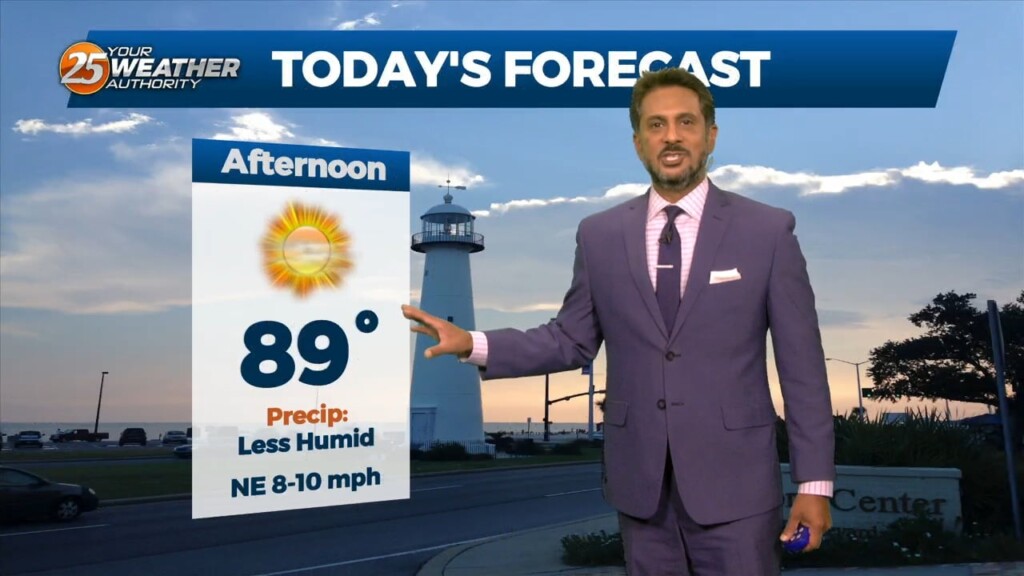
This afternoon will be very similar to yesterday in terms of low humidity values and temperatures warming back into the upper 80s to low 90s. Tuesday…
Today most things point to a favorable day for scattered to numerous storms but again obviously current events are highly impacting the thought process. This…
Multiple weaknesses in the overall pattern including an area of low pressure to the west has brought rain chances back to the region. Strong cored…
At the surface, a very subtle weakness resides across portions of the region, however, this feature hasn’t been as productive as I'd like in terms of…
An easterly wave is currently located from Appalachia Bay FL down to the NE’tern Gulf of Mexico. This wave will also get flattened down on its…