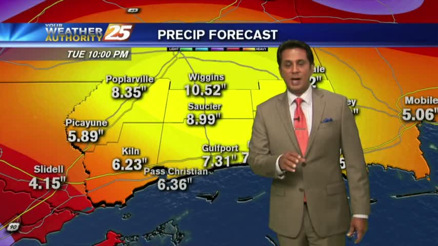
6/15 - Rob's "Heavy Rainfall" Friday Morning Forecast
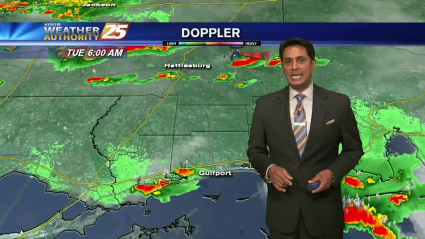
As the very saturated environment continues, activity is already in the area before sunrise...

As the very saturated environment continues, activity is already in the area before sunrise...

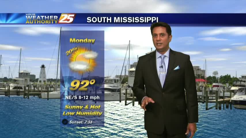
HOT & HUMID with showers and t-storms beginning to pop along the Southern 6 and the region...

Another HUMID start to the day with isolated activity in the vicinity...
The activity is taking a bit longer to fire off but will begin heading into early afternoon...
After HEAVY RAINFALL yesterday afternoon, only a few light sprinkles exist this morning...
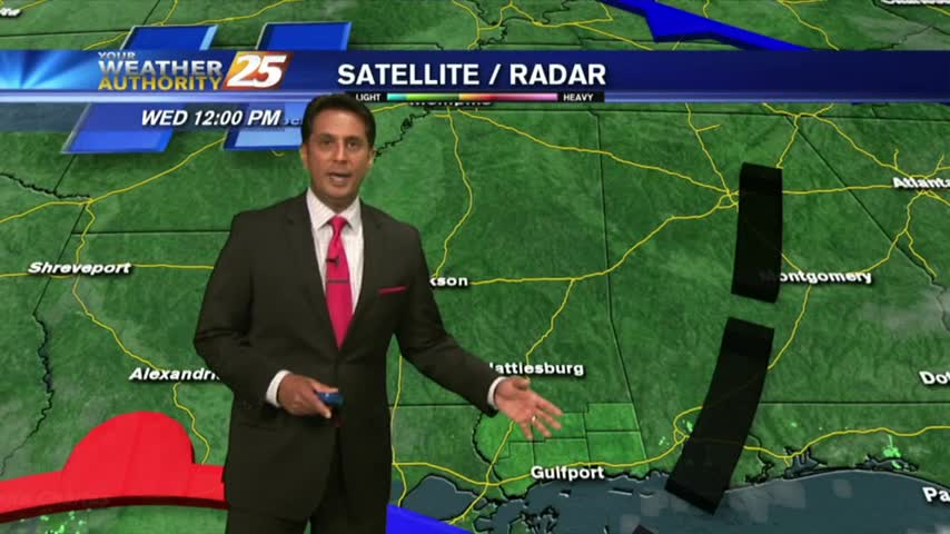
Overnight activity has dissipated but activity will redevelop this morning and then again this afternoon...

A warm/humid start with cloud coverage developing and moving in from the west...

A nice start to the day/weekend as clear skies prevail with a north wind and temps in the upper 60s/low 70s...

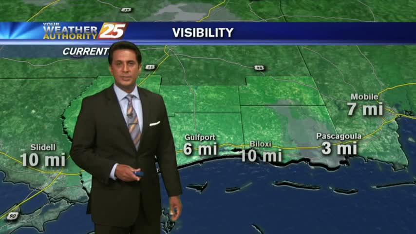
A clear start to the day with light patchy fog in Jackson County...
Isolated showers and cloud coverage prior to sunrise cleared to the SE, with hot temperatures on-tap this afternoon...
Isolated showers/t-storms are in the area this morning with the threat for HEAVY RAINFALL today...
A cold front to our south will bring hot temperatures and a drier air mass to the area...

A HOT day with the sea-breeze developing isolated activity along the southern coastal counties...

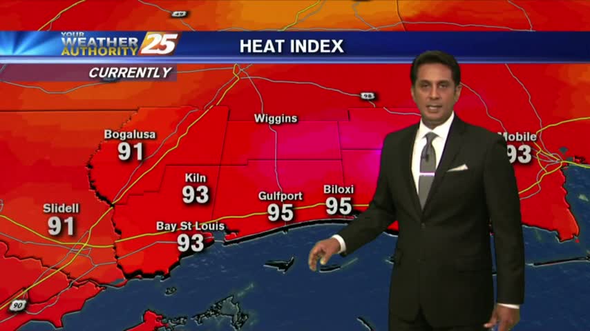
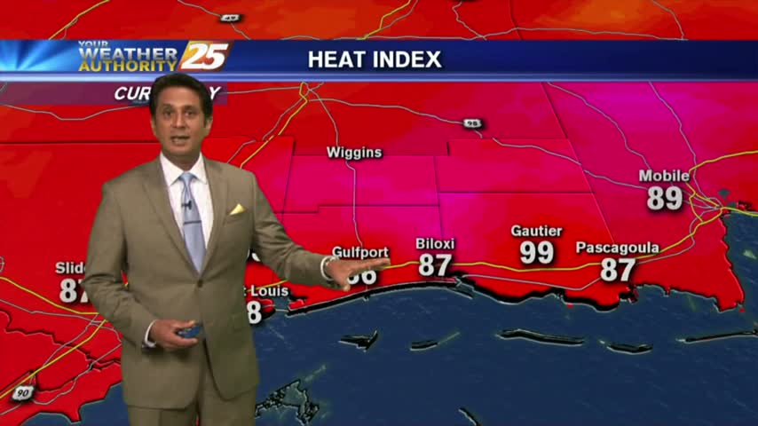
Another WARM start to the day with very high HEAT INDICES in play for the weekend...
After a mostly clear start, low-level clouds continue to develop along with a possible afternoon shower/t-storm ahead...
It's a rain-free morning with very warm and humid conditions on this final day of May...

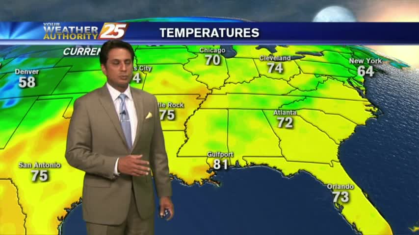
A mild start to the day with just a few mid/upper level clouds...mainly to the east.

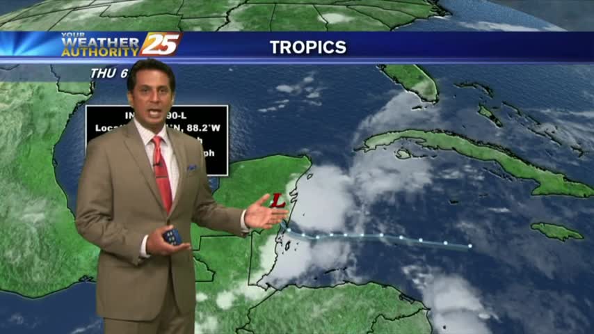
A mild start on this Memorial Day morning with cloud coverage and light rain moving in from the east/STS Alberto...

Sunrise activity diminished but starting to pop through the viewing area as daytime heating continues. TS ALBERTO is now in the Caribbean sea...
Isolated showers/t-storms are beginning to pop with more activity this afternoon...
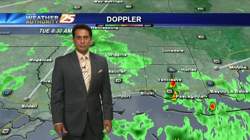
After overnight t-storms, this morning brings isolated showers/t-storms to our south...

A mild start to the day as showers from the south are dissipating as they move closer to the coast...
A humid start to the day as a strong tropical air mass continues through the region...
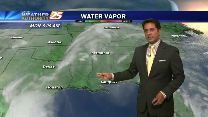
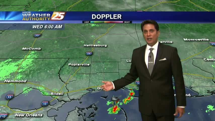
Overnight showers/t-storms continue to move in from the GOM...along with areas of patchy fog...