11/26 - Rob's "Clearing Skies" Monday Morning Forecast
The cold front continues to move further east as the cloud coverage lingers back to our west...
The cold front continues to move further east as the cloud coverage lingers back to our west...
A warmer start to the day as the cloud coverage has moved into south Mississippi...

Light rainfall is moving east across the N'tern Gulf of Mexico with a few light sprinkles skirting the viewing area...
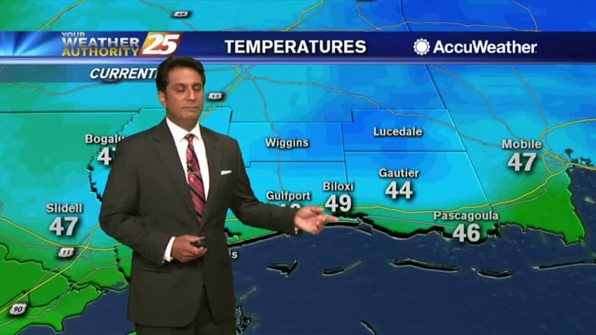
After a FRIGID start to the day, cool temps continue with upper-level clouds moving across the area...

High-pressure dominating the region to our NW, has allowed a few locations to drop into the upper 30s to start out the day...
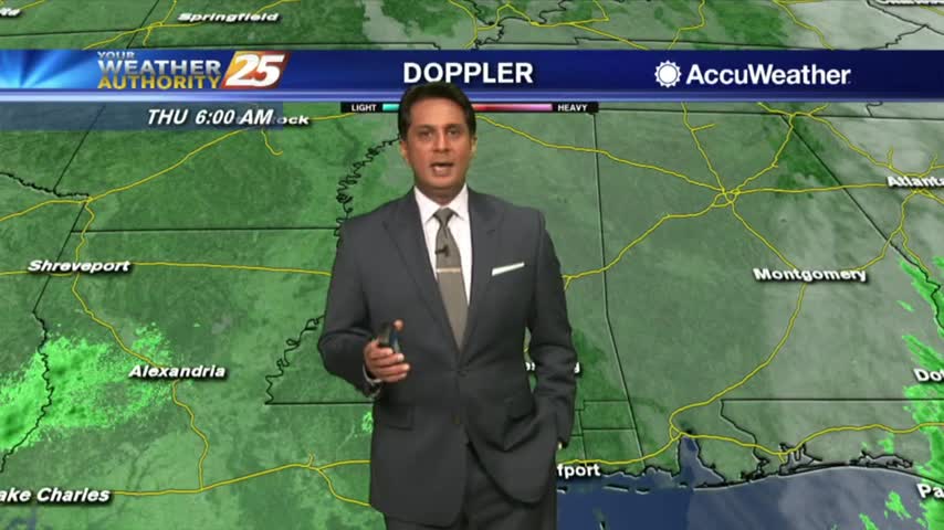
The cold front is now east of the area with the cloud shield extending way back west into western Louisiana...
A warmer start this morning with as mid/upper level clouds are moving in from the west...
After a frigid start to the day, temperatures are warming nicely into the 60s...

Another VERY COLD start to the day, but the warming trend has begun...
After a FRIGID start to the day, temps are warming but struggling to get into the 50s...
A FRIGID START to the day as a FREEZE WARNING is in effect through mi-morning...

A COLD start to the day as the rain shield is moving slowly to the east...
Another WET start to the day with WINTER about to move into the Gulf Coast...
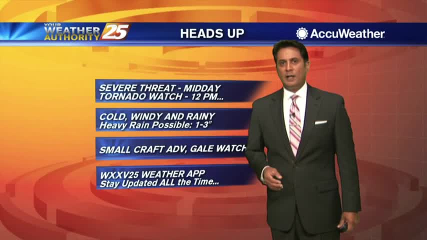
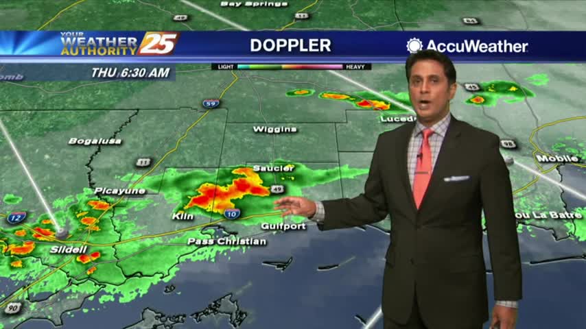
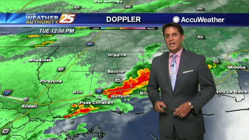
A rainy start to the workweek with a slight threat for SEVERITY as the area is under a TORNADO WATCH...
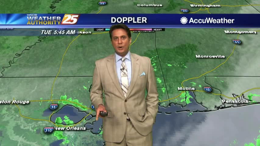
Rainfall moving into the area as the cold front continues to move to the east...
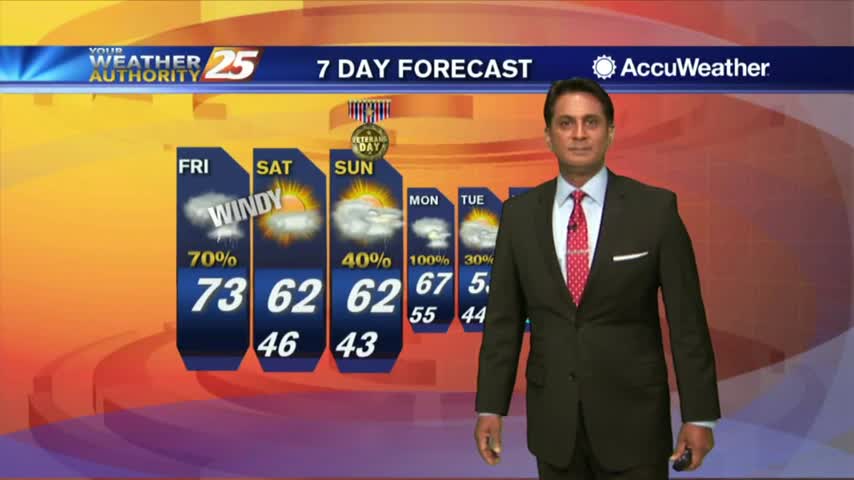
A cloudy start with areas of patchy fog for your Friday morning heading into the Veterans Day weekend...
Cloudy skies continue as spotty rain developed in SE'tern Louisiana, now moving into and through our coastal counties...
A rain-free start to the day under cloudy skies, but light constant rain will move in later this morning...
Patchy fog continues with cloudy skies and scattered rain through the viewing area...
Patchy fog has developed once again as rain is now moving into the viewing area...
The cooler air mass from this past weekend has modified with a stationary front just to our south...
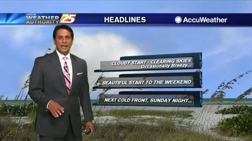
After a cloudy start, a NW winds continue to clear skies along with breezy conditions...
A cool and cloudy start to the day with the clearing line to our west moving east...
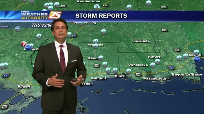
Violent weather from the squall line earlier this morning is now out of the area with clearing skies expected overnight into Friday...