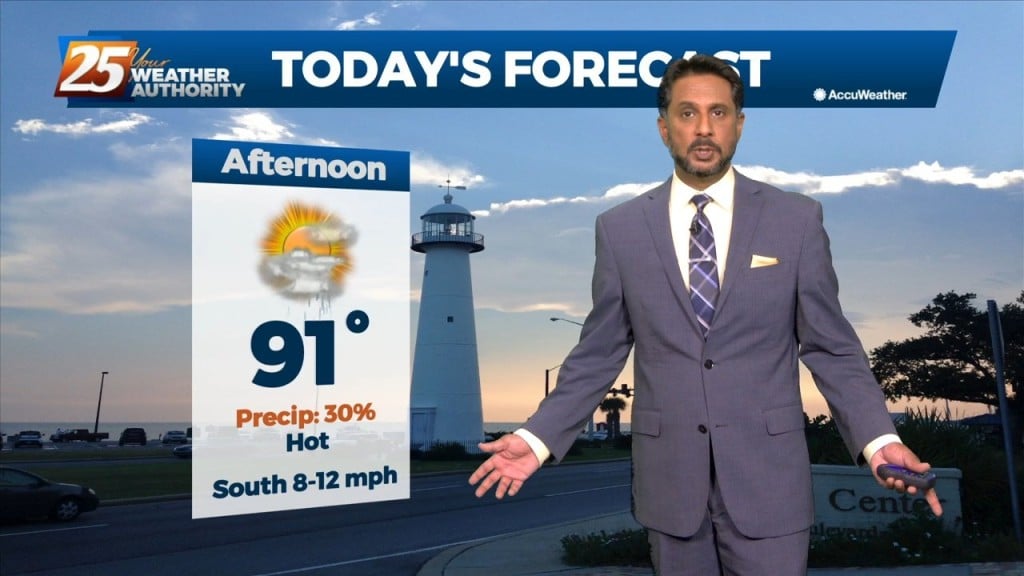
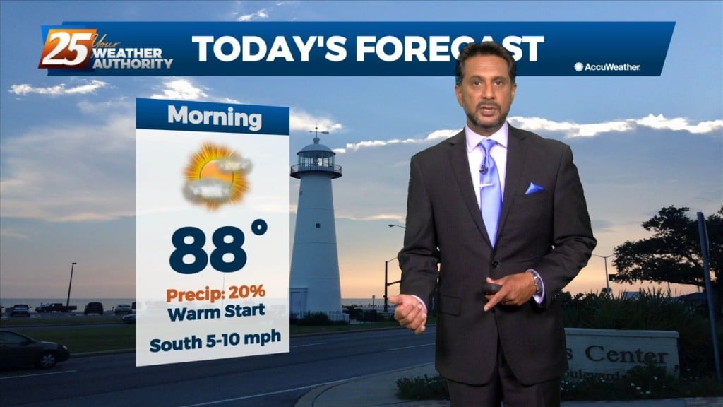
8/15 - The Chief's "Hot Temperatures" Monday Morning Forecast
Moisture flow has decreased and there are no real saturated layers. Winds are primarily northerly from 5k upward. No real indications that anything will change significantly during…
Moisture flow has decreased and there are no real saturated layers. Winds are primarily northerly from 5k upward. No real indications that anything will change significantly during…
The upper high pressure over Colorado this morning will gradually build southeastward over the next few days, even as the trough to our northeast continues to…
Today the flow will shift more northerly as a weakness along the coast continues to amplify activity. At the surface, a weak frontal boundary…
At the risk of sounding repetitive, another day of high rain chances is on tap for the area. Once again, these storms can easily produce hourly…
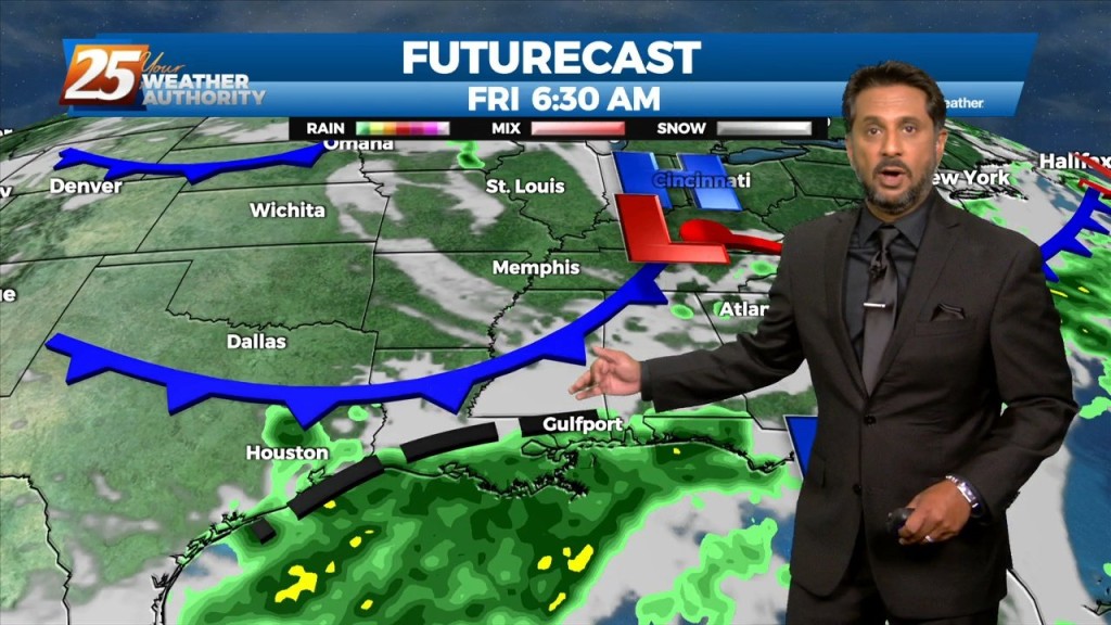
In a near carbon copy of last week, rain chances will once again continue to be high through the period. High pressure over the western Atlantic…
There is little change in thinking from the previous forecast concerning the overall trend of gradually increasing moisture, lift, and rain chances through Wednesday. The overall…
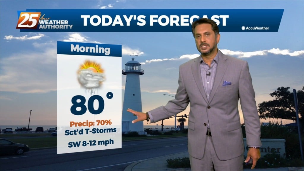
Today will bring hot and humid conditions with t-storm coverage slightly more reduced for generally areas along/near of I-55 and east to the MS coast given…
A weakness/subtle mid-level inverted trough over the northern Gulf continues a slow retrograding motion towards the WSW along the outer periphery of a mid-level high pressure…
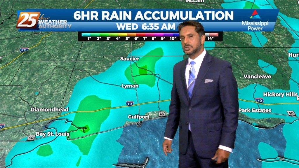
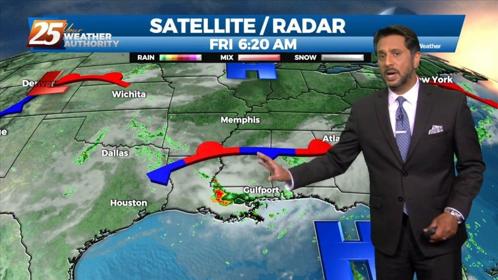
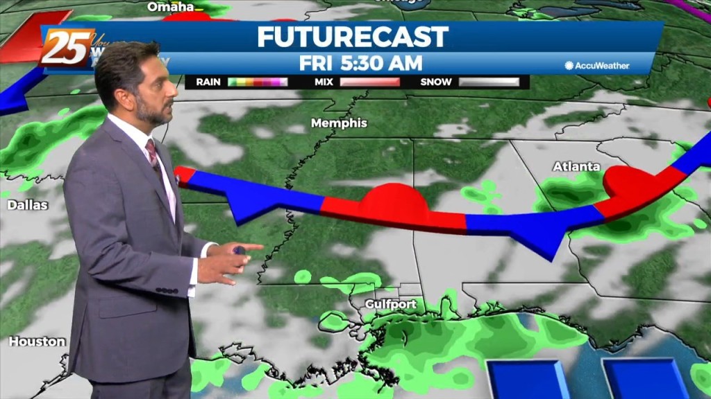
The main concern will quickly shift to the possibility of heavy rainfall once again today. Many parts of the area have seen considerable rainfall over the…

Over the short term period a wetter period will begin today as general weakness in the overall patter to the north of Hattiesburg slowly moves into…
Today won’t be very different from the last several but there are some minor changes on the way. We should see a gradual transition of dry…
Today through Friday, the current pattern continues with the upper level high pressure and daily showers and thunderstorms in the afternoon. Very moist air along with erratic…
The broad upper level ridge stretching across the CONUS is the main pattern the area will be in for the short term (and majority of the long…
The area will continue to be dominated by the mid-level high pressure with the more difficult part of the forecast today is coverage of storms. High pressure…
Today will be the most active day over the next 3 days. Today we will be between two areas of high pressure that will try to merge…
High pressure centered over southwest builds east today and dominates the weather pattern through the short term bringing more normal summer conditions of rain…
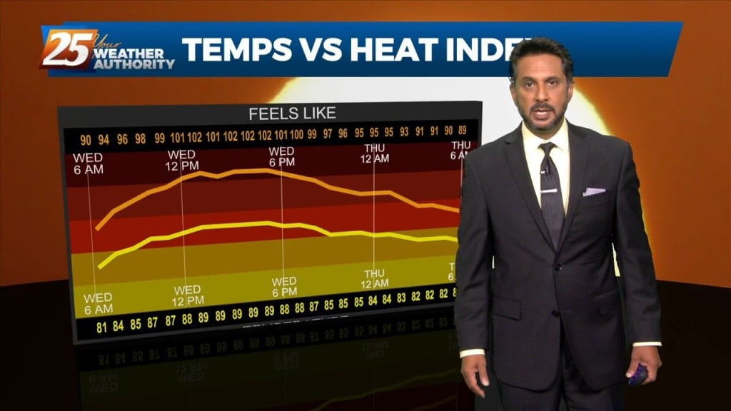
The focus early in the forecast will be the topic of heat. Heat Advisories were needed yesterday as compressional heating gradually increased, especially over the western tier.…
Today will bring a continuation of the past few days and a gradual warming trend as high pressure moves closer to the area. This will also…
The general upper level setup aloft hasn’t changed in the last week or so for all intents and purposes with the exception of small variations. A broad…
Today through Sunday a broad upper level high pressure will be centered near the 4-corners region extends from Mexico to Canada and CA to around MS.…
A broad upper level high pressure centered near the 4-Corners region extends from Mexico to Canada and CA to around MS. It will generally be…
A broad upper level high pressure system is centered near the 4-Corners region extends from Mexico to Canada and CA to around MS. This eastern portion of…

An upper level high pressure system centered near the 4-Corners region extends to the east coast north of Florida. This eastern portion of the ridge is rapidly eroding…
An upper level high pressure is to the north of a stationary front situated along the Mississippi gulf coast. If there’s some good news, it is…