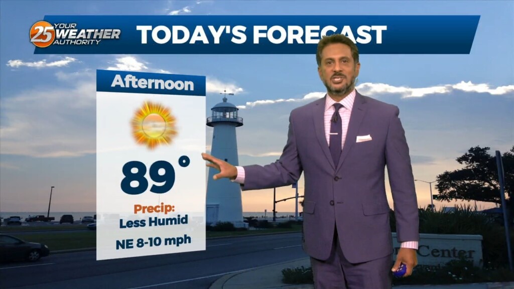
9/18 - The Chief's "Sunny, Less Humid" Monday Afternoon Forecast
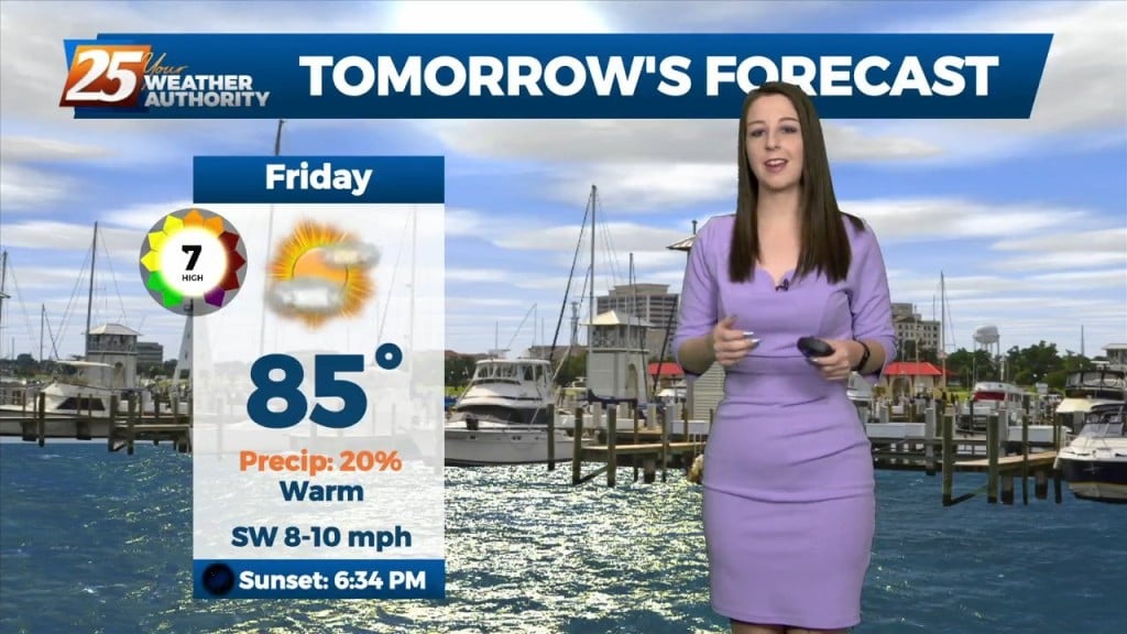
This afternoon will be very similar to yesterday in terms of low humidity values and temperatures warming back into the upper 80s to low 90s. Tuesday…
This afternoon will be very similar to yesterday in terms of low humidity values and temperatures warming back into the upper 80s to low 90s. Tuesday…
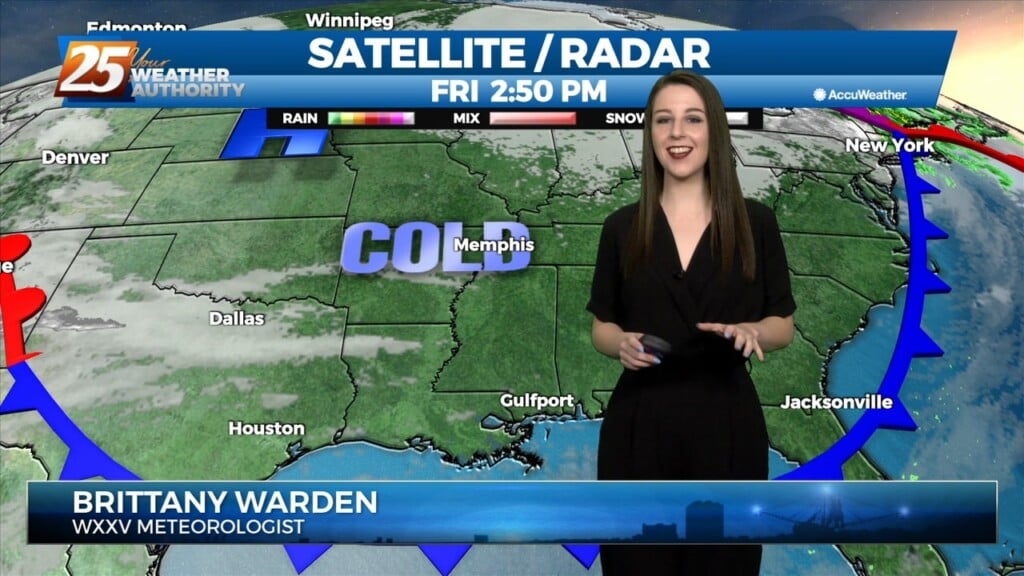
The very VERY COLD Arctic air mass brought bitter cold conditions to the region last night, with high temperatures earlier today only maxing out in the low to…
An Arctic front and a very cold air mass to the NW continues to move SE. Current expectation is that cold front will reach the…
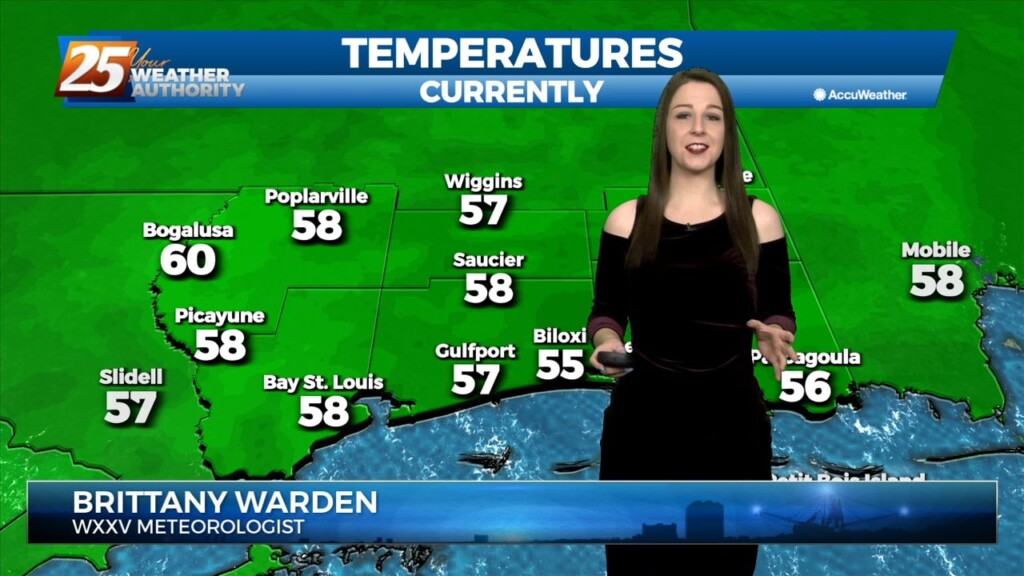
Behind a weak front which moved through earlier this afternoon, a rather strong Canadian high pressure will settle into the region tonight. With the calmer winds…
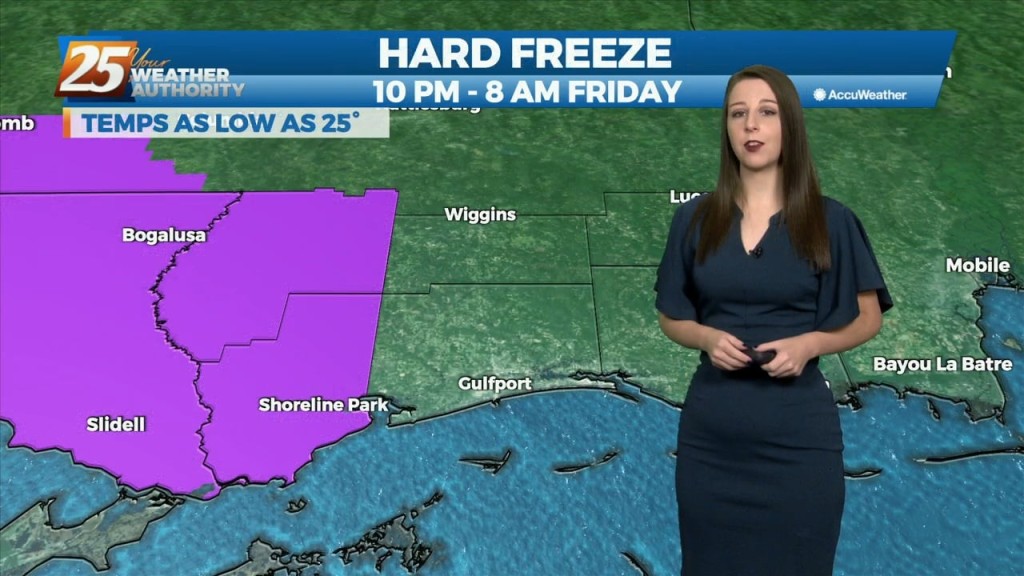
WINTER-LIKE conditions to continue through the weekend... High pressure will continue to build into the region and usher in quite cold air for this time of year.…
Strong high pressure will build into the region and usher in quite cold air for this time of year. Highs and lows will be 15+…
The forecast for the rest of the workweek is going to be quiet and dominated by high pressure building over the Gulf and southeastern CONUS. Heading…
Upper level moisture/clouds continue to stream through the area in advance of a weak upper level disturbance moving NE. The disturbance will move northeastward and deamplify,…
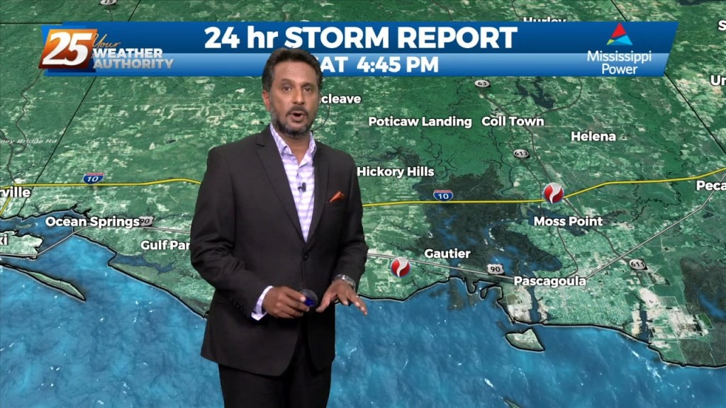
Doppler continues to indicate low-level rotation with a broken line of showers/t-storms training north in Jackson and George county. A tornado was confirmed in…
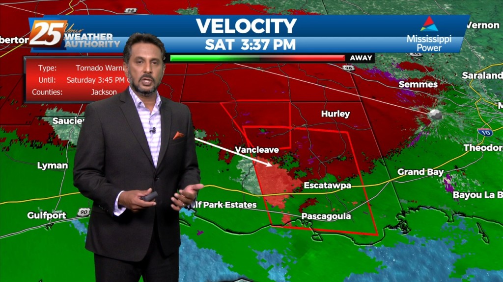
Multiple tornado warnings are being indicated by Doppler in SE Jackson County. Stay safe and stay weather aware...
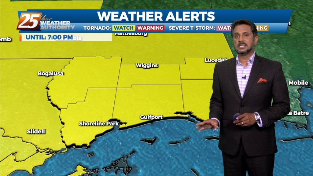
Issued By New Orleans/Baton Rouge - LA, US, National Weather Service Affected Area: Mississippi Sound Description: THE NATIONAL WEATHER SERVICE HAS ISSUED TORNADO WATCH 558 IN EFFECT UNTIL 7…
After a lovely day with sunny skies and below seasonal temperatures...changes area ahead. An upper disturbance over the Inter-mountain West will continue to move eastward into West…
High pressure will continue to bring in a colder drier air mass which will begin to modify Thursday afternoon/evening. The upper flow is expected to remain zonal…
After a bumpy start to the day, the front is now east of the area and skies will rapidly clear this evening. Dry weather is…
An upper level high pressure currently encompassing the area will weaken on its western side. Moisture will be drawn between a disturbance over the SW USA and…
After a beautiful day to start the workweek, high pressure to the north will begin to move to the east and the return flow will begin. Humidity…
A mild weather pattern has been across the area today and for the remainder of the workweek. The area of high pressure is in place to…
After mixed clouds yesterday, we have had just a few upper-level clouds today. High pressure has the biggest influence on our weather pattern overnight tonight…
A weak disturbance from earlier this afternoon has push through the area but the upper level clouds will continue overnight. Upper clouds coupled with increased moisture…
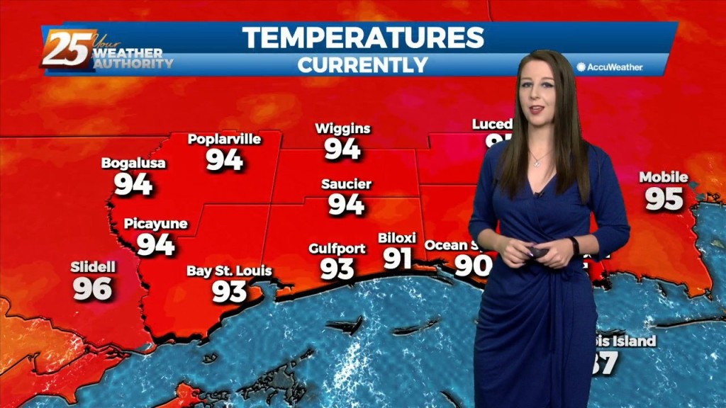
ENTER AUTUMN After another HOT day, subtle changes will over overnight into Friday morning. Expect clear skies and mild temperatures overnight as guidance has…