6/19 - Chris Denmark's "Severe Thunderstorms Possible" Monday Afternoon Forecast
A Heat Advisory is in effect untill 7pm, showers and thunderstorms will bring relief to a lucky few. How long can our NW to westerly upper…
A Heat Advisory is in effect untill 7pm, showers and thunderstorms will bring relief to a lucky few. How long can our NW to westerly upper…
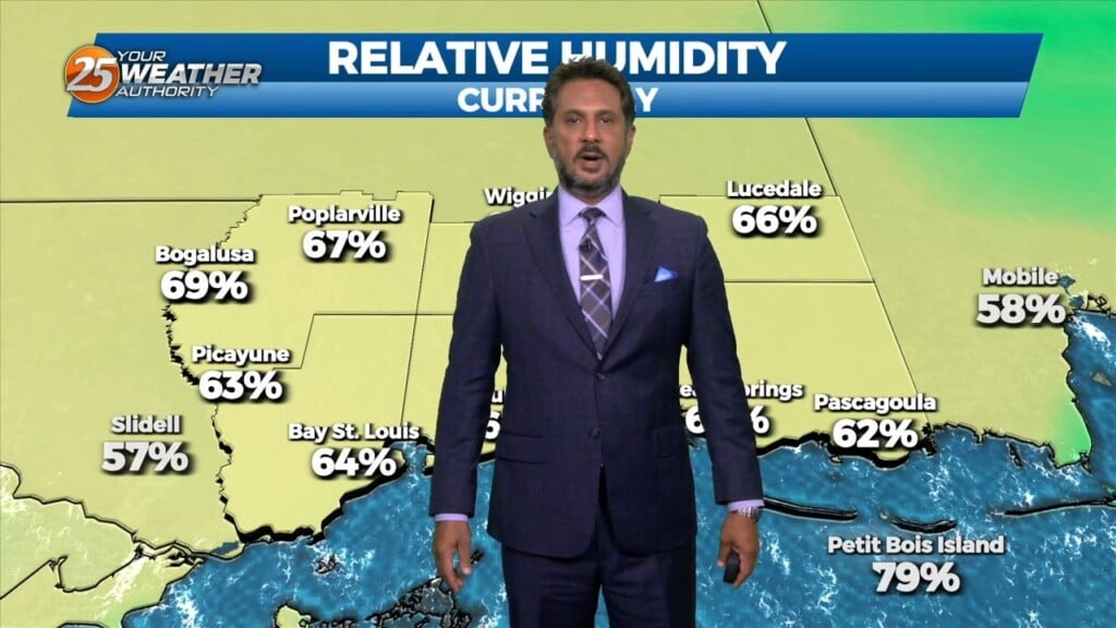
Relative humidity has been rather low the past few days…and that trend will continue heading into the weekend. The current weak upper low pressure over…
A drier day today as additional dry air advects into the region as northwesterly flow continues to take shape. Temperature will likely be a bit…
Models signal very similar activity during peak afternoon heating compared to yesterday. Temperatures today look to vary a good bit, as highs will max out in the lower…
With the cooler upper levels and amplifying disturbance, expect a continuation of lower end rain chances despite being on the drier side with upper level flow becoming…
Despite the frontal passage overnight, temperatures will actually be slightly warmer today given the drier mid-levels holding down afternoon convective development. Rain chances will be lower…
Light westerly flow ahead of the weak surface front will favor initiation of thunderstorm activity on the eastern side of Lake Pontchartrain and coastal MS earlier…
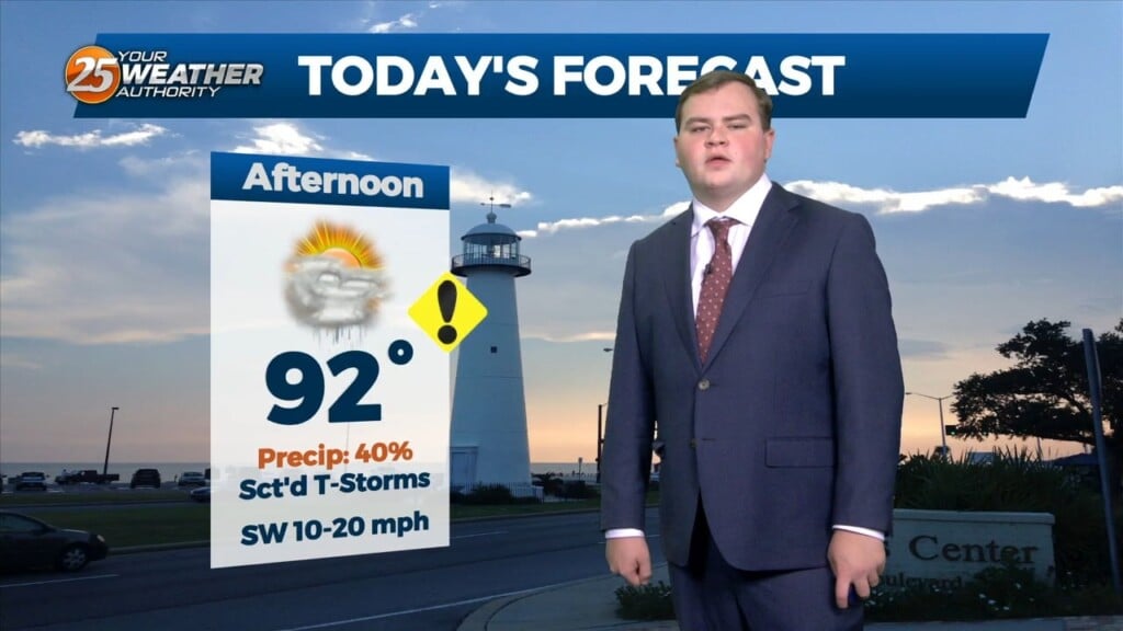
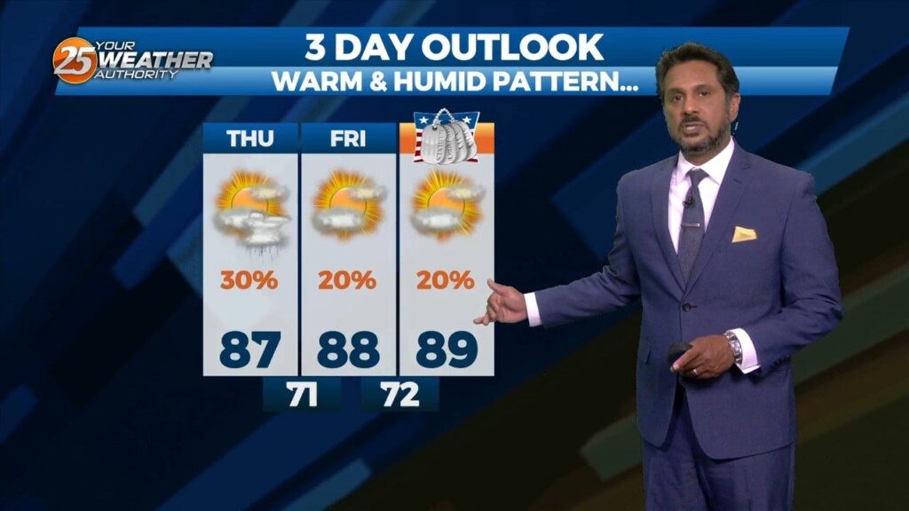
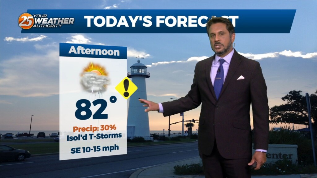
A HOT & HUMID afternoon ahead with breezy conditions out of the SE. High temperatures will max out in the mid to upper 80s, some areas…
An upper level weakness continues to reside over Texas this afternoon keeping our region under an active southwesterly flow aloft with impulses circulating around this upper level…
This afternoon will bring drier conditions from the spotty rain moving across the area earlier. The lack of convection will lead to warmer afternoon temps but…
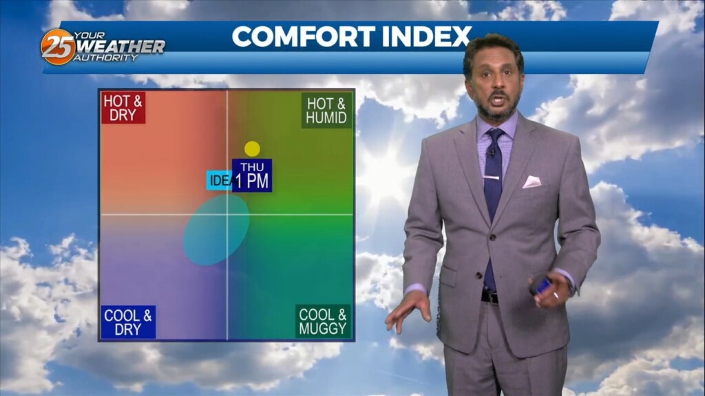
This pattern will be in place today through Sunday. This onshore flow regime will advect in a substantially more humid airmass into the area today and…
An upper level high pressure will build in across the middle of the country from the Gulf Coast all the way to the Northern Plains.…
A strong upper level low pressure system is currently located over the Ohio Valley and moving into New England is holding some influence interacting with…
As an area of low pressure continues to drag a cold front through the region, isolated t-storms will continue this afternoon but begin to diminish late afternoon.…
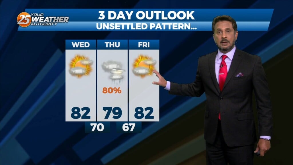
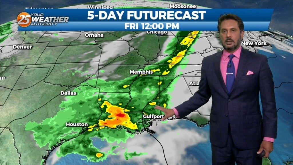
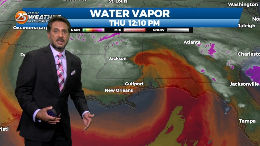
This afternoon will bring pleasant conditions as sky condition will vary between partly/mostly cloudy skies. Much of the focus is on Thursday as severe weather seems…
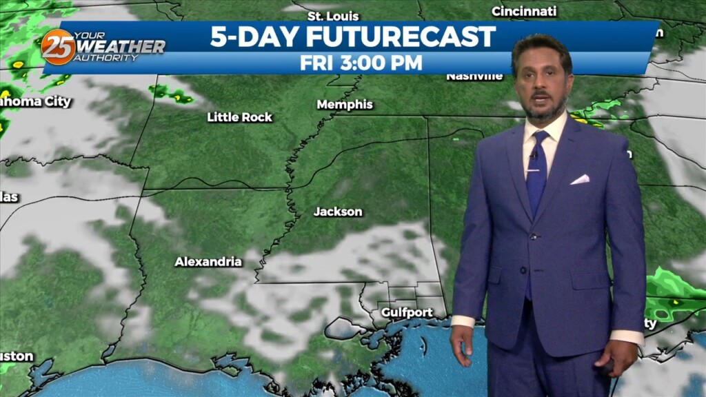
Starting on Wednesday, a disturbance over the northwest is expected to eject over the southern plains. This will pick up a stalled front over the coast and…
High pressure over the northern Rockies is setting up a quasi-zonal flow across the southern third of the country. At the surface, a reinforcement of drier…
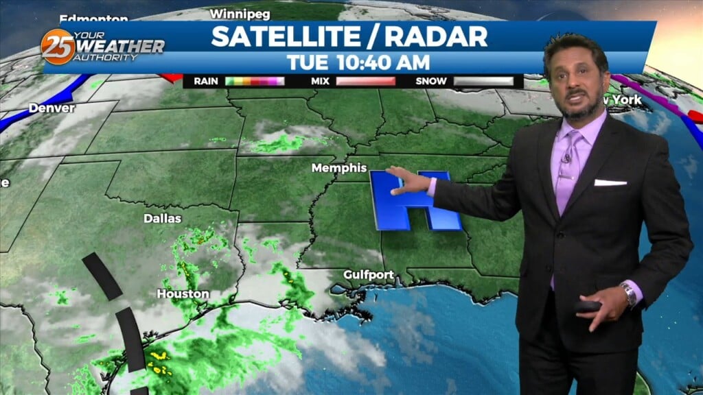
A weak disturbance moving across Louisiana will move across the local area late this afternoon and tonight. Considering the dry airmass, I don’t anticipate any precipitation,…
With high pressure in control of the region, we won’t see much in the way of moderation through at least through Tuesday as we will basically…
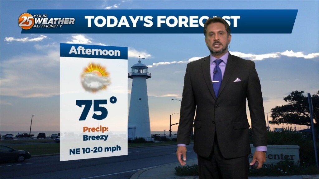
Things will be rather quiet today, with mostly sunny skies and drier conditions making for a nice day as high temperatures reach the mid-70s to low…
As the surface low pressure exits the area we will see brief high pressure move in which will slowly begin to clear the clouds. Friday will be…

A surface low pressure is developing over the central gulf at the moment but this will move north today with an explosion of storms offshore of the…
A surface low will develop rather rapidly by a strong divergent flow aloft which is also indicative of heavy rain potential ahead. The disturbance that…

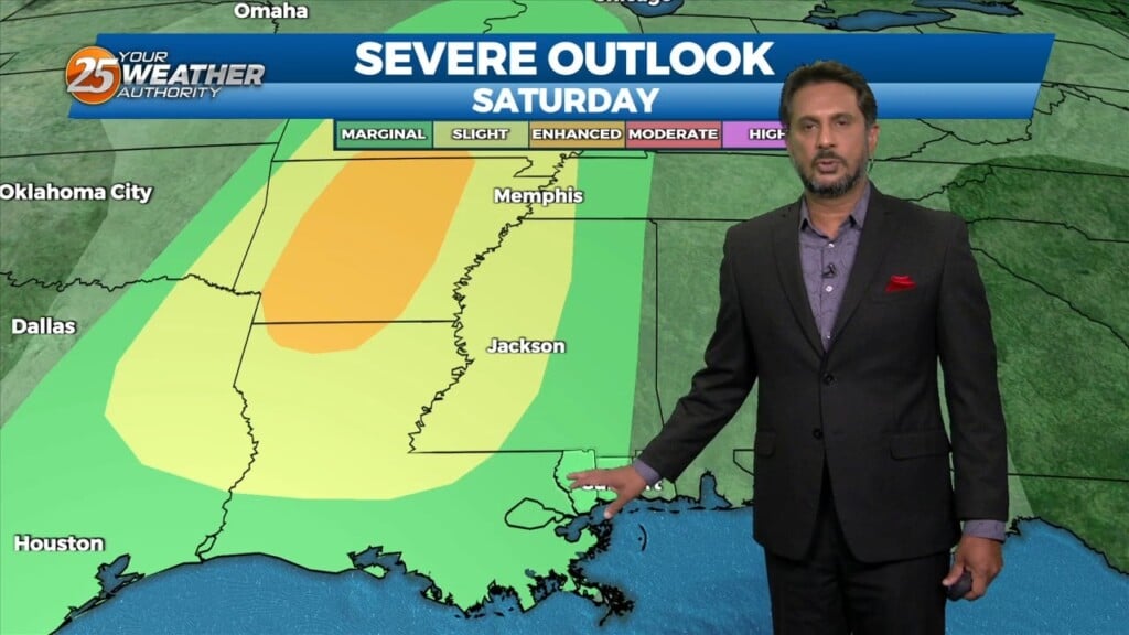
An upper high pressure builds east rapidly, it will flatten an upper trough east of the Rockies and cause it to orient more west to east over…