Wxxv25 “Midday”

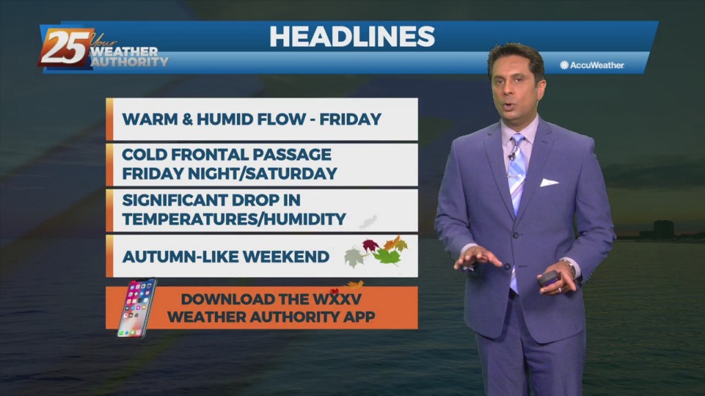
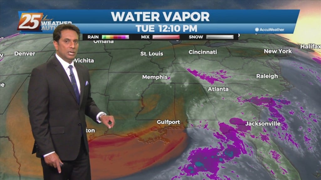
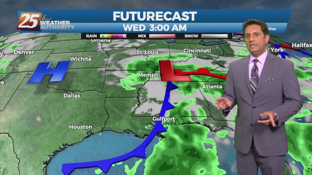
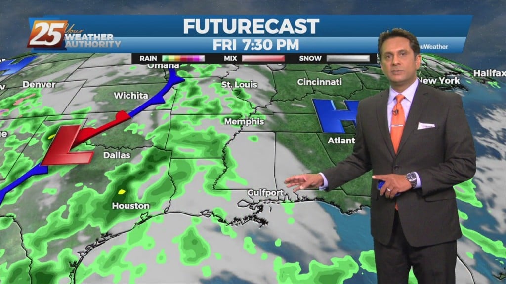
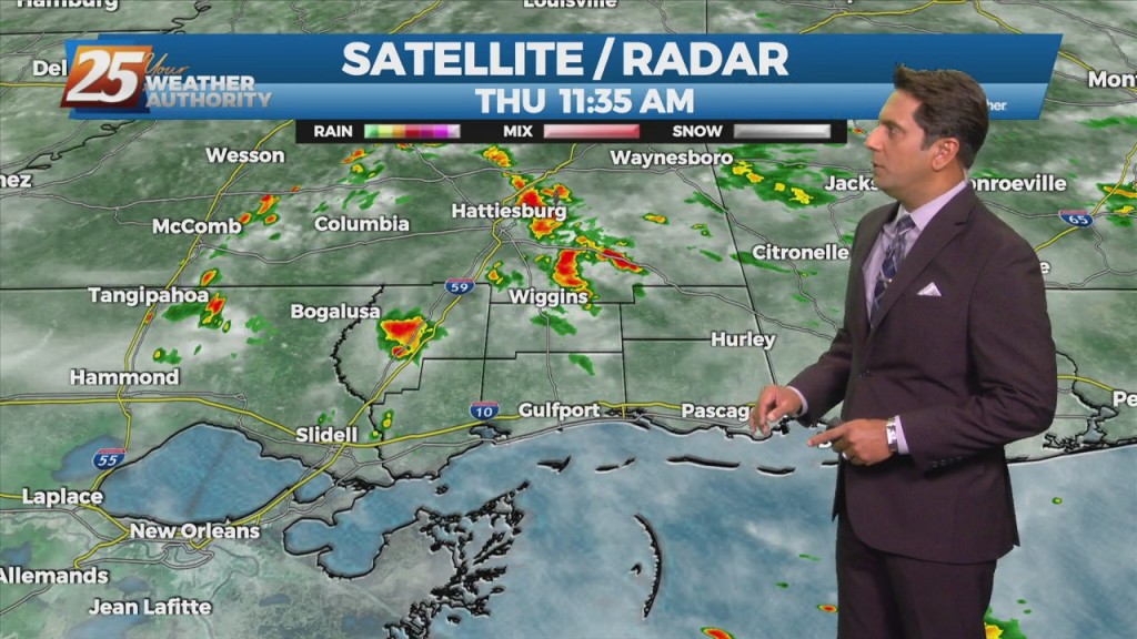
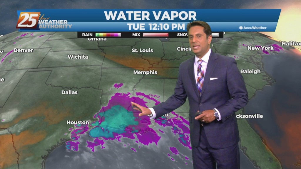
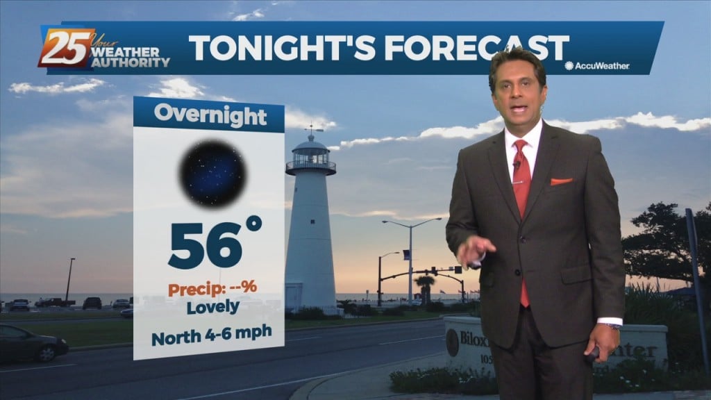
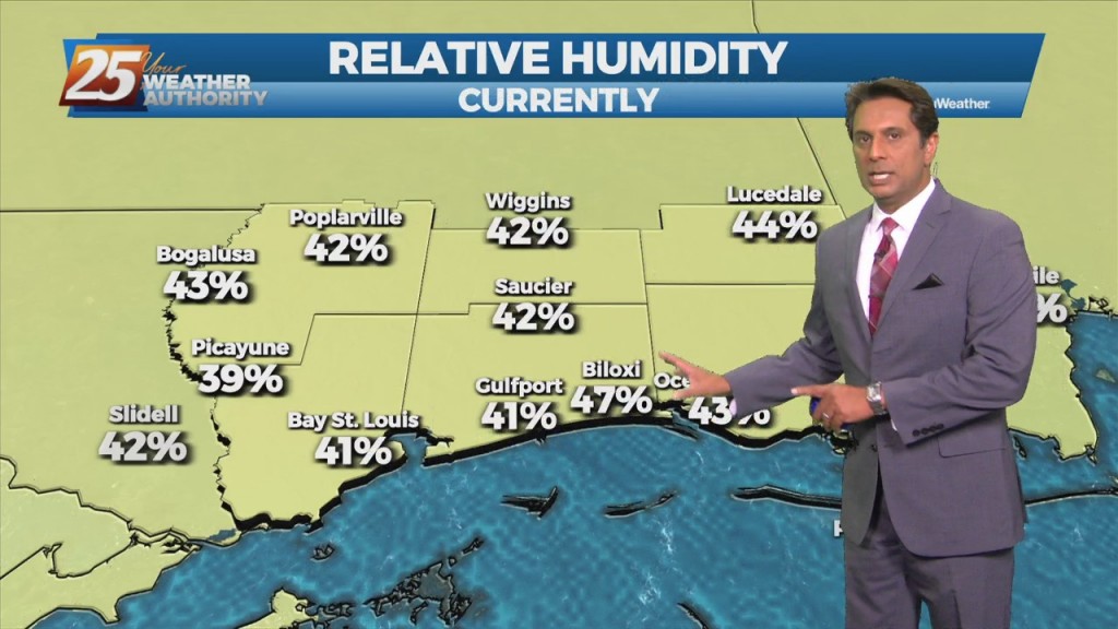
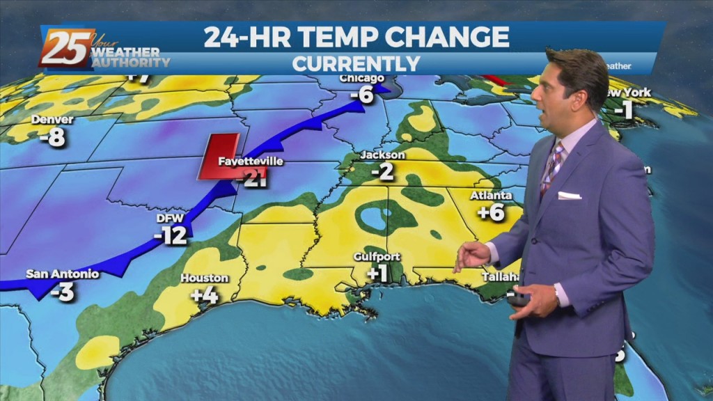
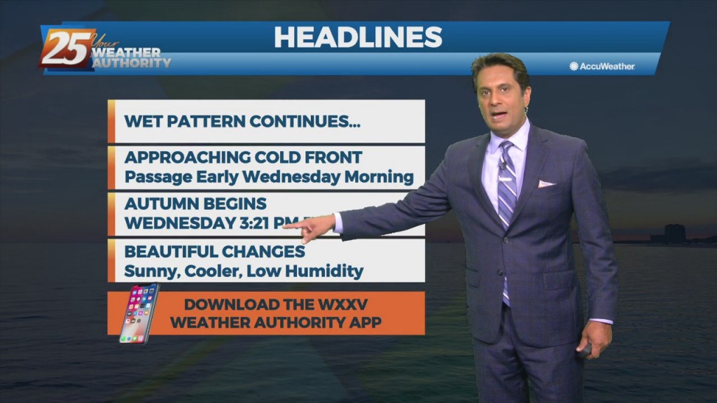
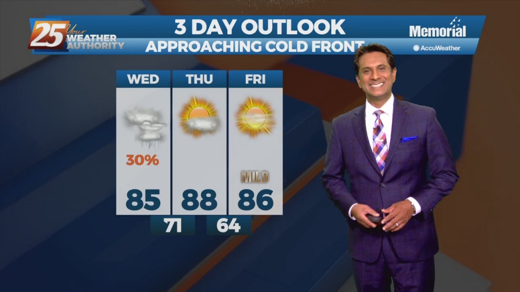
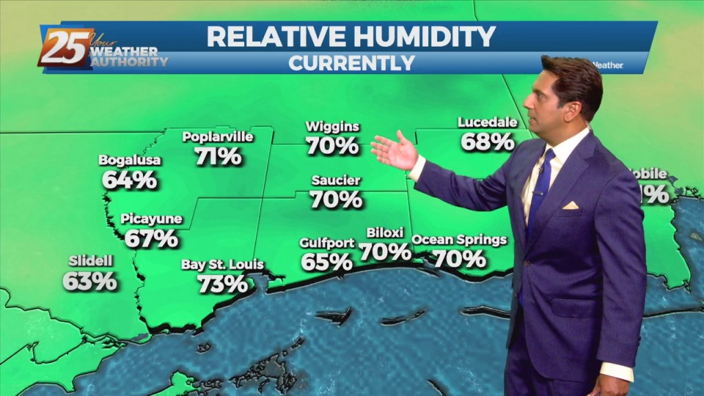
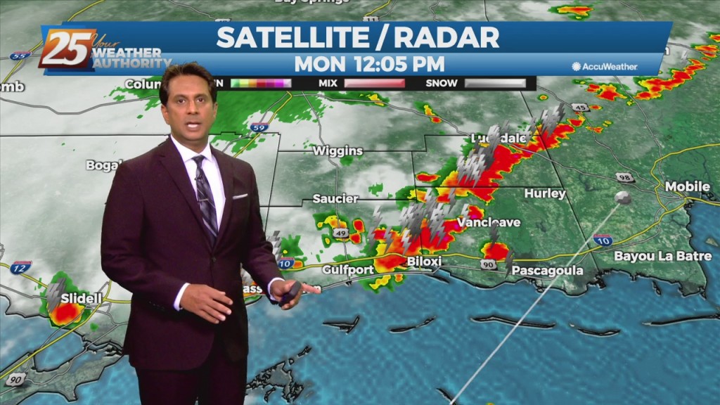
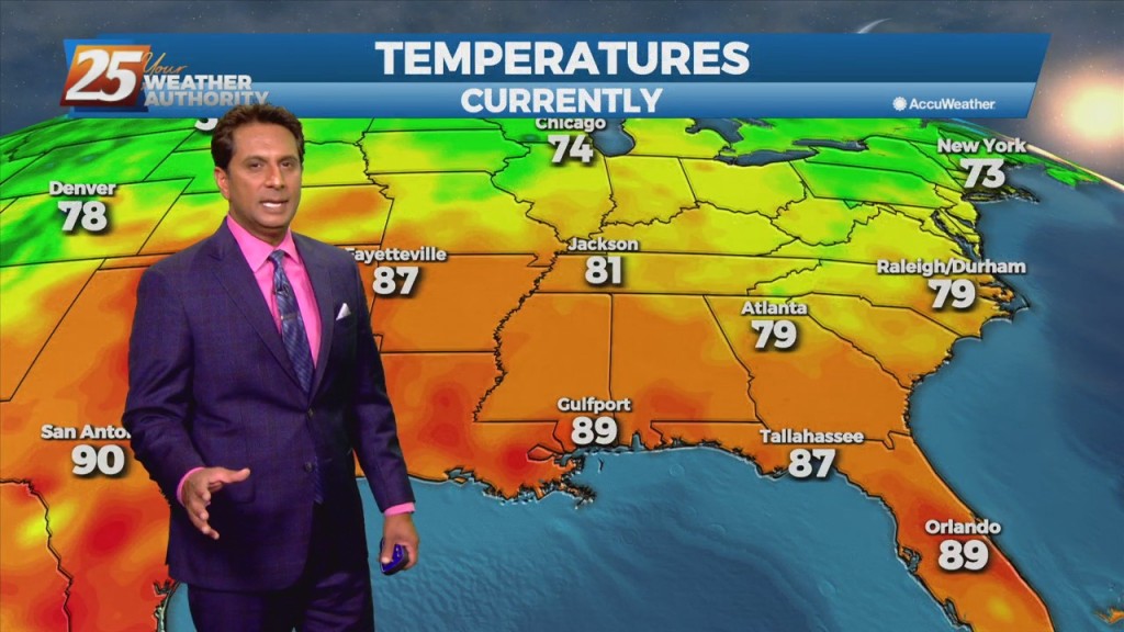
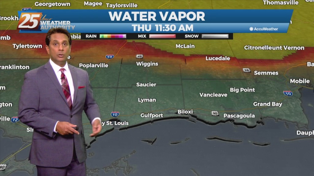
10/14 - Rob's Thursday Afternoon "Cloudy & Humid" Forecast

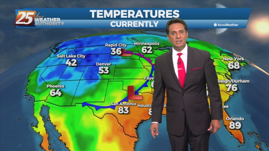
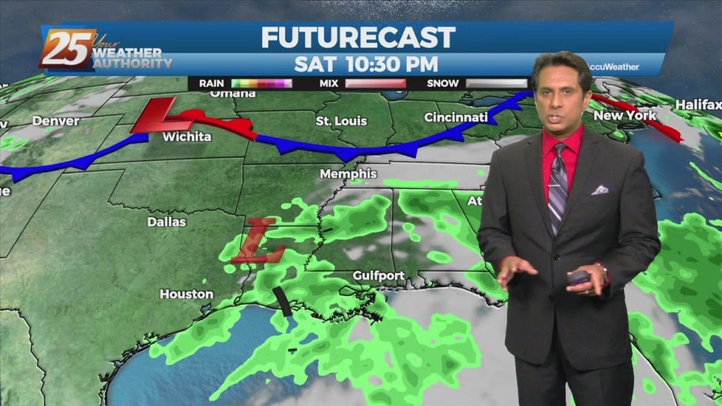
A few showers will affect the area this afternoon and Friday with the approaching cold front. The main effects from the front will come overnight Friday into Saturday morning prior to sunrise. As the upper-level support begins to outrun the…

10/13 - Rob's "Nice Changes Ahead" Afternoon Forecast

Southerly return flow around high-pressure to the east will keep us in the same weather pattern we have been in for the past week with mainly dry conditions and slightly above normal temperatures. The high-pressure will start to retreat to…

10/11 - Rob's Monday Afternoon "Warm/Humid" Forecast

High-pressure is expect to pretty much remain in place through the short range portion of the forecast. An approaching cold front to the NW will slowly move E/NE and ride north of the Hattiesburg area. By late Tuesday through Wednesday…

10/8 - Rob's "Cruisin' The Coast" Weekend Forecast

High-pressure NW will slowly move SE into the region this weekend. This will keep dry weather and lower humidity over the forecast area, although humidity levels/dew-points will be coming up slightly on Sunday to more muggy readings. Diurnal temperatures…

10/6 - Rob's "Beautiful Extended" Afternoon Forecast

As we fall back into a drier regime, a more October like pattern should show itself. But with no good cold fronts moving through at least through Friday, conditions won't change much but also shouldn't be too uncomfortable. As the…

10/5 - Rob's "Afternoon T-Storms" Midday News Forecast

There is a marginal risk for excessive rainfall for the best chances of getting rainfall this afternoon over coastal Mississippi. This is all being brought about from an upper disturbance that extends from northern LA up into the northeast. The…

10/4 - Rob's "Muggy & Damp" Afternoon Forecast

Moisture flow in advance of a cold front to the west will continue. The one positive that could keep us from seeing very heavy rain will be the instability, which is quite low. Rather thick cloud cover today should help…

10/1 - Rob Knight's 1st Weekend of October Forecast

Pulses of weak Energy from the west are expected to continue to aid a wet environment favorable for more isolated showers and thunderstorms. Isolated showers and thunderstorms may still form later than previous days and affect west of the local…

9/30 - Rob's "Improving Conditions" Afternoon Forecast

A disturbance coming out of the base of the western US will use the moist airmass to develop scattered convection during the daytime hours each day. Friday's convection may be a little later developing than today's or Saturday's, as it…

9/28 - Rob's "Warm & Humid" Afternoon Forecast

An upper level high-pressure is developing along the Mississippi Valley from Canada to the Gulf of Mexico. The moisture recovery has occurred since yesterday evening. A disturbance in the NW'tern GOM will continue to slowly move to the NW towards…

9/24 - The Chief's "Gorgeous Autumn Weekend" Afternoon Forecast

Very pleasant and comfortable conditions will continue through the weekend. With the less humid flow, morning low temperatures will continue to be a good 10 to 15 degrees below climatological lows. Afternoon high temperatures will max out in the upper…

9/23 - Rob Knight's "Beautiful" Afternoon Forecast

The strong cold front from yesterday has already exited the area and is moving further southward into the Gulf. Temperatures as well as dew points have dropped and while there are still some gusty winds currently, that should begin to…

9/20 - Rob Knight's "Humid/Cloudy" Afternoon Forecast

A disturbance with an associated cold front are expected to move across the area Tuesday night into Wednesday morning. Models indicate moisture flow decreasing slightly today/Tuesday, but still sufficient for at least scattered showers/t-storms. Scattered convection is also possible just…

9/17 - Rob Knight's Friday Afternoon "Wet Weekend" Forecast

The surface remnants of Nicholas will continue to fill today and drift towards northern Louisiana before completely dissipating. However, an upper level disturbance presently centered over northeast Texas will slide southeast which will use the lingering deep moisture to provide renewed…

9/15 - Rob's "Threat For Heavy Rain" Afternoon Forecast

The main concern the next few days will be heavy rainfall, with the potential for ongoing flash flooding.  A FLASH FLOOD WATCH and COASTAL FLOOD ADVISORY is ins effect Hourly rainfall rates can be 1.5 to 2 inches (and possibly…

9/13 - Rob's "Gray/Cloudy" Monday Afternoon Forecast

As TS Nicholas lingers in the western/NW'Tern Gulf, the moisture flow will dominate the region. Activity will be moving at a good pace for the next few days which will help keep rainfall totals for any individual storm within tolerance.…

9/9 - Rob's "Very Low Humidity" Afternoon Forecast

Very low humidity will at the very least be noticeable by most as the relatively dry air will make things feel a bit more comfortable. The comfortable conditions will continue through Saturday before the return flow slowly begins to work…

9/6 - Rob's Monday Afternoon "Wet Pattern" Forecast

A cold front will drop southeast into the forecast area, providing showers/T-Storms along the front to impact the area into tonight. Deep tropical moisture should be in place with the possibility for isolated pockets of heavy rainfall through mid-week. There…

9/3 - Rob's "Less Humid" Labor Day Weekend Forecast

This afternoon will bring hot temperatures in the wake of yesterday's cold front. Temperatures will climb to around 90 degrees but will be rather tolerable a a less humid flow continues to dominate the region. The aforementioned frontal boundary will…

9/2 - Rob's "Cold Frontal Passage" Afternoon Forecast

A cold front will continue to push south through the area providing dry air moving into the area. Despite the passing of the front, there will not be any noticeable cool off with highs staying in the upper 80s to…