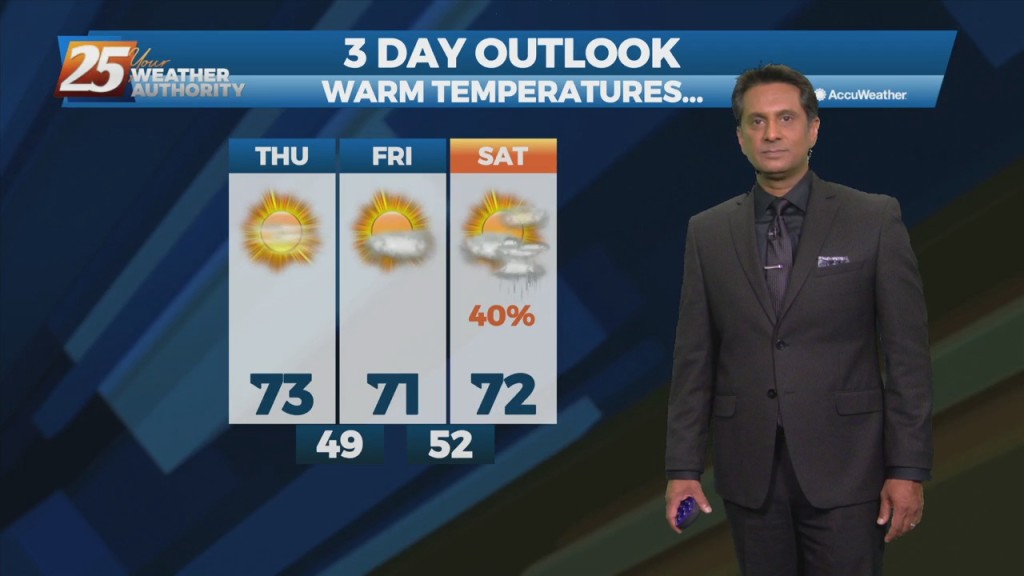
3/31 - Rob Knight's "Beautiful" Thursday Afternoon Forecast
High-pressure will begin moving in from the NW, ushering a colder/drier air mass. Pleasant condition will continue through Friday before high-pressure moves SE allowing for the next system…
High-pressure will begin moving in from the NW, ushering a colder/drier air mass. Pleasant condition will continue through Friday before high-pressure moves SE allowing for the next system…
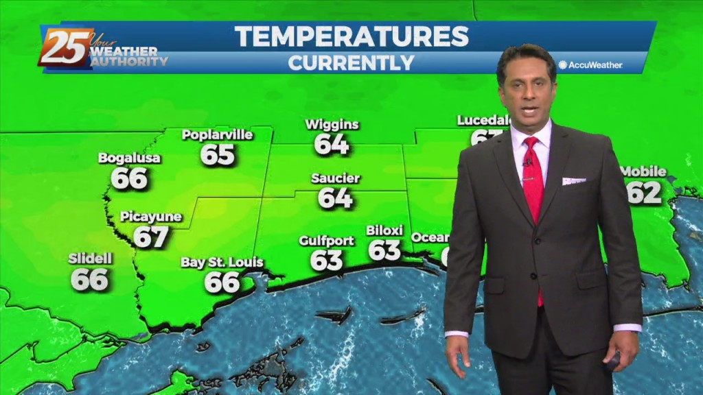
A pleasant afternoon with a few clouds and plenty of sunshine. Fog will be a factor the next few morning but not in every location and may be…
The moisture flow will move slowly eastward over the next day and a half, and may take until about Friday to totally clear the region. Lower levels should…
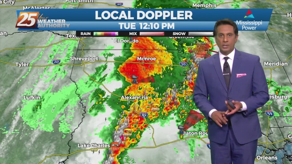
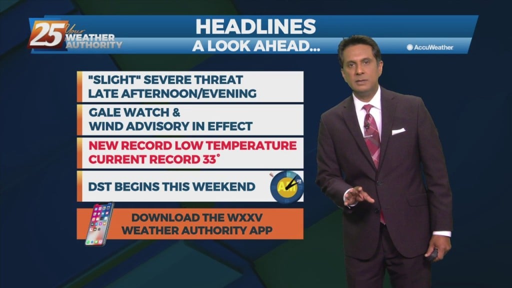
The area is under an ENHANCED/MODERATE threat for severity...especially noon through midnight A TORNADO WATCH IS IN EFFECT UNTIL 7 PM... Looking at the main event,…
Behind the front, drier and cooler air will move in for the weekend. The front may linger over the coastal waters for about 24 hours, so…
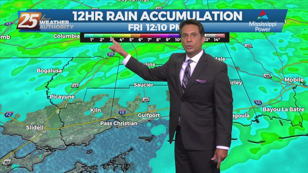
Scattered to numerous showers and storms will be possible this afternoon/tonight. Strong to possibly severe storms will be possible along the MS coastal areas and east.…
This afternoon winds will gradually come around to the southeast by this afternoon. Little in the way of cloud cover is expected today, and high temperatures should…
A cold front is no east of the area with light precipitation behind the front expected to be out of the area by moon. Forecast guidance indicates…
Above seasonal average temperatures will continue until a cold front makes its way through our area early tomorrow morning. Ahead of the front, isolated showers…
Warm and humid flow will continue from the Gulf of Mexico. The way above seasonal temperatures will continue as well as overnight DENSE FOG. A cold front draped across…
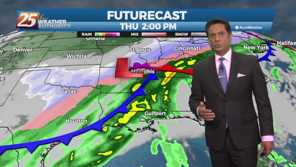
Rainfall moving into the area later today will continue to intensify overnight with the potential for 1/4 to 1" accumulation. The next round of rain will…
A west Texas disturbance will slip southeastward off the Texas Coast by Tuesday morning, and will continue to weaken as it moves toward south Florida by Wednesday…
Main concern will be temperatures. Mid and high cloud cover should hang around a good bit of the day, but do expect to see some sunshine late…
A weak cold front will slip though the area early tomorrow morning. There isn't sufficient moisture so I'm not expecting any weather with passage with the exception…
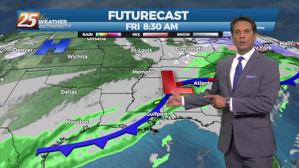
A Canadian disturbance will move into the Great Plains and middle Mississippi River Valley tomorrow morning, reaching the Atlantic Coast by sunrise Saturday. Onshore flow never gets…
An area of low-pressure to the south along with a cold front north will continue to bring rain to the area. May not see a lot of…
A cold front will continue to shift southeastward today with temperatures slowly dropping. Rain should be ending during the afternoon across the area, at least temporarily. Another…
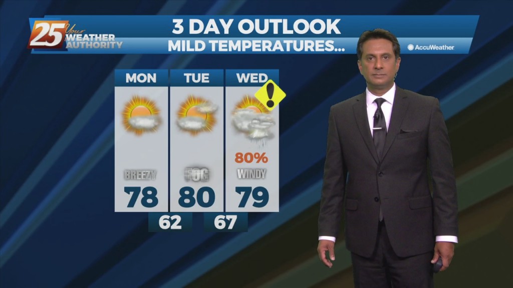
High pressure will remain centered east of the area, and this will allow for continued warm air and moisture advection into the forecast area. In advance…
Warmer temperatures overnight as the winds will become southerly along with increasing cloud coverage. Moisture levels will continue to increase Wednesday in advance of an…
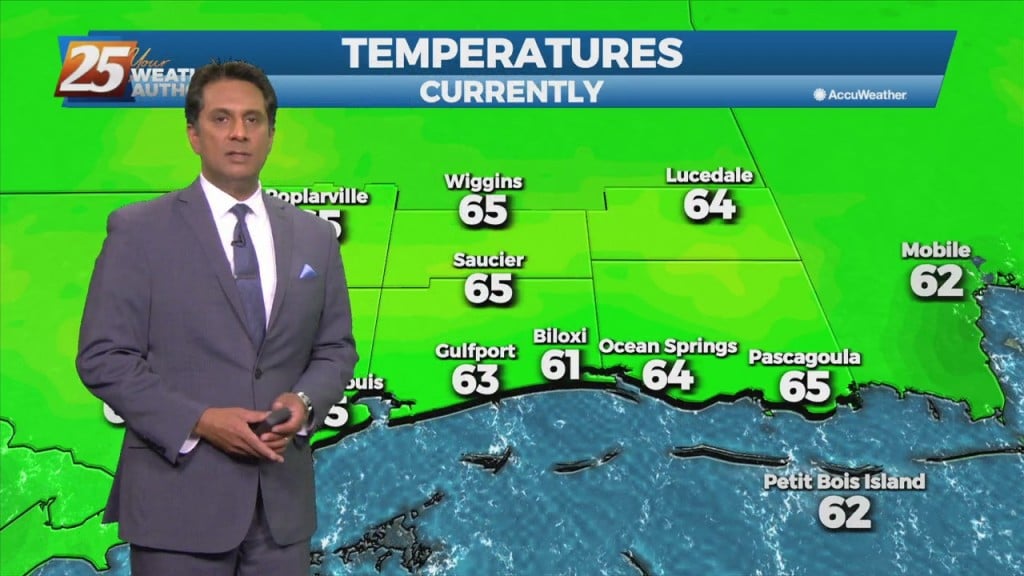
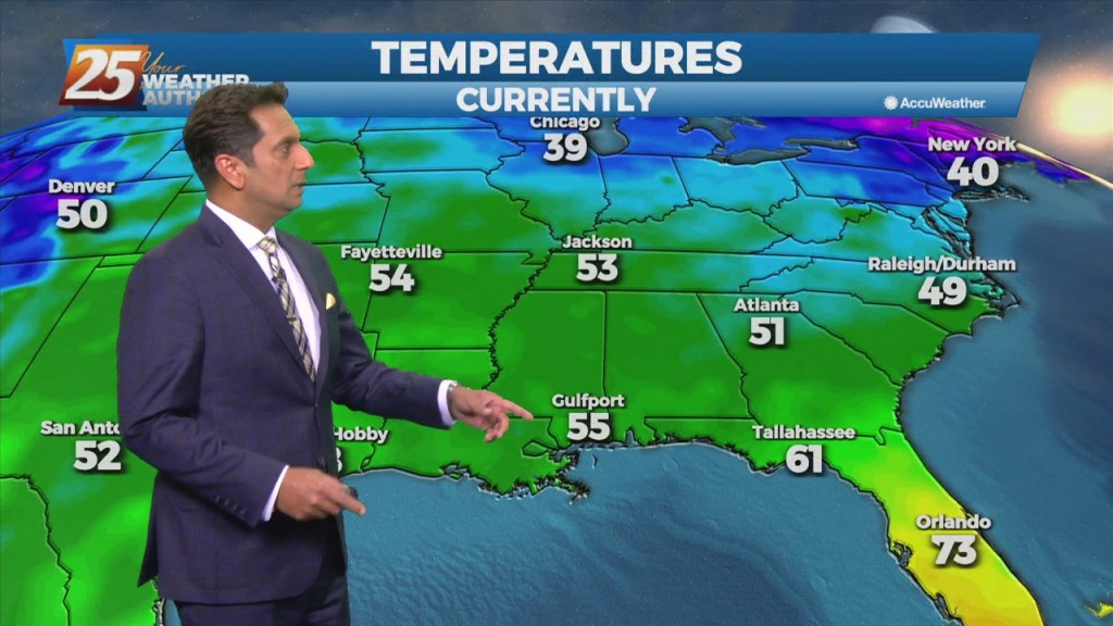
Clear & cold overnight with an abundance of sunshine tomorrow will allow temperatures to moderate fairly quickly...into the low 60s. As winds turn onshore by Tuesday afternoon, we'll…
A Canadian disturbance will drop into the central Great Plains this evening and strengthen. At this time, it looks like the most favored track of the…
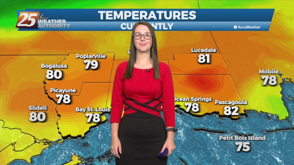
Overnight temperatures could again fall into the 30s across the northern half of the area, but a significant freeze is not anticipated. Westerly winds and little in the…
Surface high-pressure extended from Illinois to east Texas. This high-pressure will shift eastward today and Wednesday. The disturbance over New Mexico will gradually move Eastward. This should…
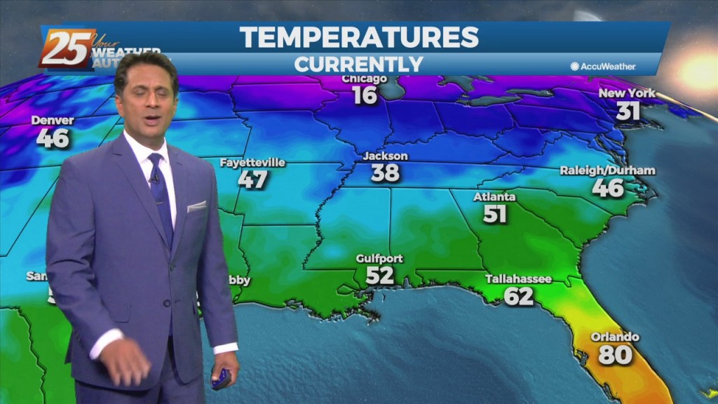
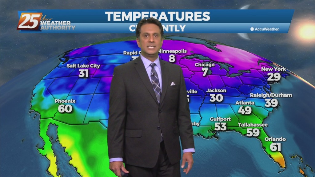
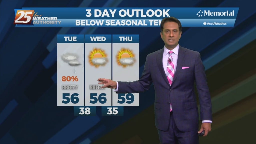
High-pressure and strong cold air advection will result in temps struggling to reach mid/upper 50s this afternoon. This colder trend will continue tonight into Tuesday with temperatures running 5…