2/20 - Sam Parker's "Grab the Gloves" Thursday Night Forecast
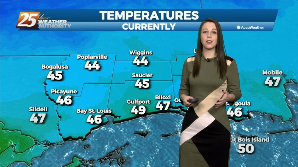
One cold day down and a few to go until we get back to warm weather next week. Today was our coolest afternoon at 45…
One cold day down and a few to go until we get back to warm weather next week. Today was our coolest afternoon at 45…
Freezing temperatures overnight as the cold comes down and wind chills makes you feel even colder. Last night we received our rain and over an…
Our second cold front has past giving windy conditions earlier today. Thursday morning is round 1 of the chilly temperatures for our area. Most of us…
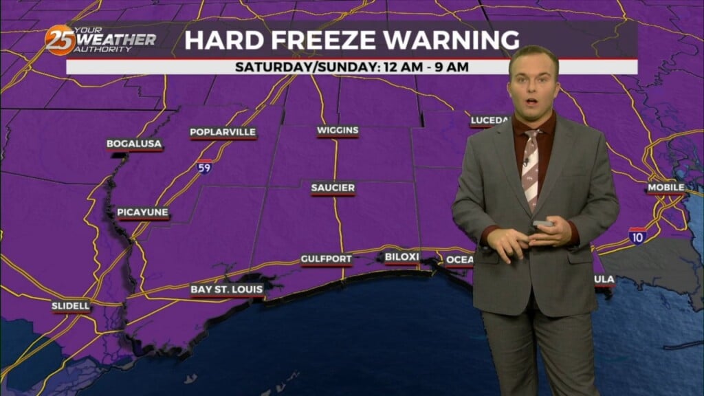
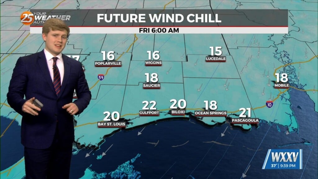
A cool and windy day turns into a frigid and windy overnight. A Hard Freeze WARNING is in effect tonight from Midnight – 9 AM, and the same…
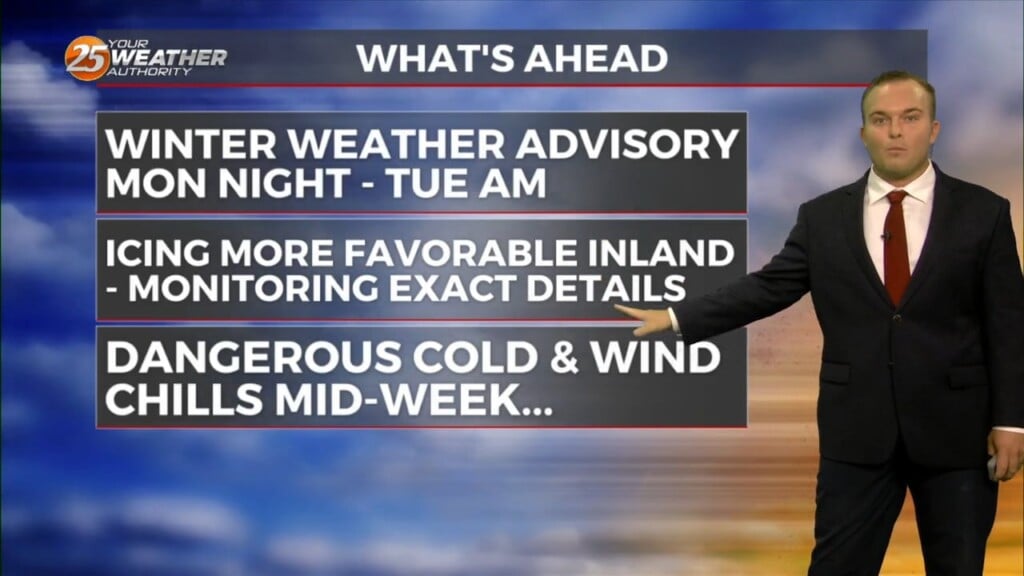
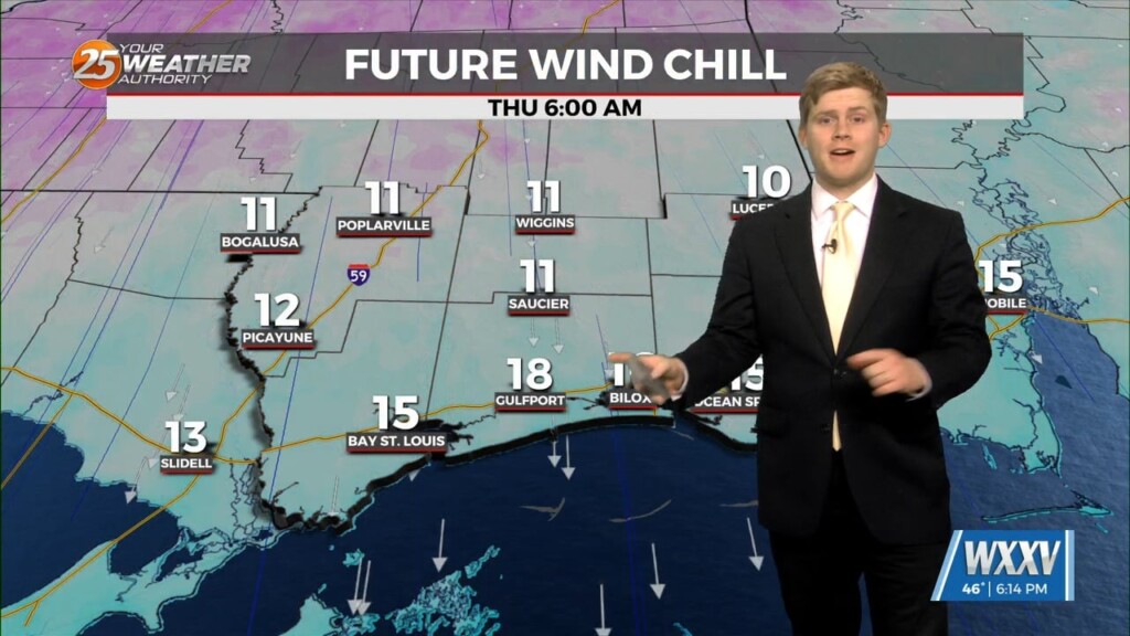
A fairly tame one we’ve had this weekend will give way to a challenging week at times for the Mississippi Coast. DANGEROUSLY COLD temperatures arrive…
The WIND ADVISORY will continue through this evening before the flow begins to weaken. Breezy conditions will continue overnight with winds around 15 mph…which means the…
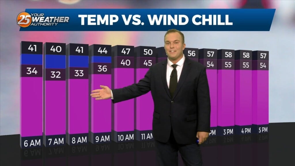
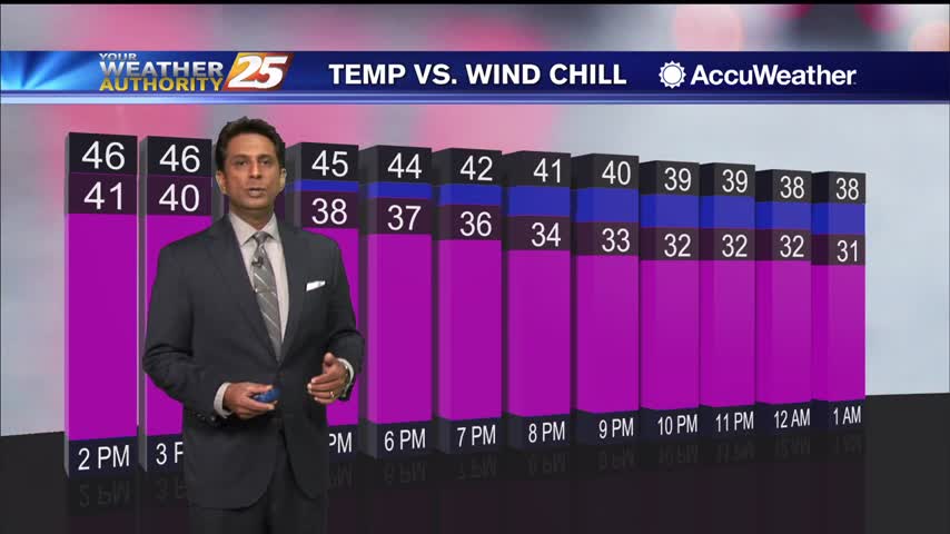
Temperatures will be very cold tonight under mainly clear skies. Winds will also remain in place and the north wind will make it feel like the 20s out the…
Skies do end up clearing out this evening but the chill is only just beginning. Temperatures plummet tonight and winds will remain elevated. Be sure to secure…
Temperatures will continue to drop through the rest of tonight. While lighter than earlier, winds will remain slightly elevated. This will make overnight low temperatures in the 30s feel…
With strong cold air advection and cloud cover, temps will not warm and may actually drop off a few degrees this afternoon. Winds will also…
Cloudy skies with occasional mist and drizzle will plague our Wednesday. As we work into the evening and overnight, mist and drizzle will remain a…
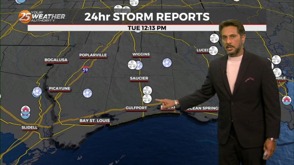
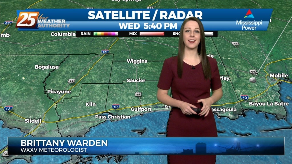
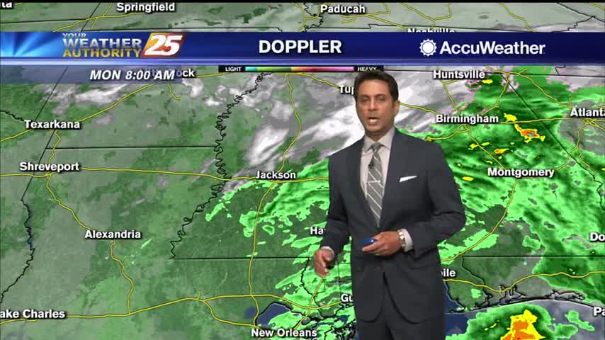
Rain is moving into South Mississippi this afternoon. An area of low pressure to our west is increasing moisture across the Gulf South. Light to steady rainfall…
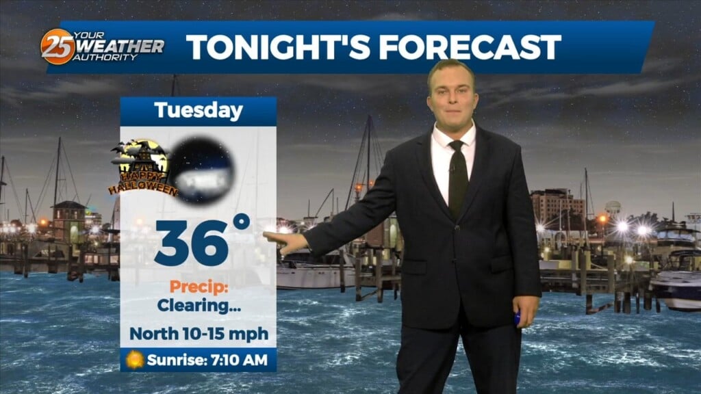
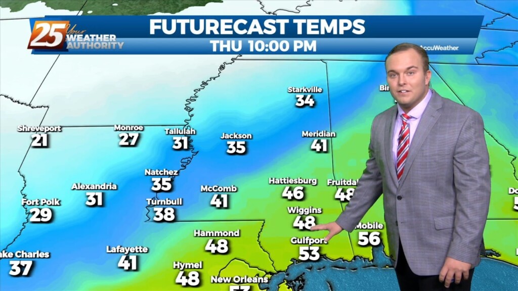
We're on tap for a clear and COLD night. Temperatures will drop down to the upper 30's tonight but given the breezy conditions we'll see, the 30's will…
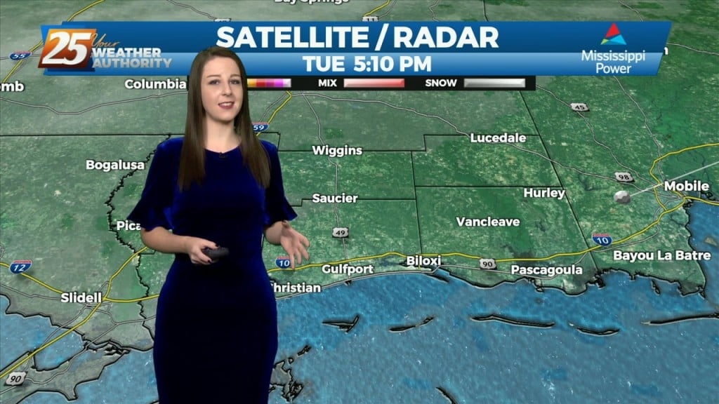
The cold front that moved through the CWA early this morning is now well south and moving into the central Gulf of Mexico. Clear skies have developed…
High pressure will continue to build into the region and usher in quite cold air for this time of year. High/low temperatures will be 15+ degrees below normal,…
Strong high pressure will build into the region and usher in quite cold air for this time of year. Highs and lows will be 15+…
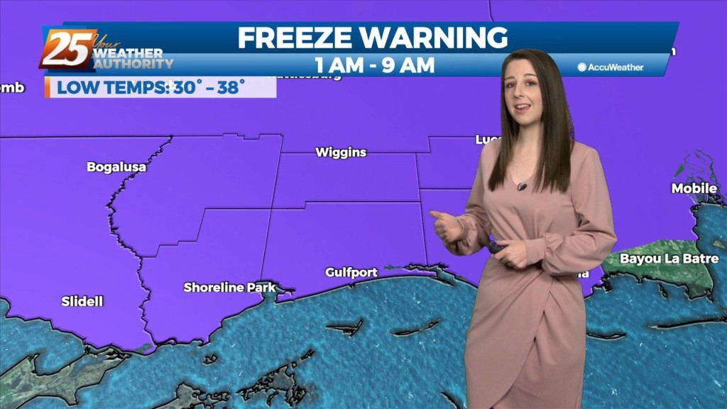
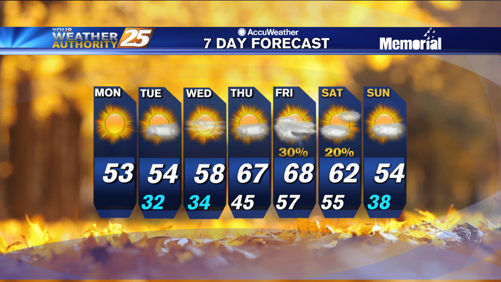
A FREEZE WARNING CONTINUES THROUGH 9 AM. A cold airmass continues to shape our forecast over the next couple of days. Temperatures will warm into the mid-60s…
Red Flag Warning continues until 7 PM. – FREEZE WARNING IN EFFECT TONIGHT – Breezy conditions will continue this evening as a colder, drier airmass dominates the…
Strong winds out of the north will enhance the cold air and dry air moving into the area. As a result, the lows will be below or approaching freezing…
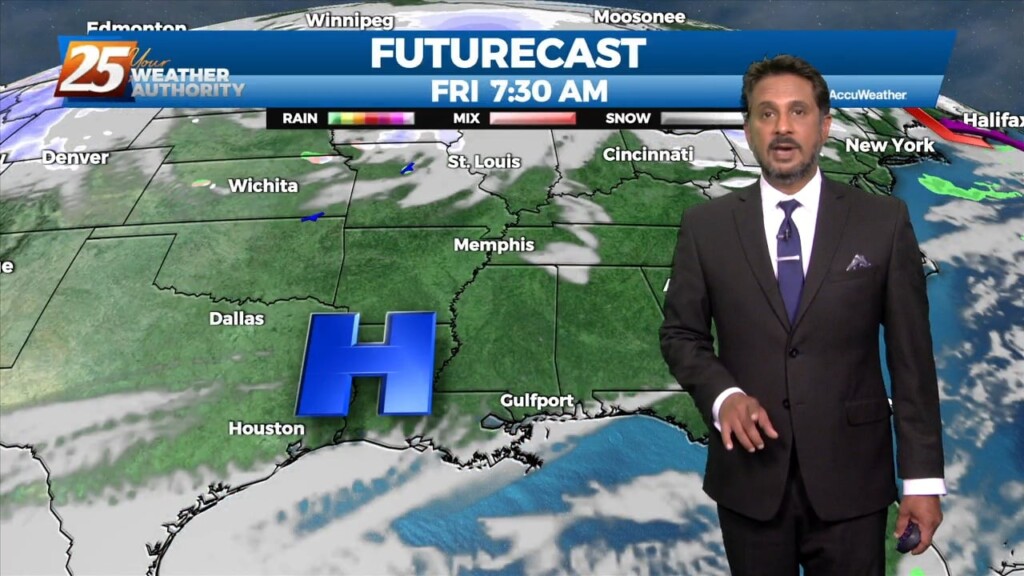
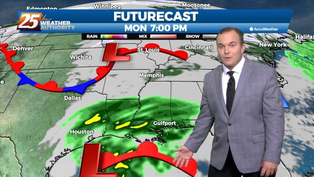
With rain on Monday, high temperatures north of I-10 will struggle to climb out of the 30s with highs a little warmer along the coast. Once the low passes, temperatures will quickly begin to drop off heading into Monday evening.…
Cooling into the night, but we're still a few days away from possible winter weather.
Expect a noticeable change tonight as the air mass shifts to a considerably cooler and drier one for most of the week.
A cloudy afternoon as the wind chill will be in the upper 30s...
A cold and wet start to the day as the rain/snow line is well north of the area...