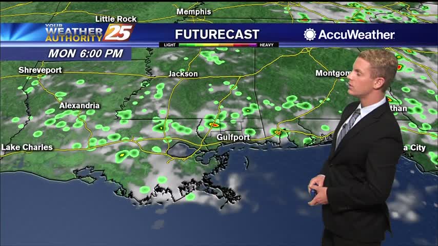
6/30 - Sam's "Warm and Damp" Monday Evening Forecast
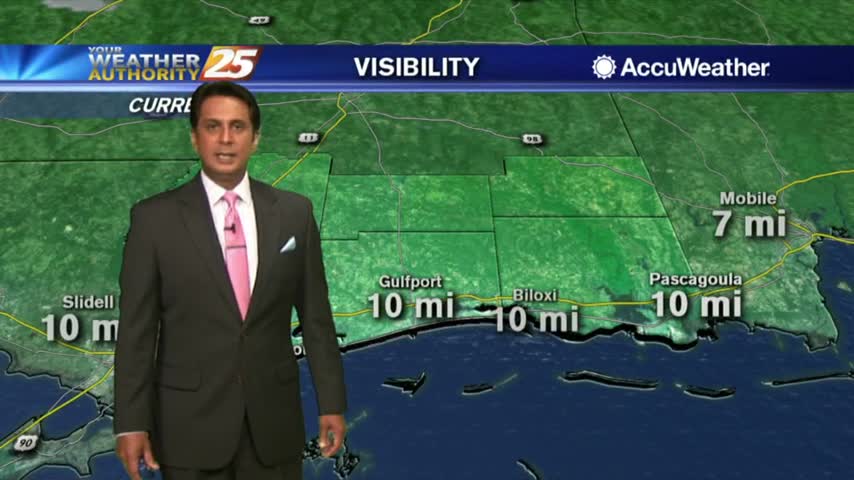
Happy Monday, South Mississippi! After numerous storms throughout the afternoon and some rain lingering through the evening, we are expecting drier conditions overnight. However, we have a lot of…
Happy Monday, South Mississippi! After numerous storms throughout the afternoon and some rain lingering through the evening, we are expecting drier conditions overnight. However, we have a lot of…
Today, wet weather returns to the forecast. We are expecting quite a bit of shower activity along with a few thunderstorms. Although there may not be more than…
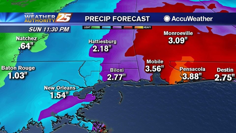
The main concern for today will be isolated areas of heavy rainfall. As seen yesterday, localized 3 to 5 inches will be possible. There’s pretty good agreement between models that main timeframe for highest rain chances will be mid-morning through…

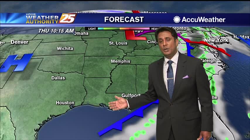
Expect cloudy through the next day or two with highs today in the lower to mid 70s. High temperatures tomorrow are expected to top out in the 70s once again due to increased cloud coverage and a higher chance of…

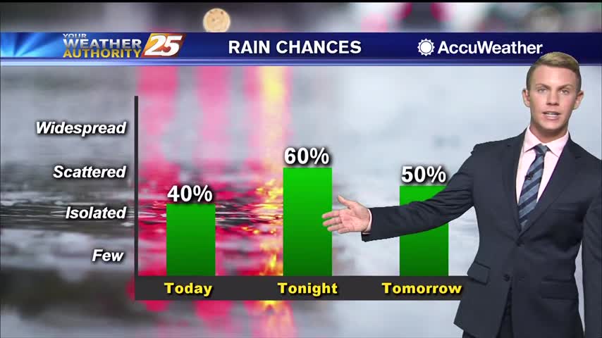
Another day... another high chance for rain. Conditions remain warm and muggy along the Gulf Coast as fog, showers, and thunderstorms continue. Rain chances stay elevated today at around 90 percent, mainly in the afternoon between 12 noon and around…
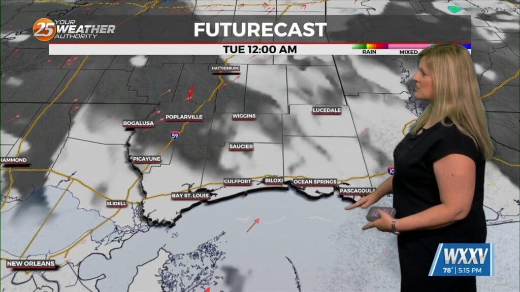
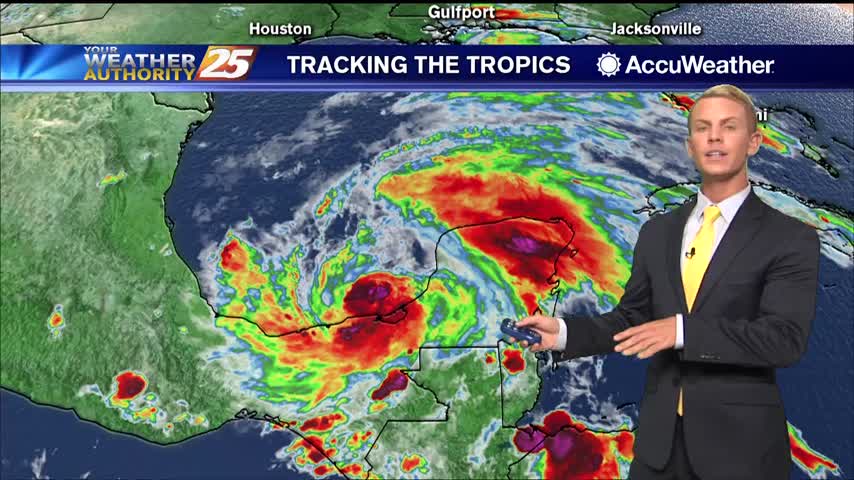
As TD Marco continues to move west along the Louisiana coast, the strong tropical flow will continue into south Mississippi. The focus will now shift to the SE'tern Gulf of Mexico as TS Laura continues to move NW. Conditions in…
The increased deep layer moisture combined daytime heating and convergence along the seabreeze will lead to increased thunderstorm coverage on Monday. Isolated showers will develop near the coast in the morning, gradually increasing in coverage and developing inland through the…

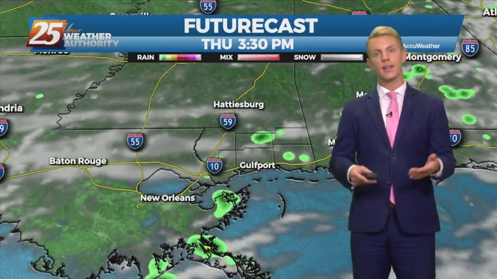
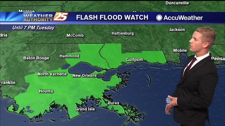
Another day of showers with isolated t-storms before the pattern begins to change. A FLASH FLOOD WATCH is in effect through this evening as another inch or 2 of accumulation will be possible. The drier period that starts on Thursday…
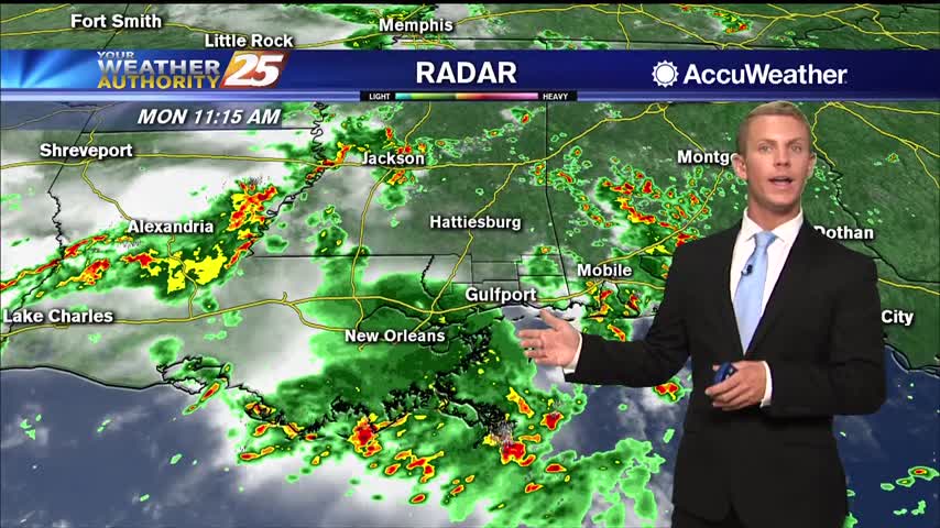
Rainy weather continues to be in the forecast for today and tomorrow. There’s around an 80 percent chance of showers and thunderstorms for both Monday and Tuesday on the Coast and we could see some minor flooding. The good news…

Coverage of storms will increase over the Gulf and along the Coast throughout the late afternoon hours. Conditions appear favorable again this for waterspouts across the nearshore waters. Muggy conditions will persist today. High temperatures will be slightly cooler in…
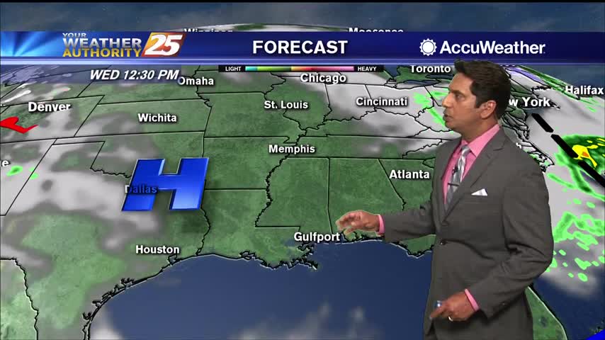
An area of high pressure near the surface will move off the Southeast U.S. coast through this evening as an upper level disturbance moves into the upper Midwest and middle Mississippi River valley. A weak associated cold front will slide…
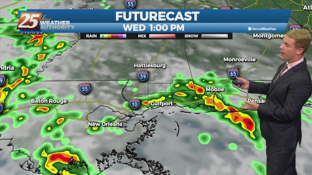
Multiple rounds of showers and thunderstorms will push through the area in the coming days. Rain chances are at around 70 percent today, and going up to 80 percent for Tuesday and Wednesday. Otherwise, it will be mostly cloudy, warm…
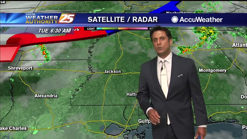
Deep upper level trough will dig through the upper Midwest today, dragging a cold front through the Mississippi Gulf Coast. Expect scattered showers and thunderstorms this morning with the activity beginning to wind down this afternoon. Due to the very…

Overnight lows will be warm with temperatures only dropping down to the upper 60s to lower 70s. Tomorrow, rain chances increase to 70 percent as coverage of storms becomes more widespread. It will be warm and muggy with highs will…
After a cloudy day with spotty rain, overcast skies will continue. Scattered showers and a few thunderstorms will be possible overnight with rain chances at around 40 percent. Overnight lows will be warm with temperatures only dropping down to the…
Showers and thundestorms will continue on and off through the afternoon and evening. High temperatures will be cooler today due to the increased cloud cover, only topping out in the lower 80s. Tonight, rain and clouds will clear out of…
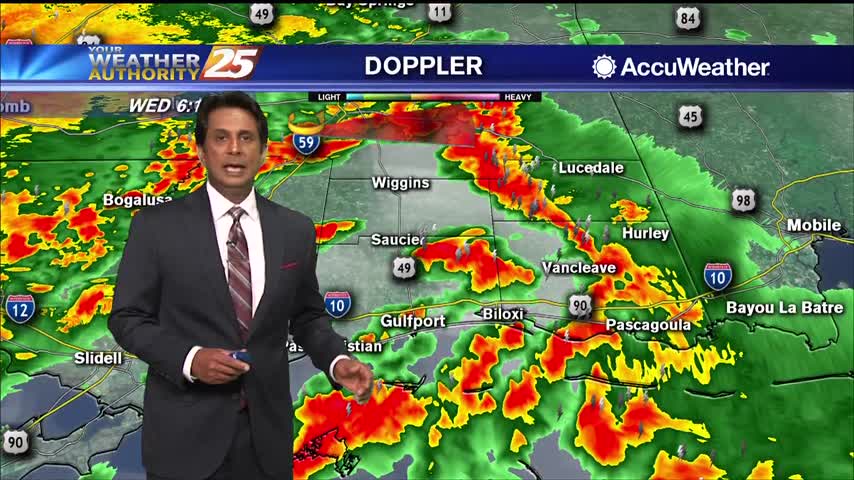
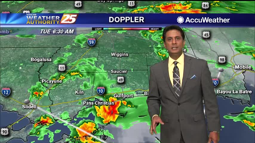
High rain chances will continue this morning with showers and scattered embedded storms along the front. A few strong to severe storms in this squall line are expected with hail and strong to damaging wind gusts being the main factor,…
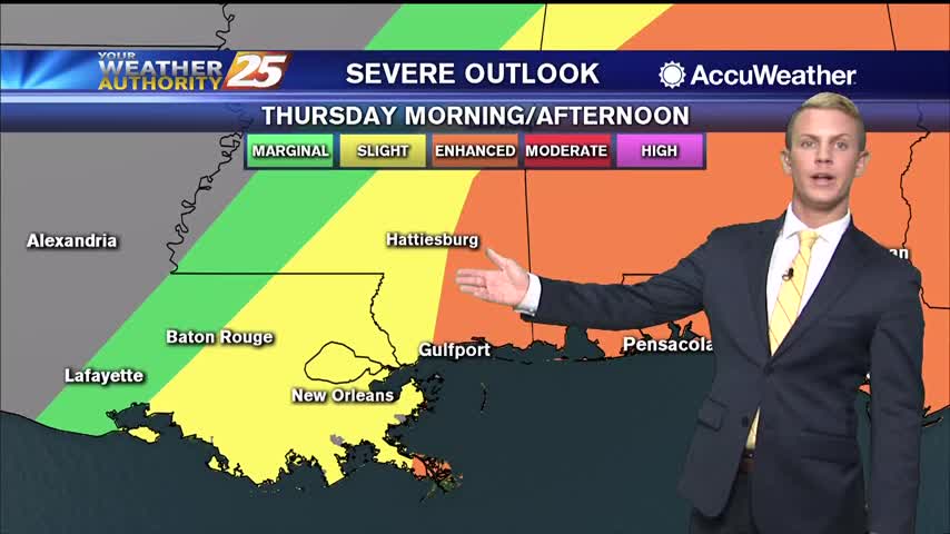
The next 36 hours will deliver showers and thunderstorms to the area with some of these becoming strong to severe. The first of these looks to arrive after dark tonight and should be mainly reserved for the northern portion of…
The low end threat for severity will move east as a cold front passes today. Some deeper and stronger t-storm cells could form this morning with strong wind gusts the primary concern. By this afternoon, dry air will move into…
Cloudy skies will continue through the afternoon and early evening with warm and humid conditions. High temperatures will top out in the lower to mid 80s once again. Tonight, rain chances increase to around 60 percent as showers and a…
Mostly cloudy skies will persist through the evening hours ahead of scattered showers late tonight. Temperatures will be cool, but not nearly as cold as last night. Overnight lows will be in the mid to upper 40s. On Saturday, the…

A slightly warmer start with upper-level clouds moving in from the west...

All across the Coast the wet weather made for some dangerous driving conditions. One of many car wrecks that occurred today happened on Three Rivers Road and Hidden Oaks Drive. News 25 spoke to eyewitnesses at the scene who sprang…
Another humid start to the day with isolated showers south moving north into the coastal counties...