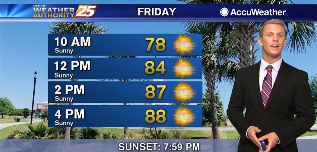
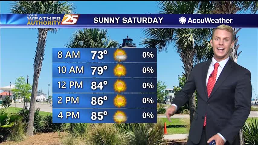
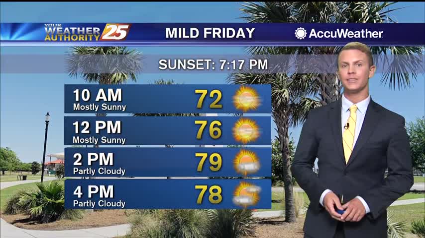
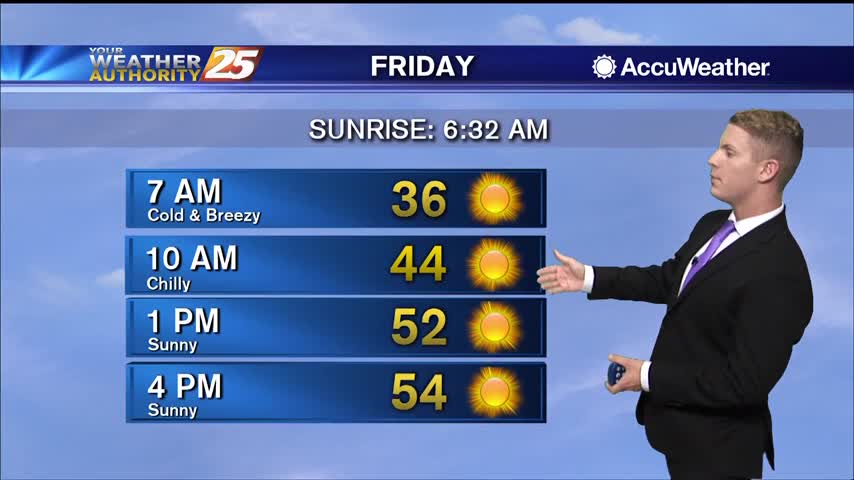
07/17 – Brantly's "Mostly Sunny, Mostly Hot" Friday Forecast
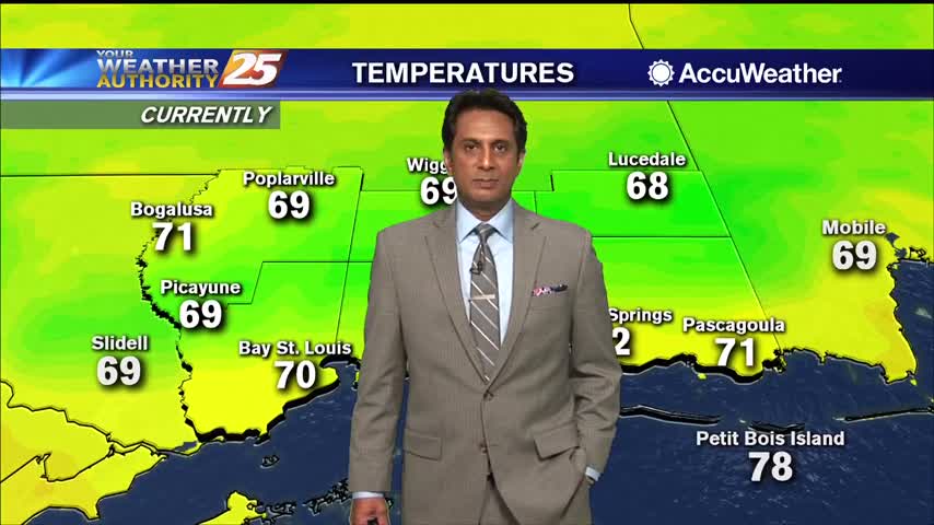
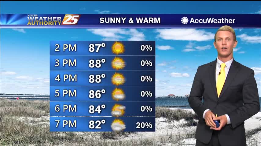
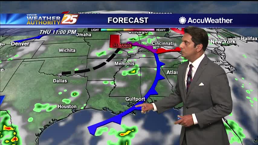
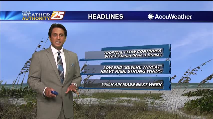
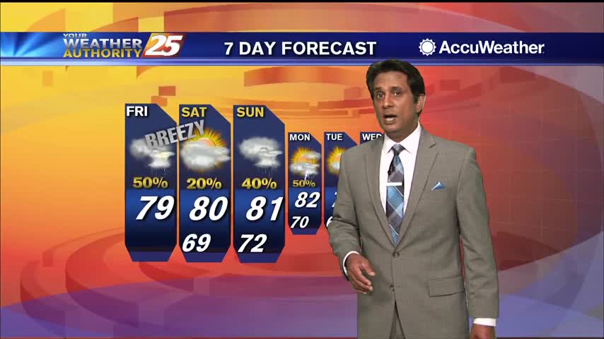
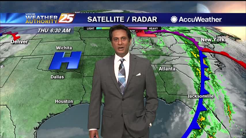
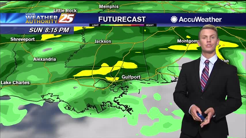
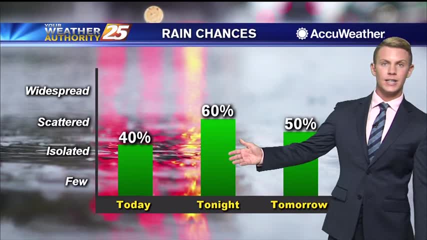
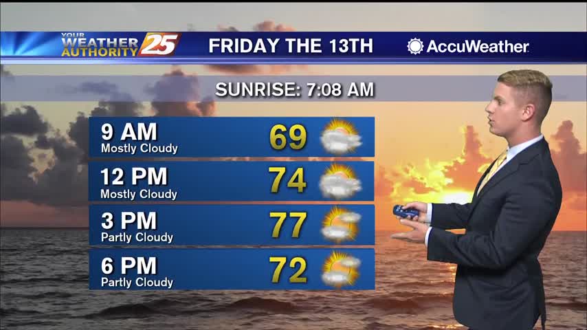
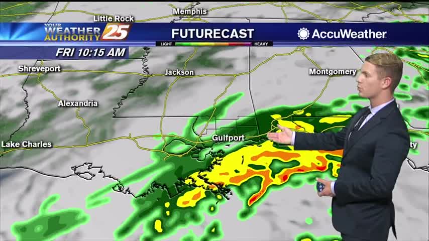
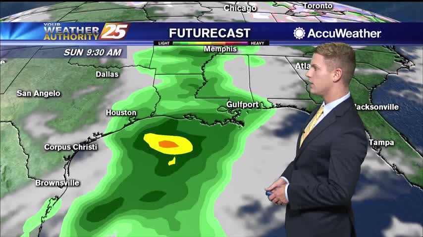
Today through Monday, we should see relatively dry conditions. Unfortunately, less cloud cover means the heat will be back but not as bad as several days ago. Heat index values will be in a 100-105 range. Most showers and thunderstorms…