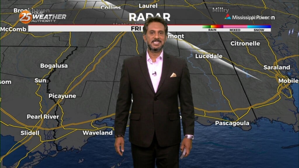
5/10 - The Chief's "Clearing Skies, Lovely Day" Friday Morning Forecast
Cold front is moving through the area this morning and will be slow to do so. Dry air will move over the area bringing cloud…
Cold front is moving through the area this morning and will be slow to do so. Dry air will move over the area bringing cloud…
T-storm complexes will stay on the lee side of the Rockies this morning and have been for a while. Another weakening one is moving up from…
Another wonderful day ahead with sun and clouds mixed, with increasing cloud coverage tonight. A tightening gradient will continue to bring breezy conditions to the area…
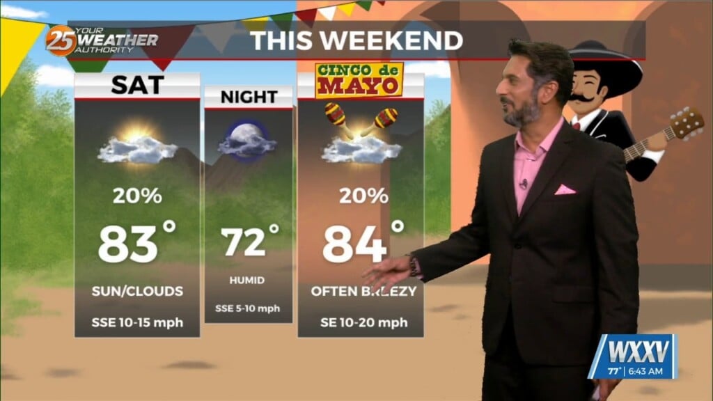
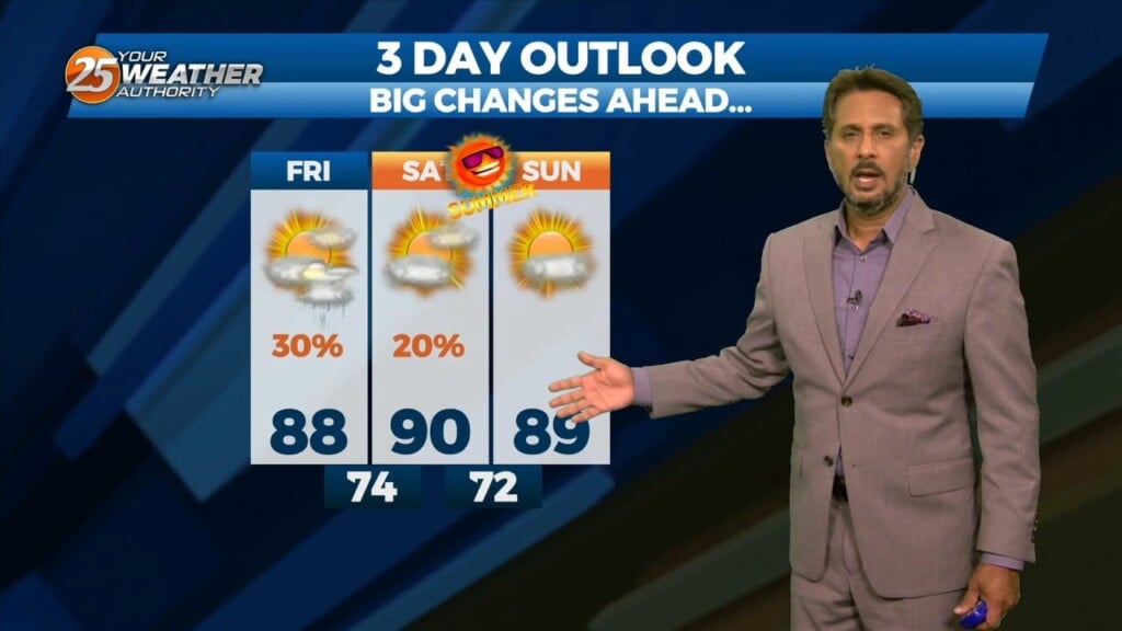
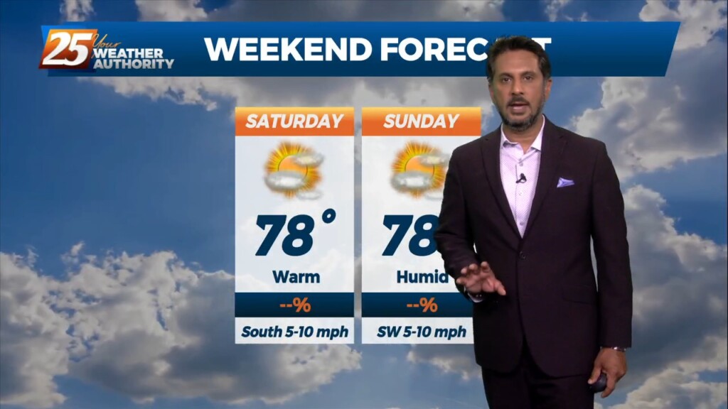
MAKE PLANS FOR OUTDOOR ACTIVITIES THIS WEEKEND... High pressure moving into the region from the NW will provide for dry conditions, which will go a long…

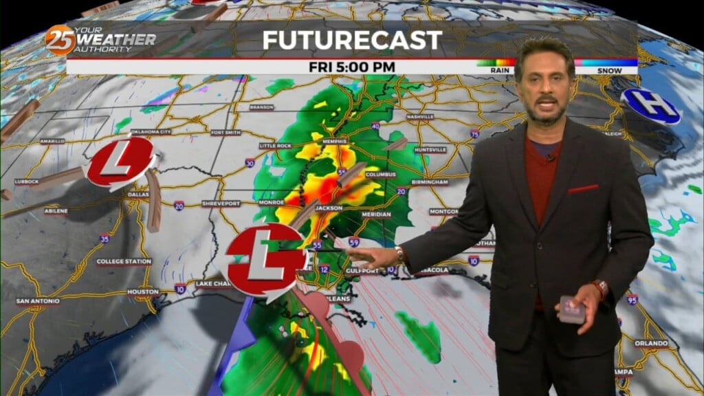
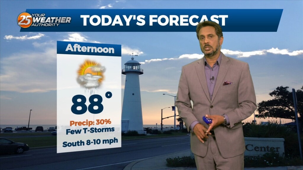
With a stalled frontal boundary overhead and moisture surge from the GOM, another round of showers/t-storms will move in around mid-morning. Moisture values will support…
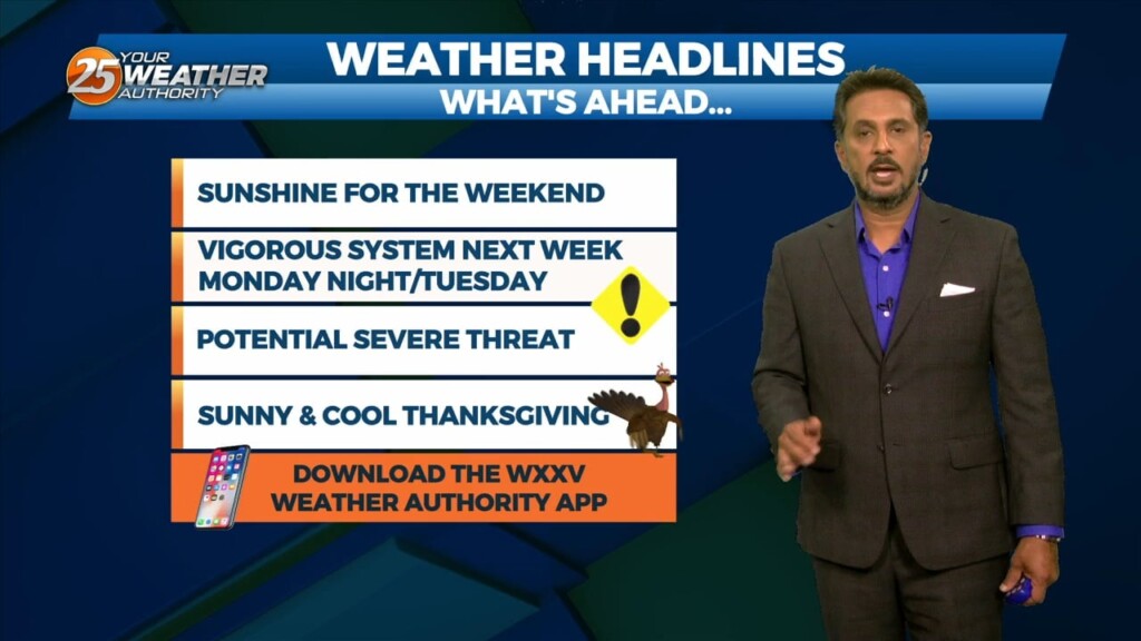
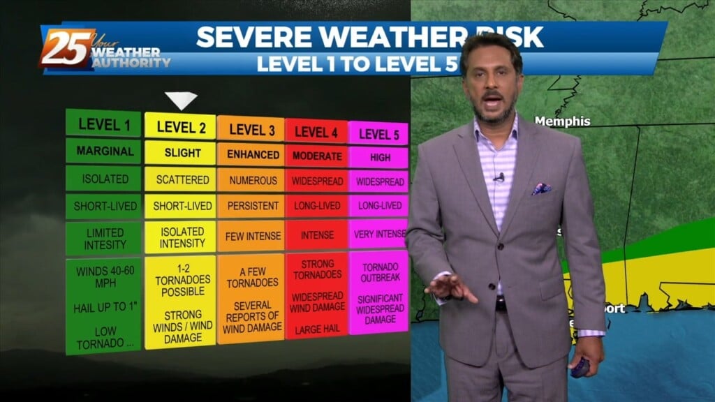
I will try to keep things as simple and non-confusing as possible by keeping headlines to what is necessary and only ramping up to the highest…
The midweek upper disturbance is now over Florida with weak high pressure over Texas. A northern stream disturbance extends from Hudson Bay to Lake Superior to the…
Scattered showers and thunderstorms will be possible this afternoon as temps warm into the upper 80s/low 90s within a fairly moisture regime. Although the latest…
The stalled stationary front to the south is beginning to wash out quite a bit, but will linger into the final weekend of summer.…
The stubborn high pressure continues to remain centered over the I-35 corridor from Kansas through much of north and central Texas this morning.…
Today I’m expecting temperatures to climb into the lower 90s (heat indices nearing mid 90s) today across much of the area so be mindful to stay hydrated…

Yesterday’s frontal system will continue sliding east out of the area. Zonal flow will dominate the upper level pattern, with a northerly surface winds becoming SE…
A line of showers/t-storms to the west associated with an approaching cold front will move into through area this morning into early afternoon. A…
The main feature at the surface remains to be a frontal boundary that has come to a slow crawl or just about stationary to our…
With moisture getting lifted over the colder air near a boundary to the east, we’ll likely be seeing precipitation pretty much all day today, but expect…