10/10 - Rob Knight's "Return of Rain" Thursday Morning Forecast
A MUCH warmer start to the day with a few light rain showers moving inland from the Gulf...
A MUCH warmer start to the day with a few light rain showers moving inland from the Gulf...
Warming temperatures as clouds continue to develop...

A warm start with isolated activity in the NE'tern Gulf as a cold front is in the area...

As the temperatures continue to warm, it feels more comfortable with low humidity...
Another warm start to the day but a north wind is making it feel quite tolerable...
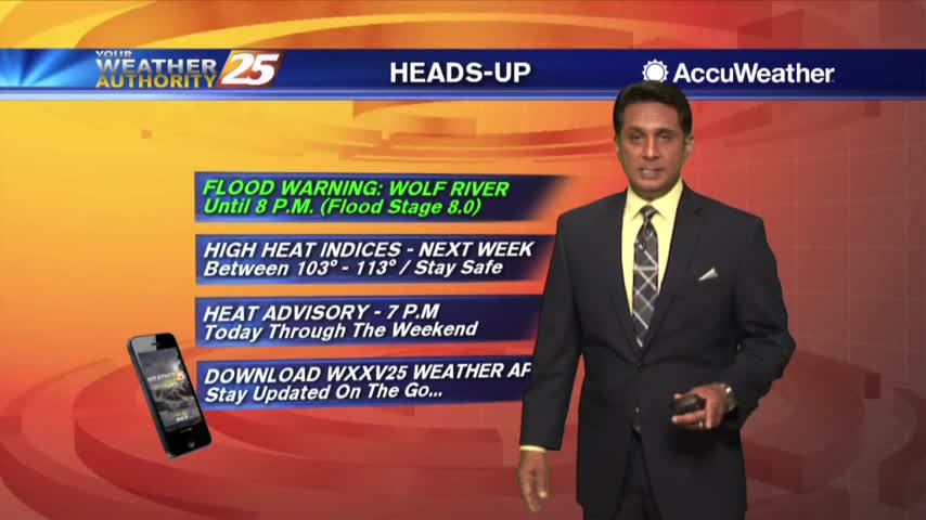
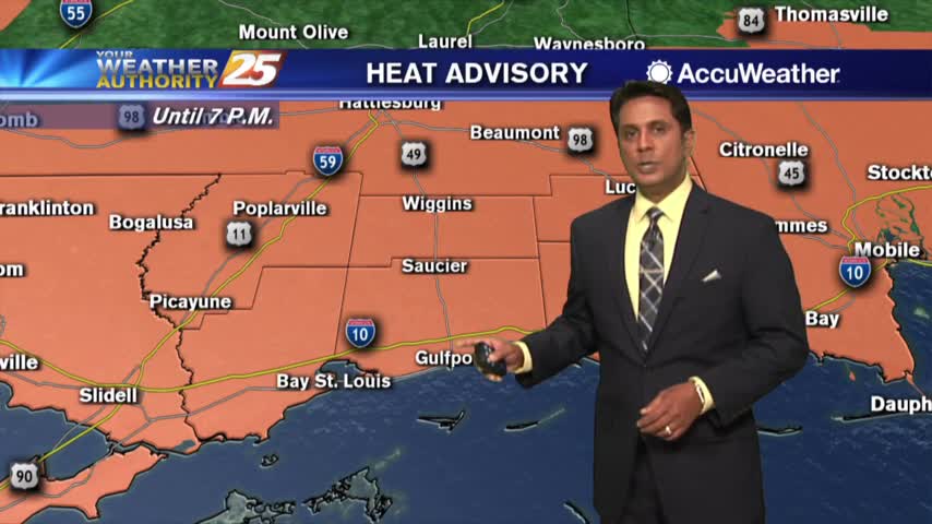
A VERY HOT & HUMID start to Summer with a HEAT ADVISORY in effect...
A VERY WARM and humid start to the final day of Spring...
Another very nice start to the day as temperatures are just a bit warmer than the past few days...

A very warm and humid start to the day with areas of patchy fog...
Morning fog has burned off with blues skies and temperatures warming into the upper 60s/low 70s...
After a chilly start, temperatures continue to warm into the 70s under beautiful blue skies...
A few hours of a south wind yesterday afternoon is providing warmer temperatures this morning...
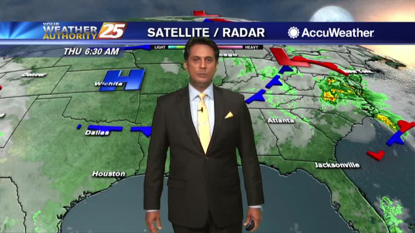
Isolated rain is moving across the area as the cold front is now to our east...
Spotty showers beginning to develop as the cold front is moving closer to our area...
A few stray showers across south Mississippi with a disturbance north of the area moving east...
After rainy conditions last night, the rain is now moving off to our east...
A warm front north of the area had a very warm air mass in south Mississippi with areas of DENSE FOG...

A COLD start to the day with a lot of upper-level clouds streaming across the area...
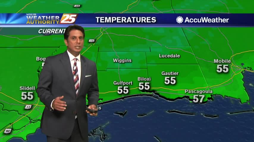
Beautiful blue skies continues as temperatures warm...now in the mid/upper 50s...
After a very cold start to the day, the return flow has begun with MUCH WARMER temps ahead...

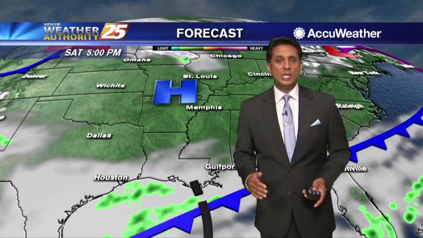
A line of light rain has moved east with only a few spotty showers this afternoon...

With a warmer/humid air mass moving in ahead of a weak cold front, spotty light rainfall is moving across the area...
A cloudy start to the day with areas of light fog and drizzle as a warm front is over the area...

In advance of a warm front, extensive mid/upper level clouds have moved into the area...