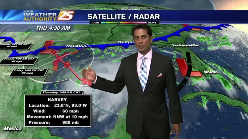
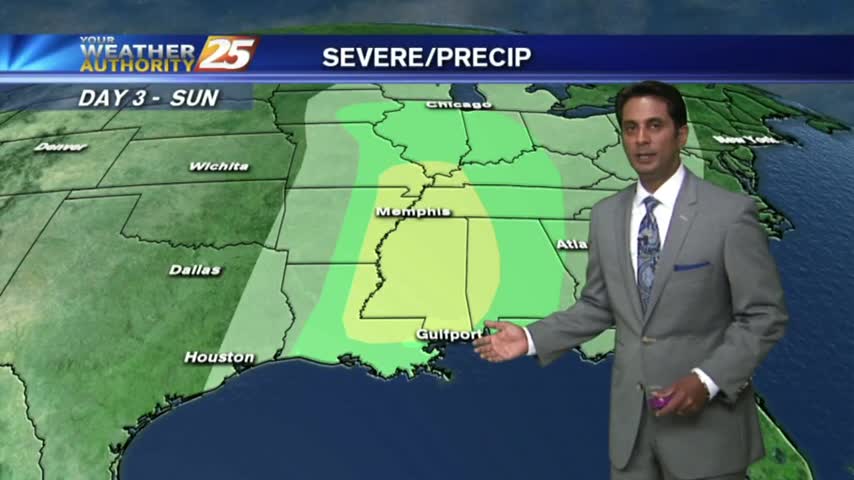
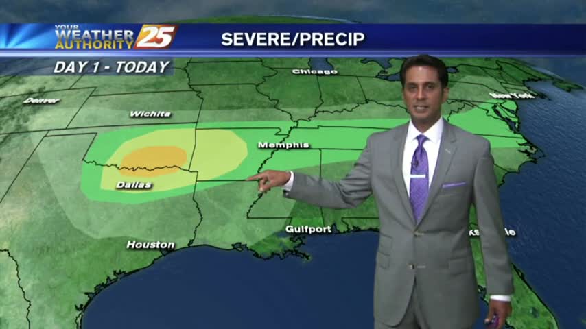
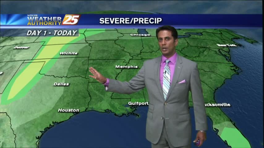
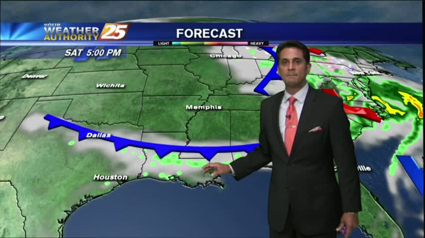
8/24 - Rob's "TS Harvey Update" Forecast
A mild start to the day as a weak cold front over head has the area under mostly cloudy skies...
A mild start to the day as a weak cold front over head has the area under mostly cloudy skies...
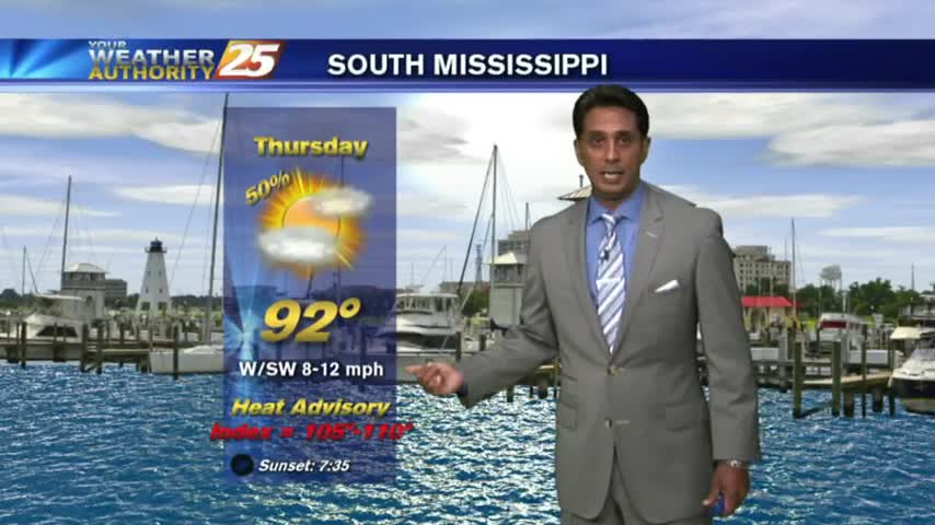
After a HUMID start to the day...warming temps has EXTREMELY HOT and HUMID under a few/partly cloudy skies on this Friday afternoon...
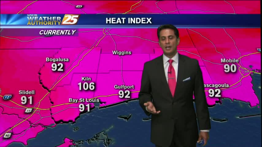
A warm/humid start to the day with minimal activity compared to the past month. DANGEROUS HEAT is on-tap though today...
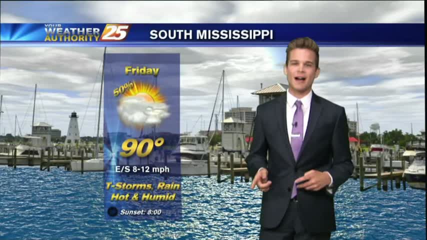
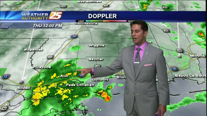
Showers and thunderstorm chances today as a surge of deep tropical moisture into the region.

Overnight showers/t-storms have made their way into the sound and along the immediate beach. More activity to come through today...
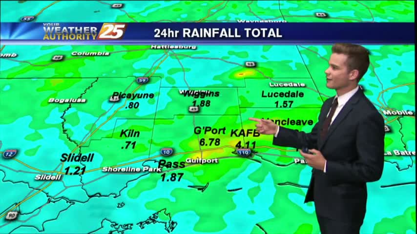
We are ending the month as the wettest June on record.
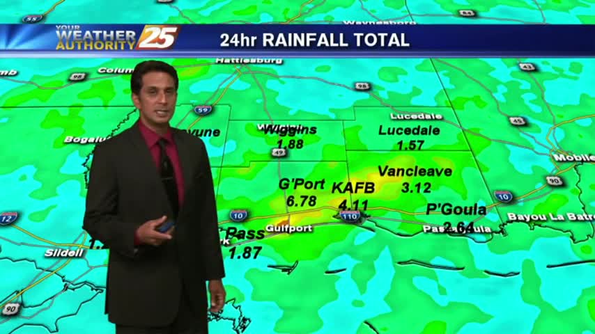
After torrential rainfall yesterday with as much as 6" of accumulation, it's a drier (rain-free) start to the final day of June. ..
The beautiful weather will continue into the weekend as high-pressure to our north continues to shape our forecast...
Under mostly cloudy skies...it's a warm & Humid start with very light sprinklers along the coast.
After a HUMID start to the day, isolated showers have been moving into the area along with a few T-Storms for this afternoon...
After a CHILLY START earlier this morning...temps have warmed nicely on this "Cinco De Mayo" afternoon...
After a cloudy and rainy start, skies have begun to clear as WINDY CONDITIONS move in...
A warm front developed this morning with a few light sprinkles, now under warm, humid and breezy conditions...
As a warm front develops north of the area, a few light showers have been moving in from the GOM...
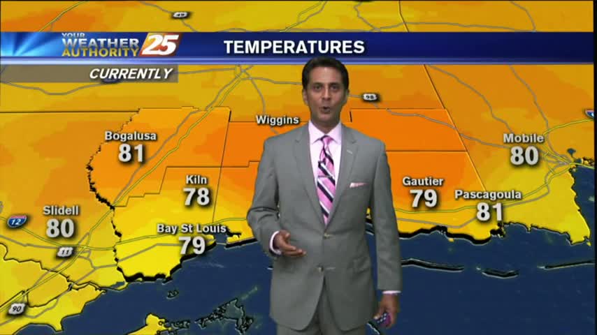
Another WARM/HUMID morning with areas of VERY DENSE fog along the coastal counties...
After a humid start with areas of PATCHY FOG, warming temps has decreased humidity along with partly cloudy skies...

After a chilly morning, temperatures continue to warm under BEAUTIFUL clear skies...

After a warm/cloudy and BREEZY morning...winds continue to escalate higher just below WIND ADVISORY criteria...
After a BEAUTIFUL start to the day with clear skies and low humidity...clouds are beginning to form as the humidity increases..
After a mostly cloudy start, skies have cleared with sunny skies on-tap though this afternoon...
After a COLD start with several locations at the FREEZING POINT, the return flow has begun with the warm up starting this afternoon...
A few clouds continued overnight through this morning with cool temps and areas of very light fog...

After a CHILLY start to the day, an abundance of sunshine already has temperatures in the mid/upper 60s...
The morning brings chilly temperatures under clear skies through the region, as we head into the first weekend of March...