8/3 - Payton's Friday Afternoon Forecast
A few thunderstorms today and going into the weekend.
A few thunderstorms today and going into the weekend.

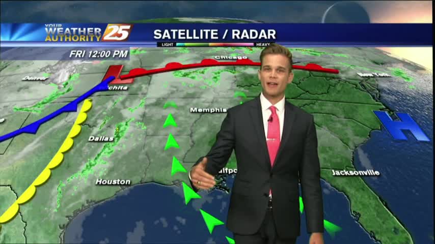
The stationary front is overhead and beginning to dissipate as minimal activity is to our south...
A good bit of clouds moving south into the area earlier this morning has thinned considerable...as the temps skyrocket!
Friday the 13th...and the forecast is fitting.
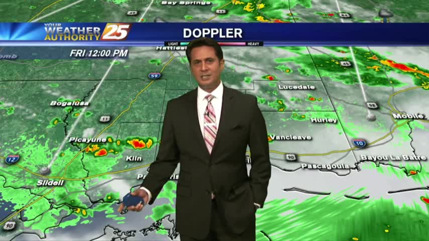
Heat and humidity continue, but rain chances will be going up.
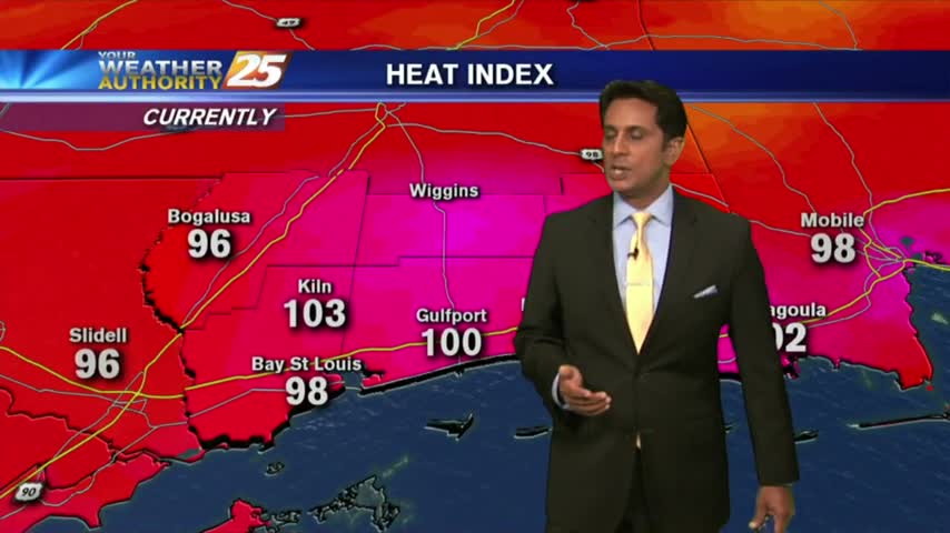
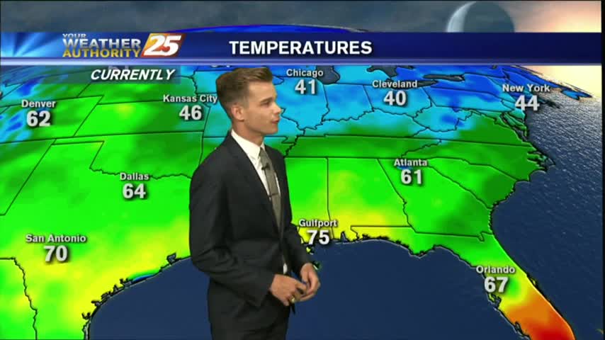
Things are getting HOT out there as the HEAT INDEX is now pushing 100 degrees...
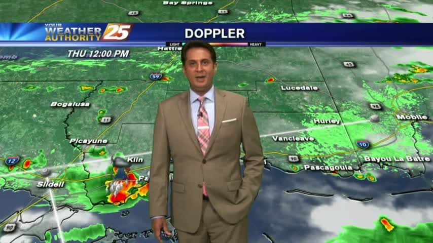
Temperatures continue to warm as the HEAT INDICES are in the mid-90s, with t-storms developing...
HOT & HUMID with showers and t-storms beginning to pop along the Southern 6 and the region...
Another warm start with the humidity poised to get very high as the return-flow from the GOM begins...
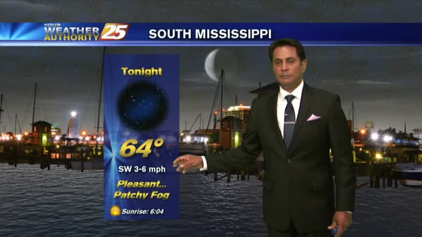
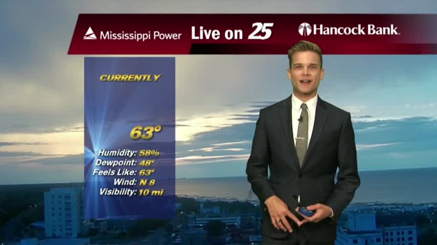
A mild start to the day as areas of light patchy fog is beginning to lift...
Another WARM & HUMID afternoon as cloud coverage continues to move through in advance of an approaching cold front...
Another mild and humid start with areas of patchy fog along the Southern 6 counties...
Another day of sunny skies and warm temperatures.
There could be an isolated shower this afternoon, but most will stay dry.
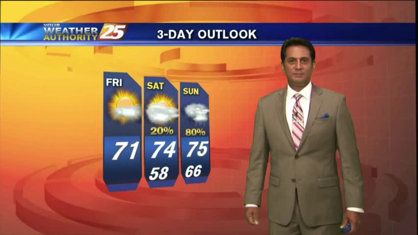
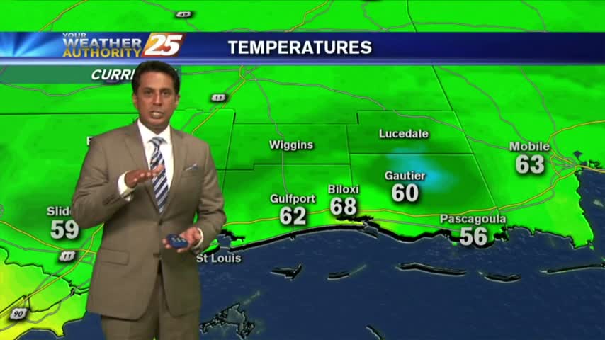
After a chilly morning, temperatures will top out around 70 degrees this afternoon...
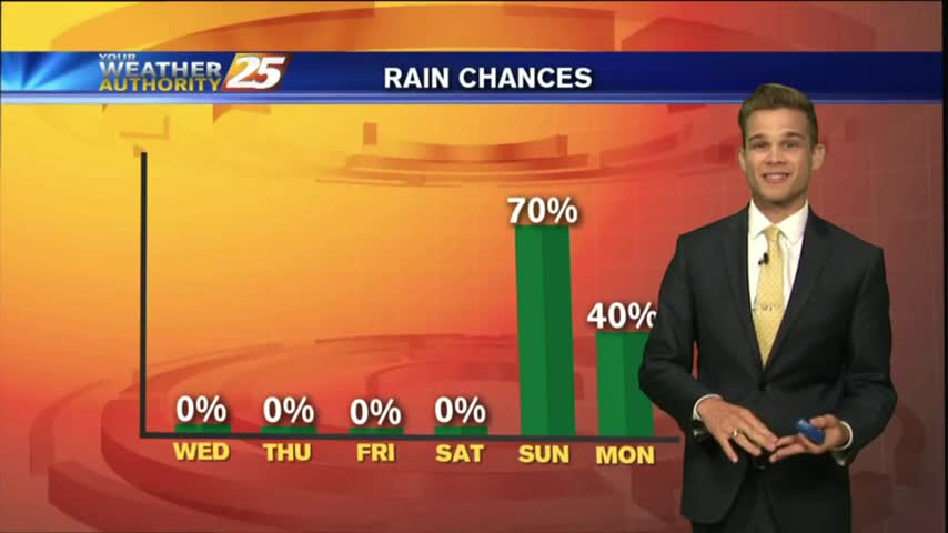
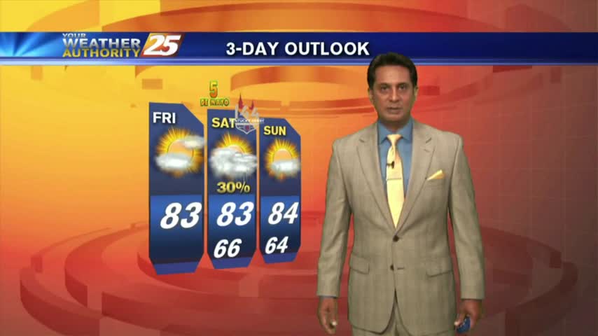
The warming trend continues, but a stormy Sunday looks likely.
Clouds and moisture are moving in, and heavy rain follows going into tomorrow.
Clouds moving in today, and severe weather for your Saturday.
Sunny and breezy today. Severe weather for the weekend.
Waking up a little chilly, but today will be very nice. Severe weather is possible as we go into the weekend.
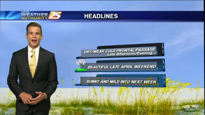
Beautiful this afternoon, and this will last into tomorrow. For the weekend big changes.
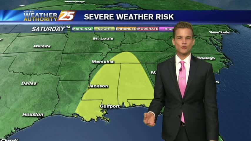
Beautiful weather over the next several days, then strong to severe thunderstorms for the weekend.
Spring weather is finally here! Enjoy the sunshine this week, because it doesn't last for the weekend.
A few showers this morning, but sunshine by this afternoon.