3/7 - Payton's Thursday Afternoon Forecast
Clouds have returned along with the moisture and warmer temperatures.
Clouds have returned along with the moisture and warmer temperatures.

Sunshine has broken through the cloud coverage and the fog has dissipated...

We are still dealing with areas of DENSE FOG as isolated rain is moving in from the south...

Cloudy skies continue with a few spots of very light rain across the Southern 6 counties...
Extensive cloud coverage continues through the region with MUCH WARMER temperatures than yesterday morning...
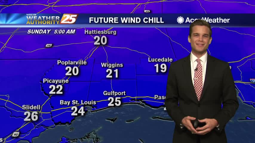
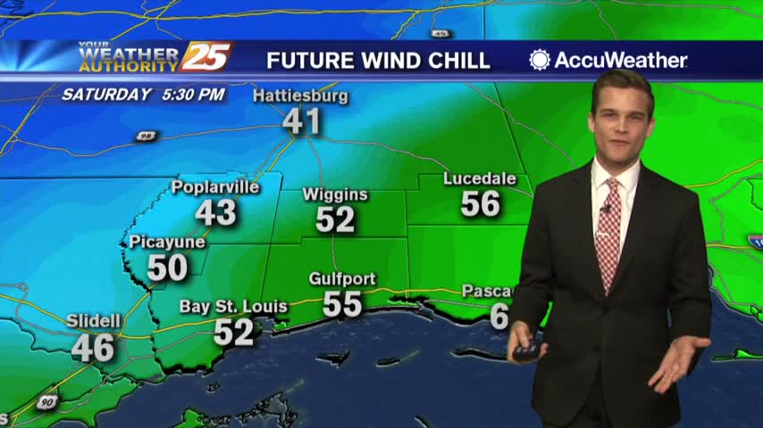
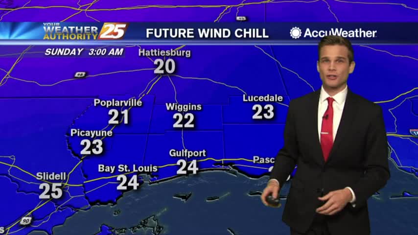
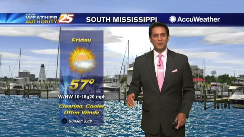
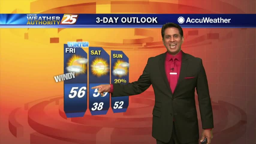
Bundle up tonight! Winter has returned.
Winter has returned...at least for a short time.
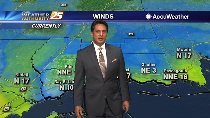
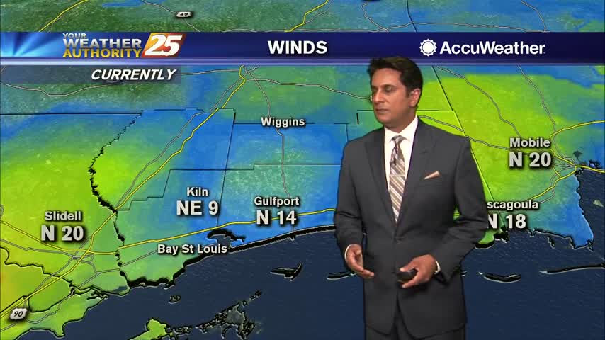
Cloud coverage is still in the area as winds continue to gust into the upper teens to low 20 mph range...
A colder and windy start to the day in the wake of last night's cold front...
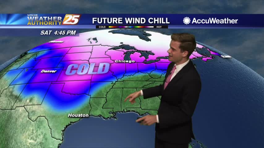
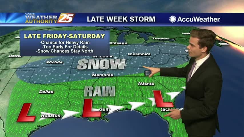
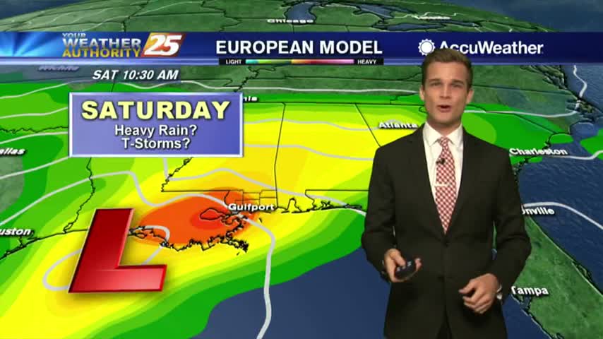
The latest on the chance for severe weather Saturday
Severe Weather tomorrow then freezing temperatures...
Fog, Severe Weather, Windchills in the 20s...Buckle Up
Not the best Monday, but warmer temps are on the way...also colder temps are on the way.
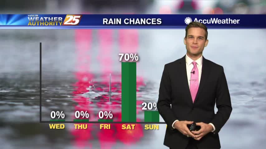
Enjoy some of the warmer weather this week...Arctic air possible next week.
Bundle up tonight! It's going to be a cold one.
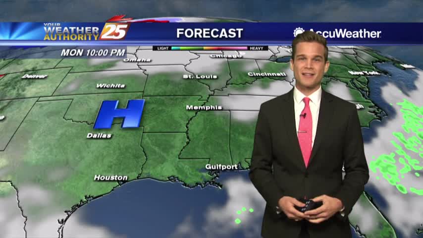
Rainfall has ended as the cold front is now moving east across the Florida panhandle...
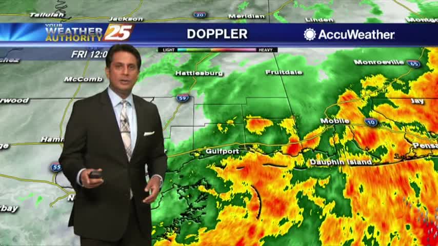
The heavier rainfall has moved east but spotty showers and t-storms will continue this afternoon into tonight...
Low-level clouds continue to dominate the area as winds have been gusting into the 20 mph range...

Light rain has moved east of the viewing area as the cloud coverage will continue through midday...
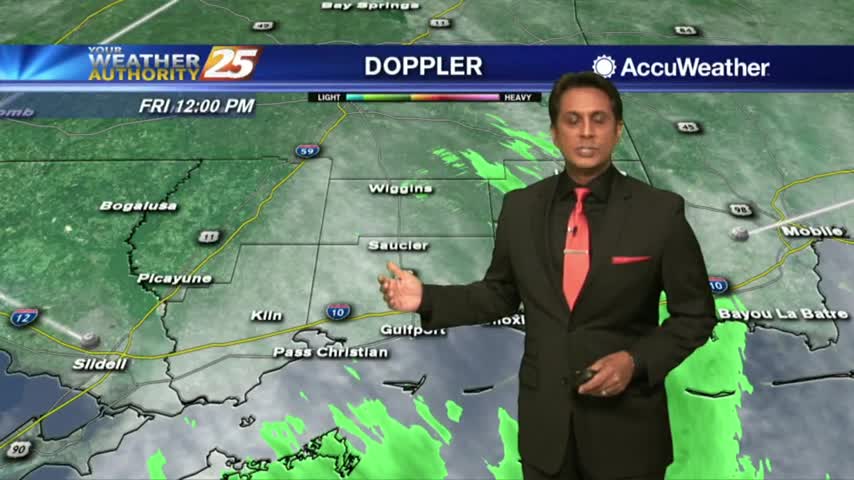
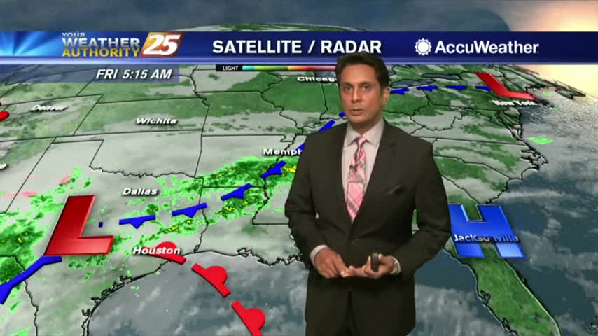
Cloud coverage and spotty rain continues as the area of low-pressure over E'tern Texas slowly moves NE...
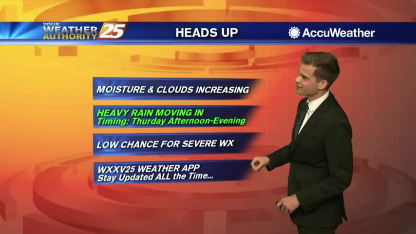
More clouds today...rain by tomorrow.
It's a MUCH WARMER start to the day as the moisture flow from the Gulf is increasing temperature and humidity...
One more day of warmth before the cold returns.
A warm weekend, but colder weather returns soon.