07/08 Ryan's "Stormy" Wednesday Evening Forecast
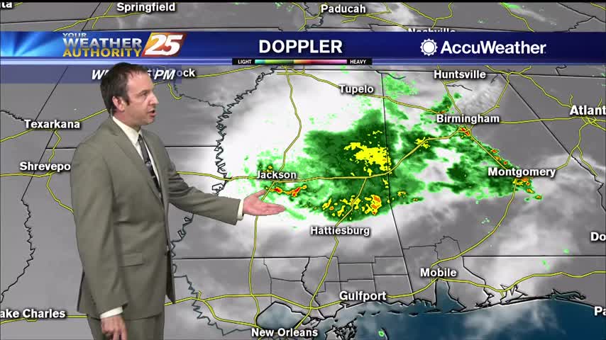
A strong line of showers and thunderstorms moved through late in the afternoon, something we're expecting to see less of over the weekend.
A strong line of showers and thunderstorms moved through late in the afternoon, something we're expecting to see less of over the weekend.
We're seeing more rain each afternoon now, a trend that will continue into the weekend.
Afternoon thunderstorms returned today, and we'll see even more of them in the days ahead.
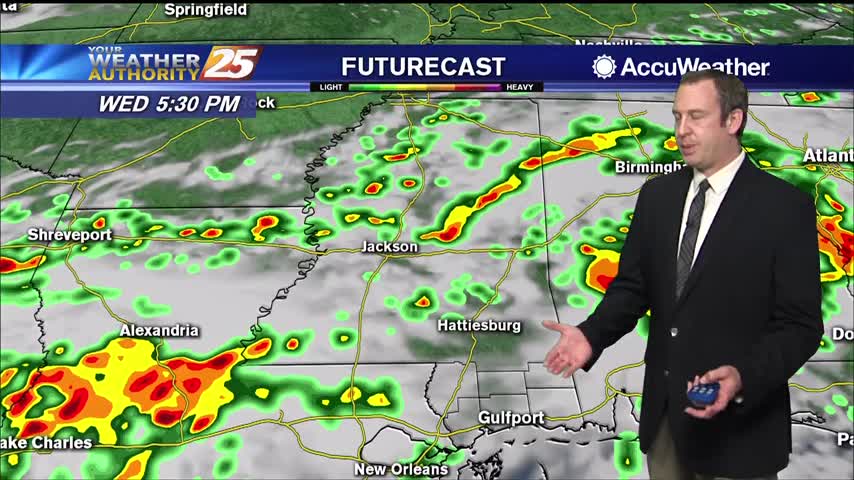
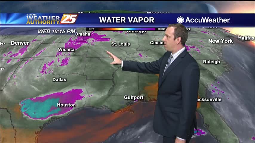
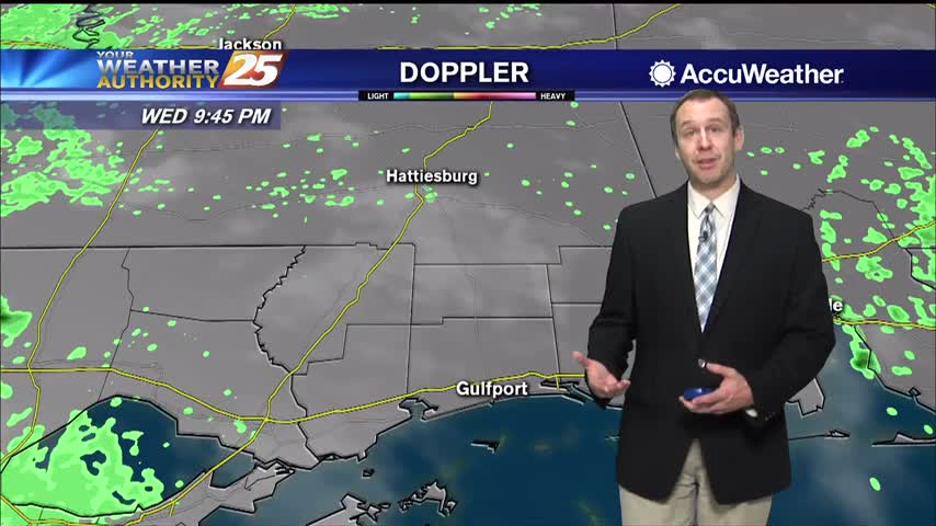
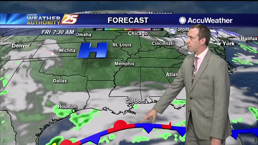
Active, strong weather moved in early this afternoon, and while it did weaken a bit through the evening the rain didn't leave completely.
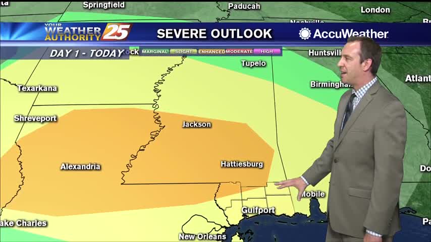
Today started off with a line of strong thunderstorms bringing severe weather to South MS, but that trend isn't going to continue beyond today.
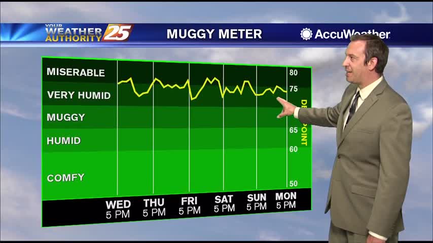
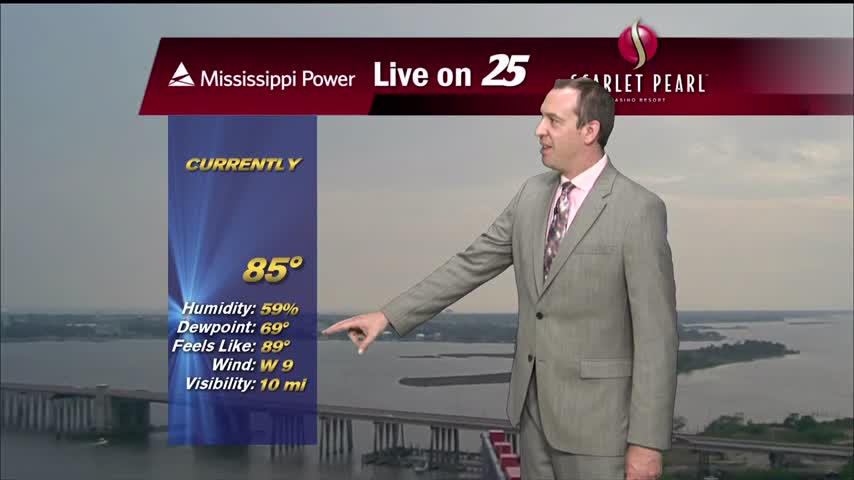
It's feeling pretty good right now, but even higher humidity is on the way as summer begins this weekend.
Not much has changed since last weekend, and won't be changing for the rest of the week.
Started off the day with rain, but drier air is moving in rapidly over the next few days.
One last blast of rain this morning, but clearing skies and cooling air is on the way.

Earlier rain has given way to partly cloudy skies and humid conditions, but the afternoon rain moves back in quickly tomorrow.

Wet conditions earlier today as showers and thunderstorms moved through, but the evening has cleared some.
Thunder rolled this morning as strong thunderstorms lingered, but things have cleared up since...won't last long though.
Warm and humid like the last few days have been, but now much more cloudy...something that won't change for the rest of the week.
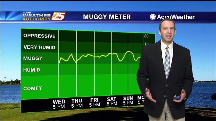
A stiff southerly breeze has increased dewpoints into "muggy" territory, and it doesn't get much better until next week.

Hot, dry conditions aren't helping the multiple fires in the South MS area, but showers are on the way...just not immediately.

It's been quite hot over the last few days and still was today, but cooler air is on the way.

Cold front brought strong storms early this morning, but is now bringing much cooler and eventually much drier air into South MS.

Had a stormy start to the day, but cooler drier air will slowly move in for the rest of the week.
Expecting showers to get going a little after midnight, but stronger, potentially severe storms are likely before sunrise.
Expect the breezy conditions to linger through the night as a front closes in and brings strong storms tomorrow afternoon.
Pretty cool and dry today, but warm, humid, and cloudy weather with scattered showers will move in quickly ahead of the weekend.
Today was the coolest day of the next seven with the lowest humidity, but both begin to increase in the days ahead.
One of the hottest days of the year so far and a very warm night ahead, but cooler...relatively drier air is on the way.
Our highest high in quite some time coupled with today's humidity lead to some scary looking heat indices today, but cooler weather is on the way...just looks like it'll be stormy too.