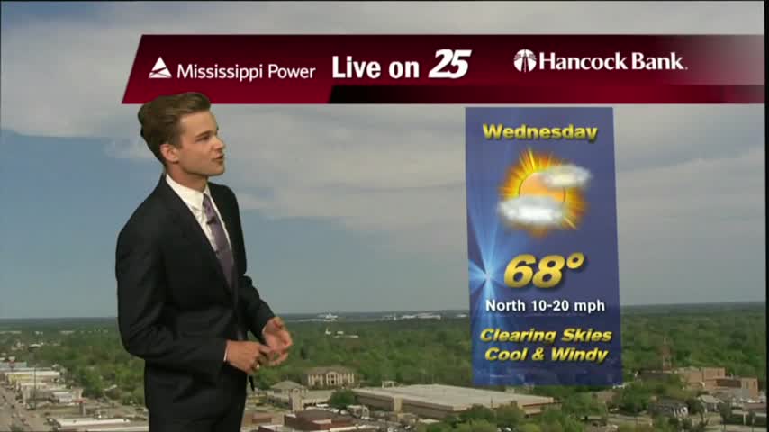
11/21 - Payton's Wednesday Night Forecast
Rain chances tonight. Sunny by tomorrow.
Rain chances tonight. Sunny by tomorrow.
Thanksgiving is looking good!
Plenty of rain in the forecast...then cold air possible next week.
Not bad this evening...severe weather Thursday morning.
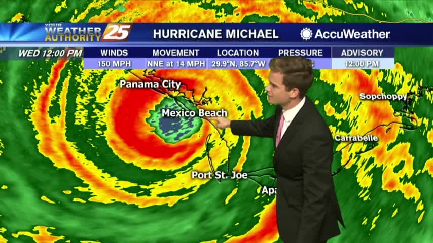
Hurricane Michael is making landfall near Panama City, FL.
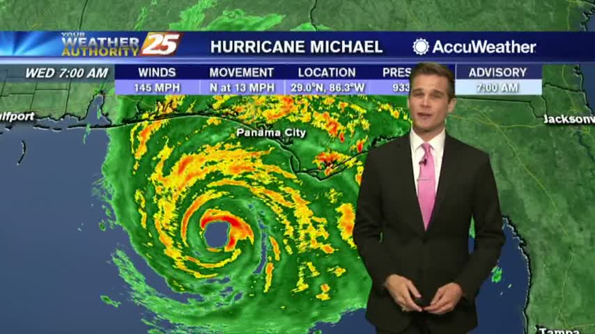
Potentially catastrophic Hurricane Michael advances toward the Florida Panhandle.
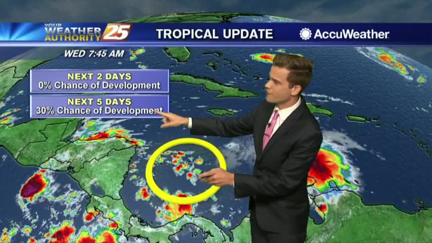
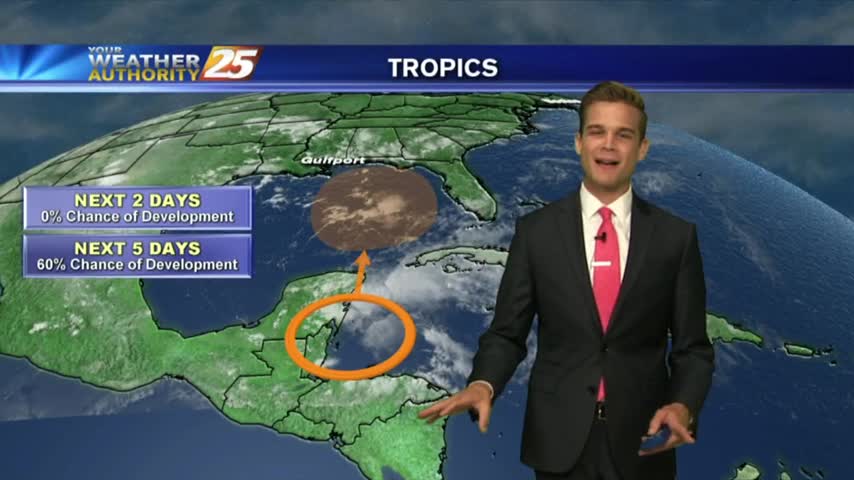
Hot and dry for cruisers and we're watching a disturbance in the Caribbean.
A much better start to the day with just a few clouds moving in from the south and mild temperatures...
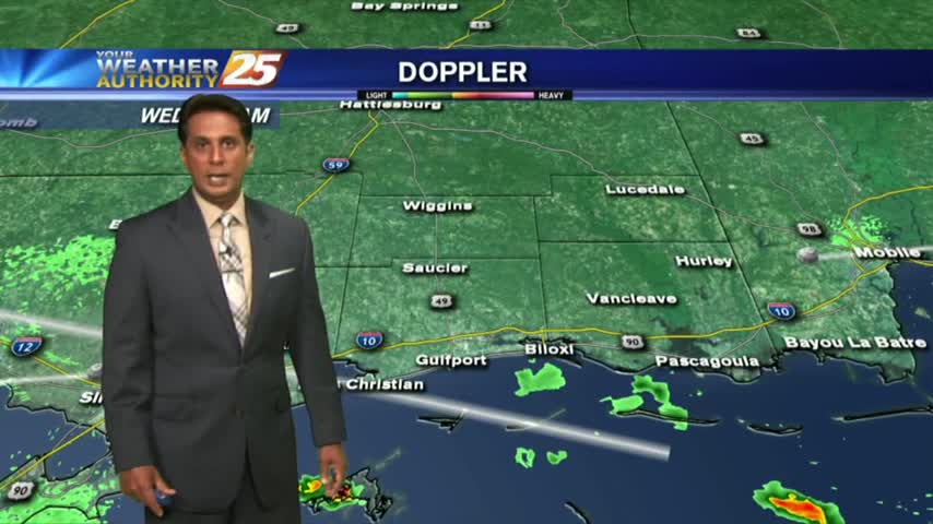
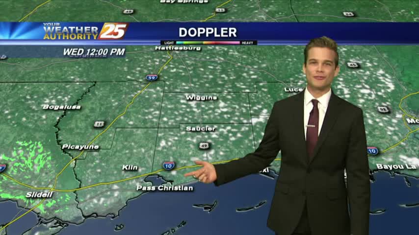
The heaviest rain will be off to the east, but we'll see some activity.

TS Gordon continues to move further away from the area as extensive cloud coverage remains...
Temperatures warming into the 90s with isolated showers/t-storms developing...
The clouds have developed along the coastal counties, with showers/t-storms to follow shortly...
A slightly cooler morning along the gulf coast with a few showers approaching from the south...
More activity this afternoon than the past few days.
Typical summertime pattern for South MS...
Most of the rain held off for fireworks, but when does the rain return...
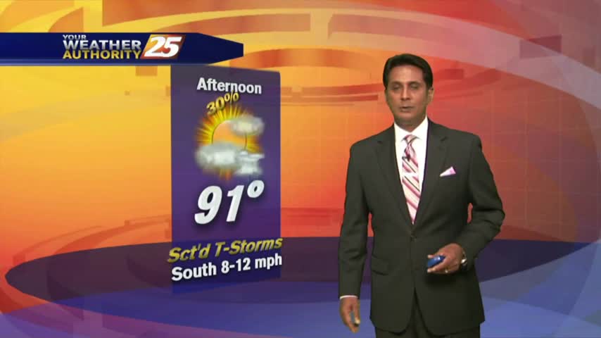
Best rain chances are today, but heat and humidity will be on the increase.
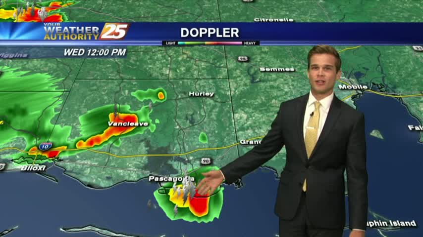
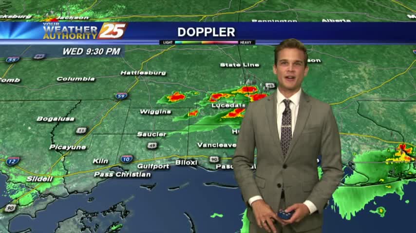
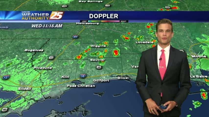
Heavy showers and a few thunderstorms this morning, but more heat and humidity in the forecast.
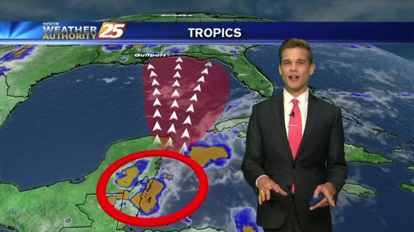
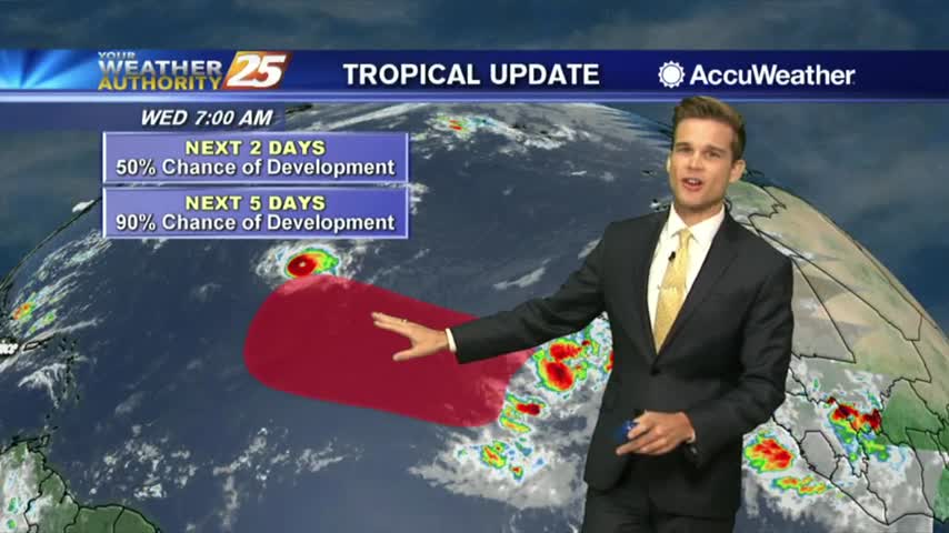
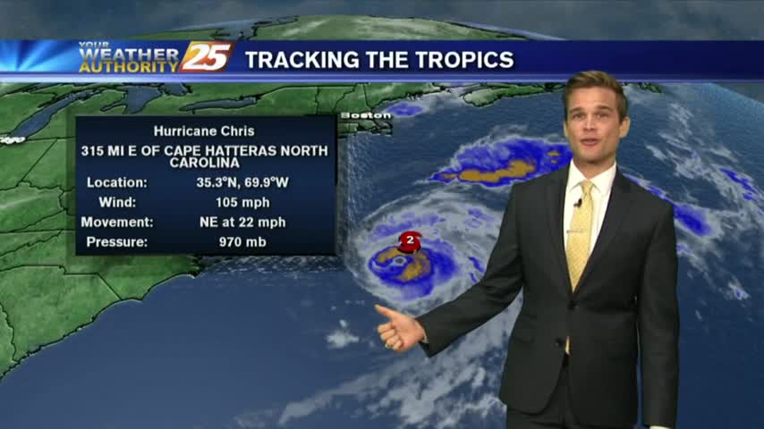
Tropical development is likely over the next five days, but heavy rain continues to be the primary threat.
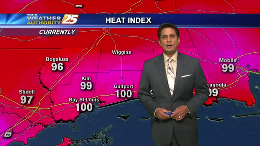
Hot and humid weather continues, but the flooding threat could go up as we head into the weekend.
Another spring afternoon...with more record heat.
Beautiful this afternoon, and this will last into tomorrow. For the weekend big changes.
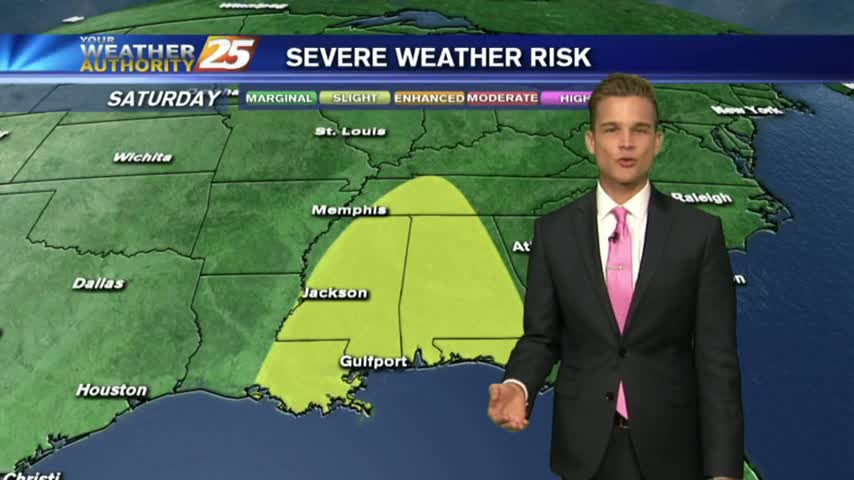
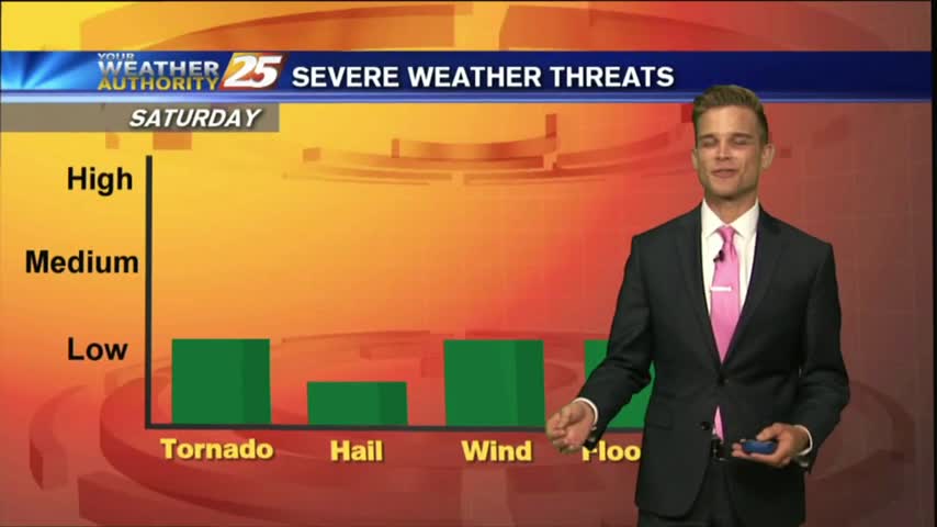
Beautiful weather over the next several days, then strong to severe thunderstorms for the weekend.
A few days of nice weather before showers and thunderstorms return.