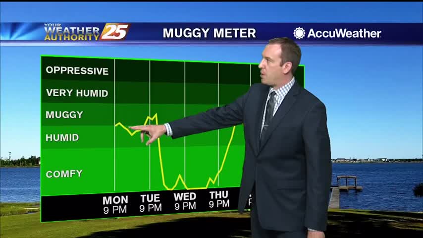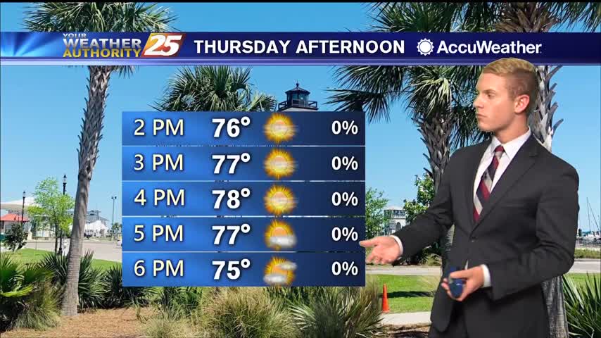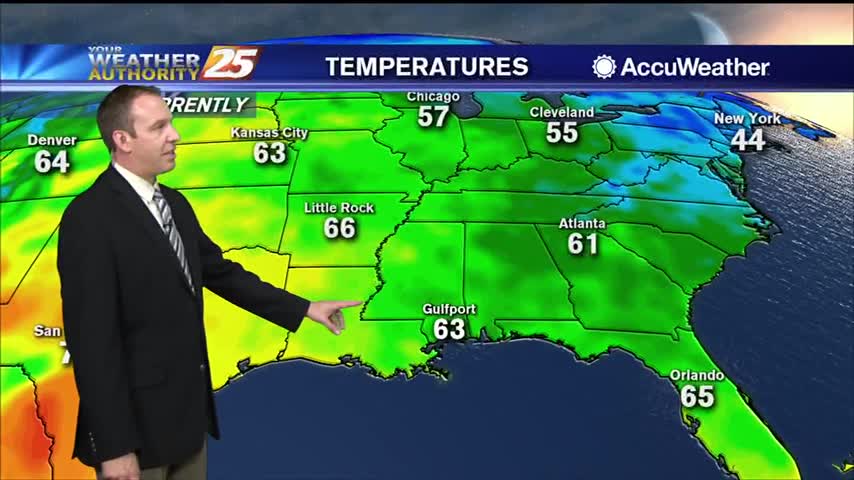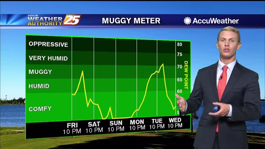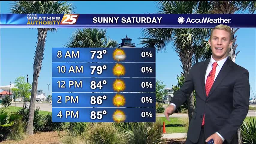
05/05 – Rob Knight's "Warm" Tuesday Morning Forecast
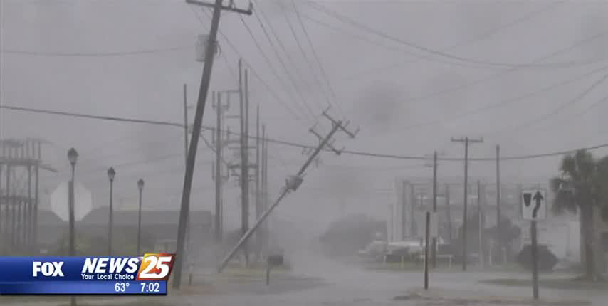
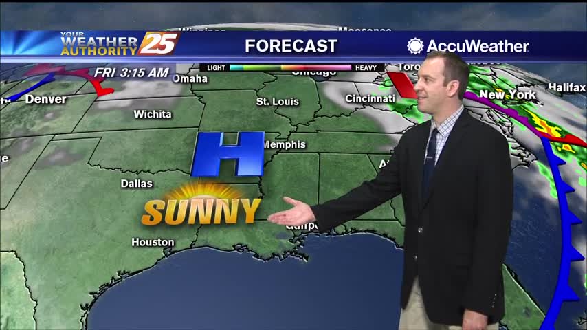
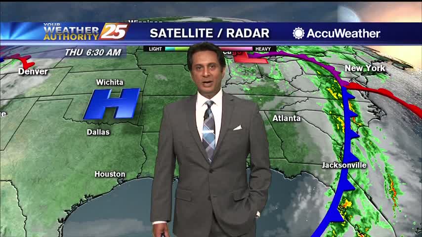
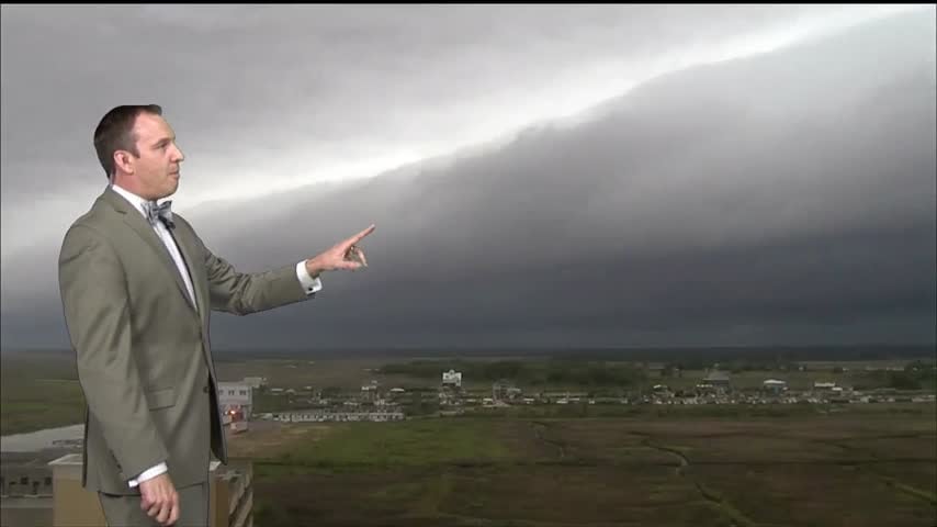
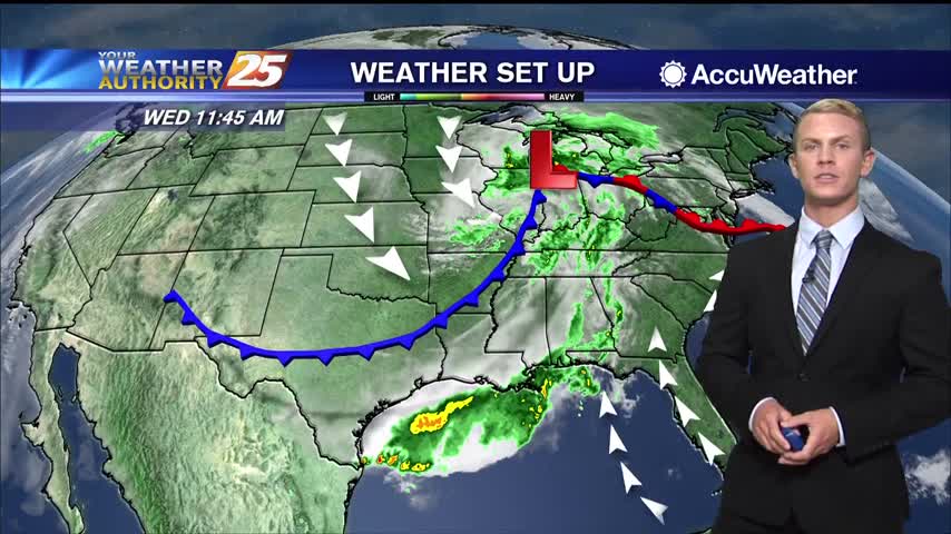
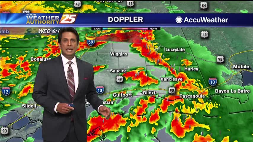
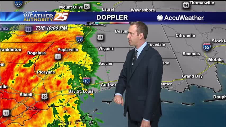
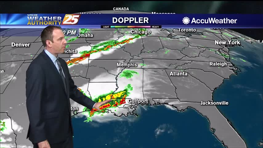
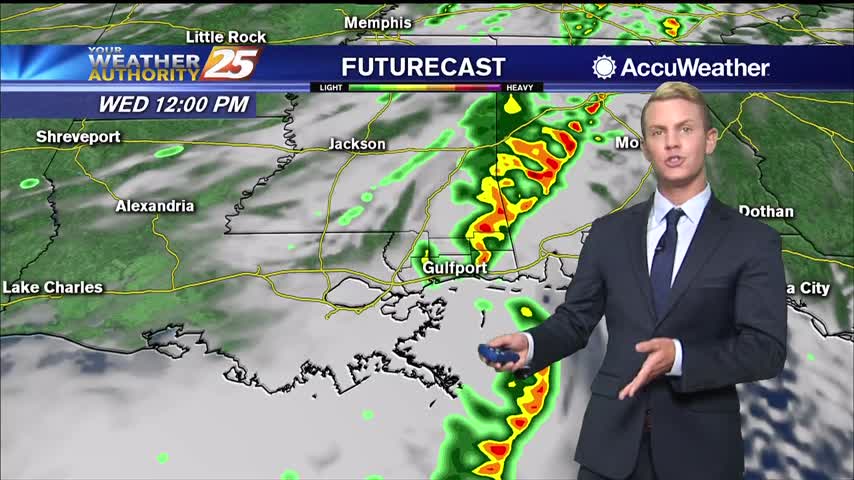
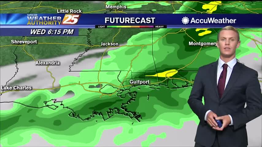
The disturbance diving through the southern Great Lakes States will push a cold front through the area this evening. Expect isolated to scattered t-storms to develop in advance of the front. The majority of activity in our region will be…