1/24 - Rob's Tuesday "Morning News" Forecast
After WINDY conditions yesterday, the winds tapered-off last night with cool and dry conditions to start off the day...
After WINDY conditions yesterday, the winds tapered-off last night with cool and dry conditions to start off the day...
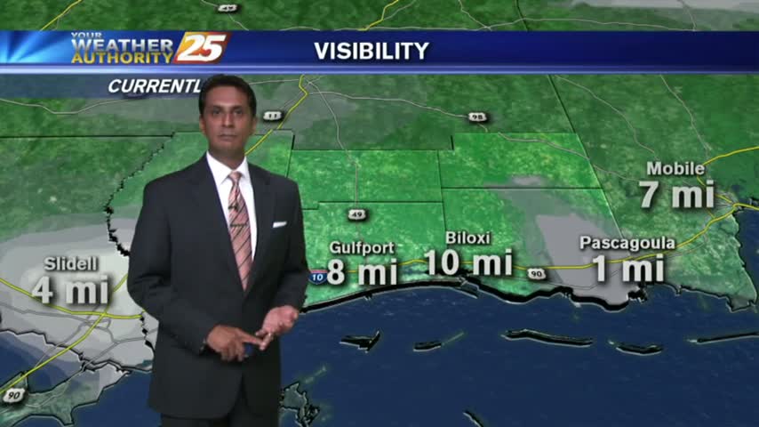
With Spring-Like conditions of very warm/humid air along the SE, DENSE FOG has developed along the Southern 6...
The warm and humid air mass continues to move in from the Gulf providing for areas of patchy fog...
After a few VERY FRIGID days...warmer air has begun moving in from the Gulf...

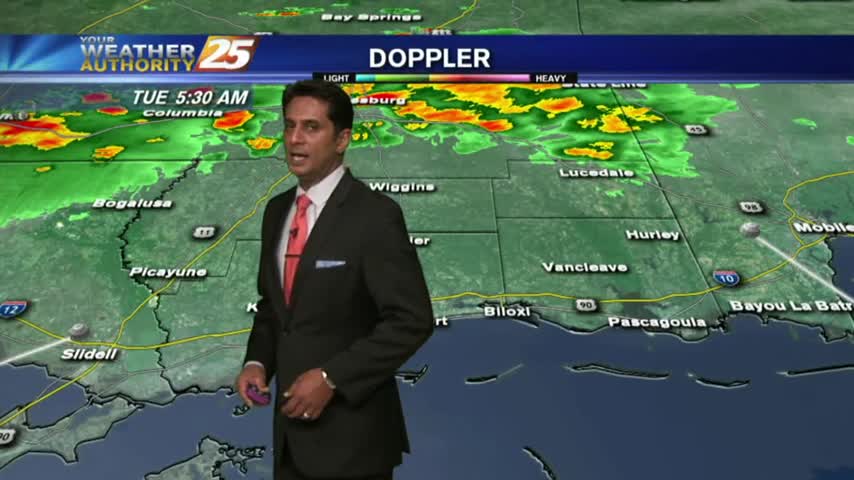
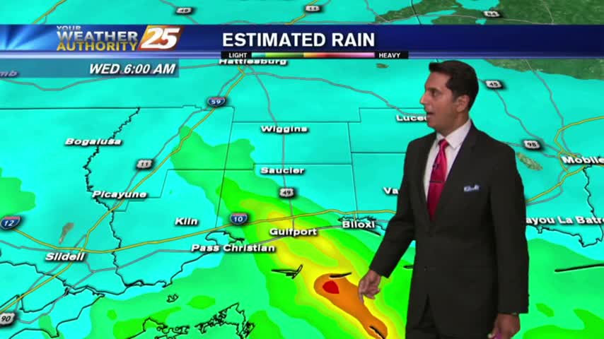
The gray/gloomy continues with rain and t-storms already in the area...and a SEVERE THREAT for this afternoon.
Status-quo from the Christmas weekend continues with a WARM/HUMID start with PATCHY DENSE FOG...
With a cold front in the area providing for WARM/HUMID air in advance, PATCHY DENSE FOG has developed with and ADVISORY through mid-morning...
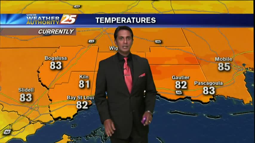
After a bit of sunshine yesterday afternoon, the clouds rolled back in overnight with cool temps to start the morning...
With high-pressure in northern Mississippi dominating the area, it's a chilly start with a few upper-level clouds...
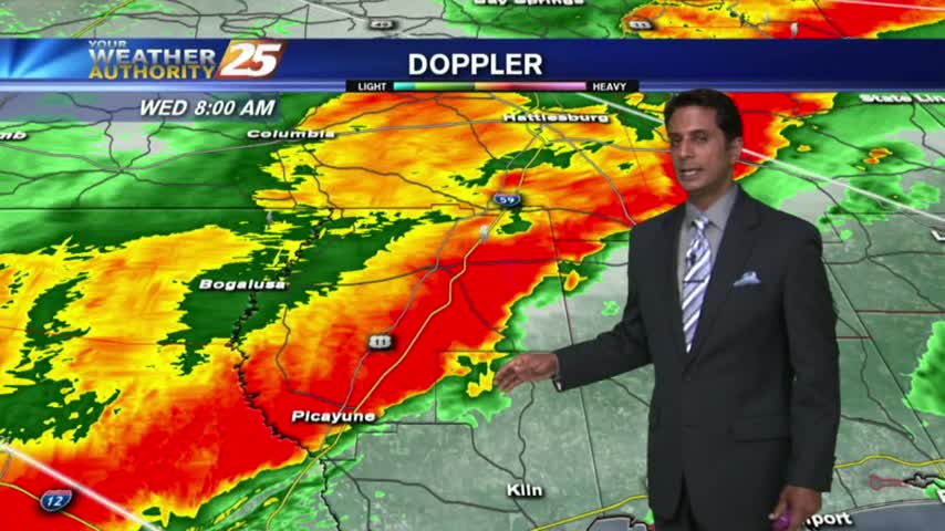
The more intense activity associated with the cold front is now moving across the area...

Mild and humid continues providing for areas of DENSE FOG...as changes are on the way with an approaching cold front.
Clear skies and light winds overnight has DENSE FOG along the southern 6 this morning...
Constant light rain from last night continues, but is moving to the east this morning...
After a humid start with light patchy fog, warming temps continue in advance of a cold front which will push through this evening...
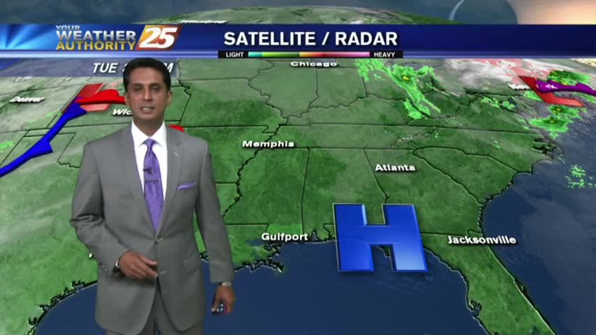
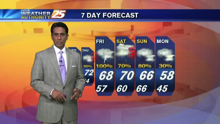
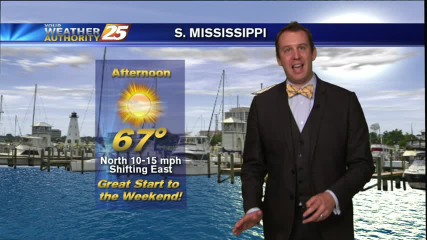
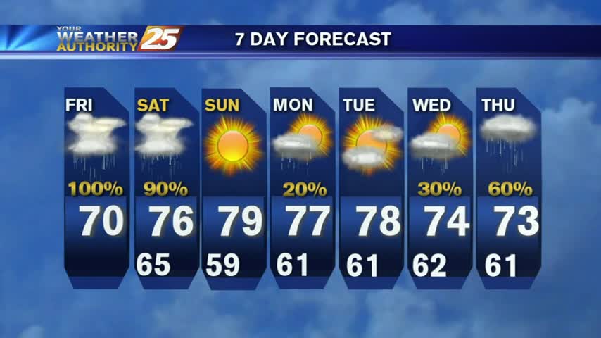
Rain chances this week are nothing like they were last week. Complete details of the forecast for the upcoming week are right here.

Another HUMID morning with upper-level clouds and areas of light FOG...
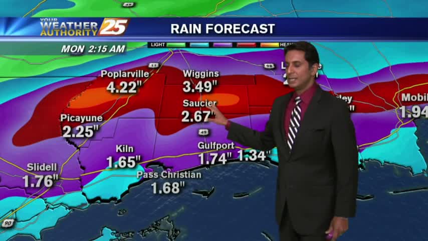
We've had our share of rain over the last few days in South MS and today was no different. Strong storms raced throughout the state earlier today, with nearly 30 hail reports as it moved across the northern central parts…
Weather Forecast 3/11/2016 Good morning, Coastians! Got your pirogue ready? While the National Weather Service has reduced the forecast rainfall amounts for the area (thankfully!), there's still the possibility of flooding rainfall for the area. Do NOT drive through an…

MORE rain ... AND cooler temperatures are featured in this evening's forecast

Weather forecast for the week of August 6th, 2015.
Weather forecast for Monday, July 6th 2015