5/22 - The Chief's "Mercury Rising" Wednesday Morning Forecast
The fight between a series of fast moving disturbances sliding along the I-20 and further north and high pressure to the E/SE will be the main forecast…
The fight between a series of fast moving disturbances sliding along the I-20 and further north and high pressure to the E/SE will be the main forecast…
A much drier air mass in the wake of an overnight cold front will remain in place through Thursday. The next reinforcing shot of dry air…
The next reinforcing shot of dry air will move down behind a new backdoor cold front overnight/Wednesday morning. There is not a lot of boundary…

A dry air mass will remain in place through Wednesday. The next reinforcing shot of dry air will move down behind a new backdoor cold front…
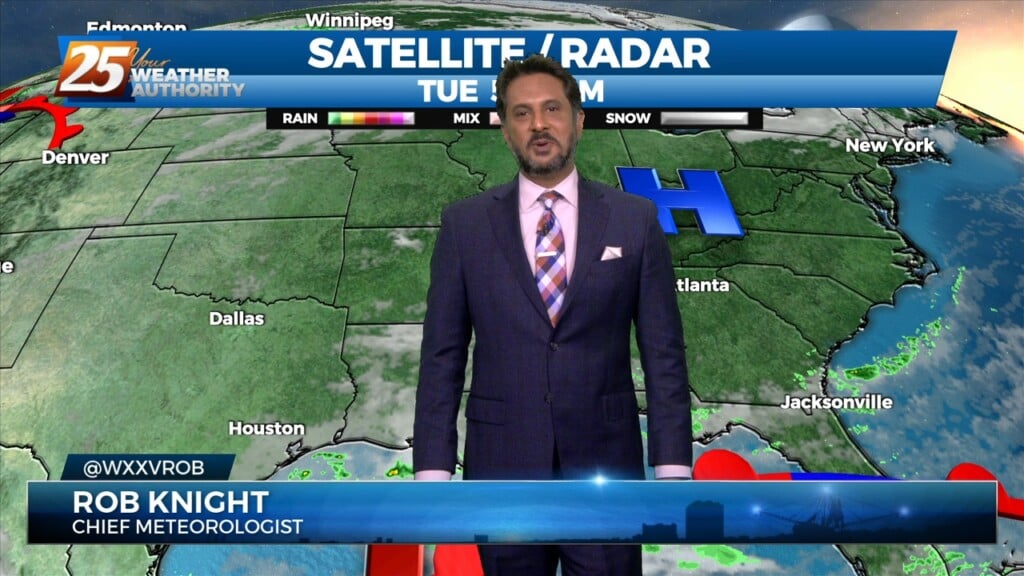
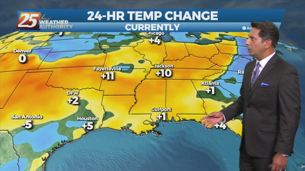
At the surface, high pressure is centered near the Carolina coastline, producing light easterly to southerly surface flow across much of the Lower and Middle Mississippi…
Weak upper level high pressure is currently over the southern Gulf of Mexico with a weakness moving eastward through Kansas. A stronger disturbance was…

The general upper high pressure over the lower and middle Mississippi River Valley extends off the eastern seaboard. At the surface, high pressure was centered…
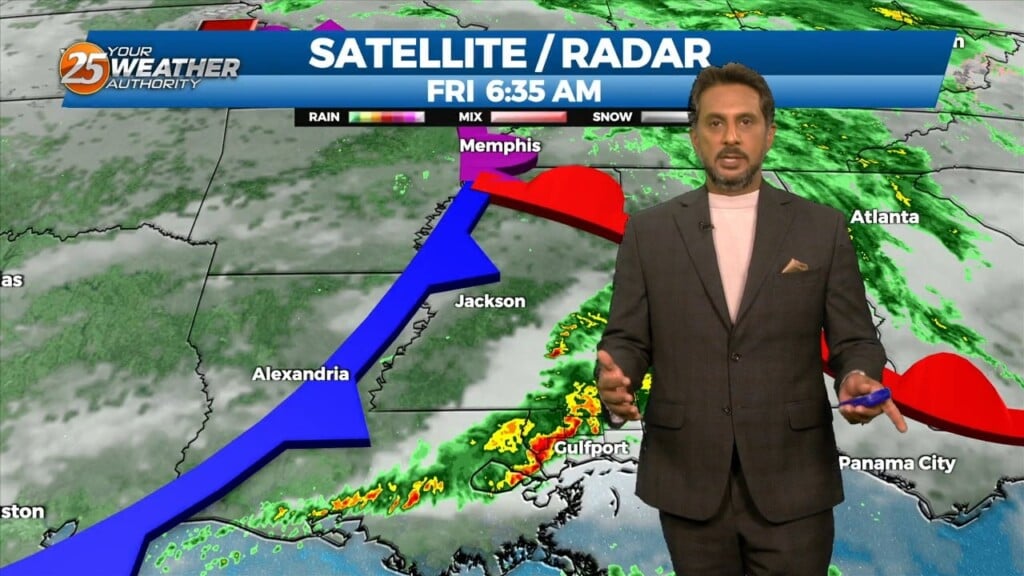
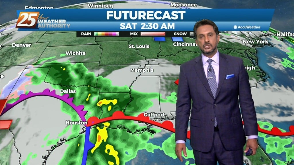
The first of 3 disturbances moving through this morning and should be out of the area by 10am today. This does not mean that the rain…
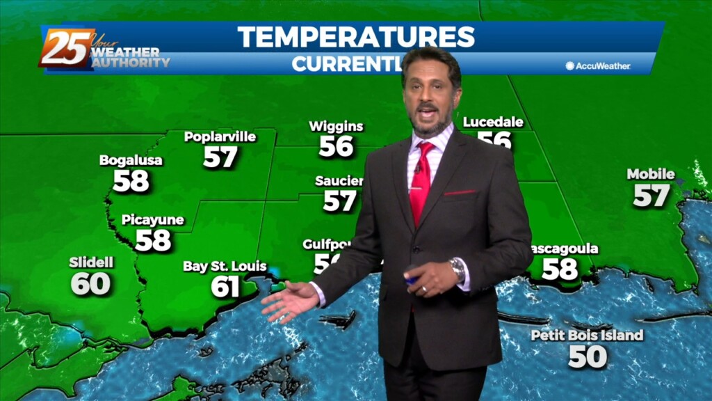
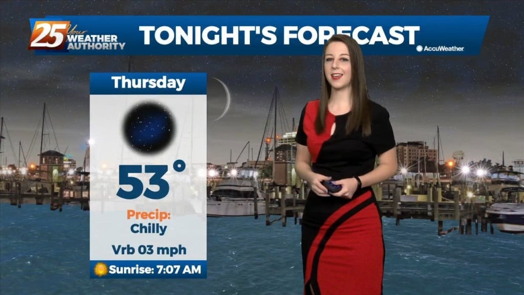
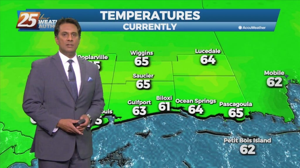
It’s another October morning with crisp temperatures in the mid to upper 50s across much of the area. Drier air and surface high pressure remains…
There really isn’t a whole lot of material for discussion in the package as we’re in a period of benign weather. Upper level northwest flow on…
A surface low pressure system will be directly under a split flow south of the Miss delta while the upper low will be to the WNW…
All is quiet now as we await our next weather system. The upper trough is currently over the Dakotas with a weaker shortwave/jet type feature moving across the…
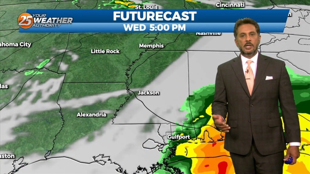
A cold front moving toward the area today will do so at a rapid pace but will not only pump the brakes but will stand on them…
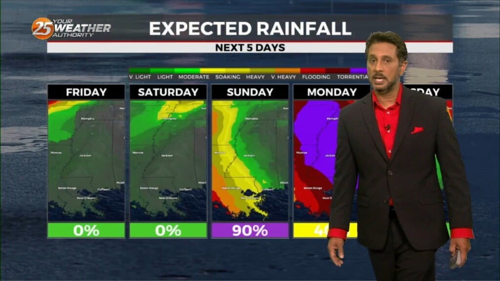
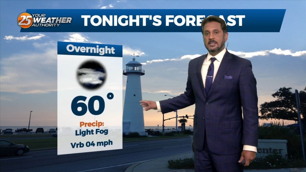
The forecast remains mainly unchanged, with heavy rain possibilities and fog potential remaining the focuses of the short term. Today will remain mostly quiet outside of…
Surface high pressure will build into the region behind this front today bringing mostly sunny skies and calm winds. Heading into the late evening and…
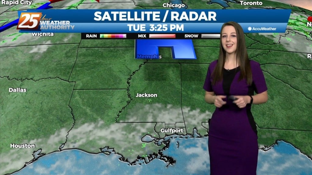
After a couple days of light precipitation in some areas with mostly cloudy skies, clouds will break up today revealing partly cloudy to eventually mostly sunny skies. These…
After a lovely day with sunny skies and below seasonal temperatures...changes area ahead. An upper disturbance over the Inter-mountain West will continue to move eastward into West…
A weak disturbance from earlier this afternoon has push through the area but the upper level clouds will continue overnight. Upper clouds coupled with increased moisture…
High pressure at the surface covers roughly the eastern half of the country, with low pressure and an associated front from the Dakotas into Colorado. The…
A departing high-pressure system will result in winds veering to the southeast today, bringing the humidity back to the area.Ample moisture will be in place each day…
After a chilly start early this morning (lows were in the 40s..below our seasonal norms in the mid 50s) it’s been a splendid April 1st, and…
High-pressure currently over the Rockies will move eastward across the Gulf of Mexico Friday and Saturday. This will gradually allow our surface flow to turn onshore and allow moisture…
Main forecast concern will be the cold frontal passage on Saturday. Somewhat of a lesser concern will be the potential for fog development Saturday morning. Still pretty good…
A west Texas disturbance will slip southeastward off the Texas Coast by Tuesday morning, and will continue to weaken as it moves toward south Florida by Wednesday…