4/3 - The Chief's "Warm & Muggy Pattern" Monday Morning Forecast
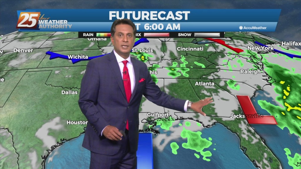
An upper level disturbance Memphis is moving quickly eastward in zonal flow across the southern states. Another strong upper disturbance is moving onshore in the…
An upper level disturbance Memphis is moving quickly eastward in zonal flow across the southern states. Another strong upper disturbance is moving onshore in the…
Fog will become an issue tonight but winds should stay too high nearest the coast and a cloud deck at 2k` starts to move in…
Widely scattered afternoon/evening showers and a few t-storms will affect the area this afternoon, dissipating this evening. The prospect of locally dense fog forming…

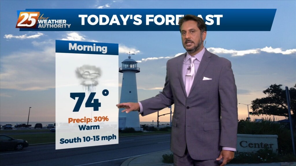
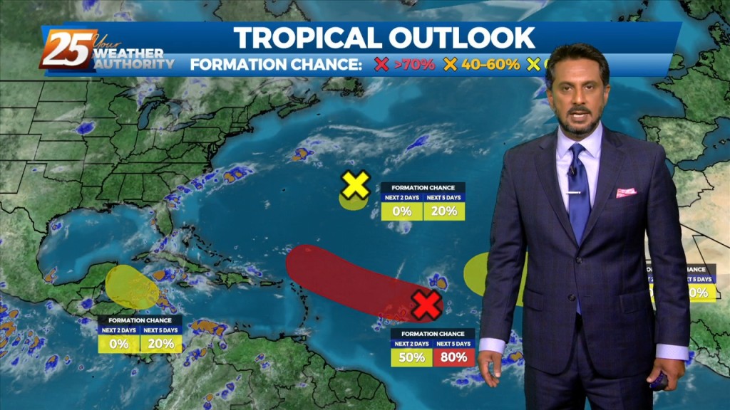
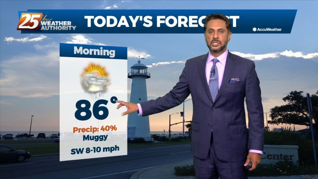
Another warm day expected across the region with most of the area warming into the upper 70s to low 80s along with breezy conditions. All eyes…
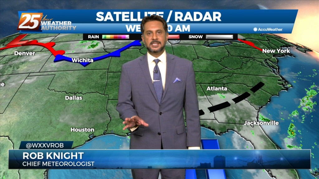
The main feature at the surface remains to be a frontal boundary that has come to a slow crawl or just about stationary to our…
The old stalled cold front that retrograded west has primed the area with warmth and instability. But there is still a weak cap in the low levels…
A weak cold front overhead will slowly move to the south as fast as molasses in winter. It will take from now until just before…
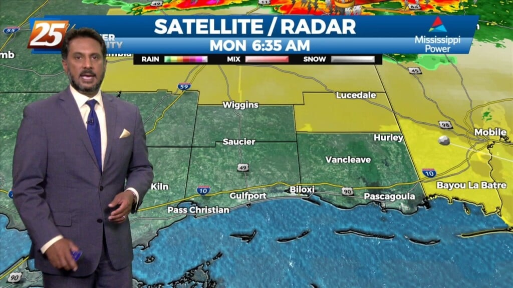
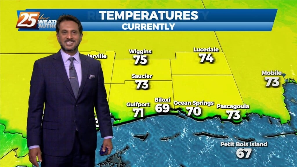
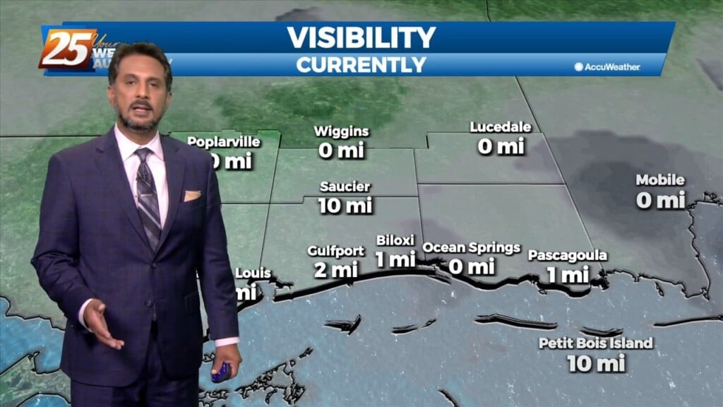
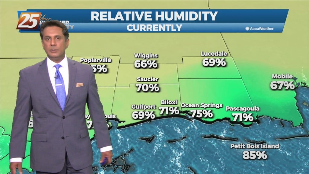
The fog machine continues across the region this morning. Southerly flow is helping advect 65-70F dew-points over sea surface temperatures generally ranging from the lower to…
Overall a much quieter day ahead with far less impacts for most of the area. Once again the main problem has been more commerce impacted due to…
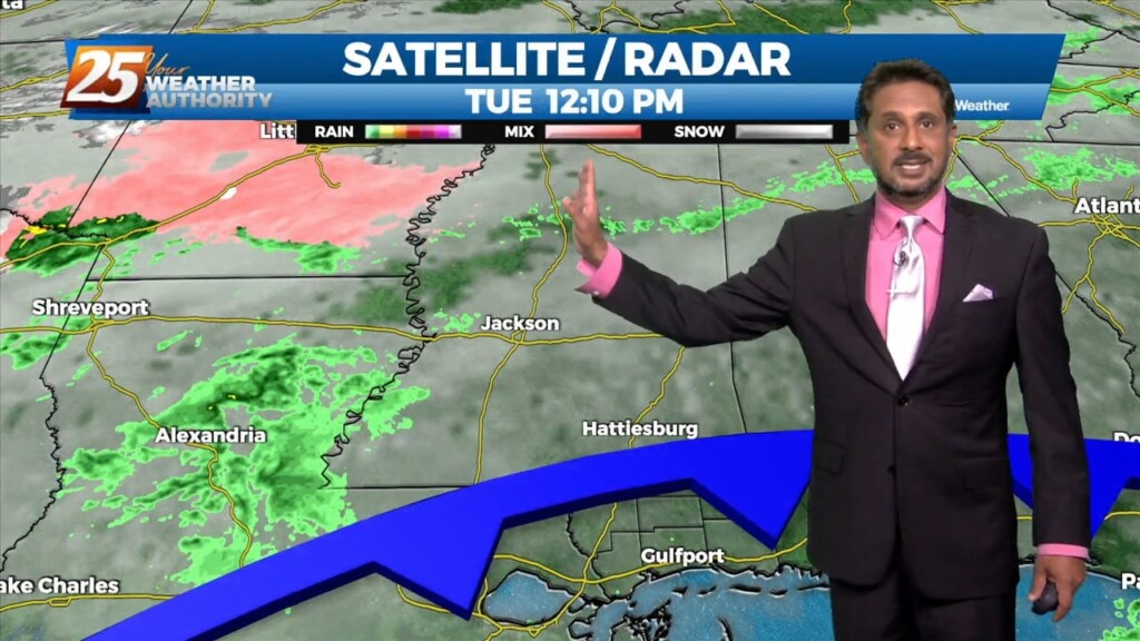
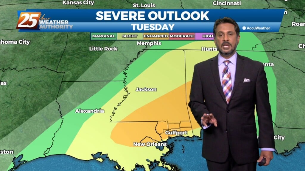
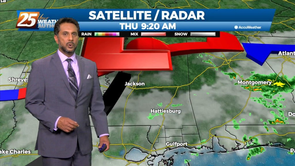
A strong surge of tropical moisture and upper diffluence is approaching the north central and NW gulf this morning. The deepest moisture surge will be…
The main concern will quickly shift to the possibility of heavy rainfall once again today. Many parts of the area have seen considerable rainfall over the…
Today will bring more of the same as yesterday as numerous showers and thunderstorms are expected to develop. Deep moisture from the Gulf of…
Upper level ridging remains in control of the southeastern part of the US with weak easterly flow. In addition, ample moisture continues to funnel through the area from the…
The eastern portion of a high pressure system to the NW will begin to eroded as an upper disturbance digs south across the Great Lakes to…
A broad upper level high pressure centered near the 4-Corners region extends from Mexico to Canada and CA to around MS. It will generally be…
There is an area of high-pressure over the Rockies and along the Atlantic Coast with disturbances over the Great Lakes and approaching the Pacific Coast. Pressure fields…

The short term weather will be quite normal for this time of year...Hot muggy with a few showers/t-storms around. The moisture is being brought…
Today will mainly be a transitional day where the surface winds will shift from northerly to southerly. Some moisture will be reintroduced to the environment and instability…
An upper level low-pressure system currently centered in the western Atlantic will move west into FL/GA today. At the same time, an upper level disturbance to the…
Hot and dry pattern continues as upper level high-pressure builds SW to NE across the Mississippi Valley. This will easily supports high temperatures around 90 degrees, with…
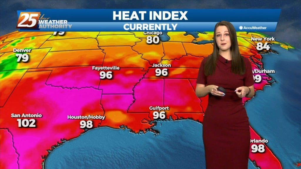
The heat will feel stronger today as moisture levels have clearly risen. The muggy hot feel will show heat index values in the mid-90s. Although, these…
Fog this morning in a few locations and may get dense in those locations around sunrise. But most areas are seeing temps high enough to keep fog…
Strong stability will move into the area once the cold front begins to move through later this afternoon. Clouds will clear the area this afternoon but since the…

Aside from a normal start to summer and high temps well above normal values, we will throw several thunderstorms on the pile for Thursday…