07/07 Ryan's "Wettest" Tuesday Morning Forecast
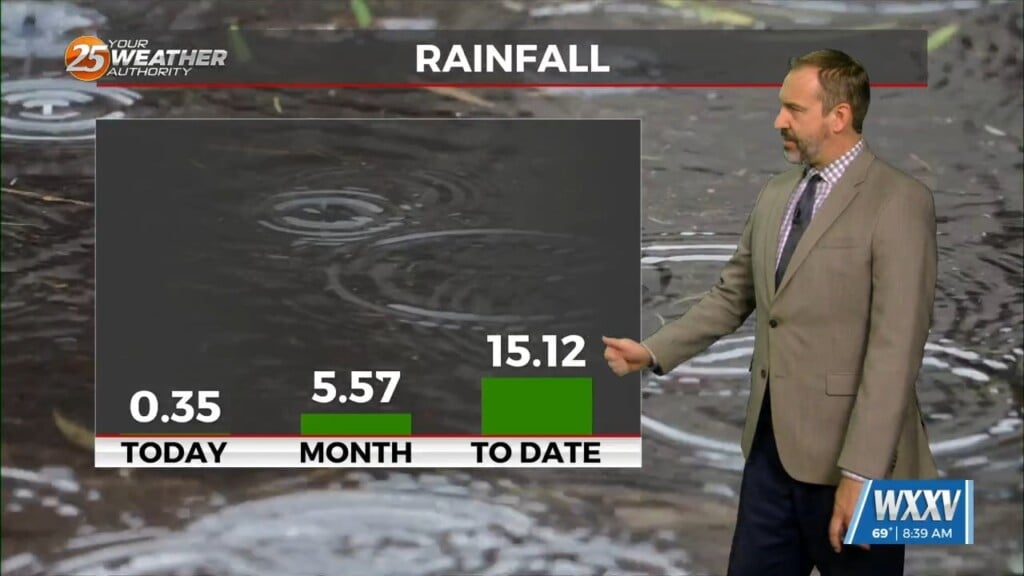
Today is looking like the "wettest" day of the week, which doesn't mean too much since even our drier days will see at least a few showers. Expect a…
Today is looking like the "wettest" day of the week, which doesn't mean too much since even our drier days will see at least a few showers. Expect a…
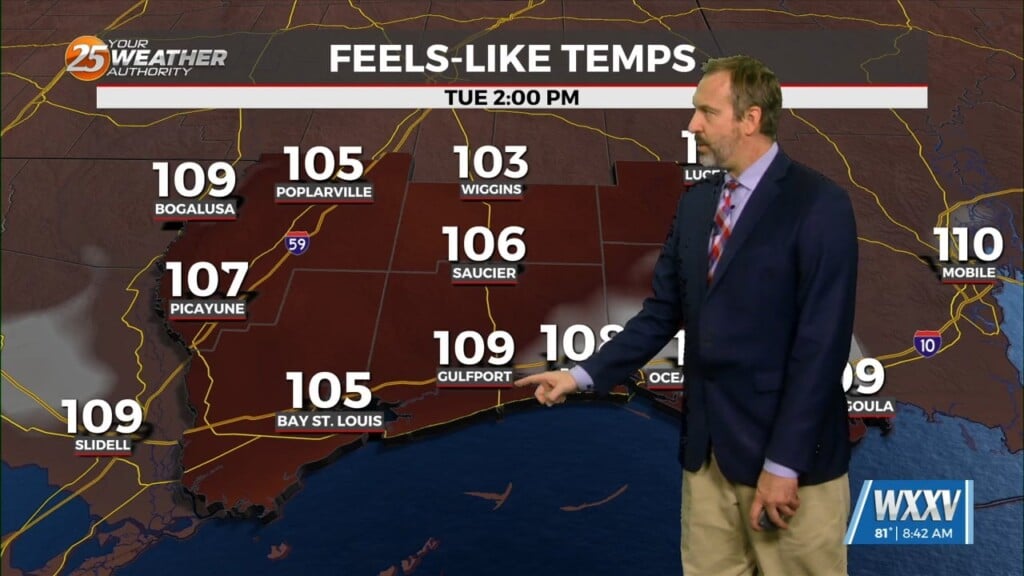
It has been quite hot for some time now, but now things will get dangerously hot later this afternoon! Heat Advisories have already been issued, and we're very…
We are firmly in a summertime pattern with hot and humid, generally dry days with at least a few afternoon showers undoubtedly popping up...particularly over the next couple…

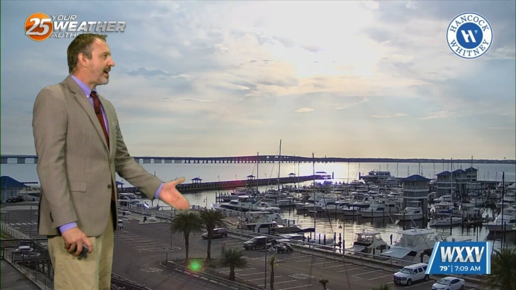
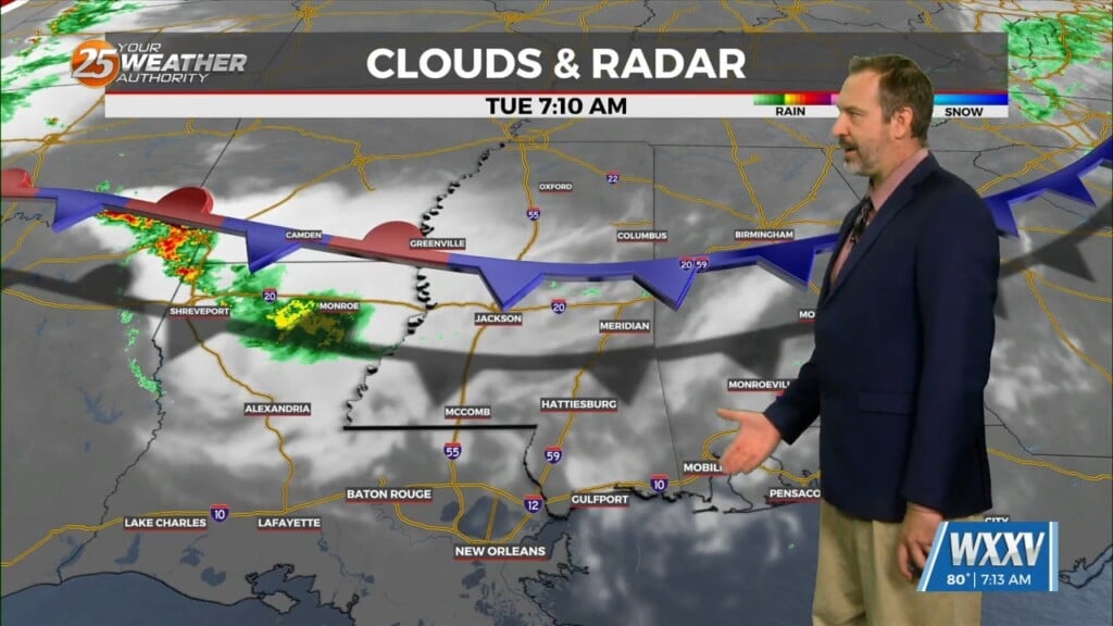
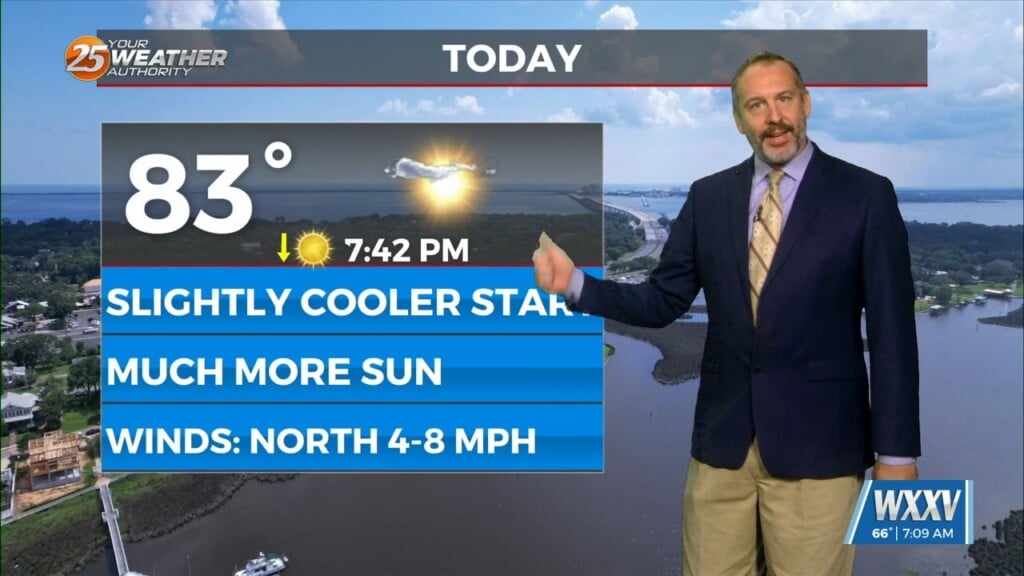
Your Tuesday was off to another cloudy start out there today ahead of a couple sunny ones as drier air starts working its way back in. That's already…
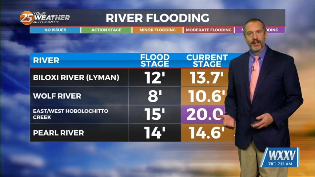
Showers and thunderstorms are expected to continue again today, with flood issues starting to pop up across the area. Almost every local river is at least at "action"…
We're coming out of a long, cloudy, and rainy period, so I'm proud to say it's finally sunny in South MS once again. We'll hold on to a…
Yesterday's sunny skies are gone as clouds move in along with higher humidity for your Cinco de Mayo festivities. It's still going to be a pretty good…
Today will "feel" exactly like yesterday when it comes to the temperature and "mugginess," but will look a little more grey as skies start getting a little…
It was still a little chilly and largely clear this morning, but it'll get more cloudy and continue our subtle warming trend as we head into…
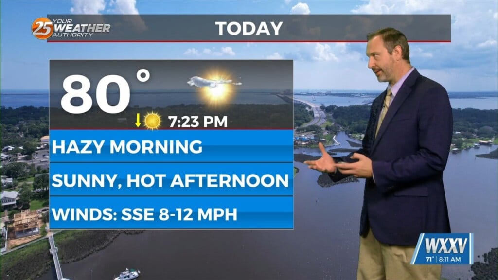
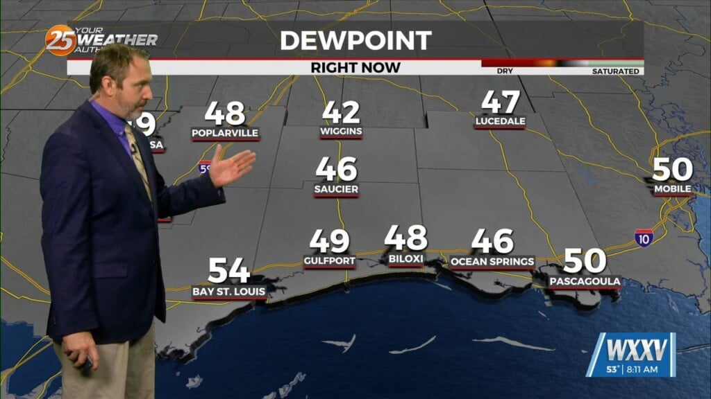
We had a couple of Dense Fog Advisories in Stone and George counties this morning with areas of locally dense fog, but that's now shifting towards hazy…
We got off to a chilly, but sunny start to the day out there with our coldest weather we'll see with the last front that moved through.…
South Mississippi woke up to more grey skies and warmer weather this morning as the low jumped from the lower 60s yesterday to the upper 60s/low…
We saw an interesting cold front move through yesterday, though it feels more apt to call it a "cool front" thanks to a few oddities. Most notably, temperatures…

We saw more grey skies this election day morning with a few areas of patchy fog, but thankfully there won't be any rain to keep you from…

It was foggy & warmer across South Mississippi this morning as continued southerly winds ahead of a series of nearby fronts lead to more such mornings ahead.…
This morning brought some of the coldest weather we've seen in the last handful of weeks, with lows falling below freezing across South MS, but a warming trend…
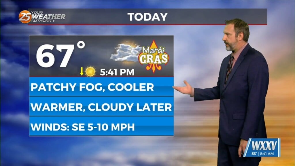
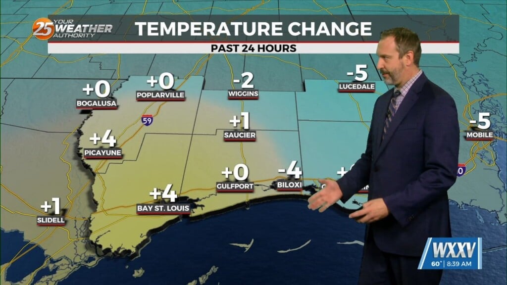
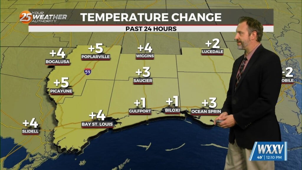
Mardi Gras 2026 is here and the weather is cooperating nicely! It might not be the prettiest out there as we wrap up carnival season today thanks…

It's even warmer than yesterday and the warm, humid air is leading to foggy conditions across South Mississippi. Dense Fog developed in every coastal and inland city, with visibilities…
Old Man Winter is here in South Mississippi, despite not seeing any of the nearby winter weather we're seeing our coldest weather yet...for now. That's because another front…
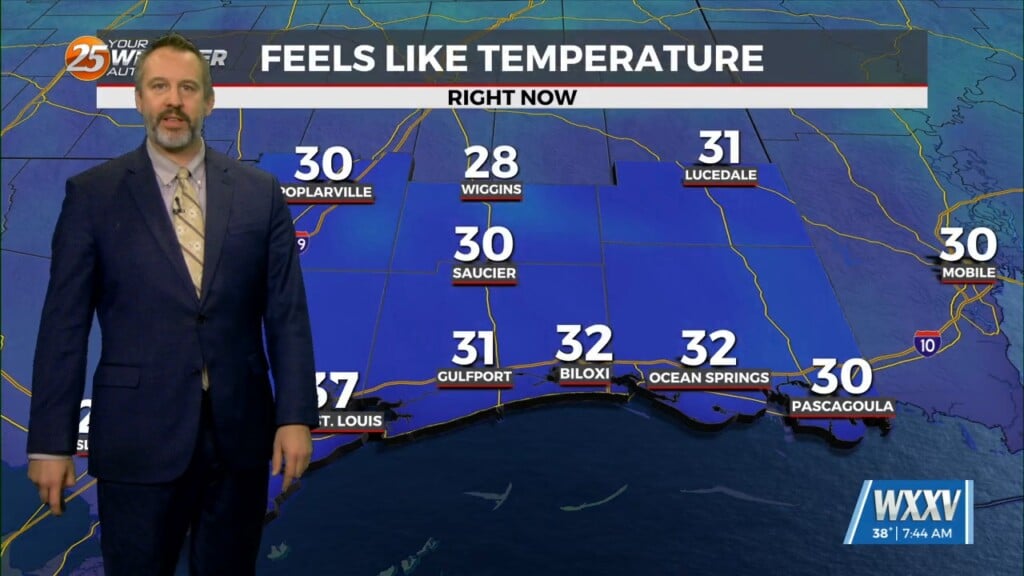
There were still some frosty areas out there this morning despite a slight warm-up, but don't expect to see any more such mornings for the rest of the…
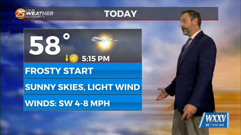
We hit the bottom of the temperature barrel we'll see with this cold front with this morning's frosty weather, but things will warm sharply over the next 24 hours.…

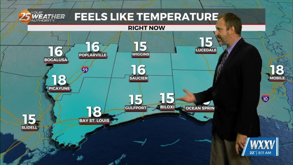
Hope you are ready for the coldest & coolest weather we'll see for the next week today! This morning fell into the mid 30s on the coastline,…
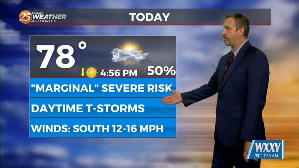
A few South Mississippi locations woke up to stormy skies, something we'll see more of as we head into the afternoon. We're currently under a "marginal" risk…