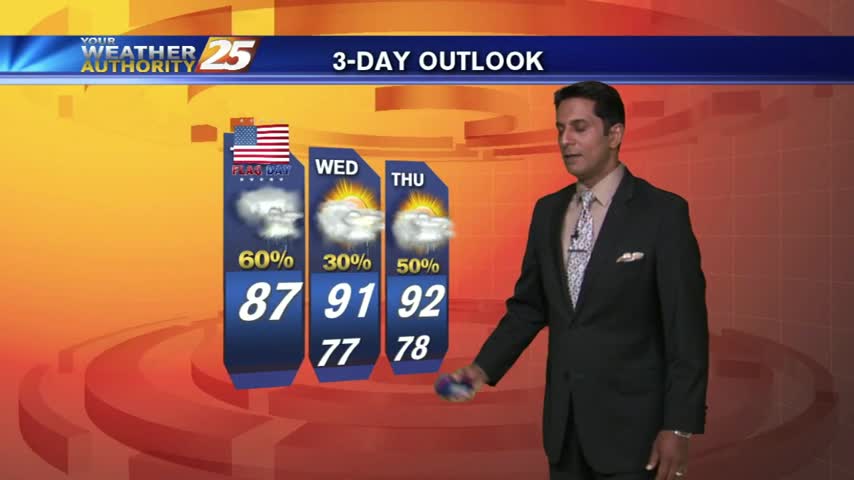
9/24 - Rob's 1st Workweek of Autumn Forecast
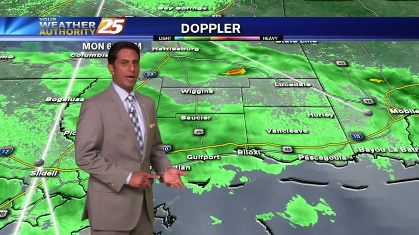
A wet start to the day/workweek with showers moving in from the Gulf of Mexico...
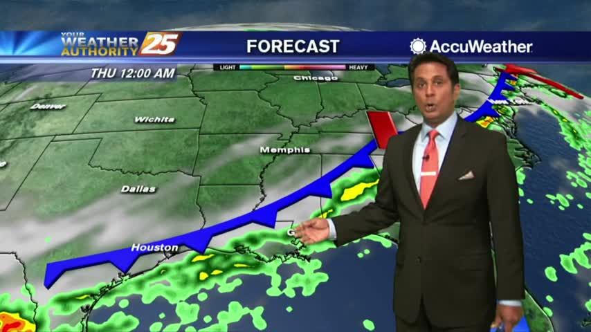
A wet start to the day/workweek with showers moving in from the Gulf of Mexico...

Early morning activity continues to plague the area with pockets of heavy rainfall...

A humid start to the week with light patchy fog and a few light showers moving in from the south...

Isolated showers south are moving north and into the coastal counties...

Isolated showers/t-storms are beginning to pop with more activity this afternoon...
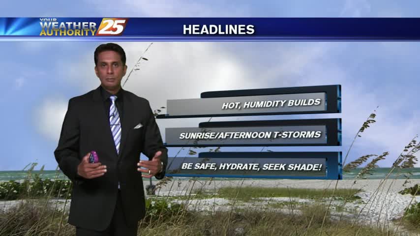
A humid start to the day as a strong tropical air mass continues through the region...
Overnight showers/t-storms continue to move in from the GOM...along with areas of patchy fog...

Naturally...it's a WARM/HUMID start to the day as showers/t-storms to the south begin to develop and move into the area...

As the very tropical air mass continues to dominate the region, isolated showers/t-storms are moving in from the south...

As we continue to keep an eye on TS FRANKLIN moving across the Yucatan peninsula, a VERY TROPICAL air mass continues to dominate the region...

After clear skies overnight, the clouds along with isolated showers are moving in from the south...
With a very strong tropical air mass dominating the area, showers & t-storms in the outer coastal waters are moving in from the south...

With a very strong tropical air mass dominating the region, overnight t-storms have moved east with a very HUMID start to the day...

After a brief period of sunny skies and low humidity, a very TROPICAL AIR MASS is back in the region with showers/t-storms moving in

After a beautiful weekend with sunny skies and drier air, the tropical air mass is moving back into the region...
After a bit of a break earlier this morning, showers continue to move in and develop along the viewing area.
Another morning with showers moving in from the south, as a very saturated air mass continues to dominate the region...

It's a WET start as t-storms moving in from the NE continues to develop/linger along south Mississippi...
Light showers moving across the area under cloudy skies...
Isolated activity from this morning continuing to develop with the help of daytime heating...
The strong tropical air mass continues, with showers and thunderstorms developing and moving into the area...
After a WARM/HUMID weekend with t-storms...you Monday morning is starting out with light rain.
A pretty sunrise with a few clouds in the area, along with warm temps in the 70s...