06/18 Ryan's "Manageable Heat" Wednesday Forecast
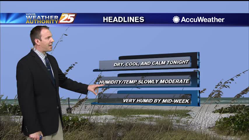
Our manageable heat and humidity is going to increase significantly soon.
Our manageable heat and humidity is going to increase significantly soon.
The weather has been consistently nice and sunny, but the temperature and humidity will steadily rise into next week.
Much more pleasant weather is moving in and won't be in any hurry to leave through the weekend.
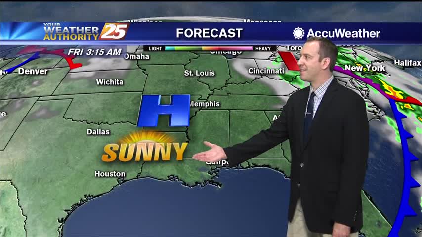
Finally a dry day out there, no chance of rain and plenty of sunshine for the rest of the week!
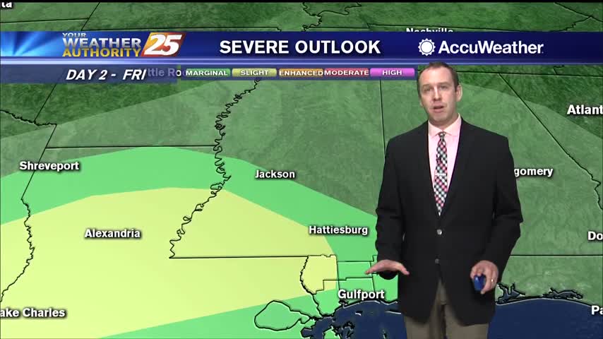
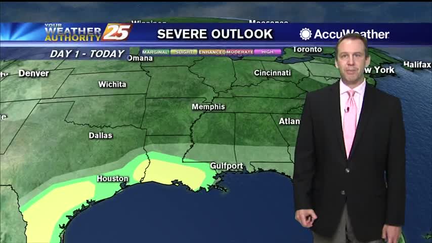
More afternoon rain today and tomorrow, but a tropical system will drive our active weather over the weekend.
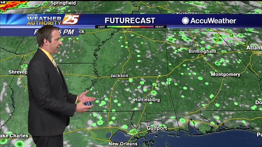
Didn't see many afternoon showers today, but we'll rarely be completely rid of them as summer rolls around....
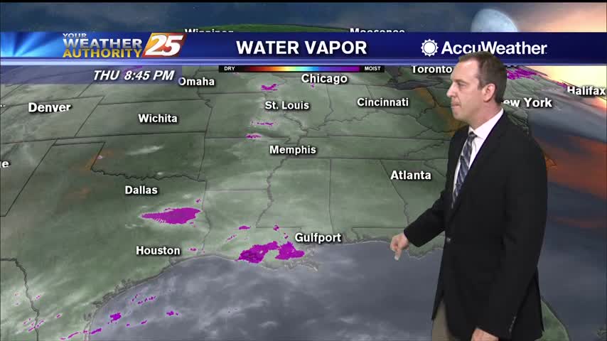
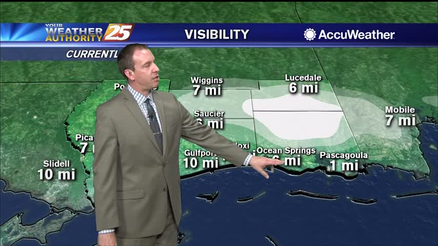
Only a small spot of rain today in South MS, but we saw plenty of clouds and high humidity again.
Much less rain today, but still cloudy in South MS. Expect the rain to return tomorrow ahead of some weekend clearing.
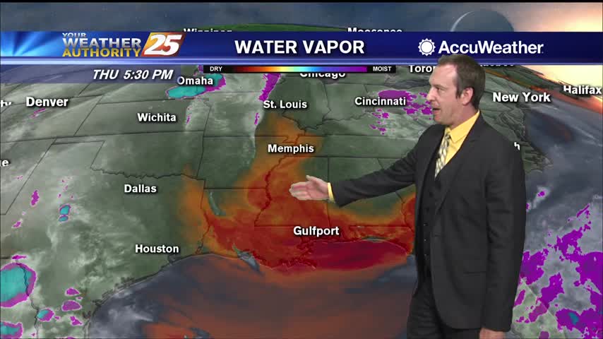
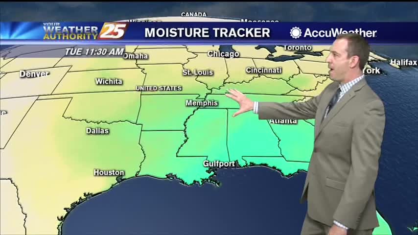
Heavy rainfall has fallen just to the west, but so far very little has moved into South MS. More is on the way though.
Much more cloudy today than recent days and with our first "active" weather in over a week!
Still clear and dry tonight, but clouds, rain, and higher humidity move in quickly tomorrow afternoon!
Dry air remains in place, but we'll see rapid changes to that and even potential thunderstorms moving in tomorrow.
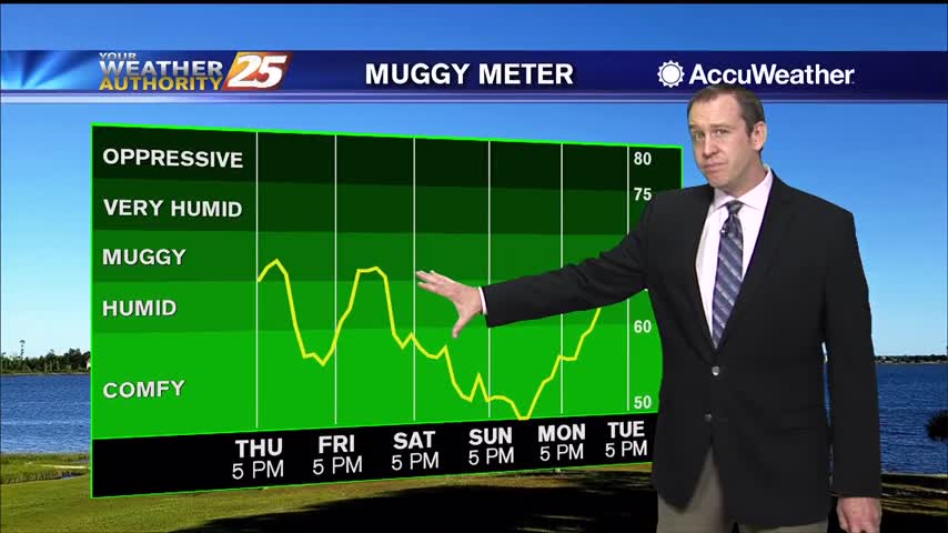
Comfortable levels of humidity will remain in place for the rest of the week, but it does begin to get a bit muggy by the start of the next.
If you liked today, there isn't much you won't like about the rest of the week and most of the next....
Don't expect significant cooling behind today's front, but it will feel much drier heading into the weekend.
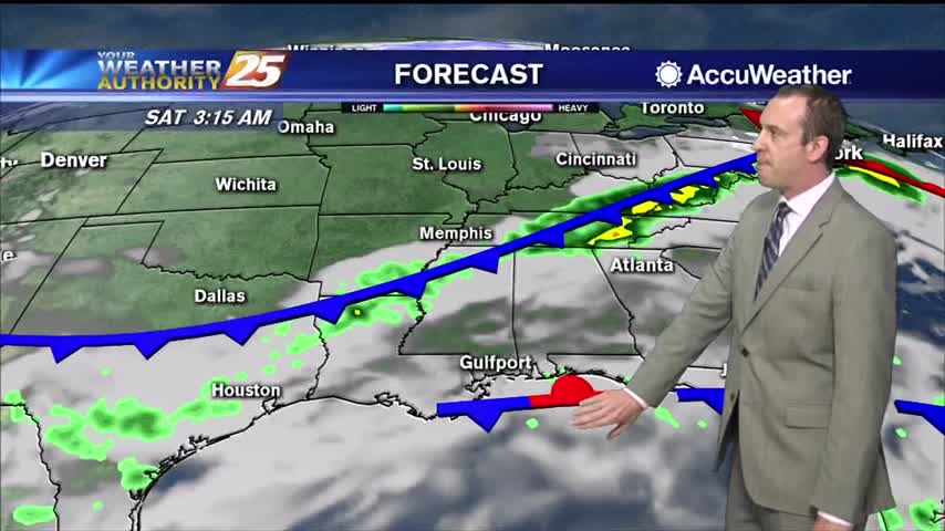
Thunderstorms pushed through South MS early this morning bringing a possible tornado to George County, but things are clearing quickly into the night.
Little warmer and more humid today, but much more so as we head into the weekend. Even our first rain since last Sunday isn't far away.
Another gorgeous day out there despite being slightly warmer and more humid, though both will increase rapidly into the weekend.
It's been downright muggy almost every night this week, but cooler air is finally moving in.
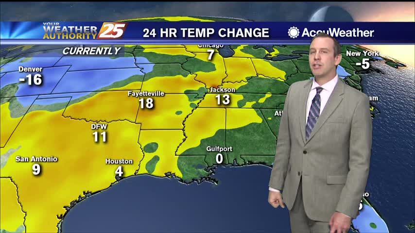
Hot and humid weather led to some mid 90 heat indices today, but cooler weather is on the way!
Still cool and relatively drier, but cloud cover is starting to creep in....
Still cooler and drier compared to the last few weeks, but we'll keep warming through the weekend as a cold front moves in.
Continued warming will bring us close to or beyond record high temperatures over the next few afternoons, but in between we still have some relatively cooler, foggy nights.
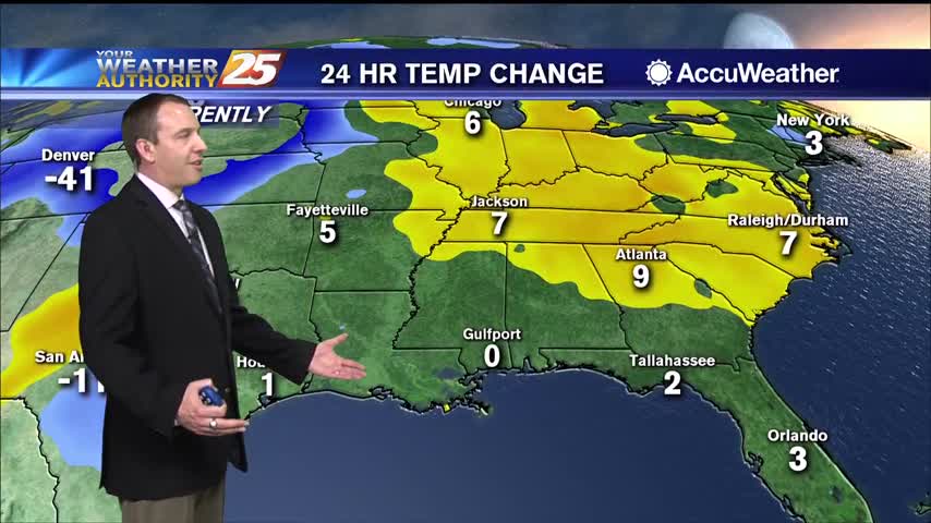
It looks like we just missed today's high temperature record, but even warmer days lie ahead.