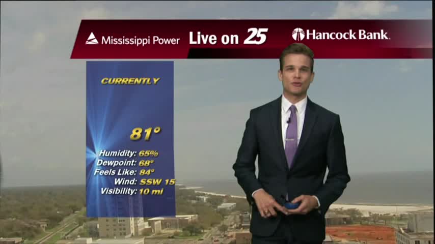
3/18 - Payton's Monday Evening Forecast
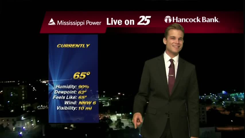
More clouds this evening along with chilly temperatures.
More clouds this evening along with chilly temperatures.
A CHILLY start to the day with upper-level clouds from the SW moving into the area...
Monday will feature clouds...but sunshine isn't far off!

Showers continue through the afternoon, then colder by tonight.
Few more days of nice weather before more rain.
Another spring afternoon...with more record heat.

An interesting day with an earthquake in the Gulf of Mexico, and very warm temperatures.
There could be an isolated shower this afternoon, but most will stay dry.
Another beautiful day before rain returns later this week.
A few day of nice weather before the rain returns.
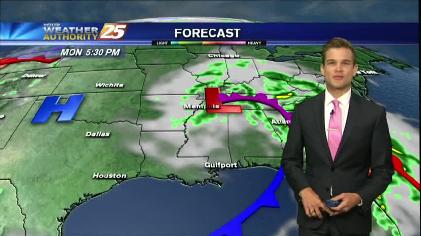
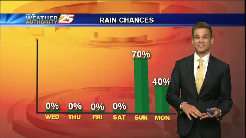
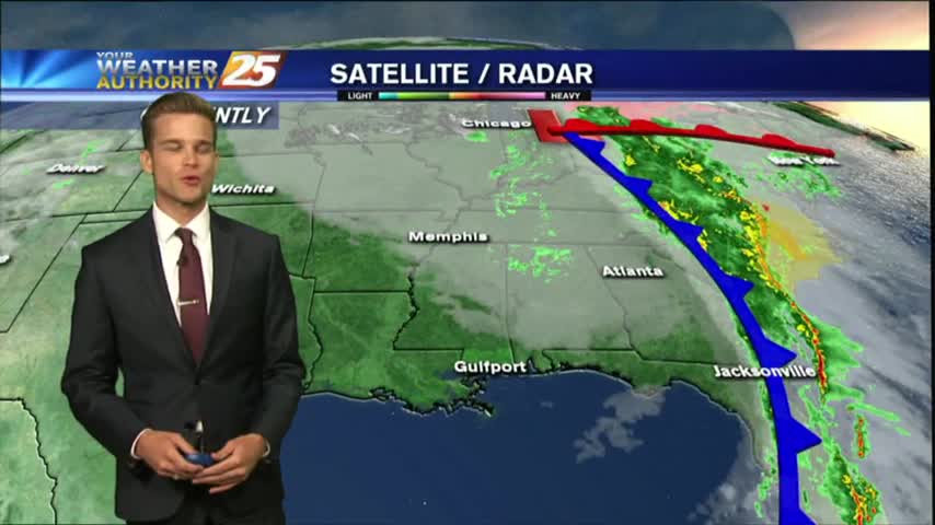
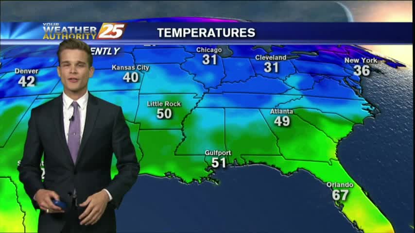
All the storms are off to the east as a cold front continues to move out of the area. This means nice weather to start the week, but rain chances are back in the forecast.
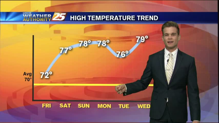
The warming trend continues, but a stormy Sunday looks likely.
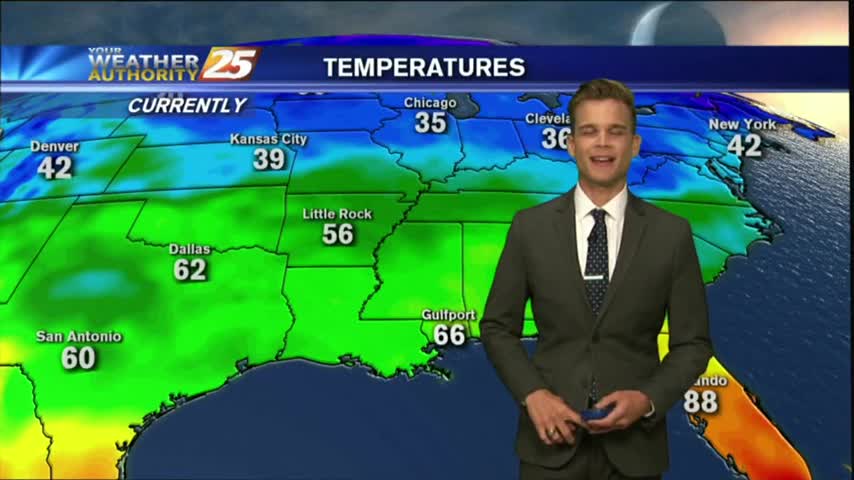
Cooler today, but a warming trend starts this week.
Clouds continue across the area, but sunshine isn't too far off.
A warm up is on the way after a cloudy and chilly weekend.
The warming trend continues, and that means expect very nice weather as we head into the weekend.
High pressure continues to move East, and moisture is gradually returning to the area.

After a few breezy days, the winds will finally start to calm.
It was the first full day of Spring, and it was beautiful!
The first day of spring was windy, but sunny. That continues into tomorrow.
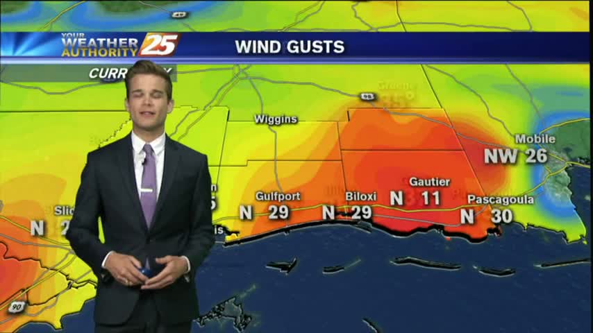
It was a very windy start to the day with gusts over 20 mph. The winds will begin to calm later this evening, which leads into a great forecast for most of the week.
The beautiful weather this weekend is coming to an end as we start the workweek.
Weekend weather is shaping up to be picture perfect!
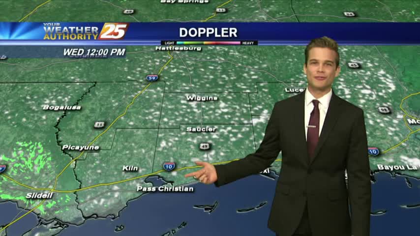
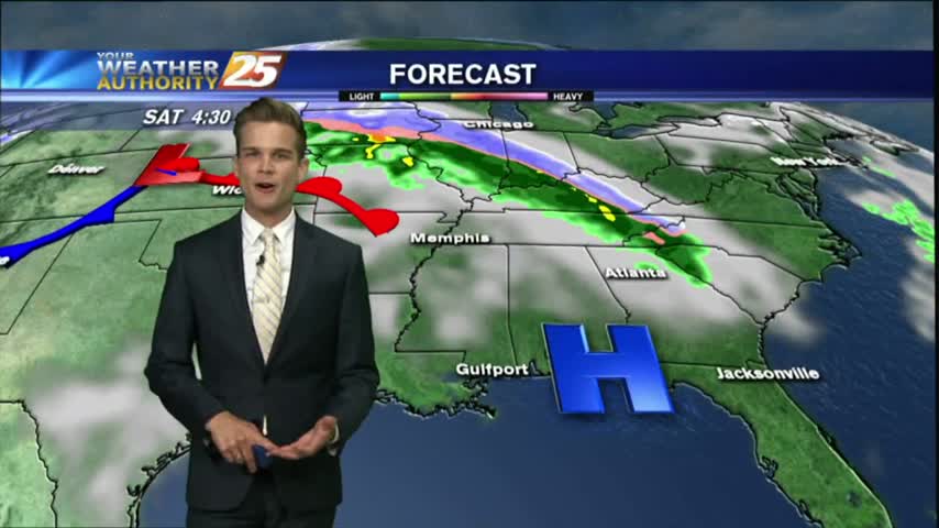
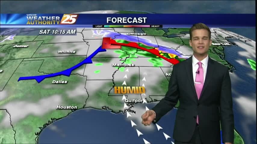
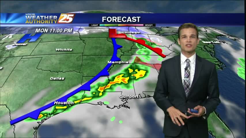
The cold front is approaching Hattiesburg at lunchtime, and will soon be in South Mississippi.