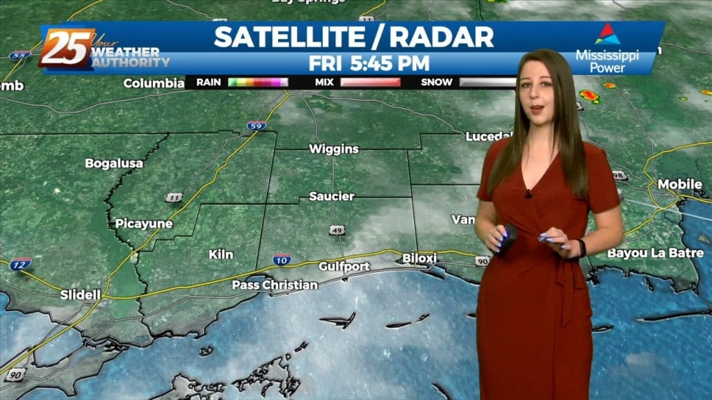
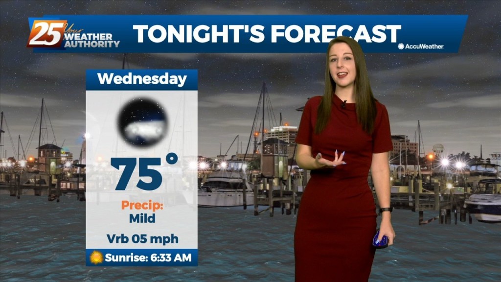
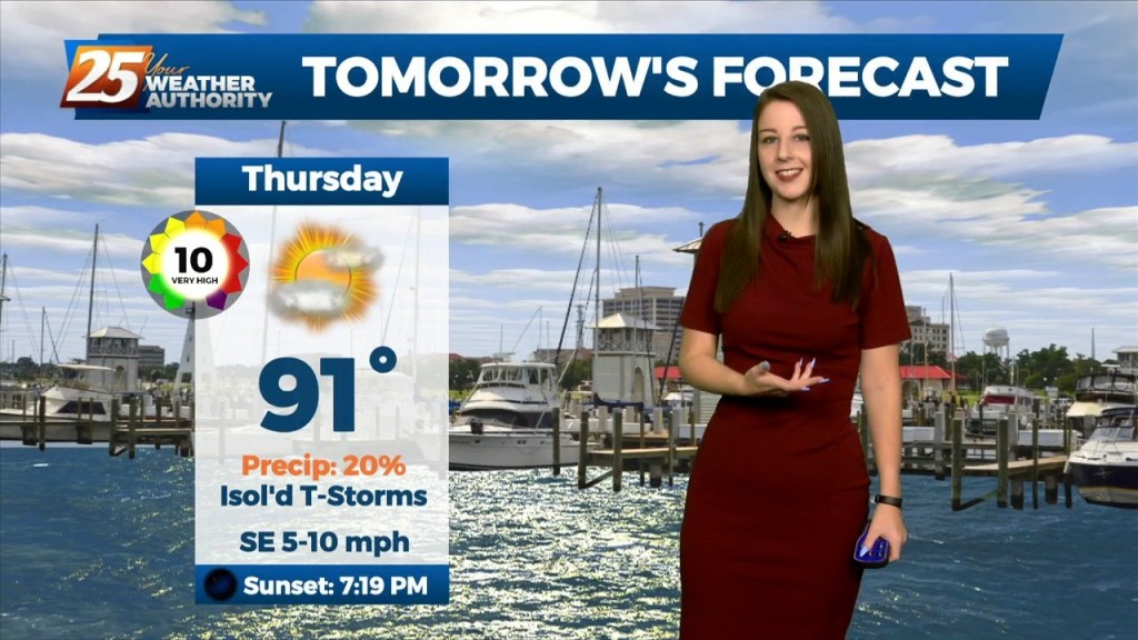
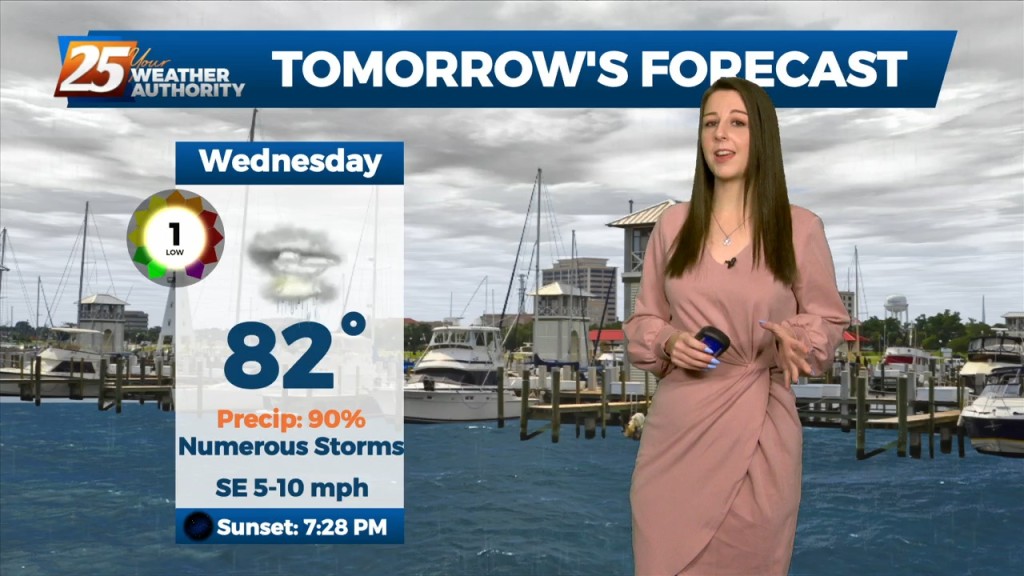
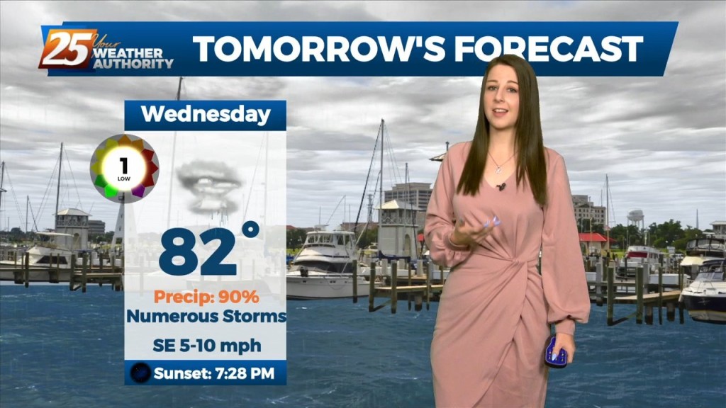
9/14 - Brittany's "Rain-Free" Wednesday Night Forecast
We can expect the quiet and calm conditions to continue, courtesy of high pressure to our north. Tonight and tomorrow night`s low temperatures will be below normal for most…
We can expect the quiet and calm conditions to continue, courtesy of high pressure to our north. Tonight and tomorrow night`s low temperatures will be below normal for most…
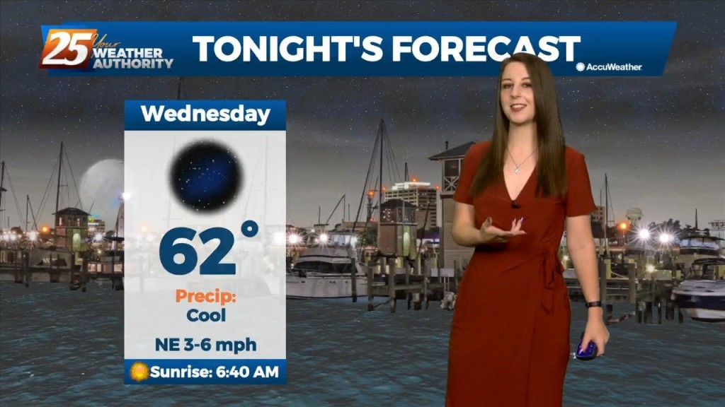
High pressure at the surface and aloft will keep things quiet in the short term. Tonight and tomorrow night`s low temperatures will be below normal for most…
Mississippi is still under the influence of upper level troughing which is slowly moving east while further west has a large ridge with a cutoff low. This trough…
Mississippi is still under the influence of upper level troughing which is slowly moving east while further west has a large ridge with a cutoff low. This trough has…
Winds will shift to a more light to moderate southerly direction by later today. This flow will help spread abundant gulf moisture back into the region and should allow…
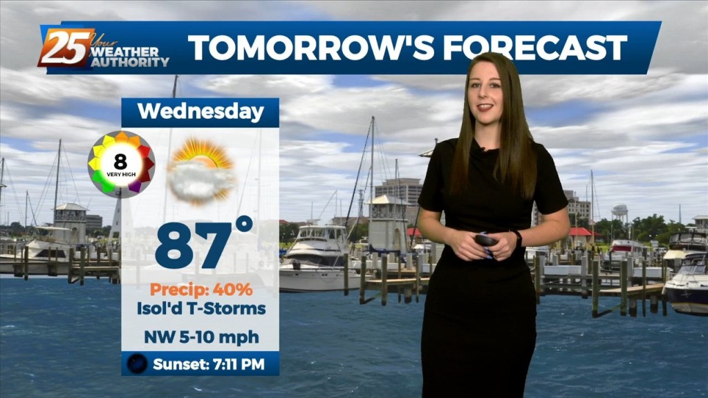
Mid level dry air will remain in place today. This will help cap the environment, making it harder for thunderstorms to get started. There will be…
Mid level dry air will remain in place today. This will help cap the environment, making it harder for thunderstorms to get started. There will be some…
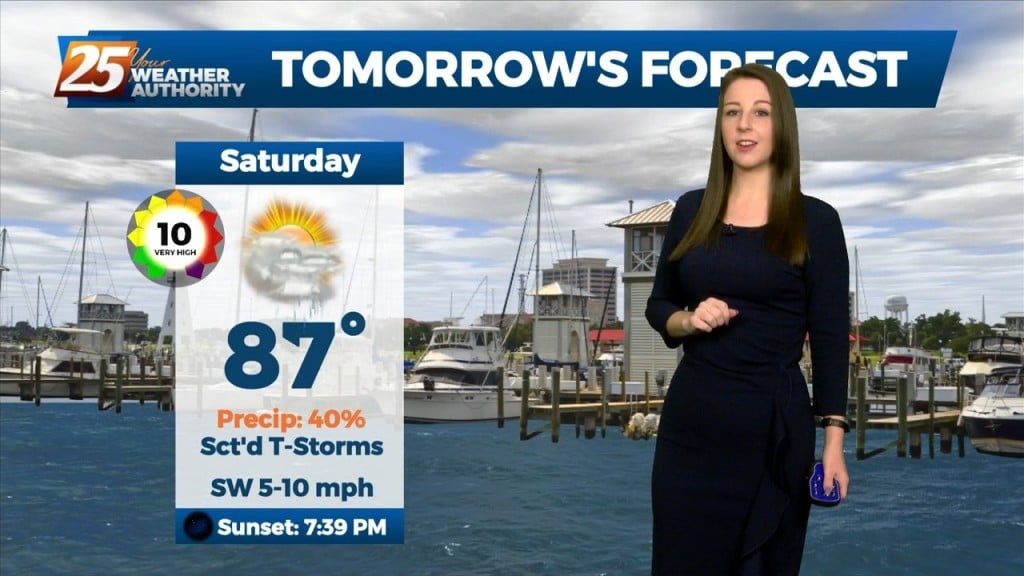
A broad ridge of high pressure will remain over the northern gulf through the week promoting onshore flow with showers and thunderstorms expected each day. Tonight through…
The boundary will lift tonight, and there will not be as much of a focus for rainfall that develops. Southerly surface winds will help to enhance…
Will be going up with a flash flood watch for today. This will not be as much of an areawide distribution but moreso a rate driven event. Some…

A stalled surface low and trough north of the coast will keep a higher risk of showers and thunderstorms in place through Friday. The low should slowly…
A strong and persistent meso-low currently over the Arklatex region and broader and weaker shortwave trough in the upper levels will continue to work in conjunction to produce…
A strong and persistent meso-low currently over the Arklatex region and broader and weaker shortwave trough in the upper levels will continue to work in conjunction to produce…
Main concerns over the next few days will be the threat of thunderstorms. Heavy rain will be the point of highest concern, but can`t rule out a…
Main concerns over the next few days will be the threat of thunderstorms. Heavy rain will be the point of highest concern, but can`t rule out a few reports…
The overall current pattern is fairly interesting across the Lower Mississippi River Valley. A surface "frontal" boundary resides generally along and north of the I20 corridor. As the…
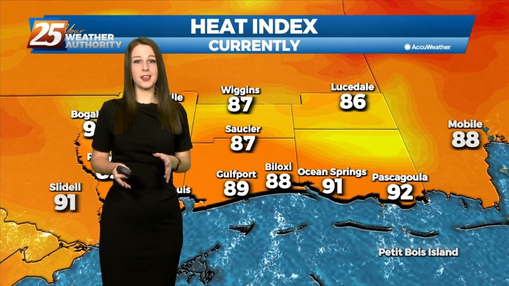
Hot and dry again for most of the day today. Focus late this afternoon and evening will be on convective development to our north and east, with short-range…
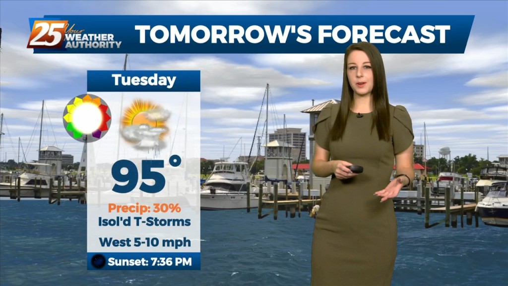
The main focus of the short term forecast will be the warmer temperatures heading into Tuesday and likely again Wednesday. It has been a while since we`ve…
The upper level pattern across the country, and somewhat locally, is starting the transition process that will begin to finally lower rain chances for the northern Gulf…
The broad upper level analysis shows a ridge centered over the Rockies which expands over at least 2/3 of the country and trough digging across the northeast…
The broad upper level analysis shows a ridge centered over the Rockies which expands over at least 2/3 of the country and trough digging across the northeast CONUS.…
An area of low pressure located of across the Northern Gulf of Mexico is producing showers and thunderstorms that are expected to move to the north and…
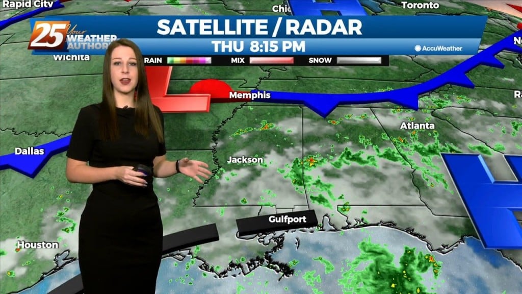
A stationary front to the east will continue to be the focal point for showers and t-storms again today. The development over land will be elevated so we are…

The showers have again thinned through the night, but we'll see them again through the weekend before drier air moves in....