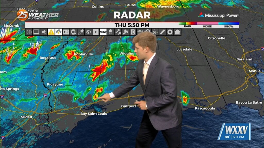
7/25 - Sam Parker's "Outflow Boundary" Thursday Evening Forecast
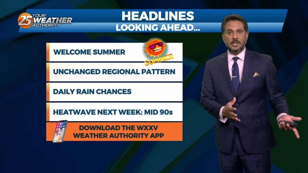
As we have experienced this week, we`re still in this wet but still pretty hot summer pattern. This evening I have been seeing many outflow boundaries kick…
As we have experienced this week, we`re still in this wet but still pretty hot summer pattern. This evening I have been seeing many outflow boundaries kick…
At the surface we have a stalled frontal boundary draped just north of the southern six counties. Two additional pieces of the atmosphere worth noting…
Overnight activity has now diminished across the area. Currently there is a stationary front to the north of the I-20 corridor with showers and thunderstorms to…
Happy Independence Day! Scattered showers and an occasional rumble of thunder have developed and moved across the area this morning moving to the NE. Isolated activity will continue…

Happy Independence Day! Scattered showers and an occasional rumble of thunder have developed across the area this morning moving to the NE. While rather isolated in coverage…
A stationary front is overhead or just to the south of our area. With that being said activity may be ignited along the stationary…
An upper level trough dropping out of the Rockies will deepen as it tracks across the northern/central Plains today. It`ll continue east through the upper Mississippi Valley and across…
Cold front has cleared pretty much all land areas in Louisiana and Mississippi and continues to push eastward through the coastal waters. A broad band…
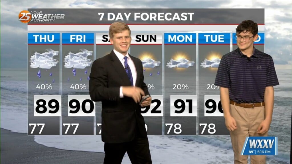
We've managed to stay rain free thus far but tonight, we'll see a 20% chance for isolated showers in the area. Heading into tomorrow, we'll see further…
Throughout the day today we've seen a gradual increase in cloud coverage in advance of an approaching cold front. We've managed to stay rain free thus far…
One last quiet day allowing for another pleasant Sunday and weekend as a whole. Not expecting much in the way of impacts for the…
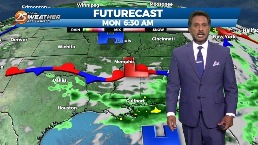
Main focus on the short term is upcoming rain chances today into tonight. A developing upper level disturbance near the Pacific Northwest will dig south and amplifying…
Hot and dry again for most of the day today. Focus late this afternoon and evening will be on convective development to our north and east, with short-range…
The upper level pattern across the country, and somewhat locally, is starting the transition process that will begin to finally lower rain chances for the northern Gulf…
Deep moisture from the Gulf of Mexico continues to stream into the area with model soundings showing precipitable water values well above 2 inches, and as high as…