11/28 - Rob Knight's "Warming Temperatures" Midday News Forecast
After another COLD start to the day, the wind flow has switched with the warming trend beginning...
After another COLD start to the day, the wind flow has switched with the warming trend beginning...
It's another FRIGID start to the day but MAJOR changes are ahead in the forecast...

A rainy start to the workweek with a slight threat for SEVERITY as the area is under a TORNADO WATCH...

A BUMPY start to the day as a squall line ahead of a cold front is moving into south Mississippi...
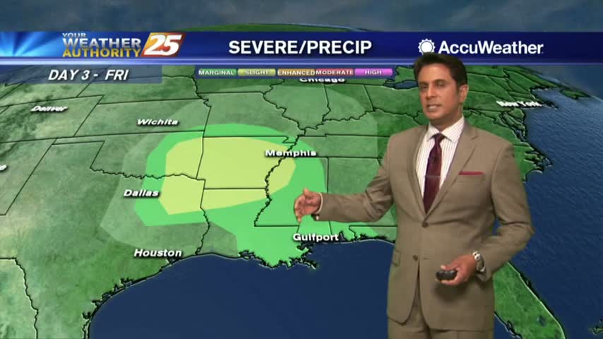
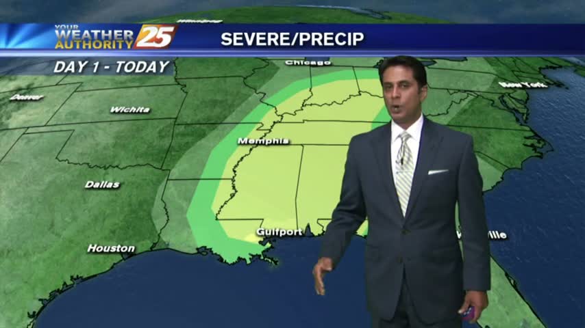
Today's weather was nearly perfect, mild and dry, but another round of potentially severe storms is moving in for the weekend.....
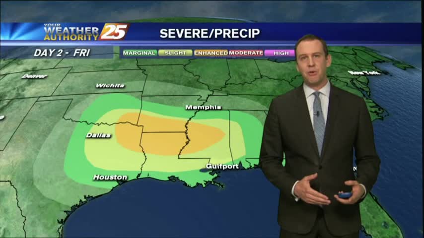
The cooling trend continued this morning, but Southerly winds will begin increasing our temperature and humidity ahead of a weekend storm front....

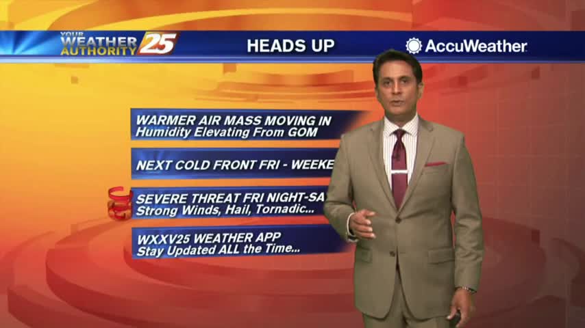
A warmer start to the day as a humid air mass moves in from the GOM in advance of an approaching cold front...

The activity with the cold front has fizzled out quite a bit but still moving across the area...

A warm/humid and windy start to the day with a POTENTIALLY SEVERE cold front approaching from the west...

FOGGY with T-STORMS moving into the area from the west with the associated cold front. The area is under a MARGINAL THREAT for SEVERITY...
It's a warm, humid and windy start to the day in advance of an approaching cold front to the NW...
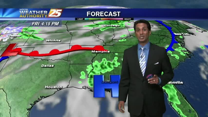
Showers & t-storms moving into and developing along the Southern 6 with a TORNADO WATCH in effect...
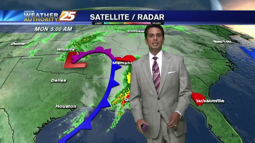
A BUMPY start on this Monday morning as weather with associated with a vigorous cold front approaches from the west...

SEVERE WEATHER continues to move across the Southern 6...

Showers/T-Storms moving in from the west with an associated cold front...SLIGHT THREAT for SEVERE STORMS...
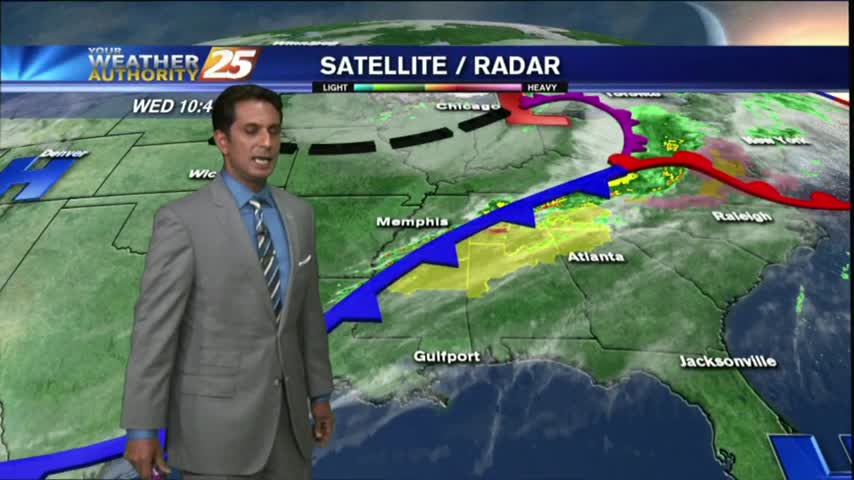
Cloud coverage has been extensive since last night, with the cold front and weather now approaching from the west...
A south wind in advance of an approaching cold front continues to get stronger. Breezy, warm & humid conditions to start off Ash Wednesday...

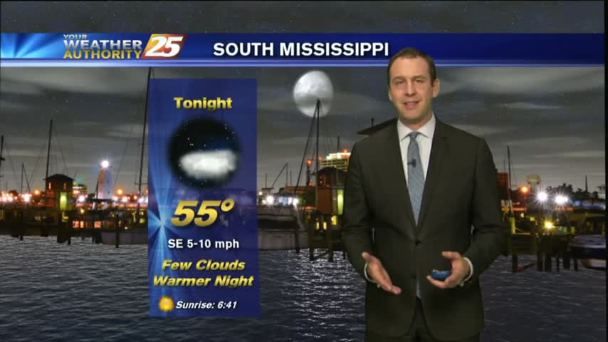
Mostly clear skies overnight with increasing humidity has developed areas of PATCHY fog this morning...

After a warm/humid start...showers and t-storms developed with STRONG/SEVERE storms moving across the viewing area...
Showers are already developing this morning as a system to our west moves east. The area is under a SLIGHT THREAT for severe weather...
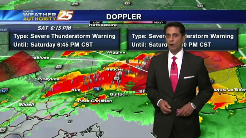
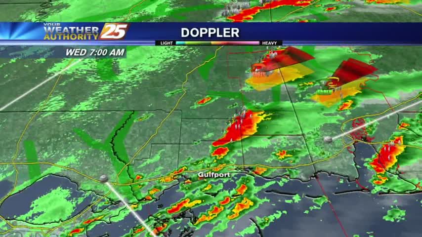
Doppler indication of early rotation of t-storms along the beach...

After sunshine this afternoon, t-storms are beginning to pop to our SW...moving NE into the area...

A SEVERE T-STORMS WARNING is now in effect for Hancock and Pearl River Counties until 6 a.m.

Dense fog is in the area with isolated showers and t-storms which continue from last night...