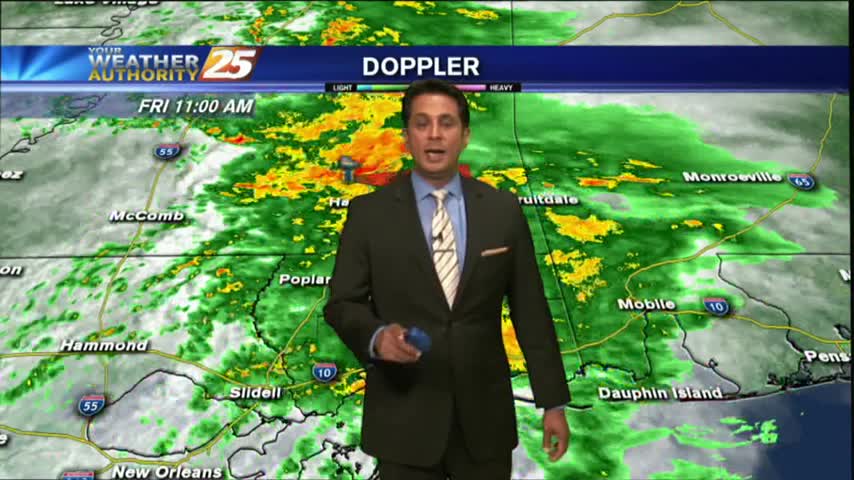
4/19 - Rob's "Midday News" Afternoon Forecast
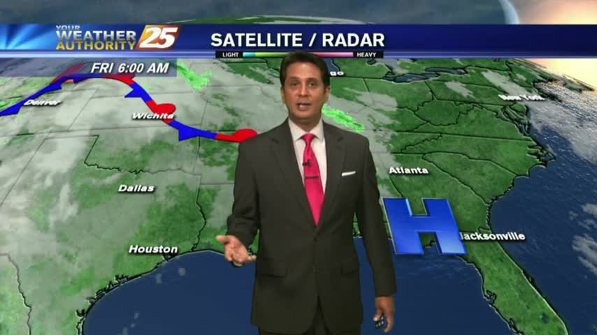
In the wake of this mornings cold front, surface high pressure building in from the north will maintain these below normal temps through Friday...
In the wake of this mornings cold front, surface high pressure building in from the north will maintain these below normal temps through Friday...
A cold front moving through the area will bring clouds this morning then sunshine this afternoon...
After a warmer start to the day, low-level clouds have been moving in and out of the area...
This morning brings slight warmer temps along with areas of very light patchy fog, mainly in JaxCo...
A quiet and chilly start to the workweek with areas of light patchy fog...
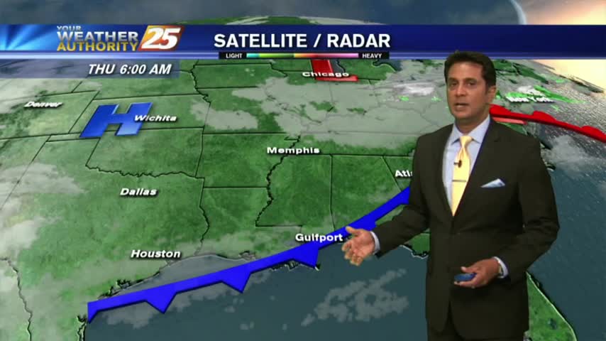
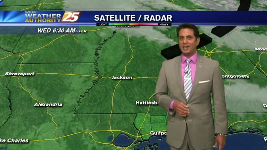
A bit of a rainy start to the day as a cold front continues to move to our east...

A warmer start to the day as a humid air mass moves in from the GOM in advance of an approaching cold front...
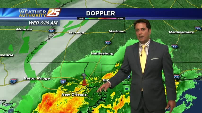
With a humid air mass south of a cold front in northern Mississippi, we have areas of patchy dense fog...

The cold front is now east with a weak boundary moving through the area, along with areas of patchy fog...
The activity with the cold front has fizzled out quite a bit but still moving across the area...

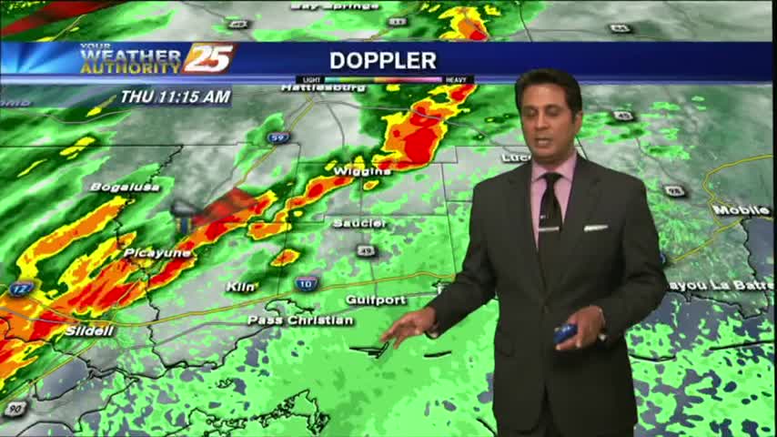
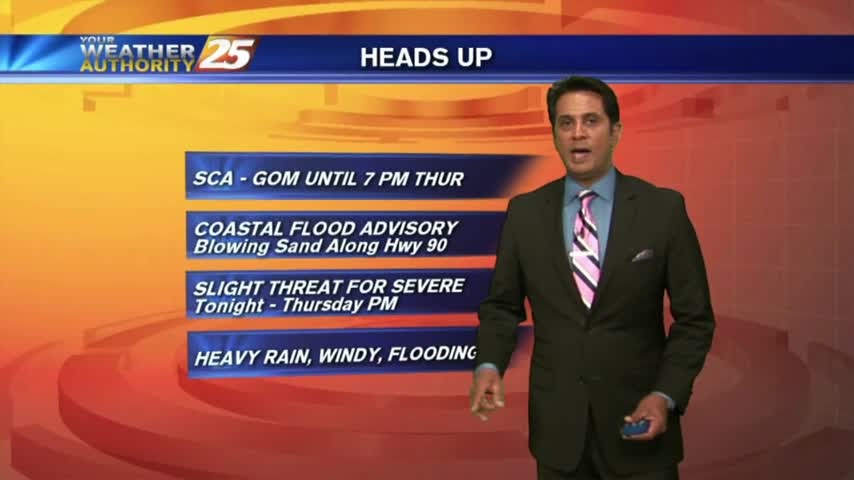
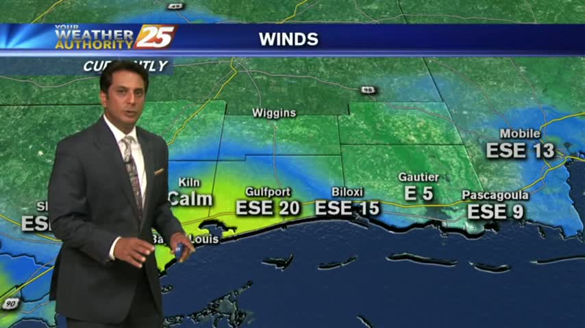
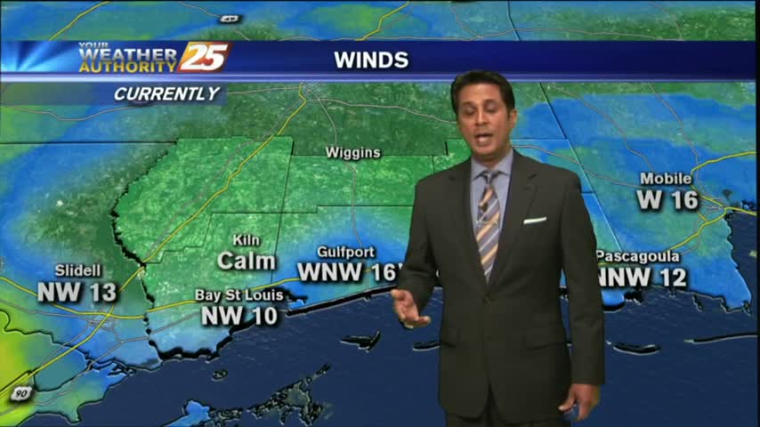
A warm/humid and windy start to the day with a POTENTIALLY SEVERE cold front approaching from the west...
Another warm, humid and breezy start to the day with a cold front approaching from the west...
A warm/humid and windy start to the day with these conditions expected to continue...
After a warm weekend, elevated humidity has areas of patchy DENSE FOG in the area...
After a warmer start to the day, warmer temps will begin moving into the region as the humidity elevates...
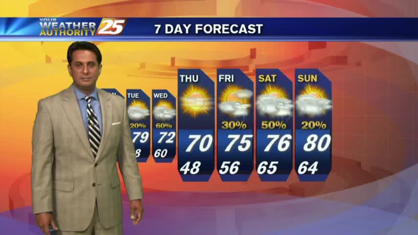
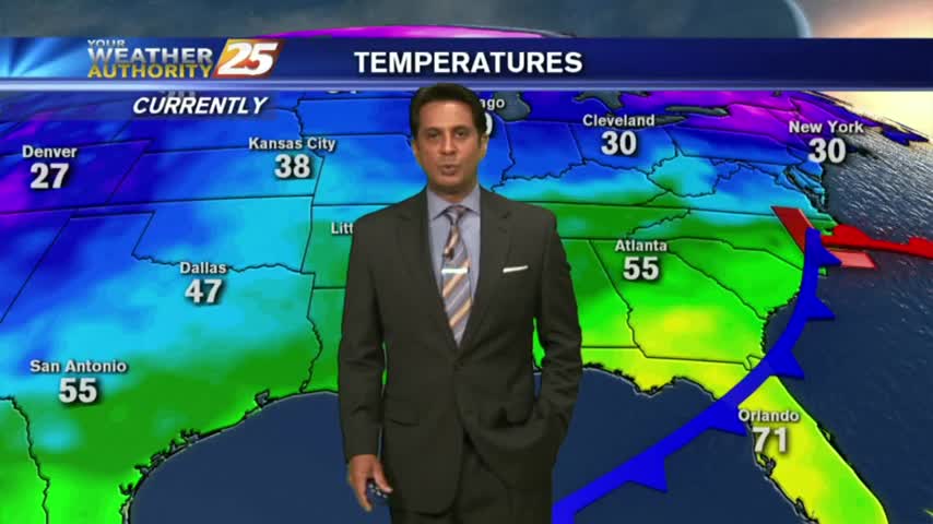
Another cool start but warmer than the past few days, even warmer for the weekend...
After a CHILLY morning temperatures are warming nicely, with the warm-up to begin tomorrow...
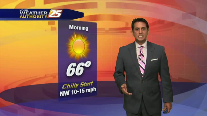
Another CHILLY morning but major changes ahead as an area of high-pressure overhead begins to move SE...
After a CHILLY start to the 1st full day of Spring, temps are warming nicely into the upper 60s under clear skies...
It's a CHILLY start on this 1st FULL day of Spring with clear skies...
Upper-level clouds moved across the area this morning with now mostly clear skies and breezy conditions...
VERY LIGHT drizzle overnight has dissipating as upper-level clouds continue to move across the viewing area...
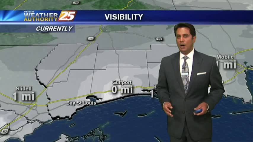
A warm/humid start to the day with DENSE FOG through the viewing area. A DENSE FOG ADVISORY is in effect...
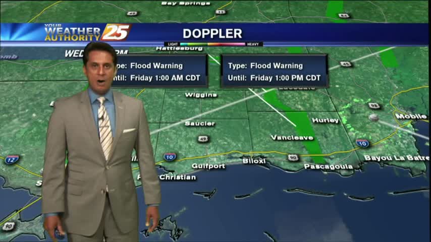
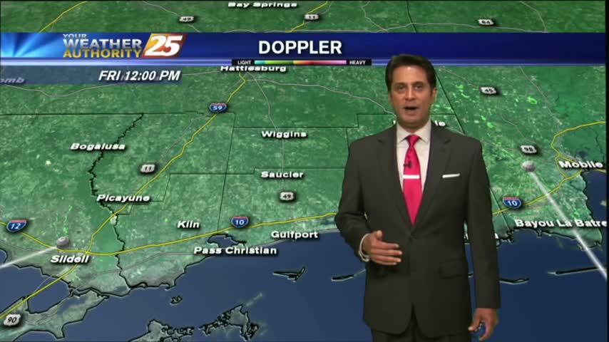
It was a much warmer start to the day with morning low temps about 20 degrees warmer than yesterday. Moderate rainfall is now moving across the area...