8/6 - Rob Knight's Monday Morning Forecast
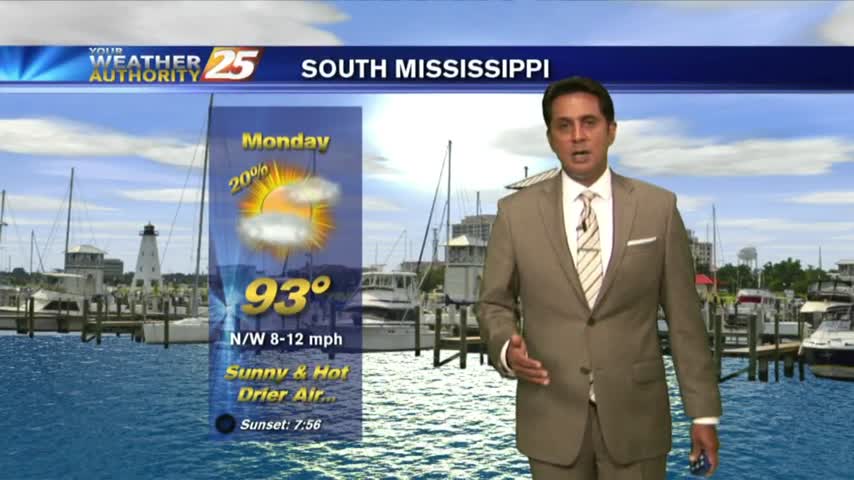
It's back to school Monday with a warm/humid start to the day/workweek...
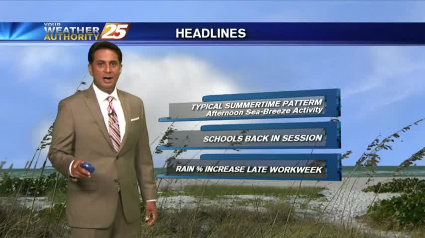
It's back to school Monday with a warm/humid start to the day/workweek...
In the wake of yesterday's rare cold front, it's a clear and mild start t the day...
After a VERY HOT weekend, we have light showers from I-20 down to the coast...moving to the south.
A warm start to the day but it is rain-free. Clouds moving south into the area will thin through midday...
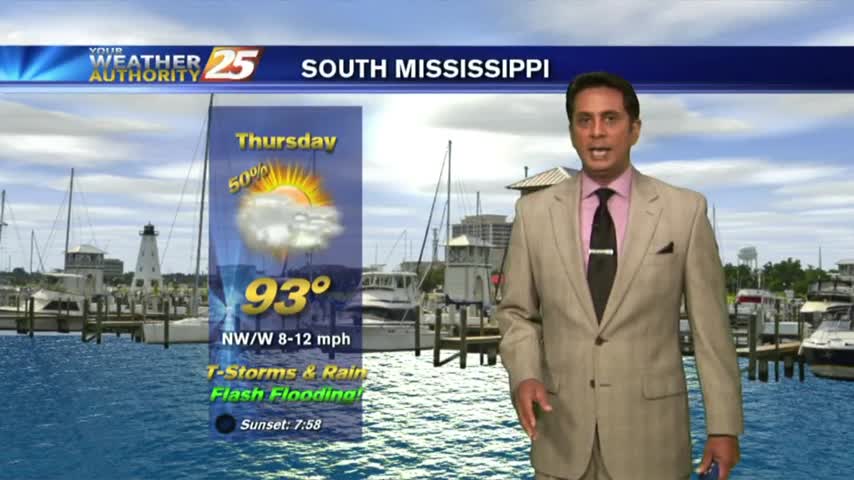
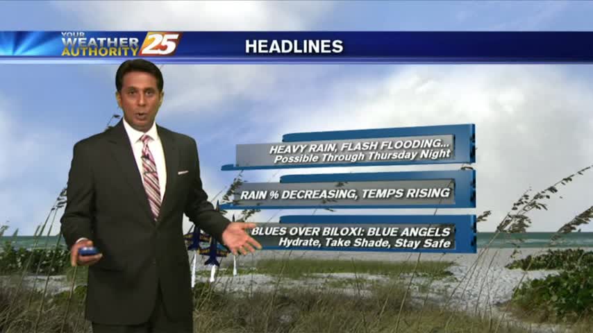
One final round of heavy rain/flash flooding before the pattern begins to change...
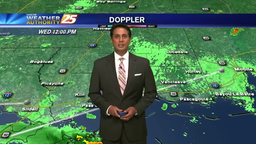
After minimal activity around sunrise, showers & t-storms continue to develop along with the threat for HEAVY RAIN this afternoon...
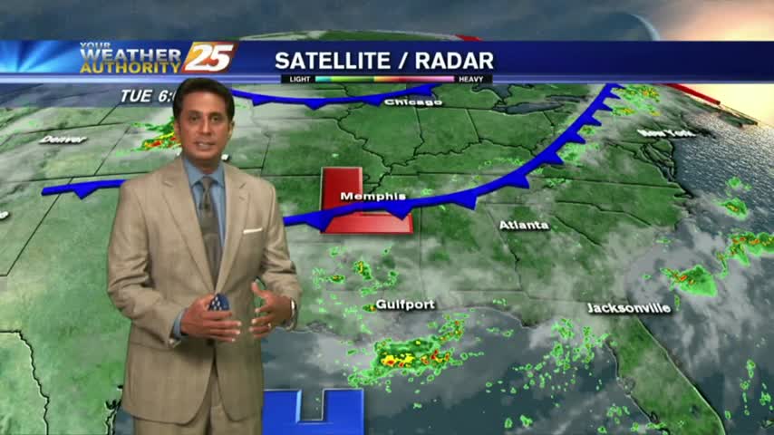
After another afternoon of TORRENTIAL rainfall, this morning is starting off with isolated light rain...
After HEAVY RAINFALL yesterday, we are under mostly cloudy skies with another round of potentially heavy rain to come...

A beautiful start to the day under clear skies, with warm temperatures in the 70s...

It's another warm and humid start on this Independence Day, but rain-free...
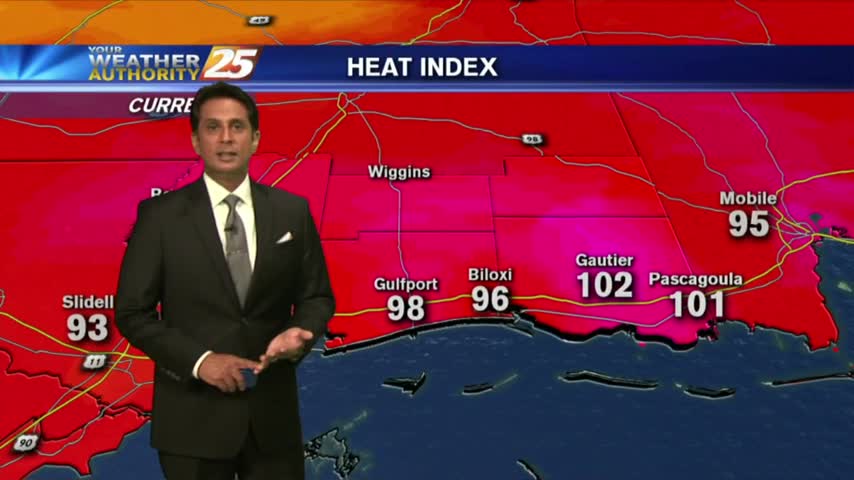
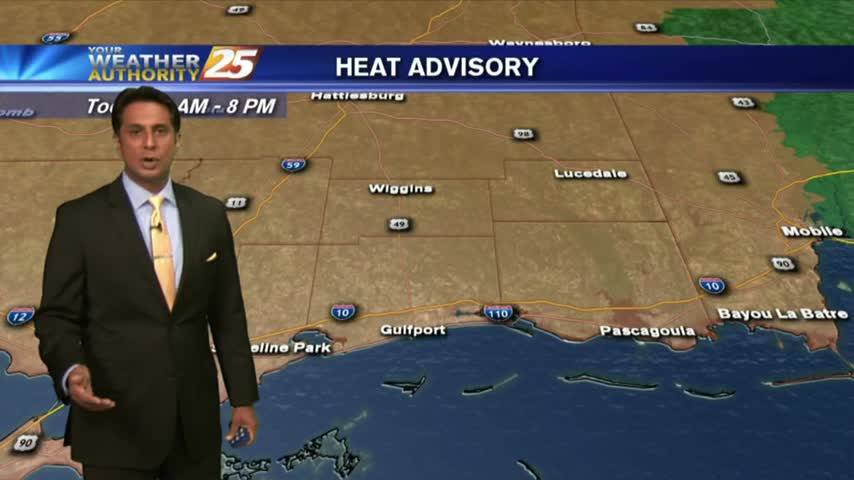
A VERY HOT 1st day of Summer with the HEAT INDICES pushing the triple digit mark...
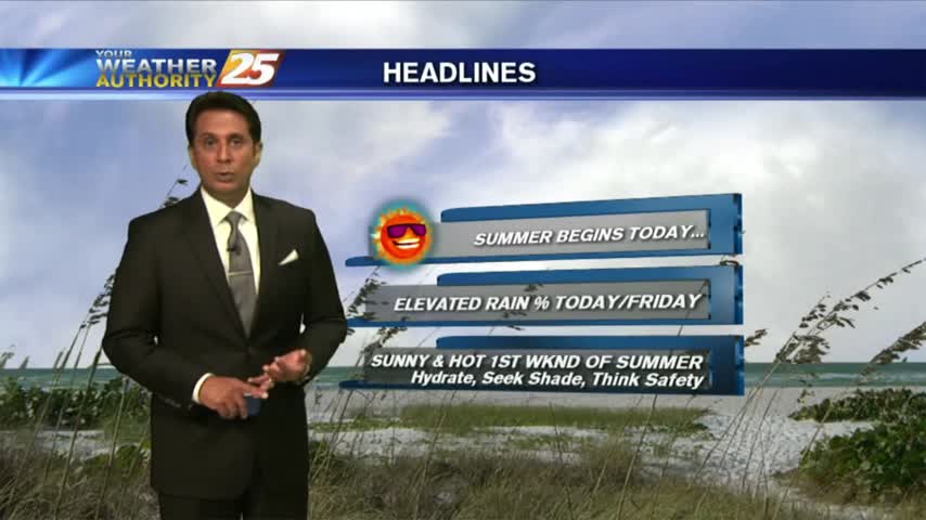
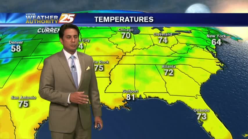
A VERY WARM start to the new season as several locations are in the low 80s this morning...

A rain-free start to this final day of Spring with areas of light patchy fog...

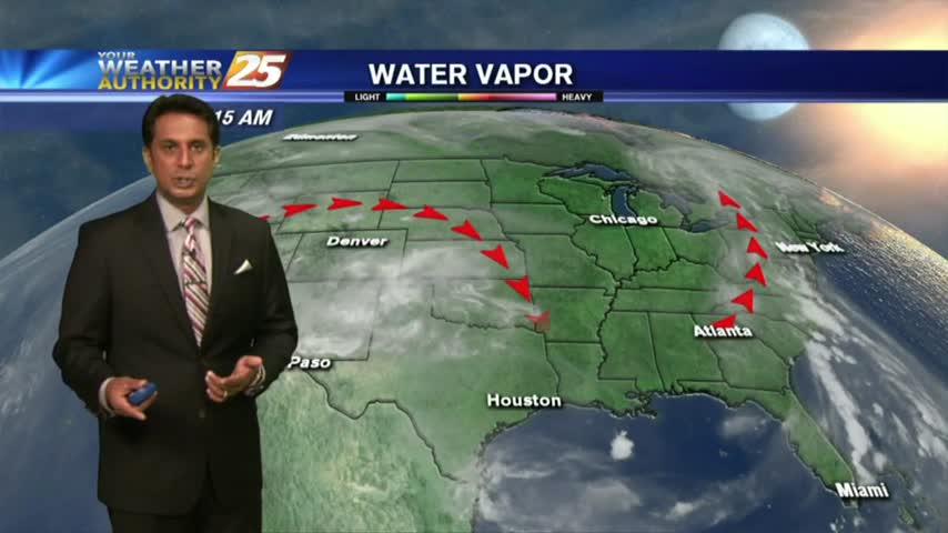
With a tropical wave in the NW'ter Gulf of Mexico, cloud coverage continues to move in from the south...

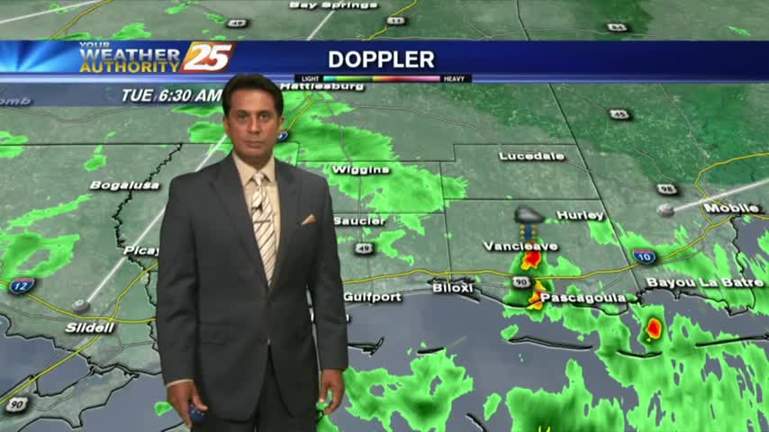
As the very saturated environment continues, activity is already in the area before sunrise...
Another HUMID start to the day with isolated activity in the vicinity...
After HEAVY RAINFALL yesterday afternoon, only a few light sprinkles exist this morning...
Overnight activity has dissipated but activity will redevelop this morning and then again this afternoon...

A warm/humid start with cloud coverage developing and moving in from the west...

A clear start to the day with light patchy fog in Jackson County...

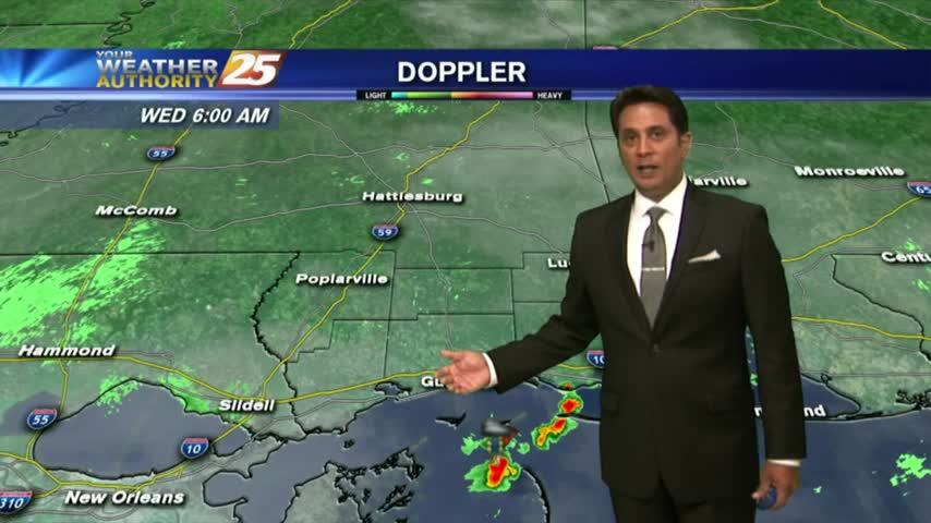
A better start to the day as the main focal point for rain has shifted to our SE...
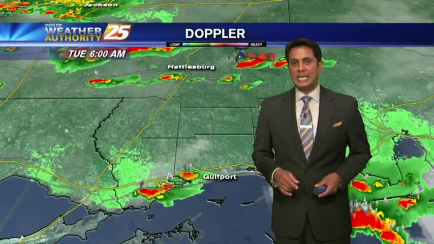
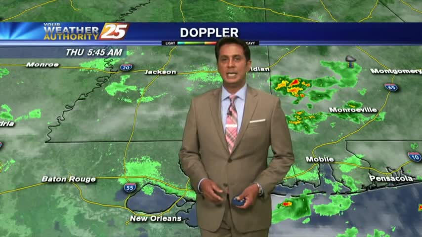
Isolated showers/t-storms are in the area this morning with the threat for HEAVY RAINFALL today...

Another WARM start to the day with very high HEAT INDICES in play for the weekend...
It's a rain-free morning with very warm and humid conditions on this final day of May...