1/1 - Rob Knight's New Year's Day "Morning News" Forecast
Another wet and foggy start to the day and the New Year as the cold front has stalled to the east of the viewing area...

Another wet and foggy start to the day and the New Year as the cold front has stalled to the east of the viewing area...
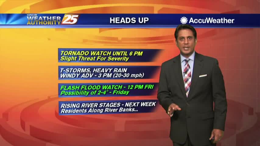
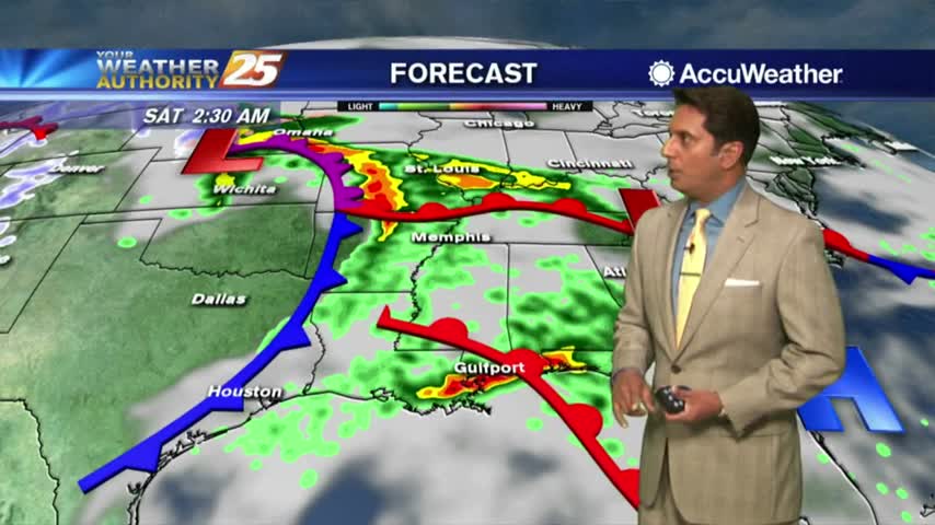
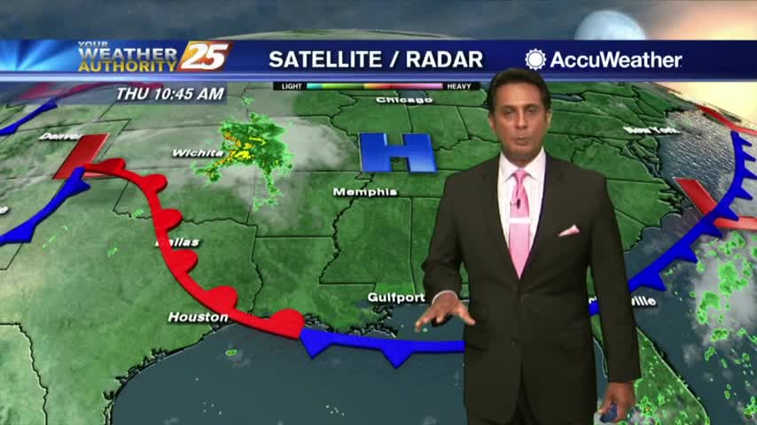
Rainfall is developing in the area in advance of a cold front west of Baton Rouge, our area is under a TORNADO WATCH...

After a FRIGID start to the day, the slow warm up will begin this afternoon...
Another cold start to the day as high-pressure to the NW moves closer to our area...
Much warmer temperatures this afternoon in advance of an approaching warm front later this evening...
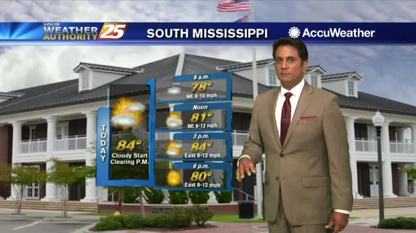
After a warmer and cloudy start to the day, a few light showers are developing along south Mississippi...
It's another FRIGID start to the day but MAJOR changes are ahead in the forecast...
Under clear skies and a northerly flow last night, it's a FRIGID start with a FREEZE WARNING in effect through 8 a.m...
The cold front continues to move further east as the cloud coverage lingers back to our west...

After a frigid start to the day, temperatures are warming nicely into the 60s...
After a FRIGID start to the day, temps are warming but struggling to get into the 50s...
A FRIGID START to the day as a FREEZE WARNING is in effect through mi-morning...

A COLD start to the day as the rain shield is moving slowly to the east...
The cold front has moved south, as cloud coverage and areas of patchy fog persist...
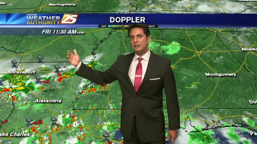
Activity is beginning to redevelop with daytime heating...
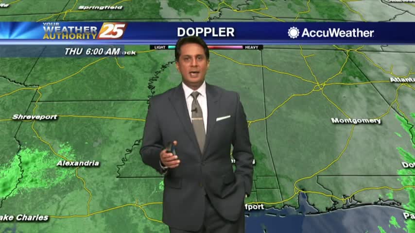
A few showers south of the coast line are dissipating as they move towards the beach...

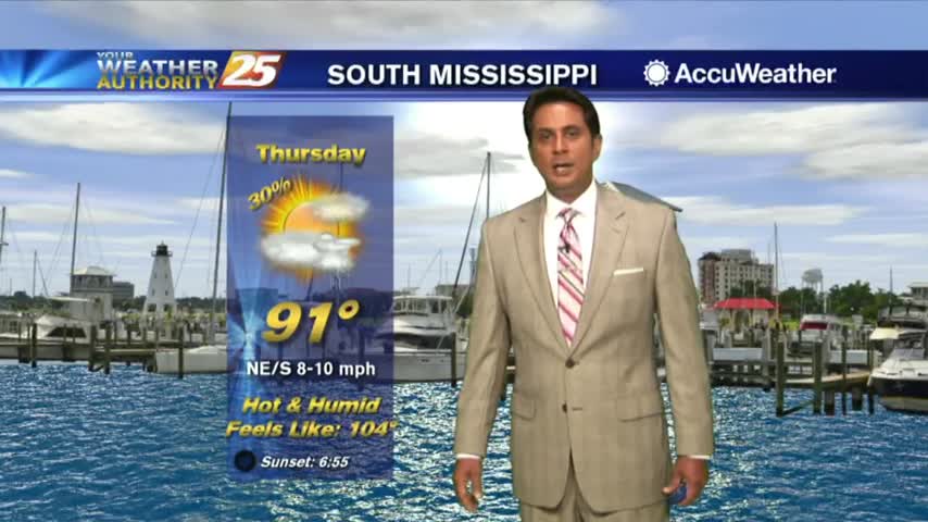
Another hot day as the humidity has brought HIGH HEAT INDICES to the area...
A warm start to the day as a few t-storms in the outer-coastal waters are dissipating...
Another warm & humid start to the day under clear skies and light winds...
A much better start to the day with just a few clouds moving in from the south and mild temperatures...
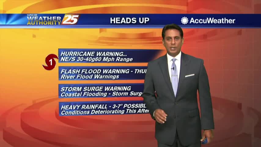
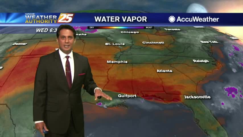
TS GORDON continues to move closer to he Mississippi gulf coast...
After a BEAUTIFUL start to the day, temps continue to warm with the humidity dropping off...
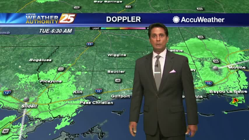
Isolated showers south are moving north and into the coastal counties...
After a clear start, the clouds have developed with showers & t-storms becoming more prevalent...