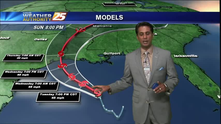
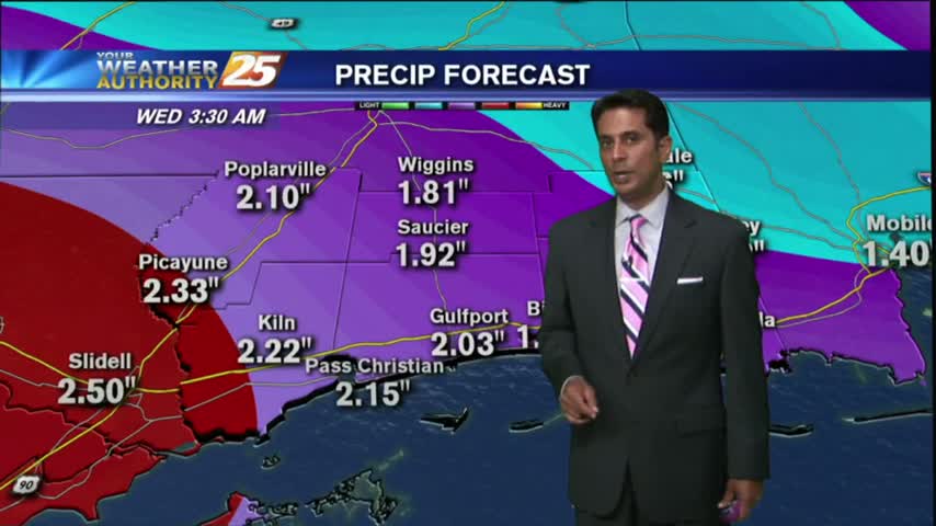
6/21 - Rob's "Tropical Storm Cindy" Forecast
A BUMPY start to the day with HEAVY RAIN...and a TORNADO WATCH. TROPICAL STORM effect will continue...

A BUMPY start to the day with HEAVY RAIN...and a TORNADO WATCH. TROPICAL STORM effect will continue...
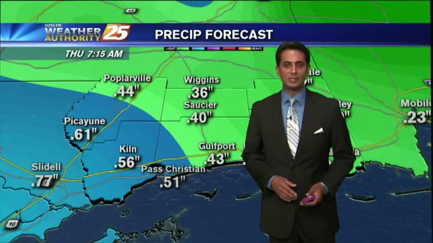
Light to moderate rainfall has been in the area since prior to sunrise and will continue through the duration of this event!

Another warm & humid start to the day as ALL EYES continue to focus on a DEVELOPING TROPICAL system in the W'tern Caribbean...
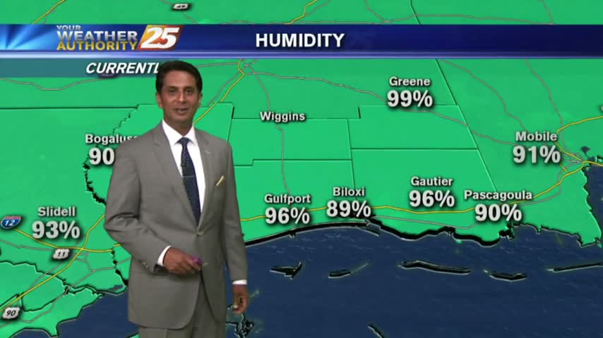
With a very strong tropical air mass dominating the region, overnight t-storms have moved east with a very HUMID start to the day...
After a brief period of sunny skies and low humidity, a very TROPICAL AIR MASS is back in the region with showers/t-storms moving in

After a beautiful weekend with sunny skies and drier air, the tropical air mass is moving back into the region...
Rain is likely this afternoon and evening as low pressure moves overhead, but a cold front pushes through tonight drying out the area for the rest of the week.
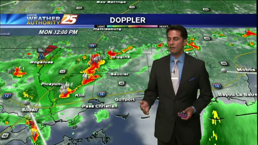
After a bit of a break earlier this morning, showers continue to move in and develop along the viewing area.
After a rain-free start to the day under partly cloudy skies....the clouds and activity has moved back into the viewing area...

A break from the rain this morning...BUT areas of PATCHY DENSE FOG have developed along the Southern 6...
Another day of showers and storms for South Mississippi as the tropical airmass stays in place.

On and off showers are possible this afternoon as we continue to get daytime heating. The strongest storms could have gusty winds, lightning and heavy downpours.
Showers and thunderstorms in the area this morning will lead to a cloudy and muggy day. On and off showers are possible this afternoon.
The stationary front that has been lingering over the area for the past few days will continue to bring rain chances for much of the region.
After showers and thunderstorms this morning, the afternoon and evening will be wet, cloudy and muggy.

It's a gloomy start to the workweek/Memorial Day with showers/T-Storms, which continue from last night...
After a CHILLY start to the day, temps continue to warm along with decreasing humidity under clear skies...
A clear and cool start this morning will lead to a warm and breezy afternoon. Cloud cover and rain chances on the increase as the weekend arrives.

After a cloudy start to the day, drier air continues to move into the region as high-pressure to the NW moves SE

Morning showers/t-storms have subsided and moved to the east as the stationary front moves east...

With a stationary front over head, showers/t-storms continues with areas of patchy fog along the Southern 6...
Light rain has been moving into the area this morning, scattered showers/t-storms on-tap this afternoon...

After a WET WEEKEND, showers and t-storms will move back into the area later this morning...

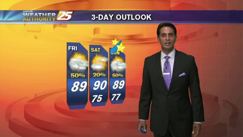
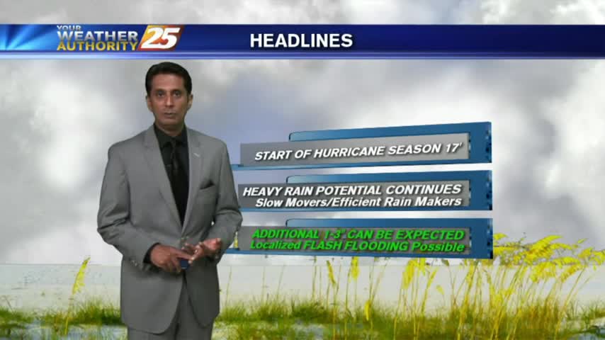
It's a WARM/HUMID day long the Mississippi Gulf Coast with the potential for HEAVY RAIN through the weekend...