10/10 - Rob's "Disruptive Morning" Weather Forecast
With a very saturated air mass in place, DISRUPTIVE WEATHER is in the area once again in the form of FOG, and ADVISORY is in effect...
With a very saturated air mass in place, DISRUPTIVE WEATHER is in the area once again in the form of FOG, and ADVISORY is in effect...
A mild and humid start to the day with rain moving in from the south and areas of PATCHY DENSE fog...
The majority of rain including HEAVY RAIN stayed west of our area yesterday, with a rain-free start this morning...
This morning started out cooler with breezy conditions along with isolated rain moving in from the SE. The activity continues with more activity developing...poised to move into he area this afternoon...
As a tropical wave moves across the N'tern Gulf of mexico, rainfall has already begun to move into the coastal counties...

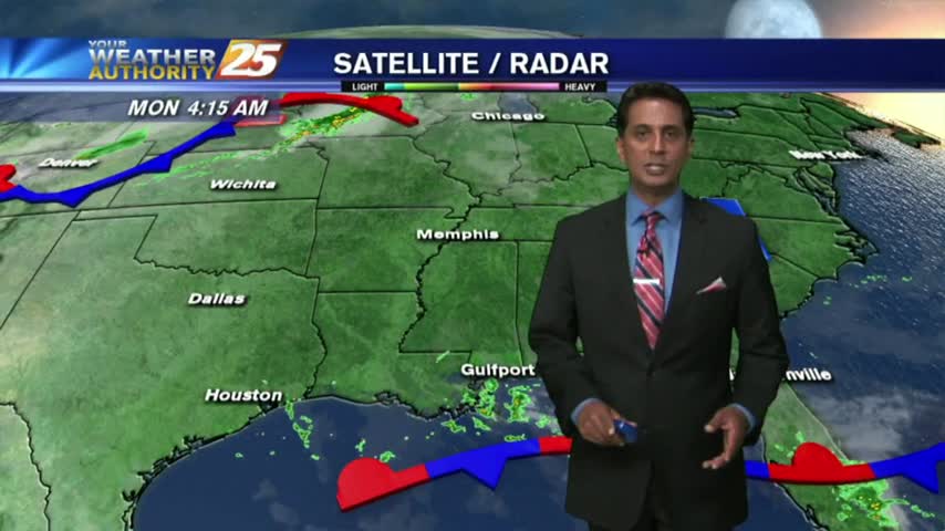
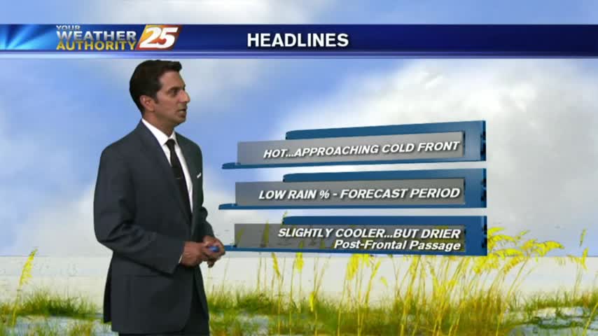
With an approaching cold front from the west, it's a warm/humid start to the day with areas of patchy fog...
A mild start with areas of light patchy fog and very isolated showers moving in from the south...

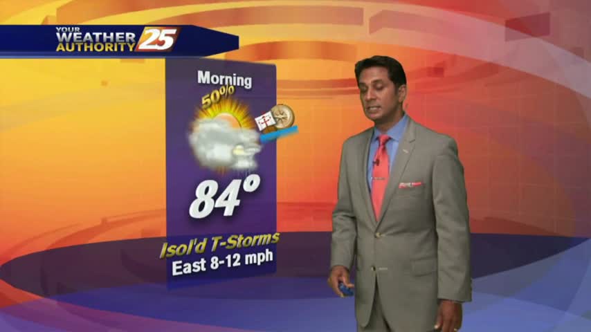
A mild start to the 1st full week of autumn...with showers/t-storms moving into the area from the SE...
A warm start to the day with areas of light patchy fog. Today will once again bring above seasonal temperatures as the mercury will climb into the 90s...
Another WARM/HUMID start to the day with areas of patchy fog and isolated rain moving in from the Gulf/Sound...
IRMA, now a TROPICAL DEPRESSION moving through N'tern Alabama continues to bring lovely conditions and a dry north wind to south Mississippi.

The LOVELY conditions continue this afternoon as TROPICAL STORM IRMA brings a drier air mass to the area...
A lovely start to the workweek as IRMA moves towards north Florida. South Mississippi dealing with a DRY north wind which will become BREEZY through this evening...
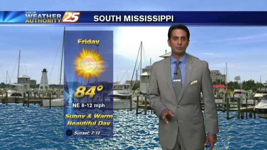
After a BEAUTIFUL start to the day, your Friday afternoon will bring sunny and warm conditions with VERY LOW humidity...
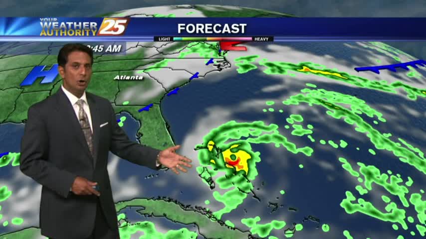
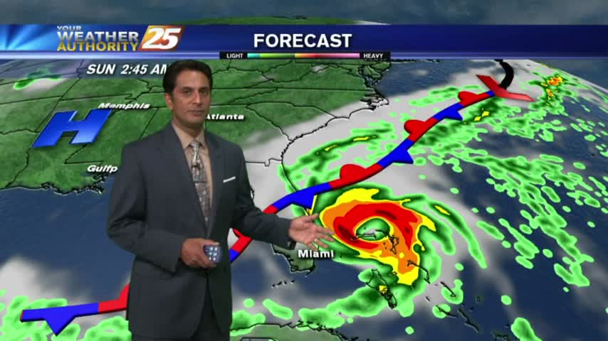
As all eyes continue to focus on the tropics and MAJOR HURRICANE IRMA, it's a BEAUTIFUL start to the day under clear skies and cool temps...

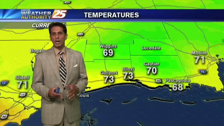
SPLENDID conditions this afternoon along the Mississippi Gulf Coast with temps in the 70s, low humidity and mostly clear skies...
A BEAUTIFUL start to the day as high-pressure to he NW is ushering in a cooler/drier air mass which will shape our forecast through the weekend...

The cold front has moved south of the area with overcast skies continuing. Major changes area ahead as a COOLER/DRIER air mass moves in...
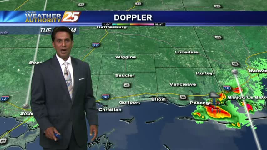
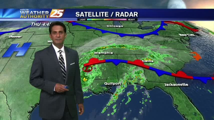
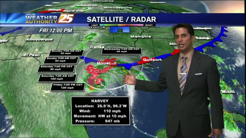
Isolated showers/t-storms continue to move into he area from the west, rotating around now TD Harvey to our NW...
A warm/humid start to the day with very BREEZY conditions and bands of rain moving in from the west...

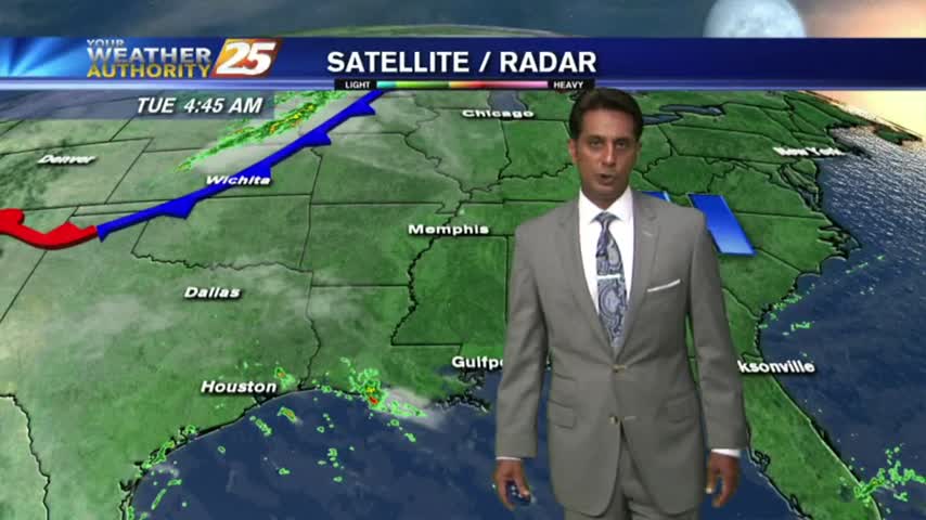
Rain overnight has continued this morning as TS Harvey has make landfall yet again in extreme SW Louisiana...
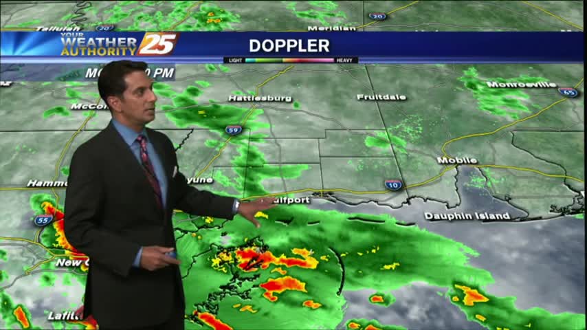
A wet/gray stat to the day as rain has been moving into the viewing area from the W/SW. Heavy activity is on-tap over the next 36 hours...
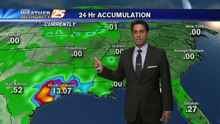
Harvey continues to pummel E/SE'tern Texas as the rain shield is beginning to move into the area: light rain moving in from the sound...
Mostly cloudy skies continue along the viewing area as an east wind is dominating the N'tern Gulf of Mexico...