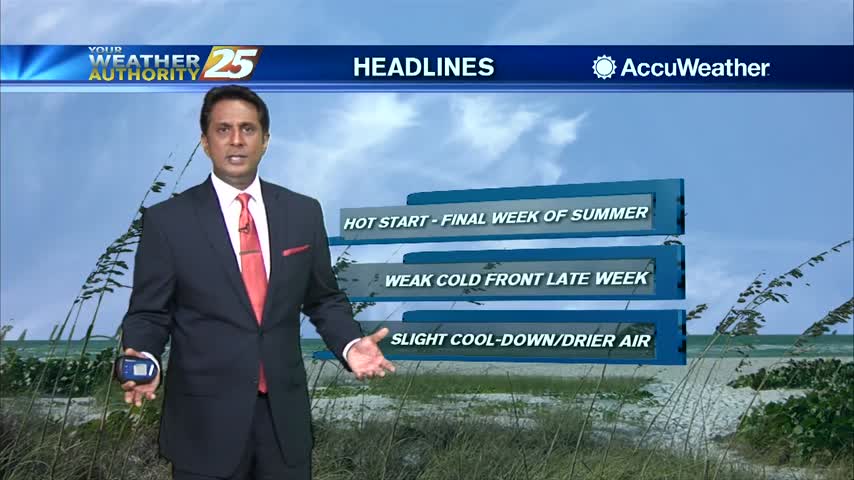
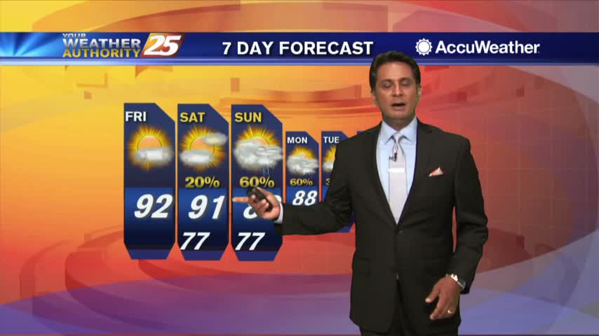
9/24 - Rob's "Hot & Dry" Tuesday Morning Forecast
Another beautiful start to the day under clear skies but changes will occur later today...
Another beautiful start to the day under clear skies but changes will occur later today...
A nice start to the workweek with morning low temperatures in the mid/upper 60s heading out the door...
Warming temperatures feel more comfortable as a drier air mass is in the area...
A warm start with a few showers moving in from the SE...
Warming temperatures as clouds continue to develop...

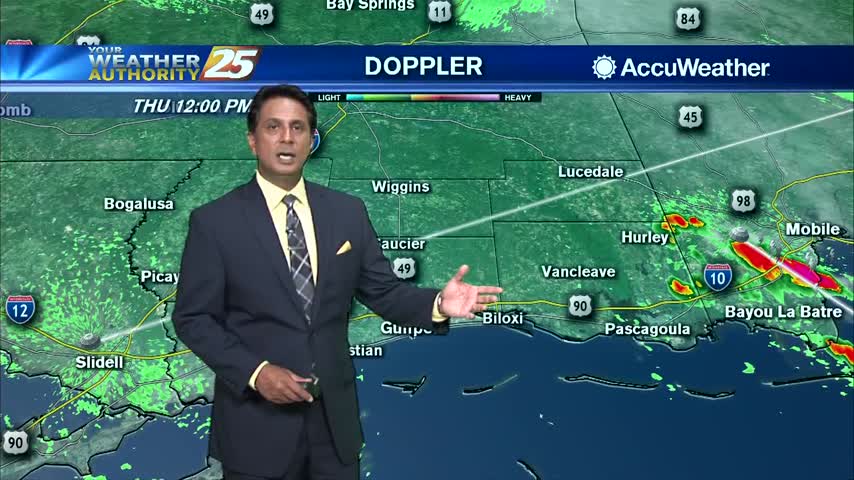
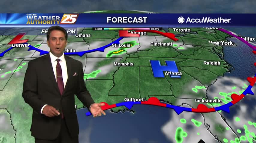
A warm start with isolated activity in the NE'tern Gulf as a cold front is in the area...

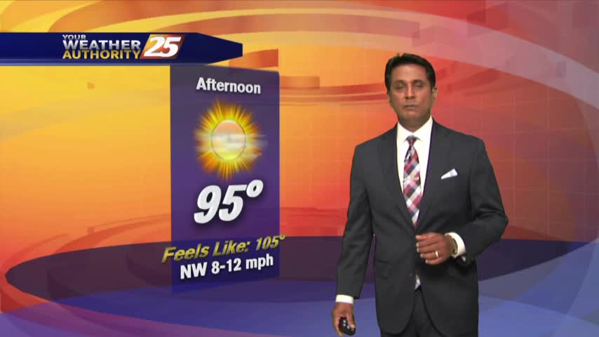
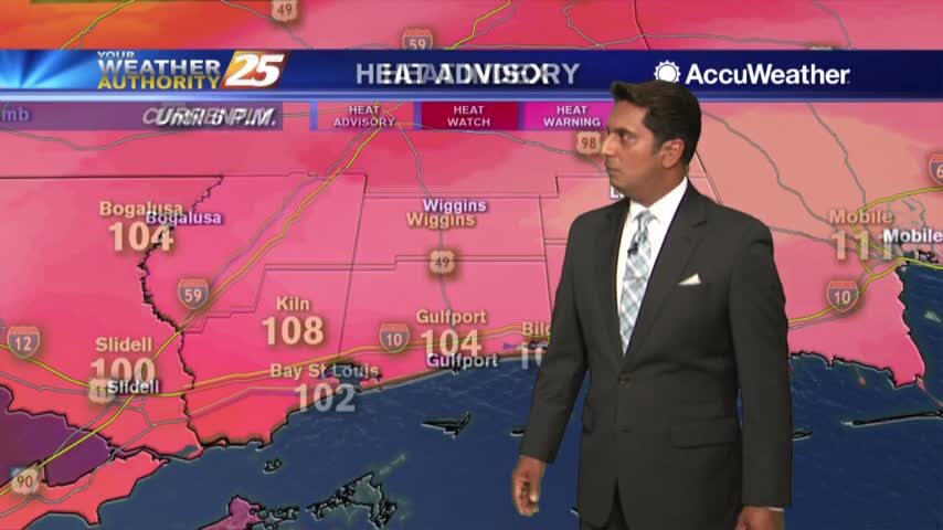
Another very hot afternoon along south Mississippi with the heat index climbing into the low 100s...
Another warm start to the day with just a few upper-level clouds to our W/SW...
Upper level clouds continue to stream across the area as temps climb into the mid/upper 80s...
Temperatures warming into the 90s feel hotter with elevated humidity and sunny skies...
A warm start to the day under clear skies with slightly lower humidity...

A beautiful start to the day with clear skies and nice temperatures in the upper 60s to low 70s...

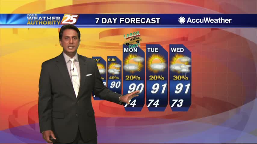
Labor Day morning update on Major Hurricane Dorian impacting the Bahamas...

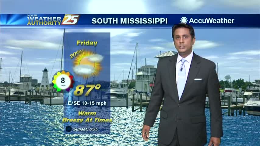
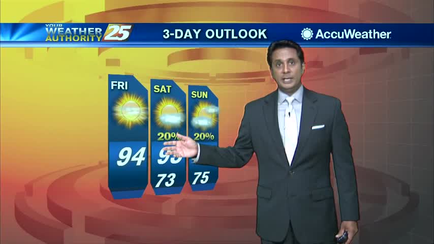
A nice Friday afternoon with a few clouds and HOT temperatures, BUT low humidity...
Another beautiful start to the day as a less humid air mass is still in the area...
An absolutely LOVELY start to the day as a cold front is now to our south...
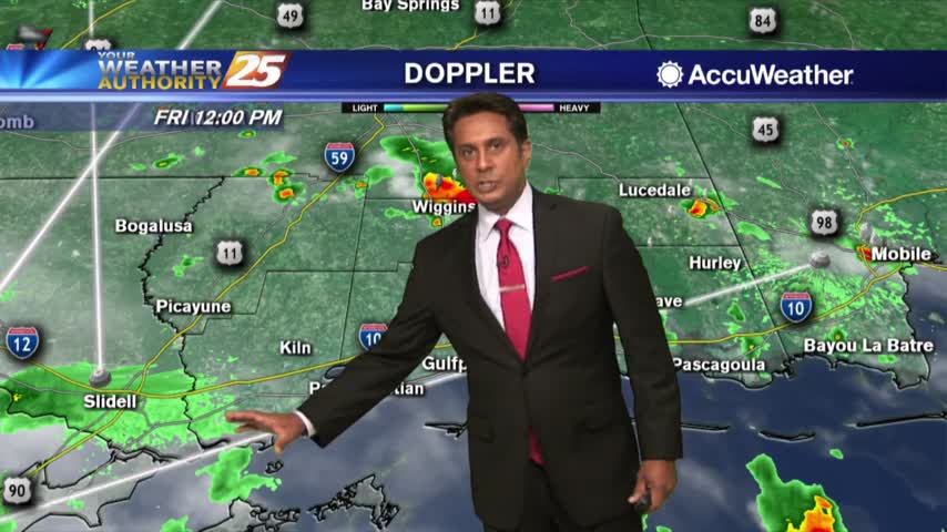
Sowers and t-storms earlier this morning will flare back up this afternoon...

Another warm and humid start to the day under partly/mostly cloudy skies as showers/t-storms moving in from the SW...

After a clear start to the day, a few clouds have developed along with VERY HIGH heat index values...
A rain-free start to the day with warm and humid conditions heading out the door...
As the mercury climbs into the low 90s, the HEAT INDEX makes it feel so much hotter....
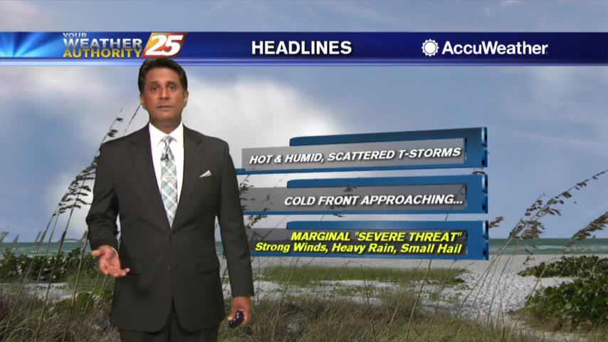
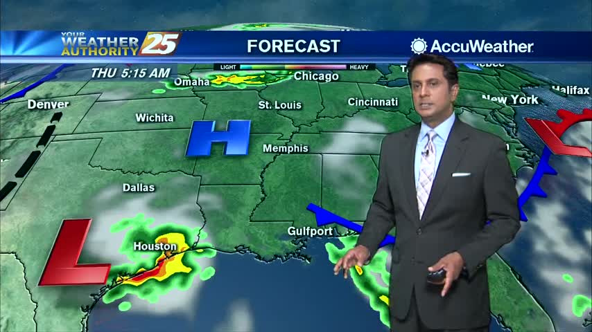
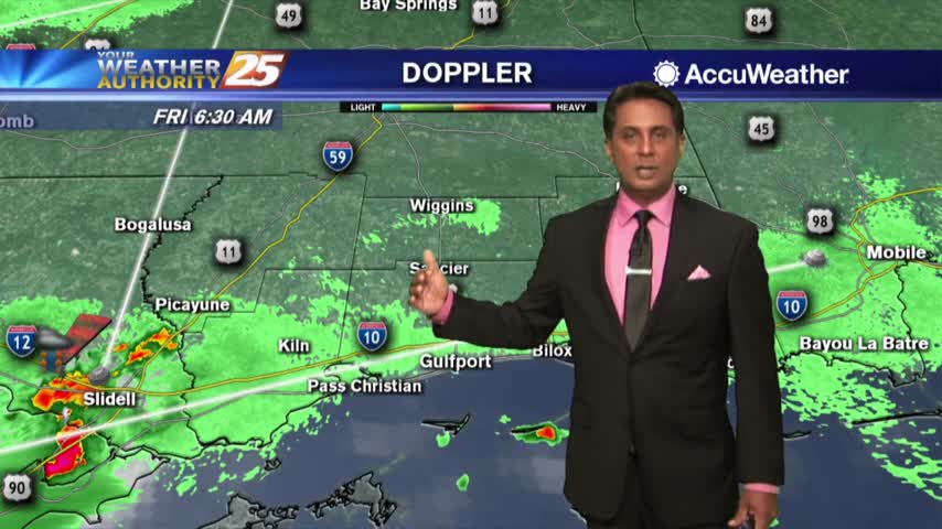
Isolated showers and t-storms are moving across south Mississippi this morning with an approaching cold front north...

As temperatures continue to warm, the HEAT INDEX will be pushing 110 degrees through this evening...
A HUMID start to the day with spotty rain/t-storms develop along the coast and south...