2/25 - The Chief's "Cold Frontal Passage" Friday Morning Forecast
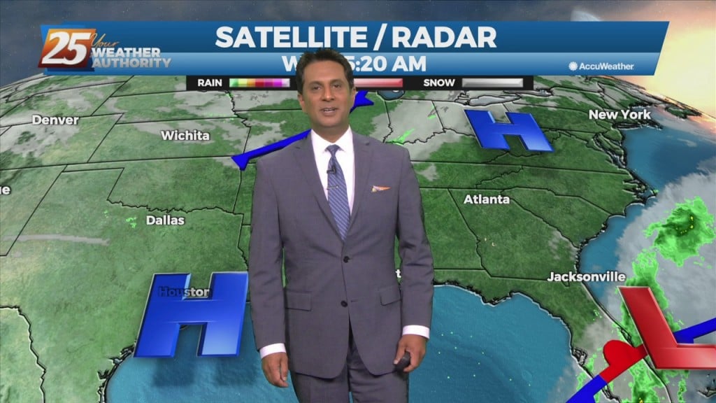
A cold front is no east of the area with light precipitation behind the front expected to be out of the area by moon. Forecast guidance…
A cold front is no east of the area with light precipitation behind the front expected to be out of the area by moon. Forecast guidance…
Above seasonal average temperatures will continue until a cold front makes its way through our area early tomorrow morning. Ahead of the front, isolated showers…
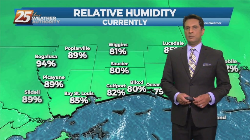
Warm and humid flow will continue from the Gulf of Mexico. The way above seasonal temperatures will continue as well as overnight DENSE FOG. A cold front draped across…
Low clouds will persist throughout the area as an approaching cold front moves into the extreme northwestern region. The warm and humid flow from the…
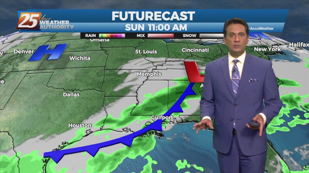
Main forecast concern will be the cold frontal passage on Saturday. Somewhat of a lesser concern will be the potential for fog development Saturday morning. Still pretty good…
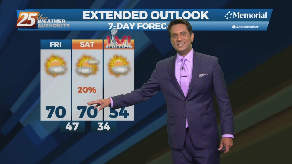
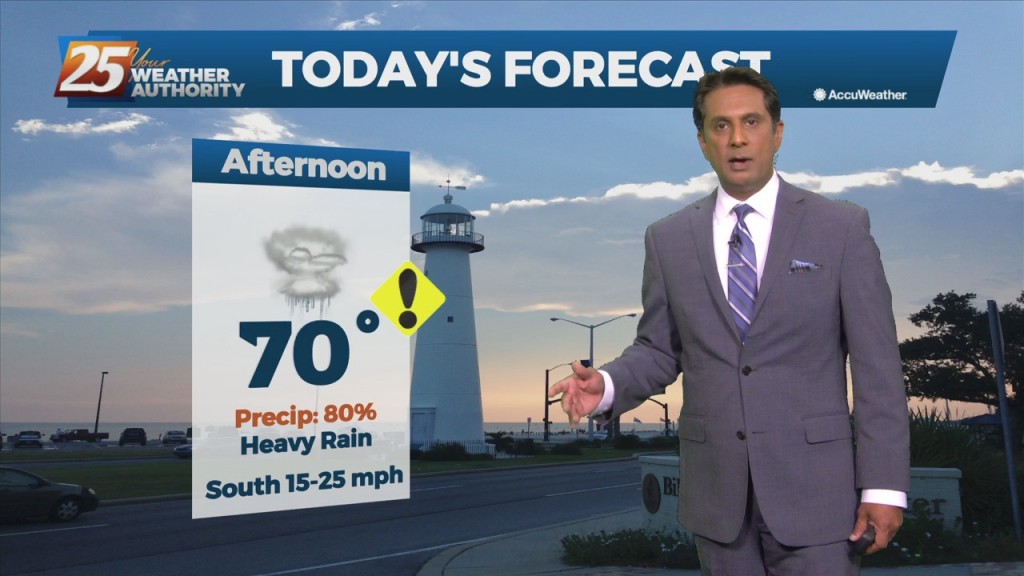
A lovely sunny day ahead with warm temperatures topping out around 70 degrees. Main forecast concern will be the cold frontal passage on Saturday. Somewhat of a…
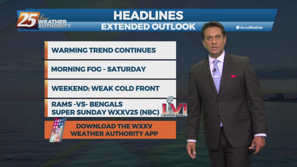
Conditions will be clear, dry, and on a warming trend into the weekend. Pockets of dense fog will be in the area on Friday and Saturday mornings.…
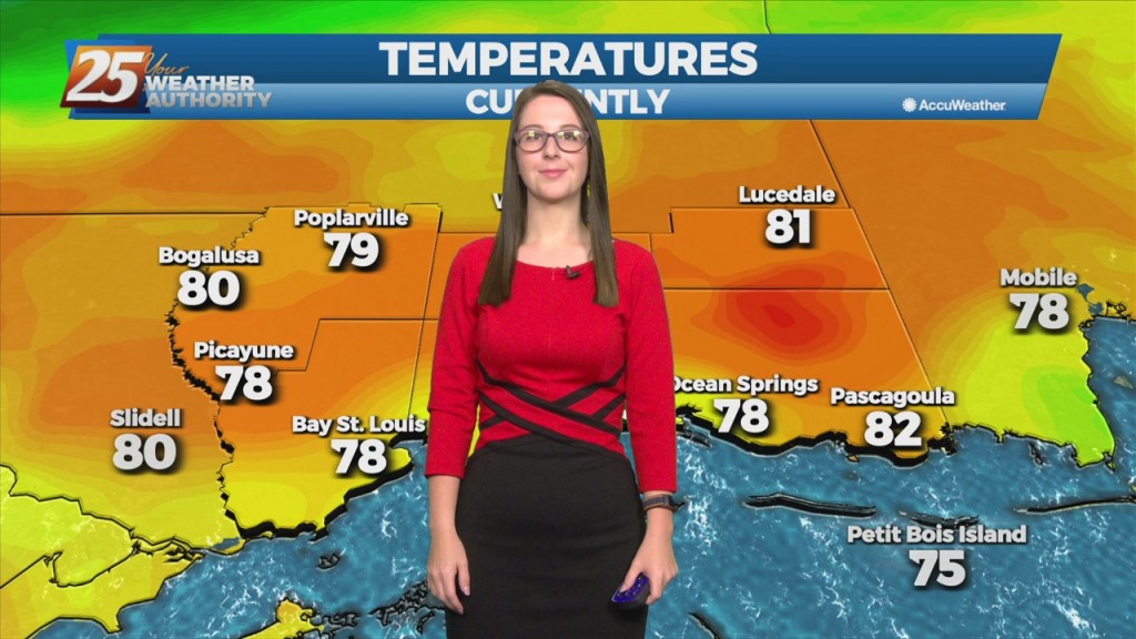
High pressure will dominate throughout the region over the next few days. Today will bring sunshine and slightly warmer temperatures with tonight being under clear skies. Low temperatures tonight…
High pressure will dominate throughout the region over the next few days. Today will bring sunshine and slightly warmer temperatures, with dry and cool tonight under clear…
Today, high pressure will begin to shape the forecast. The rest of the workweek will bring dry weather and plenty of sunshine. As the week goes…
Clear skies have moved into the area as high pressure will begin to shape the forecast. The rest of the workweek will bring dry weather and plenty of…
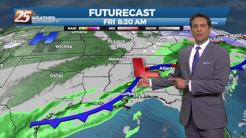
A cold front west will slowly move east and through the area this evening. This afternoon will bring the biggest potential for impactful weather to…
Today we will see the moisture axis that is currently draped north to south over southeastern Louisiana almost stall out and continue to sit over the area as…
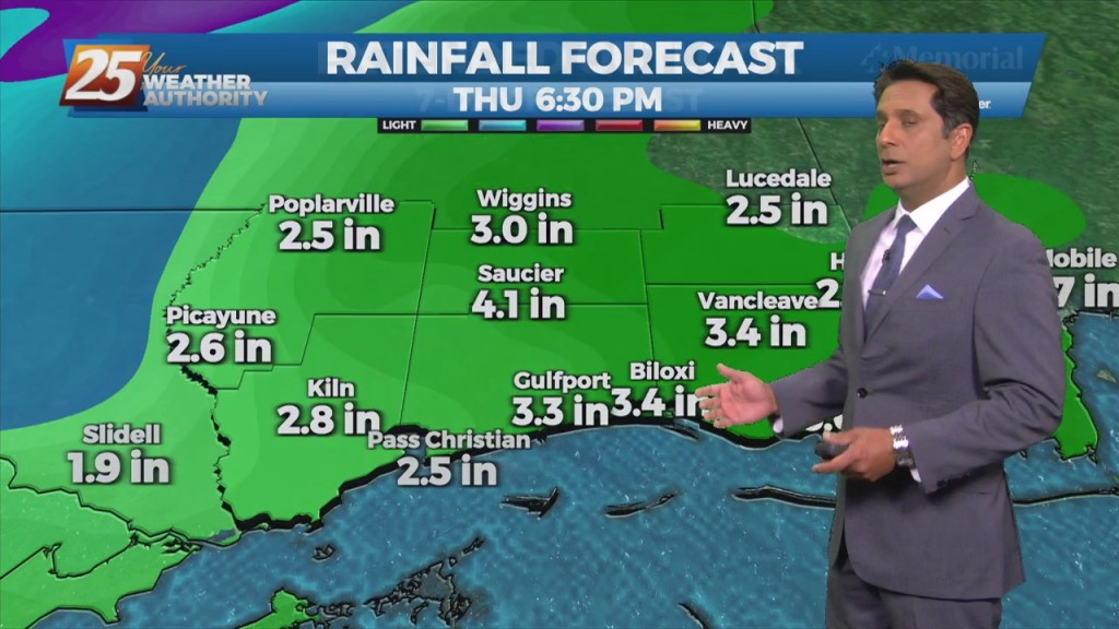
Rainfall moving into the area later today will continue to intensify overnight with the potential for 1/4 to 1" accumulation. The next round of rain will…
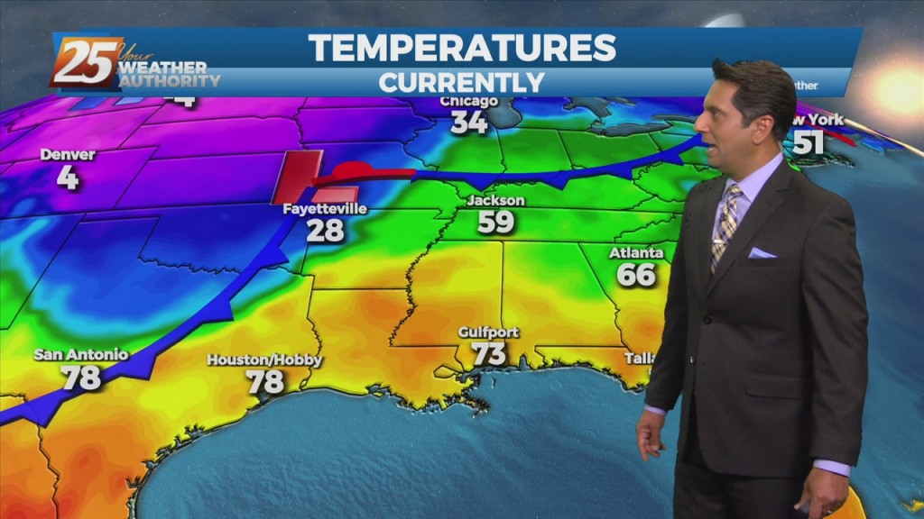
High-pressure will slowly move east as a strong cold front will begin moving rapidly SE through the Red River Valley this afternoon, with the return flow…
A west Texas disturbance will slip southeastward off the Texas Coast by Tuesday morning, and will continue to weaken as it moves toward south Florida by Wednesday…
A west Texas disturbance will slip southeastward off the Texas Coast by Tuesday morning, and will continue to weaken as it moves toward south Florida by Wednesday…
Main concern will be temperatures. Mid and high cloud cover should hang around a good bit of the day, but do expect to see some sunshine late…
Weak cold front will blasts through the area this afternoon and evening, but the airmass is too dry to produce precipitation. Not anticipating any weather systems in…
A weak cold front will slip though the area early tomorrow morning. There isn't sufficient moisture so I'm not expecting any weather with passage with the exception…
A weak cold front diving southward through the mid-west and lower Tennessee valley will move across the area during the day on Friday, with the upper…
A Canadian disturbance will move into the Great Plains and middle Mississippi River Valley tomorrow morning, reaching the Atlantic Coast by sunrise Saturday. Onshore flow never gets…
A disturbance along the four Corners will weaken over the next 36 hours as it moves eastward. The Canadian trough behind it will move into…
An area of low-pressure to the south along with a cold front north will continue to bring rain to the area. May not see a lot of…