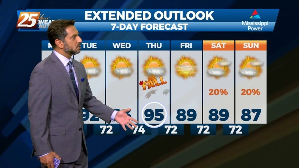
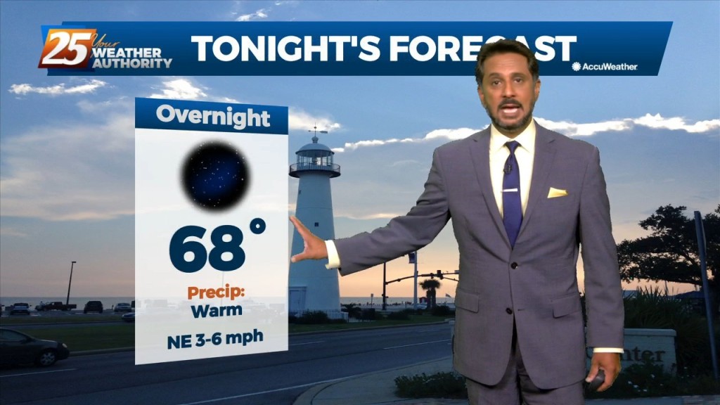
9/28 - The Chief's "Fall Conditions Continue" Wednesday Afternoon
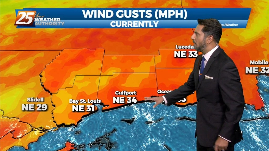
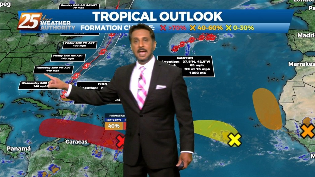
Strong northerly flow will be in place over the region for the next few days. While we are entering a Spring Tide, the new trends in the…
Strong northerly flow will be in place over the region for the next few days. While we are entering a Spring Tide, the new trends in the…
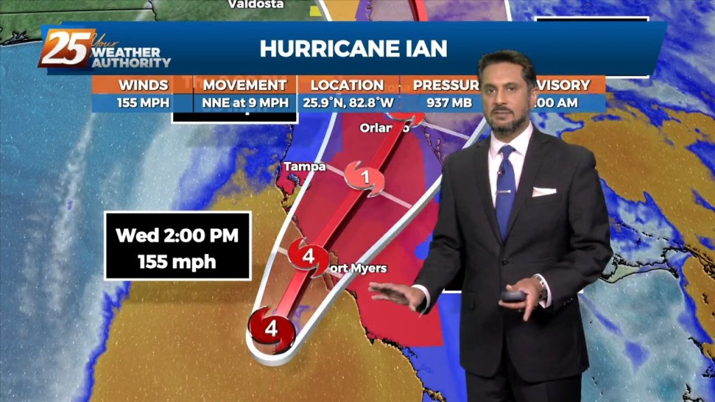
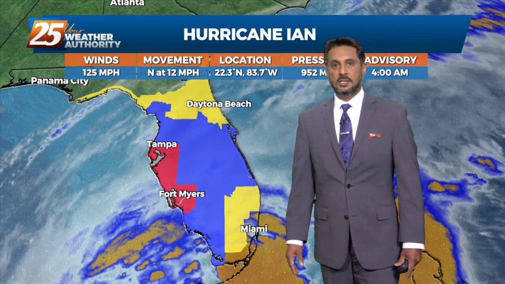
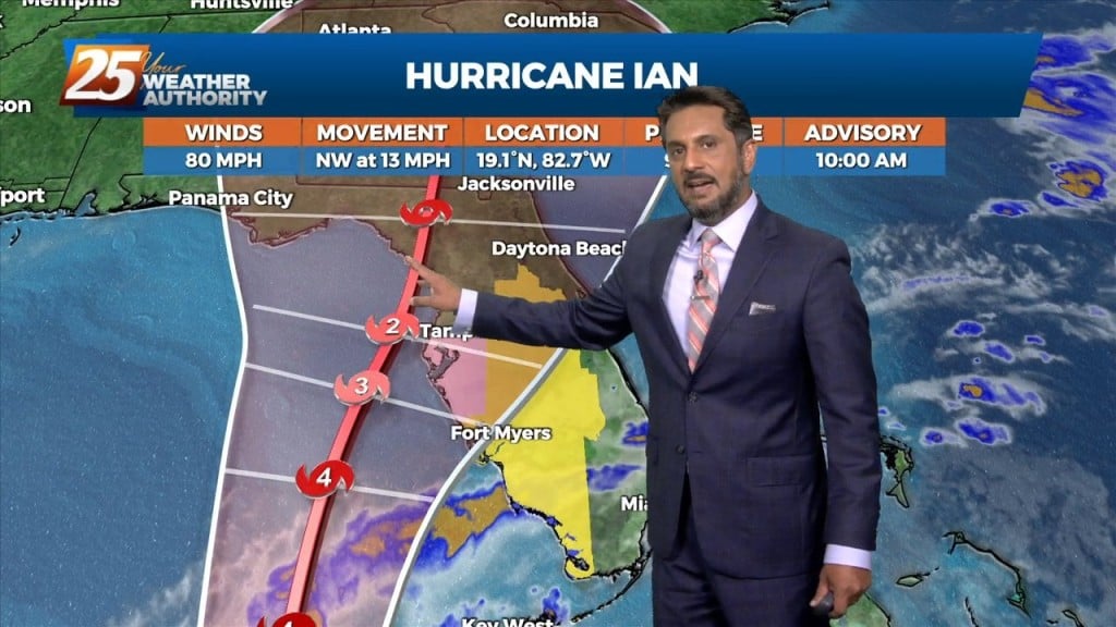
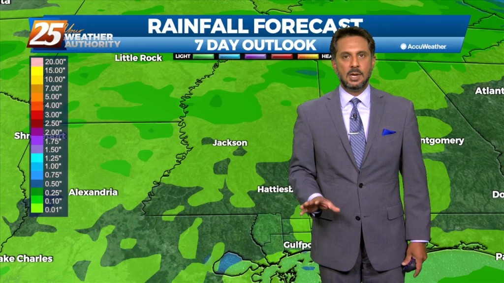
Drier and cooler temperatures are here, and Fall-like feeling is in the air! No rainfall is expected for the next few days. And while the Hurricane Ian is…
High pressure to the north moving closer will provide for lovely conditions through the rest of the workweek. A less humid flow and cooler temperatures will continue…
RED FLAG WARNING & SMALL CRAFT ADVISORY IN EFFECT... The cold front is now well south of the area with a cooler/drier air mass moving into…
A cold front has pushed through the area with HOT TEMPERATURES ahead this afternoon before the cool-down. Tuesday, the frontal system will have pushed through and…
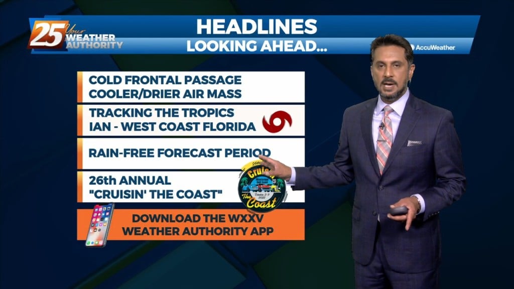
A cold front will push through the area this morning bringing in a cooler/drier air mass. Isolated to scattered showers could be possible along the coastal…

VERY HOT temperatures ahead this afternoon as a few locations will either tie or break a record high temp. High pressure will hold on one more…
High pressure has actually drifted a little further west than expected, and is now centered over west Texas northward into the Dakotas. This pattern will…

Dry conditions will continue trough the rest of the workweek thanks to the high pressure to the NE. Consequently, temperatures will be fairly warm for…
Northerly surface winds will help advect drier and more stable air into the area. Looking at the models, conditions will be dry over the next few days…

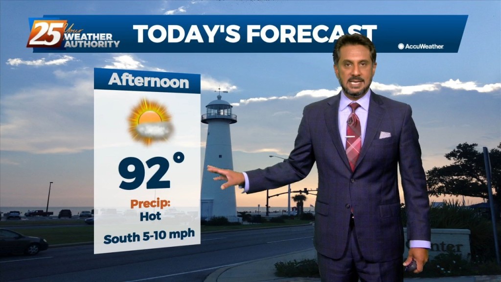
Expect sunny and hot conditions this afternoon as summer is determined to hold on until the very last minute... A strong mid-level high pressure situated…
The forecast continues to be dictated by a strong mid-level high pressure situated over the south-central CONUS that is providing drier and warmer mid-level air to…
High pressure will expand across the southern US early in the week and should be centered across TX. An upper level weakness looks to clip…
For this first couple days of this forecast period, the upper level high pressure will dominate the forecast. After expanding across the southern US early in the…
High pressure has weakened a bit over the last 24 hours with the flow becoming more zonal across the middle of the country. Shortwaves were noted along…
High pressure at the surface covers roughly the eastern half of the country, with low pressure and an associated front from the Dakotas into Colorado. The…
With a surface cold front to the south going stationary, drier air north of the front will continue to keep the area under pleasant conditions…

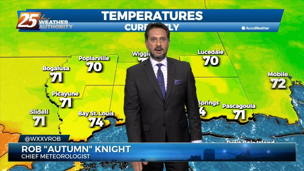
Surface high pressure continues to build in from the north, ushering in post-frontal cool and dry airmass. Observations across the local area show…
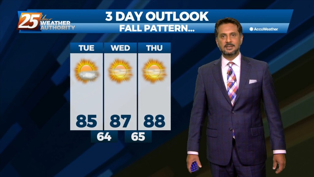
Lovely conditions ahead this afternoon as temperatures in the mid-80s and relative humidity in the 30/40% range will make it feel comfortable. As the evening and overnight…
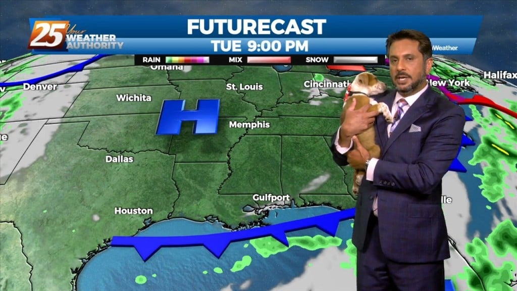
Here at News 25 we love our fur-babies...but Rob Knight goes beyond that. Here is the FURcast with Rob & Freckles. WE believe Freckles did it better!

The base of the upper level disturbance and surface cold front is now in the northern Gulf of Mexico. Other than some outer coastal convection south of…
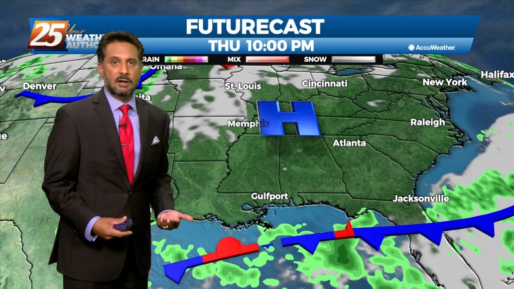
The main story is a cold front overhead moving SE. The upstream support will press east allowing the high to surge the front south and east through our…
Early this morning, we will continue to see decaying showers over coastal Mississippi, with a remnant boundary possibly leading to a few re-developing isolated showers…

A stationary front draped along the coast east through the central Florida panhandle will continue to bring showers/t-storms. A few showers could bring heavy rain as rain rate will…