Ryan's "Record Breaking" Tuesday Forecast
With another day of record breaking temperatures behind us we'll see some slight cooling through the rest of the week, but only into the upper 80s....
With another day of record breaking temperatures behind us we'll see some slight cooling through the rest of the week, but only into the upper 80s....
As of 10 o'clock it still felt like 80 degrees, and it'll only get warmer going forward. Expect many hot, humid, and beautiful days ahead.
Expect more sunny and beautiful days ahead, and it only gets hotter and more humid as we head into next week....
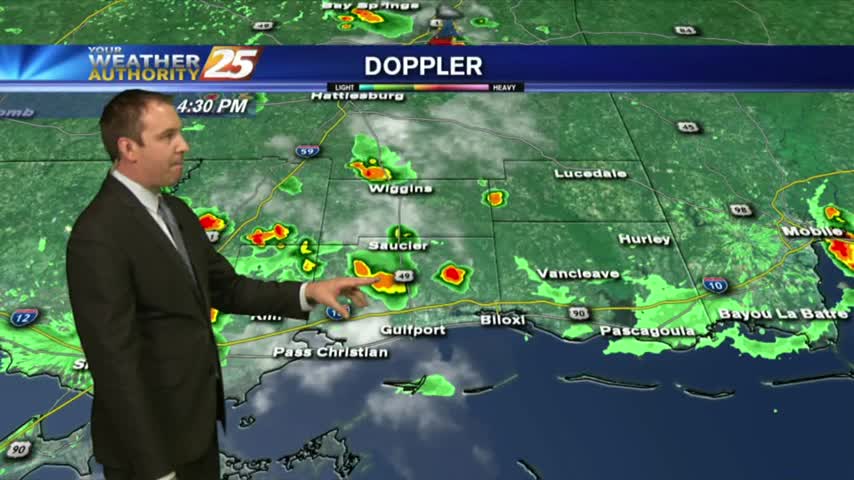
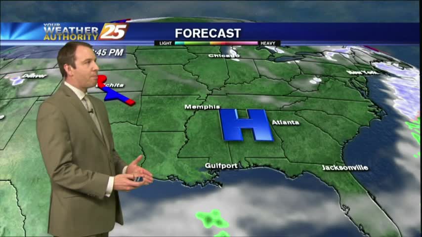
The humidity and temperature have started to rise little by little, and will continue to do so into the weekend until Saturday's storms arrive....
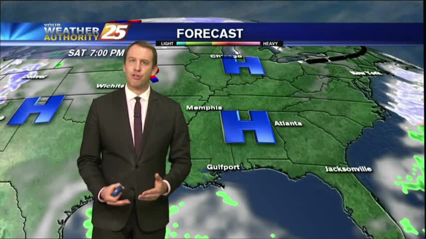
Beautiful drier and slightly cooler weather moved in as expected today, and while it will get slightly warmer and more humid over the next few days, it will remain sunny until our weekend rain moves in....
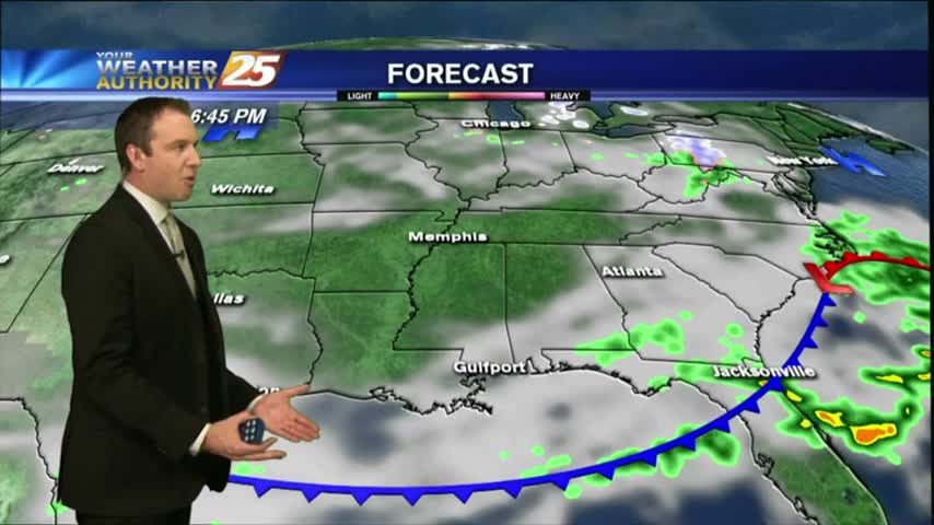
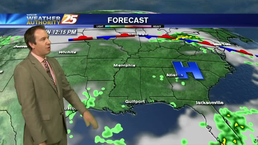
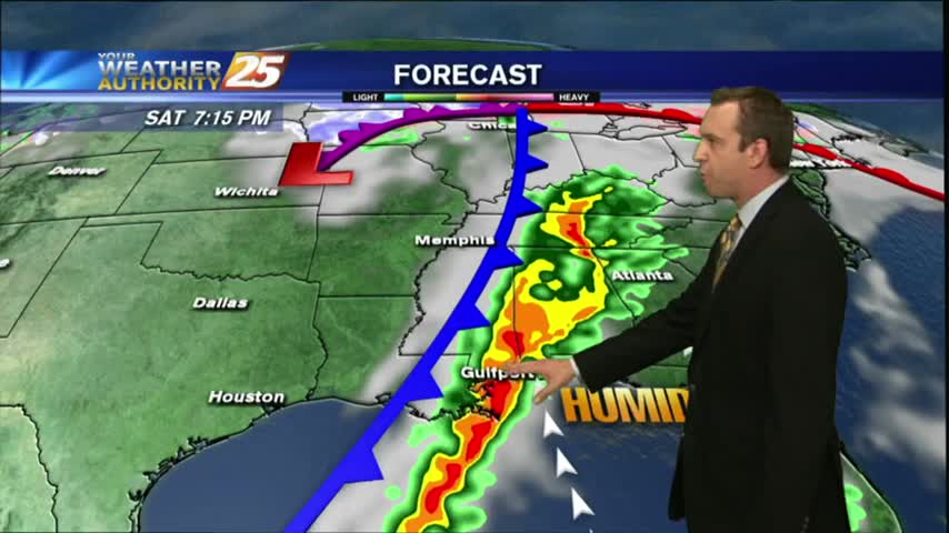
The front moved through early Saturday morning, but the clouds remain. Expect some clearing mid-week and more weekend rain.
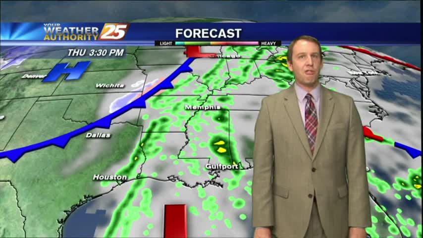
The rain moved in earlier, but is now on it's way out ushering in a cooler and drier Thursday. Click the forecast link for the details.
Not much change in weather from the afternoon until now (11 PM), but a cold front is moving through overnight and we have long week of frigid nights ahead. Click here for the full forecast.
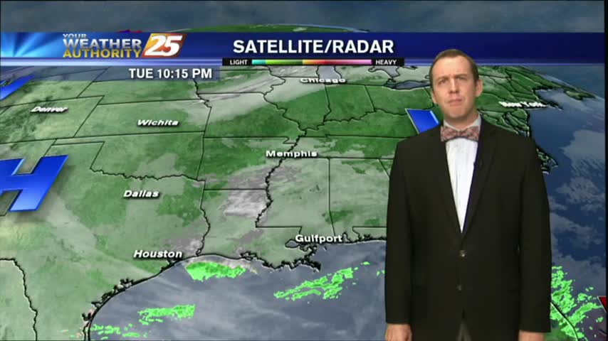
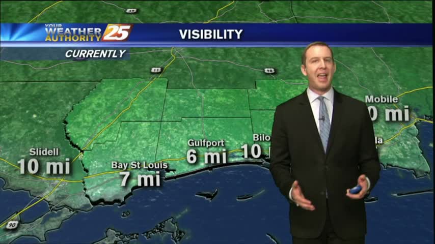
The fog cleared this afternoon and the skies even opened up for a while, but dense fog is already forming in the Southern coastal counties and Dense Fog Advisories have been issued. Click here for details.
Fog is developing quickly to the North of us near Hattiesburg, but Dense Fog Advisories have now been issued for all coastal counties and the Mississippi Sound. Click here for the full forecast.
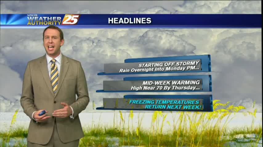
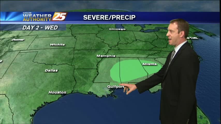
After an extended period of cold and dry weather, we're finally seeing warm and moist air move in along with some active weather. Click this tab for the full forecast.
Today was the last afternoon below 50 degrees and tonight will be the last evening below freezing for at least as week as warmer, wetter air moves in rapidly through the weekend. Watch the full forecast for more.
Temperatures continued their warming trend this afternoon, but we'll see a slight setback tonight as reinforcing cold air moves in from the North. Click the link for the full forecast.
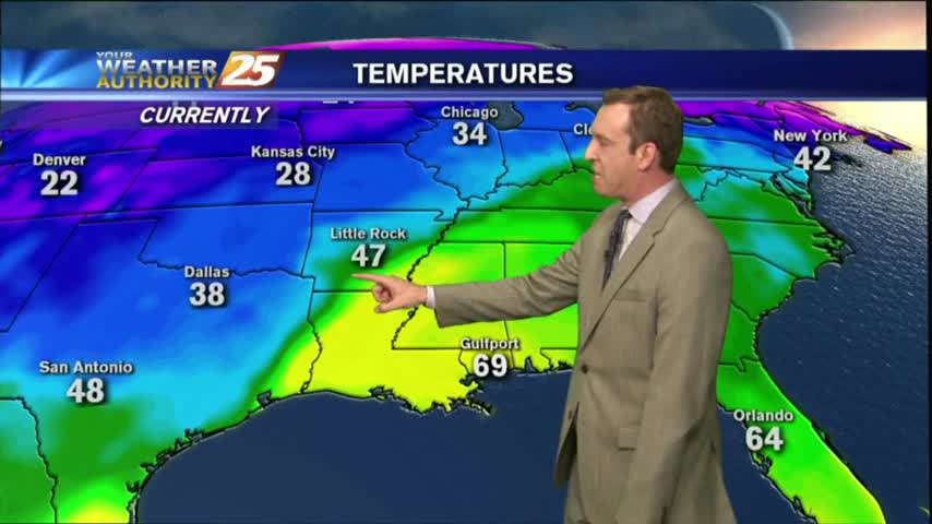
While it is still bone-chillingly cold outside at night, our afternoons are warming and we'll see highs in the 60s returning soon. Watch the full forecast for details.
More dangerously cold nights ahead, but our afternoons will begin warming soon. Be on the lookout for some non-accumulating snow flurries late tonight/early Wednesday. Full forecast within.
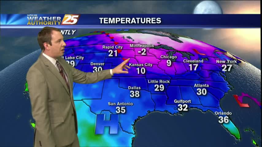
This year is starting off on an abnormally cold foot, and we'll remain in the 40's during the day and 20's at night all week long despite a gradual warming trend and plenty of sun. Click the forecast link for more details.
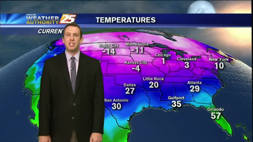
Dangerously cold temperatures move in for the next several nights, so we'll be starting the New Year off on frigid note. Watch the full forecast for details.
An approaching cold front will bring rain tomorrow and much cooler/drier conditions by Christmas, but we have one more foggy night ahead before that. Watch the full forecast for more.

The afternoons have been clear the last few days, but the nights have remained foggy, and tonight will be no different. Fog is already forming in South MS, so watch the full forecast for details.
The fog cleared this afternoon and ushered in a sunny & warm afternoon, but as we cool tonight more fog will develop...just not as bad as the last few nights have been. Watch the forecast for details.
Dense fog advisories remain in place for all six coastal counties and the surrounding area, but after tonight's frontal passage we shouldn't see those again for a few days. Rain will return before the weekend though, details within.
Dense fog advisories were issued earlier, and the fog has already moved in. Expect it to linger through the night, into the morning, and even into the afternoon in isolated areas; watch the full forecast for details.
It'll be colder tonight than it's been the last few, but not the coldest weather we've seen recently. Inland areas will flirt with freezing tonight, but we'll be back in the 70s by Sunday. Details within.
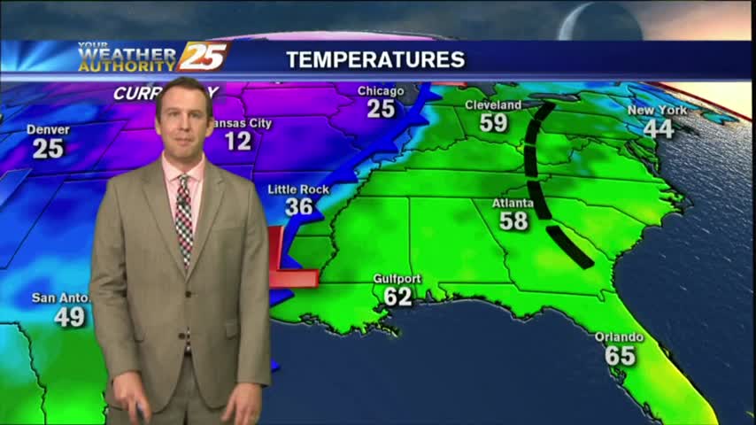
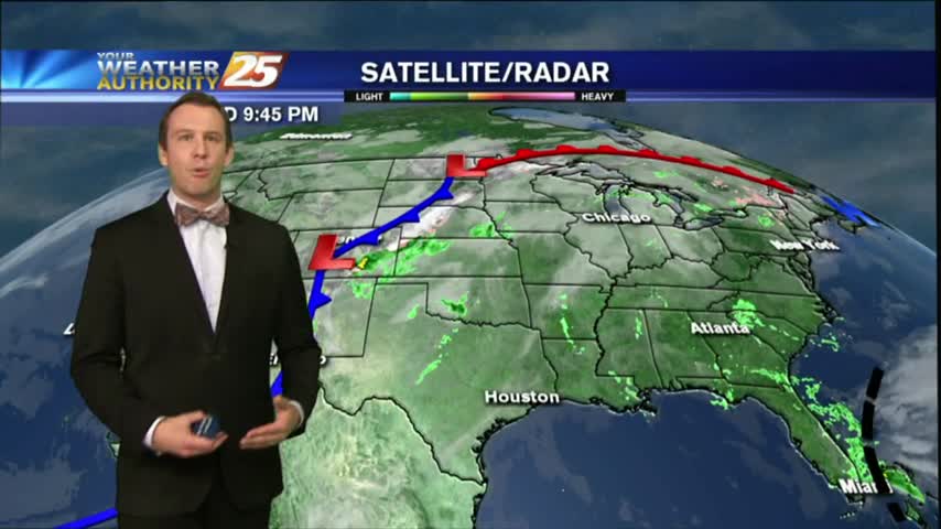
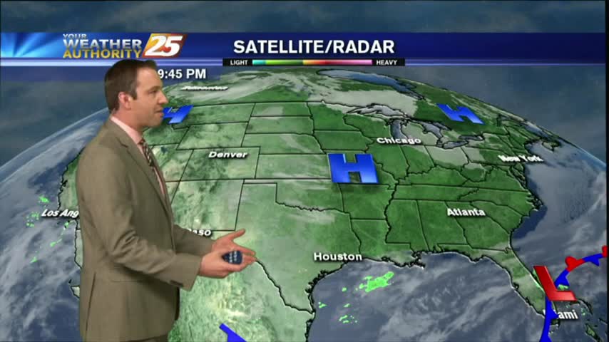
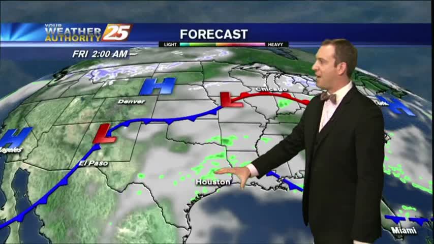
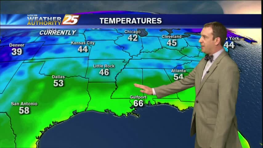
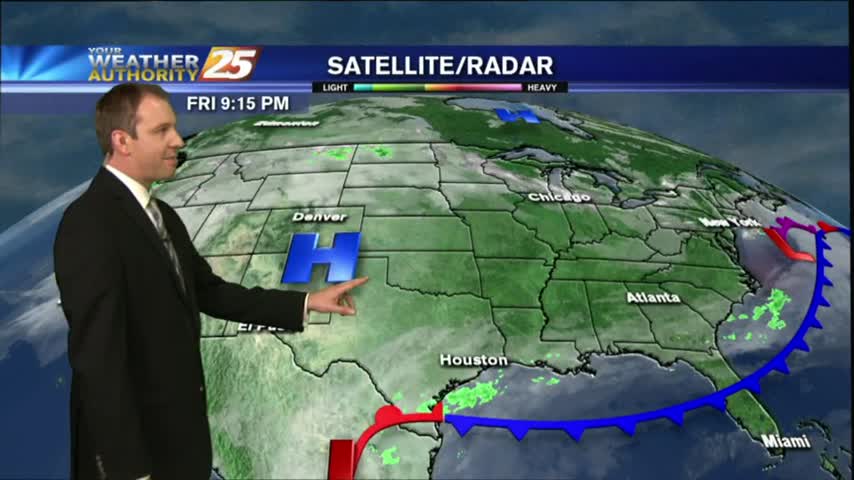
You wouldn't know it from the temperature or satellite presentation, but a cold front is moving through the area and will bring cooler temperatures into the weekend. Watch the full forecast for more.