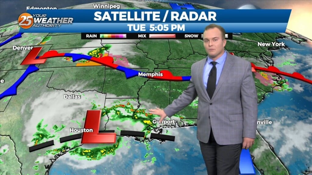
6/17 Sam's "Still Rainy and Muggy" Tuesday Evening Forecast
Showers and storms will stick around for the next several days with a chance to get some gusty winds, heavy rain and frequent lightning at times. We will also…
Showers and storms will stick around for the next several days with a chance to get some gusty winds, heavy rain and frequent lightning at times. We will also…
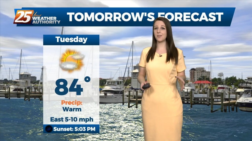
A warm and humid couple of days ahead before Easter. Temperatures will continue to rise in the upper 70s and low 80s along with more…
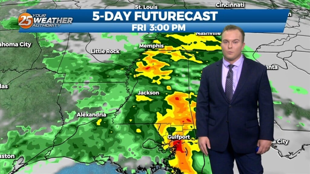
HOT...HUMID & BREEZY afternoon ahead... On Thursday a strong upper level disturbance will help send a cold front southward toward the region. During the…
Skies will clear somewhat overnight and humidity will remain a factor in terms of providing a muggy feel to the air. Your Wednesday will start off with…
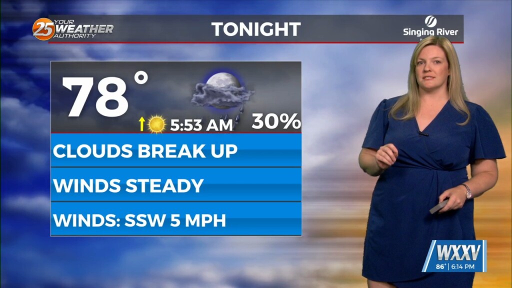
Partly cloudy skies and a 20% chance of a stray shower or thunderstorm will be around this evening. Skies will clear out overnight but a muggy feel…
An upper level trough of low pressure currently moving across the Great Lakes will continue to move through the Ohio River Valley today. With the base of the…
An upper level trough of low pressure currently moving across the Great Lakes will continue to move through the Ohio River Valley today. With the base…
Warm and muggy conditions will linger overnight as southerly flow continues. Very isolated rain chances will be in place around daybreak but widespread rain is not…
Isolated shower and thunderstorm activity will diminish through the evening as the best coverage remains west of here. Expect warm and muggy conditions to continue overnight. Very…
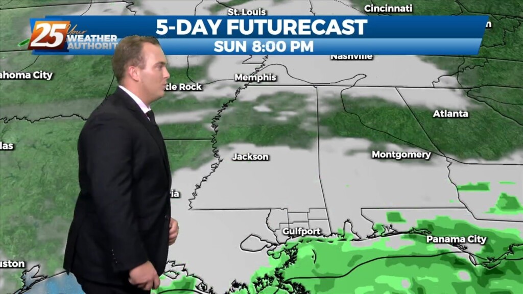
Humidity and cloud coverage will be on the increase beginning tonight. Expect a muggy start with light fog possible from a low cloud deck for your Friday morning.…
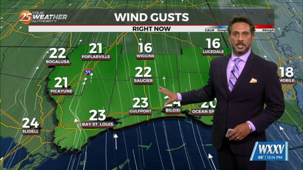
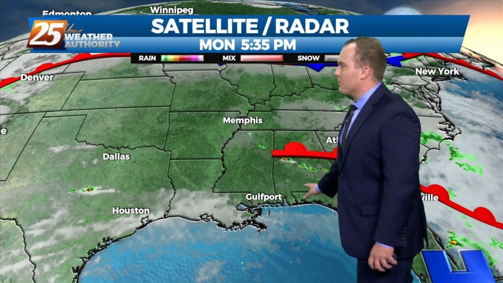
Elevated winds have backed off somewhat this evening. Cloud coverage will continue to build, and lower again overnight. Warm and muggy conditions will be around in the…
Some direct sunlight allowed for temperatures to warm into the 80s for a lot of the area today. Tonight, abundant moisture in the low-levels will allow for clouds to…
Skies will be clearer this afternoon and temperatures will be quite warm. Very elevated humidity content will be in the picture for the rest of the…
The uncharacteristically warm temperatures will continue tonight. Tonight, we can expect rain free conditions with just a few clouds in the sky which hopefully will provide for prime…
The warm conditions will continue and the average overnight lows tonight will be about 8-12 degrees warmer than seasonal average. We'll have clear skies tonight but then…
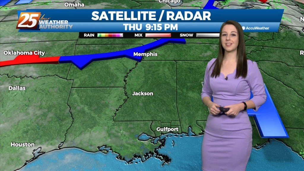
As post frontal air mass and high pressure builds into the region on Thursday, rainfall activity clears out and clouds will be on the decrease. While not looking at…
Friday temperatures will be above average thanks to some brief southerly winds ahead of a dry boundary this weekend. General model consensus shows high temperatures approaching 90 degrees.…
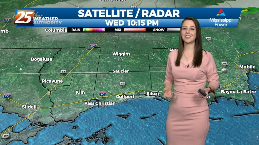
A frontal boundary is expected to move into the area late tonight and stall over the area by tomorrow afternoon. This front will bring stout mid-level dry air into…
Looks like one more day of anomalously high moisture levels before some drying occurs. Now...that doesn`t mean we`re going to have totally dry and sunny days, but…
We should see a gradual transition of dry air replace deep moist air late Saturday into Sunday. Then another transition of this dry air to the deep moist air…
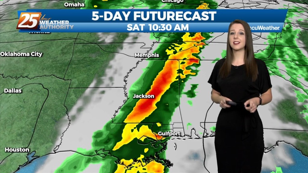
Through Tuesday, the upper ridge flattens as low pressure systems move through southern Canada. With ample moisture in place, and only weak influence of the upper ridge, generally scattered…
Current upper level analysis shows a ridge centered near the Appalachian Mountains and a trough encompassing nearly half of the western US. A slither of that ridge…
An upper level ridge is building in and across the southeastern CONUS with the center passing across the CWA today. As a result, onshore flow becomes well established and…
Temperatures are expected to be well above normal with lows warming to the mid 60s, highs climbing to the upper 70s by midweek. The fog risk will peak…