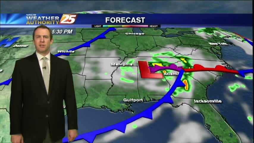
11/18 - Sam Parker's "Pack the Poncho" Monday Night Forecast
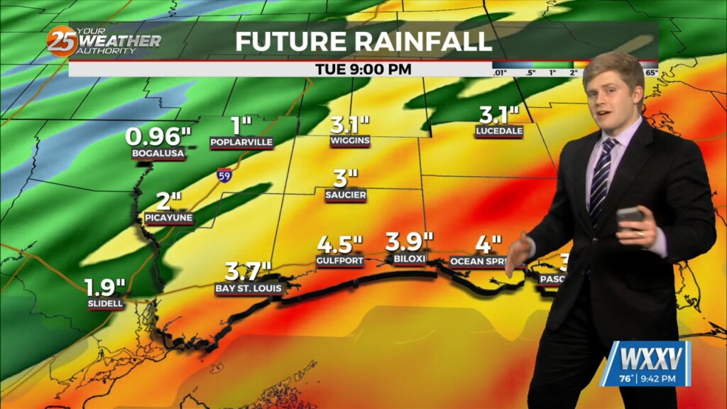
Rain throughout the overnight hours and definitely picking up early Tuesday Morning. The rain mainly coming from the south from the tropical moisture with…
Rain throughout the overnight hours and definitely picking up early Tuesday Morning. The rain mainly coming from the south from the tropical moisture with…
A closed mid-level low pressure system over TX is more of a double barrel low as the eastern portion of the low led to all of…
On water vapor satellite imagery, a plume of moisture was noted from the Pacific Ocean south of Baja California northeastward across the local area. At the surface,…
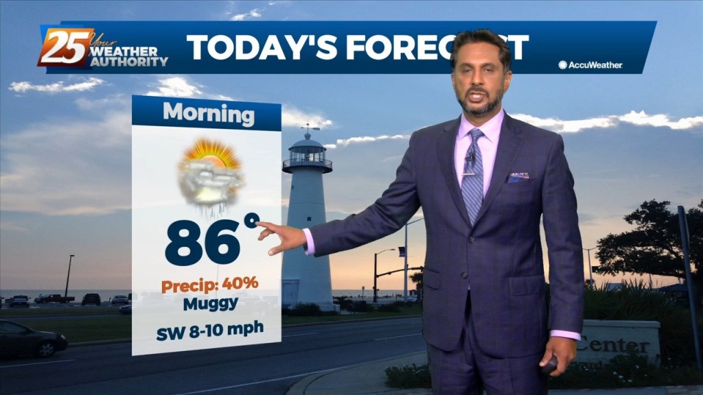
Today will bring more of the same as yesterday as numerous showers and thunderstorms are expected to develop. Deep moisture from the Gulf of…
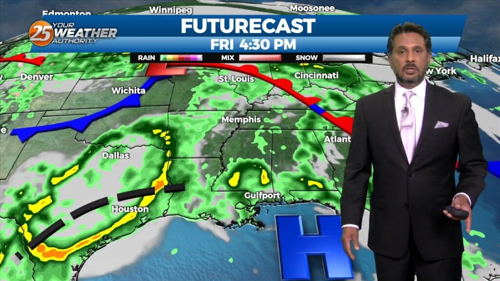
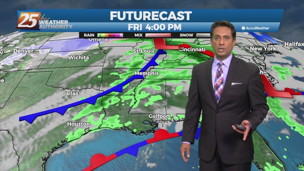
This morning will bring another line of showers/t-storms developing in response to the next disturbance which can be seen in the blowup of convection over the NW gulf.…
As the cold front is now to the east, post frontal clouds and low rain potential will continue this morning. Drier air moving in from the…
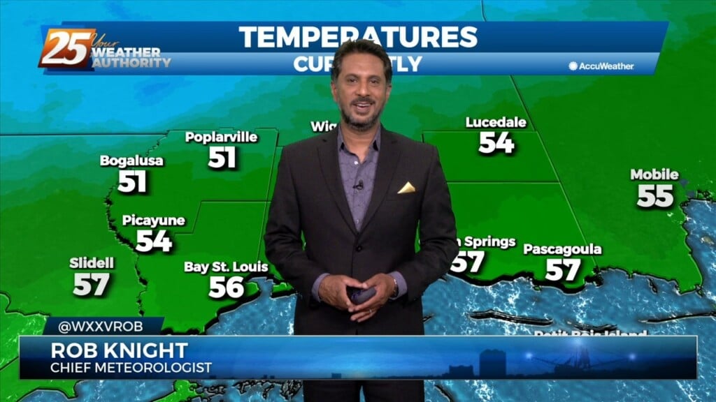
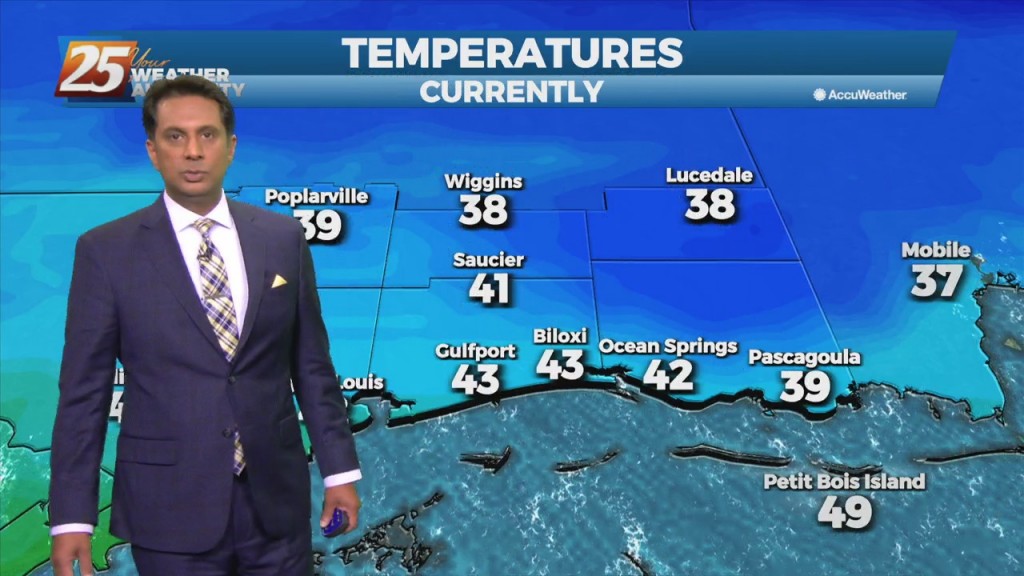
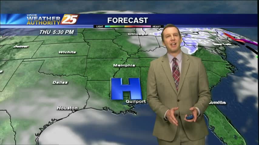
High pressure building in will bring a much drier air mass...a few degrees below our normal lows. Over the next 3 days there will be about a…
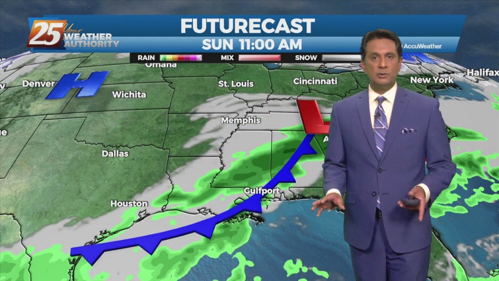
A cold front is no east of the area with light precipitation behind the front expected to be out of the area by moon. Forecast guidance…
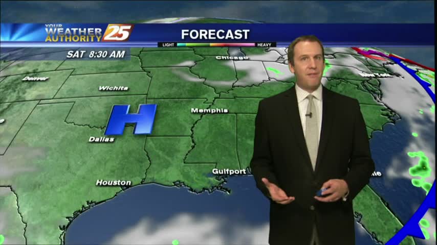
A minor disturbance to the west will exit the area this afternoon with weak high-pressure building in. This will keep our weather dry through the weekend. Tomorrow morning…
Fog continues to be the say of the day. The dense fog advisory will remain through late morning, and there is the potential that some areas could…
As a cold front moves through the area, spotty rain will be in the forecast until mid-morning. Cooler and drier air moves into the area behind…
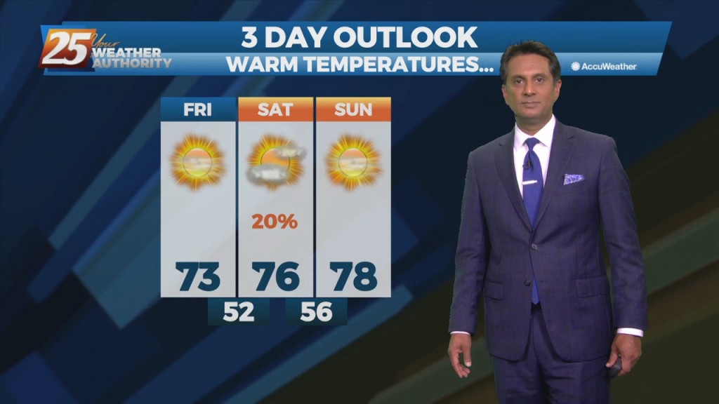
This morning's rainy start didn't do much to dampen the day, and it's gets even drier and more sunny into the weekend.
Our morning rain didn't darken the skies for long and sunny, drier weather moved in quickly, but how long will it last....
There's still a little cloud cover near the coastline, but by tomorrow we'll see cloudless skies which will linger for a few days.
As the front moved through this morning it brought rain, but is now bringing much cooler and drier air.
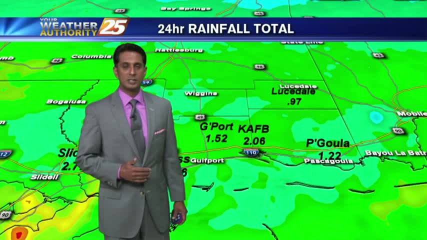
HEAVY RAINFALL from yesterday/last night is beginning to tapper-off as the cold front moves to our east...